Related Research Articles

A geographic information system (GIS) consists of integrated computer hardware and software that store, manage, analyze, edit, output, and visualize geographic data. Much of this often happens within a spatial database, however, this is not essential to meet the definition of a GIS. In a broader sense, one may consider such a system also to include human users and support staff, procedures and workflows, the body of knowledge of relevant concepts and methods, and institutional organizations.
Urbanization is the population shift from rural to urban areas, the corresponding decrease in the proportion of people living in rural areas, and the ways in which societies adapt to this change. It can also mean population growth in urban areas instead of rural ones. It is predominantly the process by which towns and cities are formed and become larger as more people begin living and working in central areas.

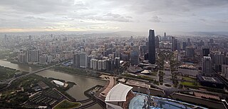
A metropolitan area or metro is a region consisting of a densely populated urban agglomeration and its surrounding territories sharing industries, commercial areas, transport network, infrastructures and housing. A metropolitan area usually comprises multiple principal cities, jurisdictions and municipalities: neighborhoods, townships, boroughs, cities, towns, exurbs, suburbs, counties, districts and even states and nations in areas like the eurodistricts. As social, economic and political institutions have changed, metropolitan areas have become key economic and political regions.

A slum is a highly populated urban residential area consisting of densely packed housing units of weak build quality and often associated with poverty. The infrastructure in slums is often deteriorated or incomplete, and they are primarily inhabited by impoverished people. Although slums are usually located in urban areas, in some countries they can be located in suburban areas where housing quality is low and living conditions are poor. While slums differ in size and other characteristics, most lack reliable sanitation services, supply of clean water, reliable electricity, law enforcement, and other basic services. Slum residences vary from shanty houses to professionally built dwellings which, because of poor-quality construction or lack of basic maintenance, have deteriorated.

Urban geography is the subdiscipline of geography that derives from a study of cities and urban processes. Urban geographers and urbanists examine various aspects of urban life and the built environment. Scholars, activists, and the public have participated in, studied, and critiqued flows of economic and natural resources, human and non-human bodies, patterns of development and infrastructure, political and institutional activities, governance, decay and renewal, and notions of socio-spatial inclusions, exclusions, and everyday life. Urban geography includes different other fields in geography such as the physical, social, and economic aspects of urban geography. The physical geography of urban environments is essential to understand why a town is placed in a specific area, and how the conditions in the environment play an important role with regards to whether or not the city successfully develops. Social geography examines societal and cultural values, diversity, and other conditions that relate to people in the cities. Economic geography is important to examine the economic and job flow within the urban population. These various aspects involved in studying urban geography are necessary to better understand the layout and planning involved in the development of urban environments worldwide.
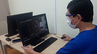
Telehealth is the distribution of health-related services and information via electronic information and telecommunication technologies. It allows long-distance patient and clinician contact, care, advice, reminders, education, intervention, monitoring, and remote admissions. Telemedicine is sometimes used as a synonym, or is used in a more limited sense to describe remote clinical services, such as diagnosis and monitoring. When rural settings, lack of transport, a lack of mobility, conditions due to outbreaks, epidemics or pandemics, decreased funding, or a lack of staff restrict access to care, telehealth may bridge the gap as well as provide distance-learning; meetings, supervision, and presentations between practitioners; online information and health data management and healthcare system integration. Telehealth could include two clinicians discussing a case over video conference; a robotic surgery occurring through remote access; physical therapy done via digital monitoring instruments, live feed and application combinations; tests being forwarded between facilities for interpretation by a higher specialist; home monitoring through continuous sending of patient health data; client to practitioner online conference; or even videophone interpretation during a consult.
Community health refers to simple health services that are delivered by laymen outside hospitals and clinics. Community health is also the subset of public health that is taught to and practiced by clinicians as part of their normal duties. Community health volunteers and community health workers work with primary care providers to facilitate entry into, exit from and utilization of the formal health system by community members.

Population health has been defined as "the health outcomes of a group of individuals, including the distribution of such outcomes within the group". It is an approach to health that aims to improve the health of an entire human population. It has been described as consisting of three components. These are "health outcomes, patterns of health determinants, and policies and interventions".

Spatial analysis is any of the formal techniques which studies entities using their topological, geometric, or geographic properties. Spatial analysis includes a variety of techniques using different analytic approaches, especially spatial statistics. It may be applied in fields as diverse as astronomy, with its studies of the placement of galaxies in the cosmos, or to chip fabrication engineering, with its use of "place and route" algorithms to build complex wiring structures. In a more restricted sense, spatial analysis is geospatial analysis, the technique applied to structures at the human scale, most notably in the analysis of geographic data. It may also be applied to genomics, as in transcriptomics data.

In medicine, rural health or rural medicine is the interdisciplinary study of health and health care delivery in rural environments. The concept of rural health incorporates many fields, including wilderness medicine, geography, midwifery, nursing, sociology, economics, and telehealth or telemedicine.
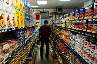
A food desert is an area that has limited access to affordable and nutritious food. In contrast, an area with greater access to supermarkets and vegetable shops with fresh foods may be called a food oasis. The designation considers the type and the quality of food available to the population, in addition to the accessibility of the food through the size and the proximity of the food stores.
Spatial inequality refers to the unequal distribution of income and resources across geographical regions. Attributable to local differences in infrastructure, geographical features and economies of agglomeration, such inequality remains central to public policy discussions regarding economic inequality more broadly.
Healthcare in China has undergone basic changes over the twentieth century and twenty-first centuries, using both public and private medical institutions and insurance programs. As of 2020, about 95% of the population has at least basic health insurance coverage. Basic medical insurance includes two systems: employee medical insurance and resident medical insurance. The former covers the urban employed population, and the latter covers the urban non-employed population and the rural population. A total of 25% of the people covered by the basic medical insurance participated in the employee medical insurance, a total of 344 million people; 75% participated in the residents' medical insurance, a total of 1.017 billion people. Medical assistance has subsidized 78 million poor people to participate in basic medical insurance, and the coverage of poor people has stabilized at over 99.9%. Despite this, public health insurance generally only covers about half of medical costs, with the proportion lower for serious or chronic illnesses. Under the "Healthy China 2020" initiative, China has undertaken an effort to cut healthcare costs, requiring insurance to cover 70% of costs by the end of 2018. In addition, there are policies such as critical illness insurance and medical assistance. China's commercial health insurance is also proliferating. In 2020, the country's commercial health insurance premium income amounted to 817.3 billion yuan, with an average annual growth rate of 20%. China's coverage of maternity insurance has continued to expand, by the end of 2020, 235.673 million people were insured under maternity insurance.
The two-step floating catchment area (2SFCA) method is a method for combining a number of related types of information into a single, immediately meaningful, index that allows comparisons to be made across different locations. Its importance lies in the improvement over considering the individual sources of information separately, where none on its own provides an adequate summary.

An isochrone map in geography and urban planning is a map that depicts the area accessible from a point within a certain time threshold. An isochrone is defined as "a line drawn on a map connecting points at which something occurs or arrives at the same time". In hydrology and transportation planning isochrone maps are commonly used to depict areas of equal travel time. The term is also used in cardiology as a tool to visually detect abnormalities using body surface distribution.

India has a multi-payer universal health care model that is paid for by a combination of public and private health insurance funds along with the element of almost entirely tax-funded public hospitals. The public hospital system is essentially free for all Indian residents except for small, often symbolic co-payments in some services.

The first case of the COVID-19 pandemic in the Indian state of Andhra Pradesh was reported in Nellore on 12 March 2020. A 24-year-old who was confirmed positive for coronavirus. He had travel history to Italy. The Andhra Pradesh Health department has confirmed a total of 5,37,687 cases, including 4,702 deaths and 4,35,467 recoveries, as of 10 September. The virus has spread in 13 districts of the state, of which East Godavari has the highest number of cases.

The United States has many regions which have been described as medical deserts, with those locations featuring inadequate access to one or more kinds of medical services. An estimated thirty million Americans, many in rural regions of the country, live at least a sixty-minute drive from a hospital with trauma care services. Limited access to emergency room services, as well as medical specialists, leads to increases in mortality rates and long-term health problems, such as heart disease and diabetes. Regions with higher rates of Medicaid and Medicare patients, as well those who lack any health insurance coverage, are less likely to live within an hour's drive of a hospital emergency room.
Medical desert is a term used to describe regions whose population has inadequate access to healthcare. The term can be applied whether the lack of healthcare is general or in a specific field, such as dental or pharmaceutical. It is primarily used to describe rural areas although it is sometimes applied to urban areas as well. The term is inspired by the analogous concept of a food desert.

The uncertain geographic context problem or UGCoP is a source of statistical bias that can significantly impact the results of spatial analysis when dealing with aggregate data. The UGCoP is very closely related to the Modifiable areal unit problem (MAUP), and like the MAUP, arises from how we divide the land into areal units. It is caused by the difficulty, or impossibility, of understanding how phenomena under investigation in different enumeration units interact between enumeration units, and outside of a study area over time. It is particularly important to consider the UGCoP within the discipline of time geography, where phenomena under investigation can move between spatial enumeration units during the study period. Examples of research that needs to consider the UGCoP include food access and human mobility.
References
- ↑ "Smaller Labour Catchments across the Western Region". Western Development Commission. 22 May 2019. Archived from the original on 2021-07-16. Retrieved 16 July 2021.
- ↑ Green, Jack (9 December 2019). "The importance of catchment in retail". Cromwell Property Group. Archived from the original on 2021-07-16. Retrieved July 16, 2021.
- ↑ "Defining Your Airport's Catchment Area". TRB's COOPERATIVE RESEARCH PROGRAMS. Archived from the original on 2021-07-16. Retrieved July 16, 2021.
- ↑ McLafferty, Sara L. (2003). "GIS and Health Care". Annual Review of Public Health. 24: 25–42. doi: 10.1146/annurev.publhealth.24.012902.141012 . PMID 12668754.
- ↑ Jenkins, C.; Campbell, J. (1996). "Catchment areas in general practice and their relation to size and quality of practice and deprivation: a descriptive study in one London borough". BMJ. 313 (7066): 1189–92. doi:10.1136/bmj.313.7066.1189. PMC 2352502 . PMID 8916754.
- ↑ Schuurman, Nadine; Fiedler, Robert S; Grzybowski, Stefan CW; Grund, Darrin (2006). "Defining rational hospital catchments for non-urban areas based on travel-time". International Journal of Health Geographics. 5: 43. doi: 10.1186/1476-072X-5-43 . PMC 1617091 . PMID 17018146.
- ↑ Cattaneo, Andrea; Nelson, Andrew; McMenomy, Theresa (2021-01-12). "Global mapping of urban–rural catchment areas reveals unequal access to services". Proceedings of the National Academy of Sciences. 118 (2): e2011990118. Bibcode:2021PNAS..11820119C. doi: 10.1073/pnas.2011990118 . ISSN 0027-8424. PMC 7959575 . PMID 33431572.
- ↑ Moreno-Monroy, Ana I.; Schiavina, Marcello; Veneri, Paolo (2020). "Metropolitan areas in the world. Delineation and population trends". Journal of Urban Economics. 125: 103242. doi: 10.1016/j.jue.2020.103242 .
- ↑ Alegana, Victor A.; Khazenzi, Cynthia; Akech, Samuel O.; Snow, Robert W. (2020-01-28). "Estimating hospital catchments from in-patient admission records: a spatial statistical approach applied to malaria". Scientific Reports. 10 (1): 1324. Bibcode:2020NatSR..10.1324A. doi:10.1038/s41598-020-58284-0. ISSN 2045-2322. PMC 6987150 . PMID 31992809.
- ↑ Massonnaud, Clément; Roux, Jonathan; Crépey, Pascal (2020-03-20). "COVID-19: Forecasting short term hospital needs in France". medRxiv 10.1101/2020.03.16.20036939v1 .
- ↑ Parsons, Eddie; Chalkley, Brian; Jones, Allan (2000). "School Catchments and Pupil Movements: A case study in parental choice". Educational Studies. 26 (1): 33–48. doi:10.1080/03055690097727. S2CID 144365321.
- ↑ "Airports: Non-Financial Analysis". Transport Canada.
- ↑ "Admission: University Admission". Students Nigeria. Archived from the original on 2019-04-20. Retrieved 2014-12-17.
- ↑ "Primary One Admission for September 2020" (PDF). Education Bureau. August 2019. Archived from the original (PDF) on 19 October 2019. Retrieved 7 March 2020.
- ↑ "Travel to Work and Labour Catchments in the Western Region. A Profile of Seven Town Labour Catchments" (PDF). WDC Insights. May 2018. Archived (PDF) from the original on 2021-07-19. Retrieved July 20, 2021.