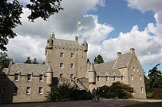
The village is the location of Cawdor Castle, the seat of the Earl Cawdor. A massive keep with small turrets is the original portion of the castle, and to it were added, in the 17th century, later buildings forming two sides of a square.[2]
Macbeth, in Shakespeare's play of the same name, becomes Thane of Cawdor early in the narrative.[1] However, since the oldest part of the castle's structure dates from the late 14th century, and has no predecessor, Shakespeare's version's historical authenticity is dubious.[citation needed]
The name "Cawdor" is the English pronunciation and spelling of the ancient and original name Calder. In the early 19th century, the Lord at the time was residing in England and changed the name of the castle, town and clan overnight so that it would match the Shakespearian designation.[citation needed]
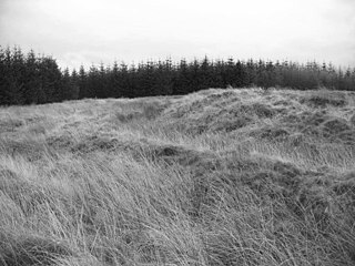
In 1984, a strong candidate for a Roman fort was identified at Easter Galcantray, south west of Cawdor, by aerial photography.
The site was excavated between 1985 and 1988 and several features were identified which are of this classification.
A single fragment of Roman coarse ware was found in the bottom of the ditch outside the south-west gateway along with burnt material; this pottery has very similar fabric to that found at Inchtuthil. In addition to this sparse pottery evidence, the demolition deposits in the western ditch yielded a piece of charcoal which has been radiocarbon dated to A.D. 80-130 (Calibrated).
The radiocarbon test gave a possible date of construction during the Agricola campaign.[3]
1 2 "Cawdor". The Gazetteer for Scotland. School of GeoSciences, University of Edinburgh and The Royal Scottish Geographical Society. Retrieved 17 June 2018.
↑ One or more of the preceding sentencesincorporates text from a publication now in the public domain:Chisholm, Hugh, ed. (1911). "Cawdor". Encyclopædia Britannica. Vol.5 (11thed.). Cambridge University Press. p.587.
Glamis Castle is situated beside the village of Glamis in Angus, Scotland. It is the home of the Earl of Strathmore and Kinghorne, and is open to the public.
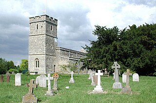
Great and Little Kimble cum Marsh is a civil parish in central Buckinghamshire, England. It is located 5 miles (8 km) to the south of Aylesbury. The civil parish altogether holds the ancient ecclesiastical villages of Great Kimble, Little Kimble, Kimblewick and Marsh, and an area within Great Kimble called Smokey Row. The two separate parishes with the same name were amalgamated in 1885, but kept their separate churches, St Nicholas for Great Kimble on one part of the hillside and All Saints for Little Kimble on other side at the foot of the hill.
Chûn Castle is a large Iron Age hillfort (ringfort) near Penzance in Cornwall, England, United Kingdom. The fort was built about 2,500 years ago, and fell into disuse until the early centuries AD when it was possibly re-occupied to protect the nearby tin mines. It stands beside a prehistoric trackway that was formerly known as the Old St Ives Road and the Tinners’ Way. The name Chûn derives from Cornish: Chi an Woon. The area is now sometimes known as Chûn Downs. Nearby is Chûn Quoit.
Combe Hill is a causewayed enclosure, near Eastbourne in East Sussex, on the northern edge of the South Downs. It consists of an inner circuit of ditches and banks, incomplete where it meets a steep slope on its north side, and the remains of an outer circuit. Causewayed enclosures were built in England from shortly before 3700 BC until at least 3500 BC; they are characterized by the full or partial enclosure of an area with ditches that are interrupted by gaps, or causeways. Their purpose is not known; they may have been settlements, meeting places, or ritual sites. The historian Hadrian Allcroft included the site in his 1908 book Earthwork of England, and in 1930 E. Cecil Curwen listed it as a possible Neolithic site in a paper which attempted to provide the first list of all the causewayed enclosures in England.
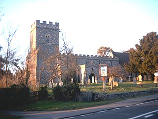
Headcorn is a village and civil parish in the borough of Maidstone in Kent, England. The parish is on the floodplain of the River Beult south east of Maidstone.
Portmahomack is a small fishing village in Easter Ross, Scotland. It is situated in the Tarbat Peninsula in the parish of Tarbat. Tarbat Ness Lighthouse is about three miles from the village at the end of the Tarbat Peninsula. Ballone Castle lies about one mile from the village. There is evidence of early settlement, and the area seems to have been the site of significant activity during the time of the Picts, early Christianity and the Vikings. The village is situated on a sandy bay and has a small harbour designed by Thomas Telford: it shares with Hunstanton the unusual distinction of being on the east coast but facing west. Portmahomack lies inside the Moray Firth Special Area of Conservation with the associated dolphin and whale watching activity.
The British Iron Age is a conventional name used in the archaeology of Great Britain, referring to the prehistoric and protohistoric phases of the Iron Age culture of the main island and the smaller islands, typically excluding prehistoric Ireland, which had an independent Iron Age culture of its own. The parallel phase of Irish archaeology is termed the Irish Iron Age. The Iron Age is not an archaeological horizon of common artefacts but is rather a locally-diverse cultural phase.
Glamis is a small village in Angus, Scotland, located 4 miles (6.4 km) south of Kirriemuir and 5 miles (8.0 km) southwest of Forfar. It is the location of Glamis Castle, the childhood home of Queen Elizabeth the Queen Mother.
Abergwyngregyn is a village and community of historical note in Gwynedd, a county and principal area in Wales. Under its historic name of Aber Garth Celyn it was the seat of Llywelyn ap Gruffudd. It lies in the historic county of Caernarfonshire.
Almeley is a village and civil parish in Herefordshire, England. The civil parish includes the hamlets of Almeley Wooton and Upcott. The 2011 Census recorded the parish's population as 601.
Gogar is a predominantly rural area of Edinburgh, Scotland, located to the west of the city. It is not far from Gogarloch, Edinburgh Park and Maybury. The Fife Circle Line is to the north.
Cawdor Castle is a castle in the parish of Cawdor in Nairnshire, Scotland. It is built around a 15th-century tower house, with substantial additions in later centuries. Originally a property of the Calder family, it passed to the Campbells in the 16th century. It remains in Campbell ownership, and is now home to the Dowager Countess Cawdor, stepmother of Colin Campbell, 7th Earl Cawdor.
Long Wittenham is a village and small civil parish about 3 miles (5 km) north of Didcot, and 3.5 miles (5.6 km) southeast of Abingdon. It was part of Berkshire until the 1974 boundary changes transferred it from Berkshire to Oxfordshire, and from the former Wallingford Rural District to the new district of South Oxfordshire.
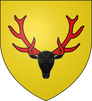
Clan Calder is a Highland Scottish clan. The clan is recognised by the Lord Lyon King of Arms but as it does not currently have a clan chief it is therefore considered an armigerous clan.
Castle Greg is the archaeological remains of a Roman fortlet in Harburn on the Camilty Plantation, approximately three miles south-east of West Calder, West Lothian, in Scotland.
The Antonine Wall, known to the Romans as Vallum Antonini, was a turf fortification on stone foundations, built by the Romans across what is now the Central Belt of Scotland, between the Firth of Clyde and the Firth of Forth. Built some twenty years after Hadrian's Wall to the south, and intended to supersede it, while it was garrisoned it was the northernmost frontier barrier of the Roman Empire. It spanned approximately 63 kilometres and was about 3 metres high and 5 metres wide. Lidar scans have been carried out to establish the length of the wall and the Roman distance units used. Security was bolstered by a deep ditch on the northern side. It is thought that there was a wooden palisade on top of the turf. The barrier was the second of two "great walls" created by the Romans in Great Britain in the second century AD. Its ruins are less evident than those of the better-known and longer Hadrian's Wall to the south, primarily because the turf and wood wall has largely weathered away, unlike its stone-built southern predecessor.
Cawdor , located near the small village of Easter Galcantray, is suspected of being one of the northernmost Roman forts in Great Britain, though this is controversial.
Cornish promontory forts, commonly known in Cornwall as cliff castles, are coastal equivalents of the hill forts and Cornish "rounds" found on Cornish hilltops and slopes. Similar coastal forts are found on the north–west European seaboard, in Normandy, Brittany and around the coastlines of the British Isles, especially in Wales, Scotland and Ireland. Many are known in southwest England, particularly in Cornwall and its neighbouring county, Devon. Two have been identified immediately west of Cornwall, in the Isles of Scilly.
Knap Hill lies on the northern rim of the Vale of Pewsey, in northern Wiltshire, England, about a mile north of the village of Alton Priors. At the top of the hill is a causewayed enclosure, a form of Neolithic earthwork that was constructed in England from about 3700 BC onwards, characterized by the full or partial enclosure of an area with ditches that are interrupted by gaps, or causeways. Their purpose is not known—they may have been settlements, or meeting places, or ritual sites of some kind. The site has been scheduled as an ancient monument.
Munsa is an archaeological site in Uganda, located in the south-eastern part of Bunyoro, and is commonly recognized by a rocky hill known by the locals as "Bikegete", which is enclosed within an earthworks system of ancient ditches. The site is approximately 5 kilometres (3.1 mi) north-west of Kakumiro township in Bugangaizi County, Kakumiro District. "Munsa" is a Runyoro(Lunyoro/Runyoro Edited by Nicholas Aliganyira Nkuuna) name that means "in the trenches". The architects of the earthworks are unknown, although it has been speculated that the site can be linked to the Bachwezi. There is no evidence for this, however, and it seems likely that association of Munsa with the Bachwezi or Chwezi is a recent development.
This page is based on this Wikipedia article Text is available under the CC BY-SA 4.0 license; additional terms may apply. Images, videos and audio are available under their respective licenses.