
The Bureau of Land Management (BLM) is an agency within the United States Department of the Interior responsible for administering federal lands. Headquartered in Washington DC, and with oversight over 247.3 million acres (1,001,000 km2), it governs one eighth of the country's landmass.
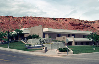
Washington County is a county in the southwestern corner of Utah, United States. As of the 2020 United States Census, the population was 180,279, making it the fifth-most populous county in Utah. Its county seat and largest city is St. George. The county was created in 1852 and organized in 1856. It was named after the first President of the United States, George Washington. A portion of the Paiute Indian Reservation is in western Washington County. Washington County comprises the St. George, UT Metropolitan Statistical Area.

Mohave County is in the northwestern corner of the U.S. state of Arizona. As of the 2020 census, its population was 213,267. The county seat is Kingman, and the largest city is Lake Havasu City. It is the fifth largest county in the United States.

The Grand Staircase–Escalante National Monument (GSENM) is a United States national monument protecting the Grand Staircase, the Kaiparowits Plateau, and the Canyons of the Escalante in southern Utah. It was established in 1996 by President Bill Clinton under the authority of the Antiquities Act with 1.7 million acres of land, later expanded to 1,880,461 acres (7,610 km2). In 2017, the monument's size was reduced by half in a succeeding presidential proclamation, and it was restored in 2021. The land is among the most remote in the country; it was the last to be mapped in the contiguous United States.
The mustang is a free-roaming horse of the Western United States, descended from horses brought to the Americas by the Spanish. Mustangs are often referred to as wild horses, but because they are descended from once-domesticated animals, they are actually feral horses. The original mustangs were Colonial Spanish horses, but many other breeds and types of horses contributed to the modern mustang, now resulting in varying phenotypes. Some free-roaming horses are relatively unchanged from the original Spanish stock, most strongly represented in the most isolated populations.

The Southern Utah Wilderness Alliance (SUWA) is a wilderness preservation organization in the United States based in Salt Lake City, Utah, with field offices in Washington, D.C. and Moab, Utah. The organization formed in 1983 and is a partner in the Utah Wilderness Coalition, a coalition of organizations nationwide that support federal wilderness designation for deserving public lands in Utah.
The Skull Valley Indian Reservation is located in Tooele County, Utah, United States, approximately 45 miles (72 km) southwest of Salt Lake City. It is inhabited by the Skull Valley Band of Goshute Indians of Utah, a federally recognized tribe. As of 2017 the tribe had 134 registered members and 15-20 people living on the reservation.

The Wave is a sandstone rock formation located in Arizona, US, near its northern border with Utah. The formation is situated on the slopes of the Coyote Buttes in the Paria Canyon-Vermilion Cliffs Wilderness of the Colorado Plateau. The area is administered by the Bureau of Land Management (BLM) at the Grand Staircase–Escalante National Monument visitor center in Kanab, Utah.

The Big Maria Mountains are located in the southeastern part of the U.S. state of California, near the Colorado River and Arizona. The range lies between Blythe and Vidal, and west of U.S. Route 95 in California and east of Midland. The mountains are home to the Eagle Nest Mine and reach an elevation of 1,030 meters, (3,379 ft). A power line that runs from Parker Dam to Yuma, Arizona runs through the range. A smaller range, the Little Maria Mountains, lie to the west of the Big Marias.

The Amargosa Desert is located in Nye County in western Nevada, United States, along the California–Nevada border, comprising the northeastern portion of the geographic Amargosa Valley, north of the Ash Meadows National Wildlife Refuge.

The Beaver Dam Mountains Wilderness is a wilderness area located in northwestern Arizona and southwestern Utah, USA, within the arid Colorado Plateau region. The jagged mountains and gently sloping alluvial plain of the Beaver Dam Mountains straddle the border between the two states. The Wilderness contains some of the lowest elevation land in Utah, and includes a 13 miles (21 km) section of the Virgin River Gorge. The area comprises some 18,667 acres (7,554 ha), 15,000 acres (6,100 ha) of which in Arizona and approximately 3,667 acres (1,484 ha) in Utah. The area was designated Wilderness by the U.S. Congress in 1984 and is administered by the Bureau of Land Management.

The Deseret Peak Wilderness is located in the Stansbury Mountains of Tooele County, Utah, United States near the towns of Tooele and Grantsville, not far from the Great Salt Lake. It is part of the Wasatch-Cache National Forest. This semi-arid wilderness is part of the Great Basin ecosystem. Elevations range from about 6,000 feet to the top of Deseret Peak's limestone escarpment at 11,031 feet (3,362 m). In this high country, with barren Skull Valley to the west, you'll find some springs and intermittent creeks, despite the general dryness of the area.
The Piper Mountain Wilderness is a federally designated wilderness area located in the White Mountains 20 miles (32 km) northeast of Big Pine, California in Inyo County, California.
The Sylvania Mountains Wilderness is a federally designated wilderness area located 30 miles (48 km) east of Bishop in the state of California. The wilderness is 18,677acres in size and is managed by the Bureau of Land Management (BLM). The California Desert Protection Act of 1994 created the Sylvania Mountains Wilderness and was added to the National Wilderness Preservation System. The wilderness is bordered by Nevada stateline on the east, Piper Mountain Wilderness on the west and Death Valley National Park to the south.

The Red Mountain Wilderness (Utah) is a 18,729-acre (75.8 km2) wilderness area in the US state of Utah. It was designated March 30, 2009, as part of the Omnibus Public Land Management Act of 2009. Located six miles northeast of St. George, it is bordered by Snow Canyon State Park to the east and the Shivwitz Indian Reservation to the southwest. Approximately one-half of the wilderness is located within the recently designated Red Cliffs National Conservation Area. Prehistoric use by the Southern Paiute Indians has been documented at seven sites in the area, and the BLM estimates archeological site densities between 4 and 40 per square mile.
The Pryor Mountains Wild Horse Range is a refuge for a historically significant herd of free-roaming mustangs, the Pryor Mountain mustang, feral horses colloquially called "wild horses", located in the Pryor Mountains of Montana and Wyoming in the United States. The range has an area of 39,650 acres (160.5 km2) and was established in 1968 along the Montana–Wyoming border as the first protected refuge dedicated exclusively for mustangs. It was the second feral horse refuge in the United States. About a quarter of the refuge lies within the Bighorn Canyon National Recreation Area. A group of federal agencies, led by the Bureau of Land Management, administers the range.

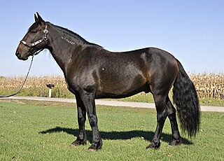
The Pryor Mountain mustang is a substrain of mustang considered to be genetically unique and one of the few strains of horses verified by DNA analysis to be descended from the original Colonial Spanish horses brought to the Americas by the Spanish. They live on the Pryor Mountains Wild Horse Range located in the Pryor Mountains of Montana and Wyoming in the United States, and are the only mustang herd remaining in Montana, and one of sixteen in Wyoming. They are protected by the Wild and Free-Roaming Horses and Burros Act of 1971 (WFRHBA) and managed by the Bureau of Land Management (BLM), who has set the optimum herd number at 120 animals. Genetic studies have revealed that the herd exhibits a high degree of genetic diversity and a low degree of inbreeding, and BLM has acknowledged the genetic uniqueness of the herd. Pryor Mountain Mustangs are relatively small horses, exhibit a natural ambling gait, and domesticated Pryor Mountain mustangs are known for their strength, sure-footedness and stamina. The Pryor Mountains Wild Horse Range is one of the most accessible areas to view feral horse herds in the United States and tourism to the area has increased in recent years.

Basin and Range National Monument is a national monument of the United States spanning approximately 704,000 acres of remote, undeveloped mountains and valleys in Lincoln and Nye counties in southeastern Nevada. It is described as "one of the emptiest spaces in a state famous for its emptiness."

The Onaqui Mountains are a mountain range in southeastern Tooele County, Utah United States.


