
Colorado is a state in the Mountain West subregion of the Western United States. It encompasses most of the Southern Rocky Mountains, as well as the northeastern portion of the Colorado Plateau and the western edge of the Great Plains. Colorado is the eighth most extensive and 21st most populous U.S. state. The 2020 United States census enumerated the population of Colorado at 5,773,714, an increase of 14.80% since the 2010 United States census.

Colorado Springs is a home rule municipality in, and the county seat of, El Paso County, Colorado, United States. It is the largest city in El Paso County, with a population of 478,961 at the 2020 United States Census, a 15.02% increase since 2010. Colorado Springs is the second-most populous city and the most extensive city in the state of Colorado, and the 40th-most populous city in the United States. It is the principal city of the Colorado Springs metropolitan area and the second-most prominent city of the Front Range Urban Corridor. It is located in east-central Colorado, on Fountain Creek, 70 miles (113 km) south of Denver.

Golden is a home rule city that is the county seat of Jefferson County, Colorado, United States. The city population was 20,399 at the 2020 United States Census. Golden lies along Clear Creek at the base of the Front Range of the Rocky Mountains. Founded during the Pike's Peak Gold Rush on June 16, 1859, the mining camp was originally named Golden City in honor of Thomas L. Golden. Golden City served as the capital of the provisional Territory of Jefferson from 1860 to 1861, and capital of the official Territory of Colorado from 1862 to 1867. In 1867, the territorial capital was moved about 12 miles (19 km) east to Denver City. Golden is now a part of the Denver–Aurora–Lakewood, CO Metropolitan Statistical Area and the Front Range Urban Corridor.

El Paso County is a county located in the U.S. state of Colorado. The 2020 Census recorded its population as 730,395. The Census Bureau's 2020 result indicates it is the most populous county in Colorado, surpassing the City and County of Denver. The county seat is Colorado Springs, the second most populous city in Colorado. El Paso County is included in the Colorado Springs, Colorado, Metropolitan Statistical Area and is located in Colorado's 5th congressional district.
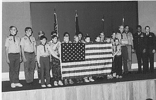
Scouting in Colorado has a long history, from the 1910s to the present day.

Woodland Park is home rule municipality in Teller County, Colorado, United States. Woodland Park is part of the Colorado Springs, CO Metropolitan Statistical Area. Many residents in this bedroom community commute to Colorado Springs. Woodland Park is surrounded by the 1,000,000-acre (400,000 ha) Pike National Forest. The population was 7,920 as of the 2020 Census.

Zebulon is a city in Pike County, Georgia, United States. The population was 1,174 at the 2010 census. The city is the county seat of Pike County. The city and county were named after explorer Zebulon Pike.
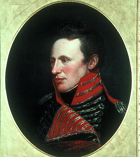
Zebulon Montgomery Pike was an American brigadier general and explorer for whom Pikes Peak in Colorado was named. As a U.S. Army officer he led two expeditions under authority of President Thomas Jefferson through the Louisiana Purchase territory, first in 1805–1806 to reconnoiter the upper northern reaches of the Mississippi River, and then in 1806–1807 to explore the southwest to the fringes of the northern Spanish-colonial settlements of New Mexico and Texas. Pike's expeditions coincided with other Jeffersonian expeditions, including the Lewis and Clark Expedition and the Red River Expedition in 1806.
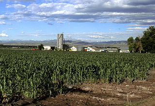
The Eastern Plains of Colorado refers to a region of the U.S. state of Colorado east of the Rocky Mountains and east of the population centers of the Front Range.
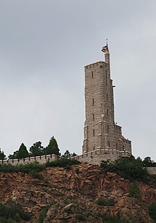
Will Rogers Shrine of the Sun, also known as Will Rogers Shrine, is a commemorative tower and chapel on Cheyenne Mountain in Colorado Springs, Colorado. It is named after Will Rogers, the American humorist, who died in a plane crash in Alaska in 1935 during construction of the shrine. It is also a tomb for the remains of Spencer Penrose – who built many of the city's prominent properties, including the neighboring Cheyenne Mountain Zoo and The Broadmoor resort – and his wife Julie Penrose. Completed by Penrose in 1937, the shrine is a 100 feet (30 m), five story observation tower that overlooks The Broadmoor, Colorado Springs, and Garden of the Gods.

The Vanguard School (TVS) is a public charter school in Colorado Springs, Colorado, United States. Founded as the Cheyenne Mountain Charter Academy (CMCA) in 1995, it is chartered with the Harrison School District 2. Originally founded as a K–6 charter school, the school expanded to a K–12 school by 2006, and it graduated its first class of seniors in 2010.

Cheyenne Mountain High School (CMHS) is located in Colorado Springs, Colorado, United States. It is the only high school in Cheyenne Mountain School District 12. Its campus contains several buildings, including a recreation center, library, cafeteria, and an arts building.

Before it was founded, the site of modern-day Colorado Springs, Colorado, was part of the American frontier. Old Colorado City, built in 1859 during the Pike's Peak Gold Rush was the Colorado Territory capital. The town of Colorado Springs, was founded by General William Jackson Palmer as a resort town. Old Colorado City was annexed into Colorado Springs. Railroads brought tourists and visitors to the area from other parts of the United States and abroad. The city was noted for junctions for seven railways: Denver and Rio Grande (1870), Denver and New Orleans Manitou Branch (1882), Colorado Midland (1886-1918), Colorado Springs and Interurban, Atchison, Topeka, and Santa Fe (1889), Rock Island (1889), and Colorado Springs and Cripple Creek Railways. It was also known for mining exchanges and brokers for the Cripple Creek Gold Rush.

Pikes Peak is the highest summit of the southern Front Range of the Rocky Mountains, in North America. The ultra-prominent 14,115-foot (4,302.31 m) fourteener is located in Pike National Forest, 12 miles (19 km) west of downtown Colorado Springs, Colorado. The town of Manitou Springs lies at its base.

The Pike County School District is a public school district in Pike County, Georgia, United States, based in Zebulon. It serves the communities of Concord, Hilltop, Meansville, Molena, Williamson, and Zebulon. Michael Duncan, Ed.D. is the superintendent of schools.
Ivywild, Colorado, is a subdivision of Colorado Springs south of the downtown, west of Cascade Avenue and along Cheyenne Creek. As of 2015, the United States Geological Survey defines Ivywild as a Populated Place. It is one of the city's oldest working-class neighborhoods.

Cheyenne Mountain Space Force Station (CMSFS) is located in Cheyenne Mountain on the Front Range of the Rocky Mountains in unincorporated El Paso County, Colorado, next to Colorado Springs, The Cheyenne Mountain Complex, an underground facility within Cheyenne Mountain SFS, was first built for the North American Aerospace Defense Command (NORAD) Combat Operations Center, though NORAD moved day-to-day operations to its headquarters on Peterson AFB in 2006. However, day-to-day operations were moved back in 2011 after a major overhaul and renovation. The location now supports U.S. Space Command's Missile Warning Center, other strategic warning and survivable capabilities, and provides a ready alternative operating location for NORAD's command center.

Blodgett Peak is a mountain summit in El Paso County, Colorado. Blodgett Peak is located in Pike National Forest. and at its base is Blodgett Peak Open Space of Colorado Springs.
The following is a timeline of the history of the city of Colorado Springs, Colorado, USA.

Cheyenne Mountain is a triple-peaked mountain in El Paso County, Colorado, southwest of downtown Colorado Springs. The mountain serves as a host for military, communications, recreational, and residential functions. The underground operations center for the North American Aerospace Defense Command (NORAD) was built during the Cold War to monitor North American airspace for missile launches and Soviet military aircraft. Built deep within granite, it was designed to withstand the impact and fallout from a nuclear bomb. Its function broadened with the end of the Cold War, and then many of its functions were transferred to Peterson Air Force Base in 2006.