
Udayapur District (Nepali: उदयपुर जिल्लाListen , is one of 14 districts of Koshi Province of eastern Nepal. The district, with Triyuga as its district headquarters, covers an area of 2,063 km2 and in 2001 had a population of 287,689, in 2011 of 317,532, in 2021 of 342,773

A village development committee in Nepal was the lower administrative part of its Ministry of Federal Affairs and Local Development. Each district had several VDCs, similar to municipalities but with greater public-government interaction and administration. There were 3,157 village development committees in Nepal. Each village development committee was further divided into several wards depending on the population of the district, the average being nine wards.
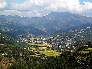
Sandhikharka Municipality is the headquarter of Arghakhanchi District which lies in Lumbini Province of Nepal. The former village development committee (VDC) was converted into a municipality on 18 May 2014 by merging the existing Sandhikharka, Wangla, Narapani, Khanchikot, Kimadada, Argha and Dibharna VDCs evdo. It is located, in a valley surrounded by hills, in the western part of the capital, Kathmandu.
Narayansthan is a village development committee in Baglung District in the Dhaulagiri Zone of central Nepal.It is located above the bank of Kali gandaki River. Now, it has become one of the major important place in baglung. They have planned to construct the domestic Airport. At the time of the 2011 Nepal census it had a population of 2,876 and had 781 houses in the town. The major castes living in the VDC are Brahman, Chhetry and Newar. There are 2 high schools - Janatadhan Higher School and Ganesh Secondary School and one campus. Krishna Gandaki Campus is at the premises of Janatadhan HSS. Ganesh Secondary School, one of the best schools in the region is known for its quality education movement. Established in 1957 [2014 BS] by Soldier Board (India), Ganesh Secondary School is one of the oldest schools. In 1964 [2021 BS], the Indian Soldier Board stopped its grant. Since there was no school support mechanism developed from the Government of Nepal, the school passed through many ups and downs. After Modern Education Act came in effect in 1971 BS [2028 BS], the school merged with Janatadhan Higher Secondary School. In 1980 [2037 BS], the school was reopened.
Dilasaini is a former village development committee that is now a Rural Municipality in Baitadi District in Sudurpashchim Province of western Nepal. At the time of the 1991 Nepal census it had a population of 4,828 and had 849 houses in the village. There is one plus two, two high schools and many primary schools in the VDC. This VDC is bordered by Mathairaj, Gokuleshwor, Rudreswor and Rim VDC and Darchula district in the northwest. This VDC is named after a local deity. The temple of this devi is located in Dhamigaun which is one of the wards of the VDC. This temple is famous in far-western Nepal for the sacrifice of huge number of bull buffaloes on occasion of Dashain.
Satyadevi is a village development committee in Dhading District in the Bagmati Zone of central Nepal. At the time of the 1991 Nepal census it had a population of 3389 and had 655 houses in it.
Juniya is a village and VDC in Gulmi District in the Lumbini Zone of western Nepal. It is surrounded by Johang VDC in the south and East, Bharse in the north and Rupakot VDC in the west. This VDC is located in a wonderful geographical location that is with high hills Lek and low hills Besi. At the time of the 1991 Nepal census it had a population of 2827 persons living in 568 individual households.
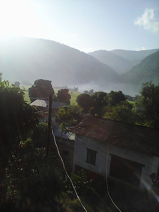
Rupakot is a Village Development Committee (VDC) in Gulmi District in the Lumbini Zone of central Nepal. Its headquarters is in Myal pokhara. It is located in about the center of Gulmi District. It is surrounded by hills. Its main religion is Hinduism. There are many temples like Chhatra Thaan, Shiddababa temple, Shiva Temple, Ram Temple, Debi deurali temple etc. The main sources of revenue for the village are agriculture and foreign employment. At the time of the 2001 Nepal census, it had a population of 3521 persons residing in 704 individual households. 76.48% of students attend school. The most populated parts of this VDC is Damuka, Sota & Ekle Pipal.

Khokana is a former Village Development Committee (VDC) which has been merged with the neighbouring VDC's of Bungamati, Chhampi, Dukuchhap, Sainbu and other 38 VDC's to form the Metropolitan City of Lalitpur in Lalitpur District in the Bagmati Zone of central Nepal. At the time of the 1991 Nepal census, Khokana had a population of 4258 living in 699 individual households. According to 2011 Nepal census, Khokana had a population of 4927 living in 1056 individual households.
Lamatar is a village and former Village Development Committee that is now part of Mahalaxmi Municipality in Province No. 3 of central Nepal.
Amlekhganj (Nepali:अमलेखगंज) is a town and Village Development Committee in Bara District in the Narayani Zone of south-eastern Nepal. At the time of the 2011 Nepal census it had a population of 6,709 people living in 1370 individual households. There were 3,413 males and 3,296 females at the time of census. At one time it was famed as the starting point of the Nepal Government Railway (NGR) which connected it with Raxaul in India.
Dhikurpokhari is a suburb and former Village Development Committee in Kaski District in the Gandaki Province of northern-central Nepal. At the time of the 1991 Nepal census it had a population of 7,392 persons living in 1,427 individual households.
Jijodamandau is a village development committee in Doti District in the Seti Zone of western Nepal. At the time of the 1991 Nepal census it had a population of 1906 living in 365 individual households.
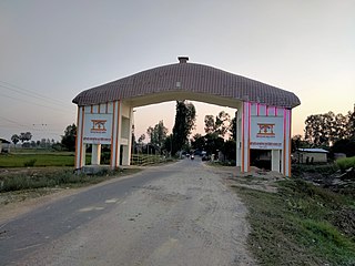
Matihani is a municipality situated in Mahottari District of Nepal. The Municipality is well known for its historical significance and its festivities. The municipality was formed in 2016 from its current 9 wards from 9 former VDCs. It occupies an area of 29.02 sq. km with a total population of 31,026.
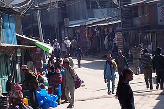
Pakhribas is an urban municipality out of three urban municipalities located in Dhankuta District of Province No. 1 of Nepal. Pakhribas municipality established on 2 December 2014 merging following VDCs: Pakhribas, Sanne, Phalate, Ghorlikharka and Muga.
Jhalariझलारी is a Village Development Committee in Kanchanpur District in Sudurpashchim Province of South-Far-Western Nepal. At the time of the 1991 Nepal census it had a population of 10,590 people living in 1702 individual households.

Katahariya is a municipality in Rautahat District in the Narayani Zone of south-eastern Nepal. Before September 2017, Katahariya was one of the Village Development Committees with 8 wards. At the time of the 1991 Nepal census, it had a population of 4,619 people living in 835 individual households. Katahariya is famous for its vegetables and cattle market. It has a well-maintained Farmers' market (vegetable) and Cattle (domestic-animal) market. Katahariya is a fast-growing VDC, with the main occupations of local people being business and farming.

Previously Ugarachandi Nala was a village development committee located in Kavrepalanchok District of Nepal. It is named after the temple of goddess Ugrachandi Bhagawati located in Nala Bazaar. But now in the year 2017 AD it has been changed and divided into ward no. 3 and 4 of Banepa municipality. According to the 1991 Nepal census, the population of the VDC is 6,327 in 1,035 individual households.
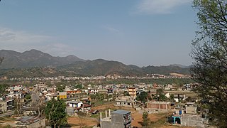
Shuklagandaki is a municipality located in Tanahu District of Gandaki Province in the Western Development Region, Nepal. The municipality was formed on 18 May 2014. It was formed by merging three Village Development Committees: Dhorphirdi, Dulegaunda and Khairenitar. And further more Thaprek, Raipur and Phirphire VDC are merged on 5 March 2017.


