Collingwood, Victoria

Last updated

Collingwood
Melbourne,  Victoria
Collingwood aerial.jpg
Aerial view of Collingwood looking south west toward Victoria Parade; Hoddle Street (left) and Smith Street on (top right)
Australia Victoria metropolitan Melbourne location map.svg
Red pog.svg
Collingwood
Collingwood, Victoria
Coordinates 37°48′07″S144°59′17″E / 37.8019°S 144.98815°E / -37.8019; 144.98815
Population9,179 (SAL 2021) [1]
 • Density7,217/km2 (18,690/sq mi)
Established1850s
Postcode(s) 3066
Elevation25 m (82 ft)
Area1.3 km2 (0.5 sq mi)
LGA(s) City of Yarra
State electorate(s) Richmond
Federal division(s) Melbourne
Suburbs around Collingwood:
Fitzroy North Clifton Hill Clifton Hill
Fitzroy Collingwood Abbotsford
Melbourne East Melbourne Richmond

Collingwood is an inner-city suburb in Melbourne, Victoria, Australia, 3km north-east of the Melbourne central business district, located within the City of Yarra local government area. Collingwood recorded a population of 9,179 at the 2021 census. [2]

Contents

The area now known as Collingwood is thought to have been named Yálla-birr-ang by the Wurundjeri people, the original Indigenous inhabitants of the area. [3] Following colonisation, the suburb was named in 1842 after Baron Collingwood or an early hotel which bore his name. [4] [5] Collingwood is one of the oldest suburbs in Melbourne and is bordered by Smith Street, Alexandra Parade, Hoddle Street and Victoria Parade.

Collingwood is notable for its historical buildings, with many nineteenth century dwellings, shops and factories still in use. Its major thoroughfare Smith Street, is one of Melbourne's major nightlife and retail strips, and has been voted the coolest street in the world. [6] A former industrial suburb, Collingwood is now considered one of Melbourne's gay villages and houses a number of creative arts businesses.

History

Toponymy

It was 'named after' Lord Horatio Nelson's 'favourite admiral' Cuthbert Collingwood, 1st Baron Collingwood (or, possibly after the Collingwood Hotel which existed there and was named after the admiral) by surveyor Robert Hoddle, under instructions from Superintendent Charles La Trobe, in 1842. [4] [5]

Establishment

Prefabricated houses imported from Singapore during the 1850s Singapore Cottage, Collingwood.jpg
Prefabricated houses imported from Singapore during the 1850s
Collingwood Coffee Palace in 1879. It now forms part of the facade of Woolworths in Smith Street. Collingwood coffee palace in 1879.jpg
Collingwood Coffee Palace in 1879. It now forms part of the facade of Woolworths in Smith Street.

Subdivision and sale of land in Collingwood began in 1838, and was mostly complete by the 1850s. Collingwood was declared a municipality, separate from the City of Melbourne on 24 April 1855, the first to follow the state's major population centres of Melbourne and Geelong. [7] Collingwood was proclaimed a town in 1873, and later a city in 1876. [8]

Collingwood's early development was directly impacted by the boom in Melbourne's population and economy during the Victorian gold rush of the 1850s and 1860s. This resulted in the construction of a large number of small dwellings, as well as schools, shops and churches to support this new population. Around the same time, large industrial developments such as a flour mill and the Fosters brewery were being established.

19th and 20th centuries

In the 1870s, Smith Street became the dominant shopping strip, with its tram line established in 1887. Many of Collingwood's grand public buildings were erected in the 1880s, including the post office and town hall. Collingwood also had a strong temperance movement, with two "coffee palaces" springing up in the 1870s, including the large and grand Collingwood Coffee Palace (now the facade of Woolworths – minus original classical pediment and mansard).

At the turn of the century Collingwood's Smith Street rivalled Chapel Street in Prahran as the dominant home of suburban emporiums and department stores. The first G.J. Coles store was opened in the street in 1912.

Since the 1950s, Collingwood has been home to many groups battling to save the suburb's unique character against development and gentrification.

In 1958 residents rallied at Collingwood Town Hall against the Housing Commission of Victoria's slum reclamation projects, which would see demolition orders for 122 of the suburb's homes. [9]

In the 1970s, 150 residents protested against plans for the F-19 freeway, with some putting themselves in front of earthmovers during the construction. [10] [11] In 1979, two women were killed in their home on Easy Street in northern Collingwood in what became known as the Easy Street murders.

Recent history

The hotel and music venue The Tote is considered an icon of Melbourne's rock and roll scene. The Tote, Collingwood.jpg
The hotel and music venue The Tote is considered an icon of Melbourne's rock and roll scene.

The Collingwood Action Group formed in 2006 to fight the "Banco" development, a large mixed use project on Smith Street. [12] In 2010, over 2,000 people rallied to save The Tote Hotel, a popular live music venue, which became a potential state election issue. [13] The 2016 Bendigo Street housing dispute occurred in north-east Collingwood, in which the community took control of up to 15 empty state government owned houses, in an attempt to provide housing for Melbourne's rising homeless population, in the absence of adequate public housing.

In recent years, the office sector has grown in Collingwood, with a number of developments in its southern former industrial area, with some major companies locating their headquarters in the suburb. [14] [15]

Geography

Collingwood's topography is mostly flat, but a prominent slope extends from Hoddle Street up to Smith Street, and also along sections of Hoddle Street.[ citation needed ]

The suburb is notable for its historical buildings, with many nineteenth century dwellings, shops and factories still in use. From its early days large commercial buildings often coexisted with small dwellings, occupied by working-class families and the mixture of industry and community continues to the present time. For example, Oxford and Cambridge Streets are dominated by imposing red-brick factories and warehouses, formerly occupied by Foy & Gibson, but also feature a number of stone, brick and timber dwellings that date back to the earliest days of the suburb.

Culture

Sport

Collingwood Football Club has a history dating back to 1892 as an incorporated football club. They were once housed at Victoria Park and are now based at the Melbourne Cricket Ground (MCG).

In recent years they won the 2010 Grand Final rematch against St Kilda. They have won 15 VFL/AFL premierships, which is the second most in the league behind Carlton and Essendon, and also won the 1896 VFA premiership.

Community radio

The Johnston Street entrance to Collingwood Yards, which houses a number of galleries, studios, artist spaces and arts businesses Collingwood Yards facade.jpg
The Johnston Street entrance to Collingwood Yards, which houses a number of galleries, studios, artist spaces and arts businesses

3CR is an independent community radio station that is located at the Victoria Parade end of Smith Street. The station has been based in the suburb since 1977 and its frequency is 855AM. [16]

PBS 106.7FM relocated from St Kilda to Collingwood and is located at 47 Easey Street. PBS is a community radio station that celebrated its 25th year of broadcasting in 2004.

Arts

The Collingwood Arts Precinct, known as Collingwood Yards, is located on the site of the former Collingwood Technical School and opened on 13 March 2021. [17] Circus Oz is also located in the Yards on Perry Street and has a purpose-built Melba Spiegeltent. [18]

Economy

Airline Jetstar, media distributor Madman Entertainment, vitamin brand Swisse and luxury cosmetics brand Aesop have their headquarters located in Collingwood. [19] [20] [21] [15] Many architecture firms are based or have offices in Collingwood and neighbouring Fitzroy, including the headquarters of DKO Architecture. [22]

Commercial areas

Smith Street in November 2006 Smith street collingwood looking north.jpg
Smith Street in November 2006

The main commercial area is Smith Street, which borders Fitzroy. In 2021, Smith Street was named the coolest street in the world. [23] [24] [25] [26]

Gay village

Collingwood is one of Melbourne's gay villages with several gay oriented entertainment venues. [27] These include the Peel Dancebar which, in 2007, was granted the legal right to ban heterosexual patrons from the bar. [28] [29] [30] By November 2019, sex on premises venue Club 80 had operated in Collingwood for over twenty years, but was closed in 2020 after the sale of its building. [31] [32]

Education

Collingwood Technical School was established in July 1912 as a trades and technical training school. The school closed in 1987 and, combined with the Preston Technical School, was the basis for the formation of the Melbourne Polytechnic, which has a Collingwood campus on Otter Street. [33] In 2022, work began on a major upgrade to the Melbourne Polytechnic Collingwood campus. [34]

Collingwood College, a state P-12 school, is located in the suburb. The private tertiary education provider Collarts is located in the suburb with its main campus on Wellington Street, and specialises in design and creative arts degrees. [35]

Demographics

Historical population
YearPop.±%
20015,081    
20065,493+8.1%
20116,467+17.7%
20168,513+31.6%
20219,179+7.8%

In the 2021 census, there were 9,179 people in Collingwood. 58.4% of people were born in Australia. The next most common countries of birth were England 4.3%, New Zealand 3.6%, Vietnam 3.1%, Ethiopia 1.9% and China 1.8%. 68.3% of people spoke only English at home. Other languages spoken at home included Vietnamese 4.0%, Mandarin 2.2%, Somali 1.9%, Oromo 1.8%, and Cantonese 1.7%. The most common response for religion was No Religion at 58%. [36]

Housing

Many of Collingwood's warehouses and factories have been converted into apartments. Apartments, Oxford Street, Collingwood.jpg
Many of Collingwood's warehouses and factories have been converted into apartments.

Collingwood's housing consists of a large number of high-rise housing commission flats and a number of older single and double storey former workers cottages on small subdivisions.

More recently older warehouses and factories have been converted into apartments and there has been modern townhouse infill and medium density unit development.

Governance

The City of Collingwood existed from 1855 until 1994, the suburb is now part of the City of Yarra local government area.

Public and commercial buildings

Collingwood Town Hall Collingwood Town Hall.jpg
Collingwood Town Hall

Collingwood has many buildings listed on the Victorian Heritage Register and several notable commercial and public buildings. Yorkuprhire Brewery, built in 1880 to the design of James Wood, with its polychrome brick and mansard roof tower, was once Melbourne's tallest building. For many years it has been subject to development proposals and the heritage stables were at one stage demolished without a permit. The site has since been converted to an apartment development.

The former Collingwood Post Office was built between 1891 and 1892 in the Victorian Mannerist style, to the design of John Marsden and is similar to Rupertswood, with its tall tower.

Prominent hotels include the Leinster Arms Hotel, established in 1865 and is the only single storey hotel built in Melbourne in that era, the Sir Robert Peel ("The Peel") Hotel and the Vine Hotel.

The original Collingwood Magistrates' Court closed on 1 February 1985, but continued local need saw the establishment of the Neighbourhood Justice Centre court in the suburb in 2007. [37] [38]

Despite its name, the Collingwood Children's Farm is in the neighbouring suburb of Abbotsford.

Transport

The roads within Collingwood are mainly narrow one-way streets. The suburb is bounded by main roads: Smith Street to the west, Victoria Parade to the south, Hoddle Street to the east and Alexandra Parade to the north. Major tram routes are on Victoria Parade (tram route 109 and tram route 12) and Smith Street (route 86), which are on the edge of the suburb. Johnston, Wellington and Langridge Streets are the main arterials going through the suburb.

The suburb is served by the nearby Victoria Park and Collingwood railway stations, located in neighbouring Abbotsford.

Separated north-south cycling lanes began being installed on Wellington Street in 2013 and now run to Victoria Street. [39] In 2018, the northern half of Collingwood and Fitzroy reduced its speed limits to 30 km/h, in a first for Melbourne. [40]

Keith Haring Mural (1984) at the former Collingwood Technical College Keith Haring Mural Collingwood.jpg
Keith Haring Mural (1984) at the former Collingwood Technical College

Australian author Frank Hardy set the novel Power Without Glory in a fictionalised version of the suburb, named Carringbush. [41] The name is used by a number of businesses in the area, such as "Carringbush Business Centre". At one time a ward in the City of Yarra that includes part of Collingwood was actually named Carringbush.

Notable people

Related Research Articles

<span class="mw-page-title-main">City of Yarra</span> Local government area in Melbourne, Victoria, Australia

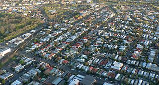
The City of Yarra is a local government area (LGA) in Victoria, Australia in the inner eastern and northern suburbs of Melbourne. It is the second smallest LGA in the state with an area of 19.5 square kilometres (7.5 sq mi), and in June 2021 it had a population of 91,543, making it the second most densely populated LGA, with around 4,695 people per square kilometre. The City of Yarra was formed in 1994 as a result of the amalgamation of the former Cities of Richmond, Collingwood, Fitzroy, and parts of Carlton North and parts of Alphington and Fairfield.

<span class="mw-page-title-main">Kew, Victoria</span> Suburb of Melbourne, Victoria, Australia

Kew (;) is a suburb of Melbourne, Victoria, Australia, 5 km east from Melbourne's Central Business District, located within the City of Boroondara local government area. Kew recorded a population of 24,499 at the 2021 census.

<span class="mw-page-title-main">Abbotsford, Victoria</span> Suburb of Melbourne, Victoria, Australia

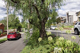
Abbotsford is an inner-city suburb in Melbourne, Victoria, Australia, 2 km (1.2 mi) north-east of Melbourne's Central Business District, located within the City of Yarra local government area. Abbotsford recorded a population of 9,088 at the 2021 census.

<span class="mw-page-title-main">Clifton Hill, Victoria</span> Suburb of Melbourne, Victoria, Australia

Clifton Hill is an inner-city suburb in Melbourne, Victoria, Australia, 4 km (2.5 mi) north-east of Melbourne's Central Business District, located within the City of Yarra local government area. Clifton Hill recorded a population of 6,606 at the 2021 census.

<span class="mw-page-title-main">Fitzroy, Victoria</span> Suburb of Melbourne, Victoria, Australia

Fitzroy is an inner-city suburb in Melbourne, Victoria, Australia, 3 km (1.9 mi) north-east of Melbourne's Central Business District, located within the City of Yarra local government area. Fitzroy recorded a population of 10,431 at the 2021 census.

<span class="mw-page-title-main">Fitzroy North, Victoria</span> Suburb of Melbourne, Victoria, Australia

Fitzroy North is an inner-city suburb in Melbourne, Victoria, Australia, 4 km (2.5 mi) north-east of Melbourne's Central Business District, located within the Cities of Merri-bek and Yarra local government areas. Fitzroy North recorded a population of 12,781 at the 2021 census.

<span class="mw-page-title-main">Richmond, Victoria</span> Suburb of Melbourne, Victoria, Australia

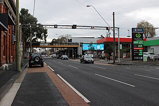
Richmond is an inner-city suburb in Melbourne, Victoria, Australia, 3 km (1.9 mi) east of the Melbourne central business district, located within the City of Yarra local government area. Richmond recorded a population of 28,587 at the 2021 census, with a median age of 34.

<span class="mw-page-title-main">Greensborough, Victoria</span> Suburb of Melbourne, Victoria, Australia

Greensborough is a suburb of Melbourne, Victoria, Australia, 17 km (11 mi) north-east from Melbourne's Central Business District, located within the City of Banyule and Shire of Nillumbik local government areas. Greensborough recorded a population of 21,070 at the 2021 census.

<span class="mw-page-title-main">Alphington, Victoria</span> Suburb of Melbourne, Victoria, Australia

Alphington is a suburb in Melbourne, Victoria, Australia, 7 km (4.3 mi) north-east of Melbourne's Central Business District, located within the Cities of Darebin and Yarra local government areas. Alphington recorded a population of 5,702 at the 2021 census.

<span class="mw-page-title-main">Hoddle Highway</span> Highway in Melbourne, Victoria

Hoddle Highway is an urban highway in Melbourne linking CityLink and the Eastern Freeway, itself a sub-section of Hoddle Main Road. Both these names are not widely known to most drivers, as the entire allocation is still best known as by the names of its constituent parts: Hoddle Street, Punt Road and Barkly Street. This article will deal with the entire length of the corridor for sake of completion, as well to avoid confusion between declarations.

<span class="mw-page-title-main">Smith Street, Melbourne</span> Street in Melbourne, Australia

Smith Street is a street in inner northern Melbourne, running north from the city proper and separating Fitzroy from Collingwood.

<span class="mw-page-title-main">Eastern Freeway (Melbourne)</span>

The Eastern Freeway is an urban freeway in eastern Melbourne, the state capital of Victoria, Australia. It is one of the most important freeways in terms of commuting to the city, connecting Alexandra Parade and Hoddle Street in the inner suburbs, with EastLink tollway farther east. It consists of between three and six lanes in each direction, also an inbound transit lane reserved for vehicles with two or more occupants during peak hours.

<span class="mw-page-title-main">Elizabeth Street, Melbourne</span> Road in Melbourne, Victoria

Elizabeth Street is one of the main streets in the Melbourne central business district, Victoria, Australia, part of the Hoddle Grid laid out in 1837. It is presumed to have been named in honour of governor Richard Bourke's wife.

<span class="mw-page-title-main">East Melbourne</span> Suburb of Melbourne, Victoria, Australia

East Melbourne is an inner-city suburb in Melbourne, Victoria, Australia, 2 km (1.2 mi) east of Melbourne's Central Business District, located within the City of Melbourne local government area. East Melbourne recorded a population of 4,896 at the 2021 census.

<span class="mw-page-title-main">Victoria Street, Melbourne</span> Road in Melbourne, Victoria

Victoria Street is one of the major thoroughfares of inner Melbourne, running east–west for over six kilometres between Munster Terrace in North Melbourne and the Yarra River. The road is known as Victoria Parade for over one-and-a-half kilometres of its length, distinguishable with a wide reservation and tramway down the middle.

<span class="mw-page-title-main">Collingwood College, Victoria</span> Public, co-educational, prep to year 12 school in Collingwood, Victoria, Australia

Collingwood College is a government school located in the inner-city suburb of Collingwood, close to the Melbourne CBD.

<span class="mw-page-title-main">Collingwood Town Hall</span>

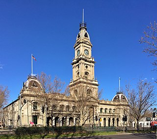
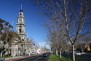
Collingwood Town Hall is a civic building located on Hoddle Street in Abbotsford, a suburb of Melbourne, Australia.

Eastern Highway is a 1.2 kilometre highway in inner northern Melbourne, Australia, that ultimately acts as a feeder road into the Eastern Freeway. This name however is not widely known to most drivers, as the allocation is still best known by the name of its sole constituent part: Alexandra Parade.

<span class="mw-page-title-main">Austral Picture Theatre</span> Former theatre in Collingwood, Victoria

The Austral Picture Theatre was a theatre and cinema built in Collingwood, Victoria, Australia. It opened in 1921 as a theatre and later became a roller skate rink. It is currently used as a carpet store, with plans to partially demolish the building to make way for apartments.

References

  1. Australian Bureau of Statistics (28 June 2022). "Collingwood (Vic.) (Suburb and Locality)". Australian Census 2021 QuickStats. Retrieved 28 June 2022.  OOjs UI icon edit-ltr-progressive.svg
  2. "The forgotten Aboriginal names for 10 of Melbourne's suburbs". ABC News. 9 July 2018. Retrieved 30 May 2022.
  3. 1 2 "VICTORIAN HISTORY". The Argus . Melbourne. 15 October 1909. p. 9. Retrieved 26 September 2013 via National Library of Australia.
  4. 1 2 Barnard, Jill (25 February 2010). "Collingwood". e-Melbourne. School of Historical Studies Department of History, The University of Melbourne. Retrieved 25 September 2013.
  5. Russo, Rebecca. "Smith Street has been named the coolest street in the world". Time Out Melbourne. Retrieved 30 May 2022.
  6. Chisholm, Hugh, ed. (1911). "Collingwood (Australia)"  . Encyclopædia Britannica . Vol. 6 (11th ed.). Cambridge University Press. p. 691.
  7. Monash University (November 2004). "Collingwood, Victoria". Internet Archive Wayback Machine. Internet Archive Wayback Machine. Archived from the original on 15 June 2005. Retrieved 1 September 2012.
  8. "The Age - Google News Archive Search". news.google.com. Retrieved 12 April 2018.
  9. [ dead link ]
  10. "1970s. Anti-freeway protest". www.picturevictoria.vic.gov.au. 1 June 2005. Retrieved 12 April 2018.
  11. "Smith Street - Collingwood Action Group (CAG)". Archived from the original on 8 January 2010. Retrieved 28 January 2010.
  12. Stark, Jill; Craig, Natalie (24 January 2010). "Spring Street tap dances, fearing the Tote could rock the vote". The Age. Melbourne.
  13. Ng, Thierry (19 June 2023). "Demand surges through Collingwood's office market". The Property Tribune. Retrieved 5 September 2023.
  14. 1 2 Pallisco, Marc (2 June 2022). "Swisse relocates HQ within Collingwood". Real Estate Source. Retrieved 5 September 2023.
  15. 3CR 855 AM (2012). "The 3CR story". 3CR Community Radio. 3CR 855 AM. Retrieved 1 September 2012.[ permanent dead link ]
  16. "Collingwood Yards official Open Day | Yarra City Arts". arts.yarracity.vic.gov.au. Retrieved 18 November 2021.
  17. "The Melba Spiegeltent". www.onlymelbourne.com.au. Retrieved 18 November 2021.
  18. "Contact Information." Madman Entertainment. Retrieved 29 March 2010.
  19. "Map of the Ward Boundaries Archived 2 June 2010 at the Wayback Machine ." City of Yarra. Retrieved 29 March 2010.
  20. "Inside Aesop's New Melbourne Headquarters". Design Anthology. 30 June 2023. Retrieved 5 September 2023.
  21. Nicholson, Ralph (17 November 2022). "DKO Plans $30m Headquarters in Collingwood". The Urban Developer. Retrieved 5 September 2023.
  22. Kelly, Cait (11 June 2021). "Melbourne beats out Sydney, with this street named the coolest in the world". The New Daily. Retrieved 17 June 2021.
  23. Street, Francesca. "The world's 'coolest' street revealed by Time Out". CNN. Retrieved 17 June 2021.
  24. McMah, Lauren. "Melbourne's Smith Street named coolest street in the world". news.com.au. News Corp. Retrieved 17 June 2021.
  25. Russo, Rebecca. "Smith Street has been named the coolest street in the world". Timeout. Retrieved 17 June 2021.
  26. Richard Watts (2011). "Gay & Lesbian Melbourne" (PDF). Lonely Planet. Archived from the original (PDF) on 7 June 2011. Retrieved 12 September 2020.
  27. Editorial (29 May 2007). "Gay conundrum". The Herald Sun . Archived from the original on 3 July 2007. Retrieved 12 September 2020.
  28. "Gay pub defends 'straight' ban". The Age . Australian Associated Press. 28 May 2007. Retrieved 21 December 2008.
  29. Steve Dow (30 May 2007). "Don't lock out the heterosexuals". The Age . Retrieved 21 December 2008.
  30. Marc Pallisco (1 November 2019). "Collingwood home of Club 80 sold and set to make way for offices". realestatesource.com.au. Retrieved 12 September 2020.
  31. Pallisco, Marc (28 July 2020). "Collingwood's ex-Club 80 earmarked for eight storey office". realestatesource. Retrieved 5 September 2023.
  32. "Collingwood Campus | Melbourne Polytechnic". www.melbournepolytechnic.edu.au. Retrieved 5 September 2023.
  33. "A $40 mil Collingwood campus | Melbourne Polytechnic". www.melbournepolytechnic.edu.au. Retrieved 5 September 2023.
  34. Collarts. "About Us – Collarts". www.collarts.edu.au. Retrieved 21 September 2022.
  35. Australian Bureau of Statistics (28 June 2022). "Collingwood (Vic.)". 2021 Census QuickStats. Retrieved 25 July 2022. OOjs UI icon edit-ltr-progressive.svg
  36. "Special Report No. 4 - Court Closures in Victoria" (PDF). Auditor-General of Victoria. 1986. p. 79. Retrieved 12 April 2020.
  37. "Neighbourhood Justice Centre Celebrates 10 Years". 6 March 2017. Department of Premier and Cabinet. Retrieved 12 April 2020.
  38. Price, Nic (30 December 2013). "Yarra Council to press ahead with Copenhagen bike lanes and loss of 117 car parks in Wellington St, Collingwood". Herald Sun.
  39. "YARRA COUNCIL RECOMMENDS MAINTAINING 30KM/H LIMIT". City of Yarra. 19 December 2019.
  40. Hardy, Frank (1950) Power Without Glory, Random House.
  41. Tipping, Marjorie J. (1979). "Boyd, Emma Minnie (1858–1936)". Australian Dictionary of Biography . National Centre of Biography, Australian National University . Retrieved 29 December 2020.
  42. Maidment, Ewan (1996). "Duncan, John Cowan (1901–1955)". Australian Dictionary of Biography . National Centre of Biography, Australian National University . Retrieved 29 December 2020.
  43. Edward Augustus Petherick, 1847-1917: Bookseller, bibliographer, book collector, publisher, Collingwood Notables Database, collingwoodhs.org.au. Retrieved 29 September 2022.
  44. Boadle, Donald (1988). "Patterson, John Hunter (1841–1930)". Australian Dictionary of Biography . National Centre of Biography, Australian National University . Retrieved 29 December 2020.