Related Research Articles

Worcester Cathedral is an Anglican cathedral in Worcester, in Worcestershire, England, situated on a bank overlooking the River Severn. It is the seat of the Bishop of Worcester. Its official name is the Cathedral Church of Christ and the Blessed Mary the Virgin, of Worcester. The present cathedral church was built between 1084 and 1504, and represents every style of English architecture from Norman to Perpendicular Gothic. It is famous for its Norman crypt and unique chapter house, its unusual Transitional Gothic bays, its fine woodwork, and its "exquisite" central tower, which is of particularly fine proportions. The cathedral contains the tombs of King John and Prince Arthur.
Eadburh was the daughter of King Edward the Elder of England and his third wife, Eadgifu of Kent. She lived most of her life as a nun known for her singing ability. Most of the information about her comes from hagiographies written several centuries after her life. She was canonised twelve years after her death and there are a small number of churches dedicated to her, most of which are located near Worcestershire, where she lived.

The area now known as Worcestershire has had human presence for over half a million years. Interrupted by two ice ages, Worcestershire has had continuous settlement since roughly 10,000 years ago. In the Iron Age, the area was dominated by a series of hill forts, and the beginnings of industrial activity including pottery and salt mining can be found. It seems to have been relatively unimportant during the Roman era, with the exception of the salt workings.

Bordesley Abbey was a 12th-century Cistercian abbey near the town of Redditch, in Worcestershire, England.
White Ladies Aston is a village in the Wychavon local government district of Worcestershire, England, United Kingdom, and also lends its name to the Civil Parish in which the village is located. The village is located to the east of the A44 which started as a Saltway linking Droitwich to Oxford. To the south is Pershore and five miles west is Worcester. The parish is bound to the east by the Bow Brook. The parish, according to the 2011 census, has 87 households with 220 residents.
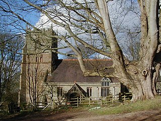
Beoley is a small village and larger civil parish north of Redditch in the Bromsgrove District of Worcestershire. It adjoins Warwickshire to the east. The 2001 census gave a parish population of 945, mostly at Holt End. The parish includes the hamlet of Portway, adjacent to the A435 road. It adjoins the Redditch suburb of Church Hill and the civil parishes of Alvechurch, Tanworth-in-Arden, Mappleborough Green and Wythall.
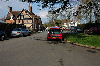
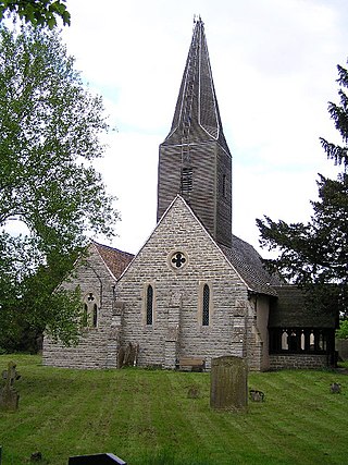
Hanley Castle is a village and civil parish in Worcestershire, England, between the towns of Malvern and Upton upon Severn and a short distance from the River Severn. It lies in the administrative area of Malvern Hills District, and is part of the informal region known as The Malverns. It is served primarily by bus service 332 Worcester - Upton upon Severn - Hanley Castle operated by Aston Coaches and 363 Worcester - Tewkesbury operated by First Worcester.

The second and longest siege of Worcester took place towards the end of the First English Civil War, when Parliamentary forces under the command of Thomas Rainsborough besieged the city of Worcester, accepting the capitulation of the Royalist defenders on 22 July. The next day the Royalists formally surrendered possession of the city and the Parliamentarians entered Worcester 63 days after the siege began.
Amesbury Abbey was a Benedictine abbey of women at Amesbury in Wiltshire, England, founded by Queen Ælfthryth in about the year 979 on what may have been the site of an earlier monastery. The abbey was dissolved in 1177 by Henry II, who founded in its place a house of the Order of Fontevraud, known as Amesbury Priory.
Westwood Priory was a priory of Benedictine nuns founded in 1153, near Droitwich, Worcestershire, England. It was a daughter house of Fontevraud Abbey, seized by the English crown in 1537 during the Dissolution of the monasteries.

Worcestershire was the county where the first battle and last battle of the English Civil War took place. The first battle, the Battle of Powick Bridge, fought on 23 September 1642, was a cavalry skirmish and a victory for the Royalists (Cavaliers). The final battle, the battle of Worcester, fought on 3 September 1651, was decisive and ended the war with a Parliamentary (Roundhead) victory and King Charles II a wanted fugitive.

Strensham is a village in the Wychavon district of Worcestershire. In the 2001 census, the civil parish of Strensham had a population of 314 across 127 households. Since 1991, the population has risen 28.7% from 244 residents.

Worcester Castle was a Norman fortification built between 1068 and 1069 in Worcester, England by Urse d'Abetot on behalf of William the Conqueror. The castle had a motte-and-bailey design and was located on the south side of the old Anglo-Saxon city, cutting into the grounds of Worcester Cathedral. Royal castles were owned by the king and maintained on his behalf by an appointed constable. At Worcester that role was passed down through the local Beauchamp family on a hereditary basis, giving them permanent control of the castle and considerable power within the city. The castle played an important part in the wars of the 12th and early 13th century, including the Anarchy and the First Barons' War.
Whistones Priory was a priory in Worcestershire, England.

Grafton Manor was established before the Norman Conquest. Grafton means "settlement at or near the wood" and may indicate a role in woodland management within a larger estate, for instance.
Colonel Sir Gilbert Gerard was a Royalist officer during the English Civil War.

Worcester's early importance is partly due to its position on trade routes, but also because it was a centre of Church learning and wealth, due to the very large possessions of the See and Priory accumulated in the Anglo-Saxon period. The city was sometimes important for strategic military reasons, being close to Gloucester and Oxford, as well as Wales, which led to a number of attacks and sieges in the conflicts of the early medieval period. For similar reasons, it was valuable to the crown in the English Civil Wars.
The Bund family of Wick Episcopi owned estates in Worcestershire since the fifteenth century; from this armigerous landed gentry family came several individuals of note in the fields of law, local government and literature.

Walter de Beauchamp, of Beauchamp's Court, Alcester in Warwickshire and of Beauchamp Court, Powick in Worcestershire, was Steward of the Household to King Edward I from 1289 to 1303. He was the younger brother of William de Beauchamp, 9th Earl of Warwick (c.1238-1298), the first of his family to hold that title and was the founder of the junior line of the Beauchamp family known as "Beauchamp of Powick".
References
- 1 2 3 4 Willis-Bund & Page 1971 , pp. 156–158
- ↑ Cookhill Priory, British Listed Buildings
- ↑ "Main page". Vada Recording Studios. Retrieved 12 May 2018.
- ↑ https://www.flickr.com/photos/my-friend-map/3233314103
- ↑ Butler 2016 , pp. 77–79