Cumbria is a ceremonial and non-metropolitan county in North West England. The county and Cumbria County Council, its local government, came into existence in 1974 after the passage of the Local Government Act 1972. Cumbria's county town is Carlisle, in the north of the county. The only other major urban area is Barrow-in-Furness on the south-western tip of the county.
Arnside is a village and civil parish in Cumbria, historically part of Westmorland, near the border with Lancashire, England. The Lake District National Park is located a few miles North. Travelling by road, Arnside is 22 miles (35 km) to the south of Kendal, 25.3 miles (40.7 km) to the east of Ulverston, 35.2 miles (56.6 km) to the east of Barrow-in-Furness, 15.7 miles (25.3 km) to the west of Lancaster and 14.3 miles (23.0 km) to the east of Grange-over-Sands. In the 2001 census the parish had a population of 2,301, increasing at the 2011 census to 2,334.
Roa Island lies just over half a mile (1 km) south of the village of Rampside at the southernmost point of the Furness Peninsula in Cumbria, though formerly in the county of Lancashire north of the sands. It is located at 54°5′N3°10′W. It is one of the Islands of Furness in northern England. It has an area of about three hectares.

Chapel Island is a limestone outcrop that lies in the Leven estuary of Morecambe Bay in England, less than one mile (1.6 km) from the shoreline at Bardsea in the area known as Ulverston Sands. It is located at 54.1741°N 3.0416°W. It is one of the Islands of Furness in the county of Cumbria, in the area of the historic county of Lancashire. The island is approximately 450 yards (410 m) long and just over 100 yards (91 m) at its widest. Its area is about 7.5 acres.

Silverdale is a railway station on the Furness Line, which runs between Barrow-in-Furness and Lancaster. The station, situated 9+1⁄2 miles (15 km) north-west of Lancaster, serves the village of Silverdale in Lancashire. It is owned by Network Rail and managed by Northern Trains.

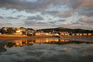
Silverdale is a village and civil parish within the City of Lancaster district of Lancashire, England. The village stands on Morecambe Bay, near the border with Cumbria, 4.5 miles (7 km) north west of Carnforth and 8.5 miles (14 km) of Lancaster. The parish had a population of 1,519 recorded in the 2011 census.
Morecambe and Lunesdale is a constituency represented in the House of Commons of the UK Parliament since 2010 by David Morris, a Conservative.

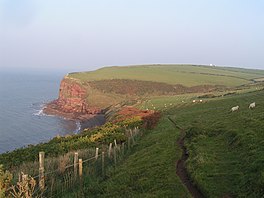
St Bees Head is a headland on the North West coast of the English county of Cumbria and is named after the nearby village of St Bees.
Arnside and Silverdale is an Area of Outstanding Natural Beauty in England, on the border between Lancashire and Cumbria, adjoining Morecambe Bay. One of the smallest AONBs, it covers 29 square miles (75 km2) between the Kent Estuary, the River Keer and the A6 road. It was designated in 1972.
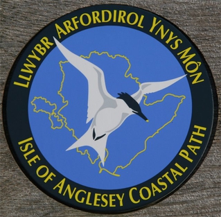
The Anglesey Coastal Path is a 200-kilometre (124 mi) long-distance footpath around the island of Anglesey in North Wales. The route is part of the Wales Coast Path.

Askam and Ireleth is a civil parish close to Barrow-in-Furness in the county of Cumbria, in North West England. Historically part of Lancashire, it originally consisted of two separate coastal villages with different origins and histories which, in recent times, have merged to become one continuous settlement. In the 2001 census the parish had a population of 3,632, reducing at the 2011 census to 3,462.

The Lancashire Coastal Way is a long-distance footpath following the coast of the county of Lancashire in the north west of England. Its end points are Silverdale in the north and Freckleton in the south. Its length is variously asserted to be 66 miles (106 km) or 137 miles (220 km).
The Roman Heritage Way is a long-distance path in England and Scotland. It covers parts of Cumbria, Northumberland, the Scottish Borders, and Tyneside.

Roanhead refers to the limestone outcrop of Roanhead Crag in Cumbria and the farmland behind it, but in recent years the term has been taken to mean the sandy beaches adjoining Sandscale Haws extending to Snab Point. The Irish Sea lies to the west of Roanhead, whilst the Duddon Estuary and Walney Channel are due north and south respectively. The beach is noted for its abundance of sand dunes and strong, often dangerous coastal currents. Today the beach is a National Trust conservation area, and a two-mile stretch of the Cumbria Coastal Way runs through it.

Canal Foot is an industrial village in Cumbria, England, on the Leven estuary. It is located 1.7 miles (2.7 km) by road to the east of the centre of Ulverston. Its name comes from its location being where the Ulverston Canal meets the Estuary.

The Limestone Link is a waymarked footpath in South Lakeland, Cumbria, England, connecting Arnside and Kirkby Lonsdale, a distance of 13 miles (21 km).
The England Coast Path is a proposed long-distance National Trail which will follow the coastline of England. When complete, it will be 2,795 miles in length.

The Ullswater Way is a 20-mile (32 km) waymarked walking route around Ullswater in the English Lake District. It was created by a partnership which included The Lake District National Park Authority, the National Trust, Eden District Council, and Ullswater 'Steamers' and was opened on 25 April 2016 by broadcaster and film-maker Eric Robson. The idea of a path circumnavigating the lake had been considered for many years, but the 2015 Cumbria floods which devastated the area gave an incentive for the completion of the project.

The Bay Cycle Way is an 80-mile (130 km) cycling route around Morecambe Bay in Lancashire and Cumbria in north west England. Most of it forms National Cycle Route 700, while other sections are waymarked as NCN 6, NCN 69 and NCN 70.