Cuzcatlan

Last updated
Kuskatan
The polity of Cuzcatlan in Mesoamerica Senorio cuzcatlan.svg
The polity of Cuzcatlan in Mesoamérica
Capital Kuskatan
Official language Nawat
Ethnicity Nahuas of Kuskatan
Government Monarchy tributary
Establishment
Dissolution
approx.1200
1528
The seal of Kuskatan based on the "Lienzo de Tlaxcala" with the symbol of an altepetl El escudo del Senorio de Kuscatan con simbolo de altepetl.png
The seal of Kuskatan based on the "Lienzo de Tlaxcala" with the symbol of an altepetl

Cuzcatlan (Nawat: Kuskatan) (Nahuatl: Cuzcatlan) was a pre-Columbian Nahua state confederation of the Mesoamerican postclassical period that extended from the Paz river to the Lempa river (covering most of western El Salvador); this was the nation that Spanish chroniclers came to call the Pipils or Cuzcatlecos. No codices survive that shed light on this confederation except the Annals of the Cakchiquels, although Spanish chroniclers such as Domingo Juarros, Palaces, Lozano, and others claim that some codices did exist but have since disappeared. Their Nawat language, art and temples revealed that they had significant Mayan and Toltec influence from the ties they had with the Itza in Yucatan. It is believed that the first settlers to arrive came from the Toltec people in central Mexico, mostly Puebla during the Chichimeca-Toltec civil wars in the 10th century AD.

Contents

The people of Cuzcatan came to be called Pipiles in the historical chronicles, a term that today is usually translated as "boys" or less likely as "young nobles." This was due to the perception of the Central Nahuatl-speaking Tlaxcala and Mexica allies of the Spanish that the Nahuas of Cuzcatan were speaking a corrupted version of their language in those regions. An alternative theory is that it meant "nobles," from the Nahuas social class "Pipiltin" and the Nawat Pipil origin story that they are descendants of Nanahuatzin.

Etymology

The name Kuskatan (place of jewel necklaces) possibly comes from the Náwat words "kuskat" (necklace) and Kuzti (jewel) meaning "jewel necklace", and "tan", meaning "among/in/near/place of/with.". In Nahuatl its cognate term is Cuzcat(l)an. [1]

Origins

Map of El Salvador's Indigenous Peoples at the time of the Spanish conquest: 1. Pipil people, 2. Lenca, 3. Kakawira o Cacaopera, 4. Xinca, 5. Maya Ch'orti' people, 6. Maya Poqomam people, 7. Mangue o Chorotega. Pueblos Indigenas antes de la conquista El Salvador.svg
Map of El Salvador's Indigenous Peoples at the time of the Spanish conquest: 1. Pipil people, 2. Lenca, 3. Kakawira o Cacaopera, 4. Xinca, 5. Maya Ch'orti' people, 6. Maya Poqomam people, 7. Mangue o Chorotega.

The Pipil people are an ethnic group who resided in western modern day El Salvador and parts of Honduras. They are a subgroup of Nahua people, who can also be known as Nawats, Nahuats, or Southern Nahuas.[ citation needed ] Nahua people originally resided in modern-day Mexico with waves of Pipil people migrating to what was Cuzcatlan. This Mesoamerican land is believed to be inhabited by the first wave of Pipils as early as 3000 BCE. Another wave of Nahua migrants, known as the Izalco Pipils, voyaged in the 10th century.[ citation needed ]

The Nawat Pipil arrived in El Salvador around the year 900. On arrival, they had to fight their way to the new land due to the fact of the Mayan civil wars that were taking place as well but with the treaty or "cult" of Quetzalcoatl, Qʼuqʼumatz and Kukulkan as the Pipil had many Mayan allies. City states such as Tehuacán, Chalchuapa and Cihuatán eventually became absorbed into the Cuzcatlan polity confederation. According to legend, the city of Cuzcatlán (the capital city of Cuzcatan), was founded by the exiled Toltec Ce Acatl Topiltzin around the year 1054. In the 13th century the Pipil city states were most likely unified, and by 1400, a hereditary monarchy had been established. The Pipil people aided in the flourishing of Cuzcatlan and referred to this region as the "Land of the Jewel". Using techniques that were heavily influenced by ancient Mayan culture. Pipil people inhabited this land but also resided with other indigenous groups. They were alongside specifically Lenca and Pokomam Maya and expressed similarities in their culture and traditions. [2] Pipil's created towns and cities that were able to support large populations which were supported by irrigated agricultural lands.[ citation needed ]

Political organization

The area of Cuzcatan was divided into different regions:

The Lordship did not form a unified political system and were at first independent, and were obligated to pay tribute/taxes to the polity of Cuzcatán although the four Pipil tribes became a loose confederation, unifying in times of war or natural disasters. With time, they were all annexed by the chiefdom of Cuzcatán, today the modern city of Antiguo Cuscatlan a city and municipality that is part of the San Salvador Metropolitan Area (AMSS).

Confederacy

The leader of Cuzcatan was the head of state; below him the state elders and priests who advised the ruling family; then a caste of commoners. Upon the death of a Lord, the succession was hereditary starting with the eldest son and so on. In case there were no sons available, the closest male family member was chosen by the counsel of elders and priests.

At the time of the Spanish conquest, Cuzcatan had developed into a powerful state that maintained a strong standing army. It had successfully resisted Mayan invasions and was the strongest military force in the region.

Lords of Cuzcatan

There were many Lords of Cuzcatan; most have been forgotten with time, but historical writings by Spanish chroniclers, including Domingo Juarros, mention some that may have existed: [3]

  • Cuachimicín: Governed before the Spanish conquest, he was overthrown and executed by the priests.
  • Tutecotzimit: Successor of the previous one, restored the hereditary system.
  • Pilguanzimit
  • Atunal Tut of Izalco, Atecozol: He is said to have won the Battle of Acajutla that took place during first contact with Pedro De Alvarado and his tribal allies, wounding Alvarado with Atunal's lance.
  • Atlácatl or Atacat: He is said to have killed off many of Diego de Alvarado's horses and horsemen during the last stand for Cuzcatlan at the Cinacantan stone masonry fort.

Over time, a legend developed that the last leader of Cuzcatlan was named Atacat, [4] some authors say this is a mistake originating from a misreading of a few Spanish accounts. Historical accounts of the Annals of the Cakchiquels called the Pipil coastal people Panatacat (place of the water man); this could have been a name or a title for a person as well. After the collapse of the Nawat standing warriors in the first two battles with Alvarado's forces, Alvarado entered the capital of Cuzcatlan without resistance. Initially the people had to accept this conquest, offering gifts and service. Alvarado then enslaved those Nawat Pipil that they could capture. The Lenca people in the eastern zone maintained a guerrilla resistance for a further decade with Lord Lempira.

Warrior Society

Warrior service was obligatory for men from about age 15 or 20 until they were unable to serve due to age. The warrior's attire consisted of a breastplate, a corselete or vest (made of cotton) and a mashte (species of loin cloth) and each painted their faces and bodies with unique colored abstract shapes and forms. The warriors were organized in teams or platoons bearing distinctive names, such as:

The warriors of Cuzcatlan had a variety of weapons, most made of wood and volcanic rock shards. Pedro de Alvarado reported that they also wore thick cotton armor, which were evidently designed to repel the caliber of throwing weapons they themselves had (see list below) as it could not repel Spanish lances. So heavy was this cotton when it became wet, Alvarado reported, that the Nahuat soldiers could not rise from the ground when thrown down. No pictorial depiction of this armor has survived. Some of the documented weapons are described below.

Geography

The Lordship of Cuzcatan covered an area of approximately 10,000 km2 covering a large part of the central and western areas of present-day El Salvador and covering different varieties of environments with a total of 7 plant formations between the coast and elevations greater than 2,000 meters.

Economy

The economy of Cuzcatlan had contributions from both the indigenous Pipil people who inhabited the land and Spanish conquistadors post colonization. Indigenous economy consisted of the Pipil people and even indigenous Mexican, including Nahua and Mixtec. [5] The economy was based on the barter or exchange of agriculture and handcrafted goods such as multicolored textiles.

Cocoa bean and Indigo dye was a major export crop that was carefully cultivated in the Izalcos area and traded throughout the isthmus. Indigo specifically was a large part of Cuzcatlan economy, it was the base for agrarian and industrial products. The large dependency on Indigo and Cocoa beans required massive amounts of labor which were carried out by the areas indigenous people. This became a large way for people to survive as the landowning class grew due to its labor system. [6] Its production involved the construction of an elaborate irrigation network, parts of which can still be seen today. Cacao served in the region as currency.

Other agricultural products grown by the Pipil were cotton, squash, corn, beans, fruits, balsam, some peppers, and chocolate; but chocolate could only be prepared and served to the ruling class. There was modest mining of gold and silver, although these were not used as currency but as offering to their many gods. Only the priests and the ruling family could use gold and silver as ornaments.

Another large contribution to Cuzcatlan economy was the establishment of slave trafficking and labor which appeared after Spaniard colonization. Pedro de Alvarado began establishing slave labor throughout Central America beginning in modern-day Guatemala. This was then established into Cuzcatlan during his first invasion in 1524. [5] As Spaniards continued to settle in the Cuzcatlan, it became common for their households to contain indigenous slaves, typically women to act as servants. Many of these slaves were obtained through war or through barter. [5] Those who were not placed into households would be forced to contribute to local cultivation. Settlements would be assigned to an "encomienda" which indicates what type of contribution they must provide. Typically an "encomienda" consisted of food products such as maize, beans, chilli peppers, turkeys, venison, salt, dried fish, honey, and beeswax. However, it was also common to be assigned firewood, woven cotton clothes and clothing. [5] These contributions were expected and required of the settlements and acted as payment to the Spaniards. Those who failed to pay their contributions were typically faced with threats and even violent force. [5]

There were large contributions to the Cuzcatlan economy due to the creation of Spanish industries in the area. They began to overtake the economy due to the large local force that they exerted. A new dynamic was established as these industries consisted of Spanish overseers and indigenous mestizo. One of the most significant industries they cultivated were war supplies. During the years 1525 - 1539, there was an influx of raids that occurred in the area. This led to slave labor being utilized for the creation of war supplies such as iron. [5] Archaeology and architecture also gained prevalence in the area due to Spanish influence. This is another industry that was dependent on male indigenous labor for brick making, roof and tile manufacturing, blacksmithing, and charcoal making. [5]

Religion

Through Spanish chroniclers ( cronistas ) and archaeological investigations we know that the Señorío de Cuzcatlán was well organized with respect to its "Creator" or "Divine energy of life" Tiyut/Teotl, its priesthood, first ancestors, religious rites, etc. One of the pilgrimage sites was the sanctuary dedicated to the ancestor goddess Nuictlán constructed by Cē Ācatl Topiltzin Quetzalcoatl and located on Lake Güija. [7] Human sacrifice was practiced during war time as part of a warrior code of honor.

Deities/Spirits associated with the Nahuas of Cuzcatan

The people living in the ancient Cuzcatlán possibly attributed cosmic power to the following: Xipe Totec, Quetzalcoatl, Ehécatl, Tláloc, Chacmool, Tonatiuh, Chalchiuhtlicue and others. In addition there were some deities identified with the Señorío of Cuzcatlán like Itzqueye. Téotl, Quetzalcoatl and Itzqueye were three of the most important to the people's spiritual beliefs.

Music

Cuzcatlan was within proximity to other indigenous groups, with their music being made up of new ideologies and borrowed traditions. A specific instrument used music was a slit drum that Cuzcatlan's referred to as tepunahuaxtles. [2] This drum was not specific to the Cuzcatlan people. It is believed that this sacred drum could be dated back to ancient Mesoamerica. [2] This word derives from the Aztec word Teponaztli, which means drum. [8] In Aztec ceremonies this drum was used for religious, military, and royal ceremonies which reflected the use of this instrument in Cuzcatlan. [8]    

Fall of Cuzcatlan

After the fall of the Aztec Empire, Hernán Cortés sent Pedro de Alvarado to conquer the native city states further south. After subduing or striking alliances with the Mayan peoples in the highlands, on June 6, 1524, Pedro de Alvarado crossed the Paz river with a few hundred soldiers and thousands of Kaqchikel Mayan allies and subdued the Cacique of Izalco (the first major city state en route to Cuzcatlan). Fierce battles were fought in defense of Izalco in Acaxual (today Acajutla in the Spanish version) and Tacuzcalco. On June 17, de Alvarado arrived in Cuzcatan. Some of the population acquiesced to his rule; others fled to the mountains.

After the fall of Cuzcatan in 1525, Pedro de Alvarado's cousin Diego de Alvarado established the Villa De San Salvador. Over the next three years, various attempts by the Nahuas of Cuzcatan to destroy the newly founded town resulted in the decision to move the town a few kilometers south to its present location, to the valley commonly known as "the valley of the hammocks" (due to significant seismic activity) next to the Quezaltepeque (San Salvador) volcano.

Legacy

Archeological sites in El Salvador include the Tazumal complex, which has Mesoamerican masonry, including truncated pyramids resembling those of Toltec temple sites. Other sites include San Andrés, Cara Sucia, Joya de Cerén and Cihuatán. Otherwise, Kuskatan is not known for the kind of monumental architecture used by the Classical Maya because its later Spanish rulers dismantled most of the palaces and temples over the centuries to build walls and roads. El Salvador is one of the most looted archeological places in the western hemisphere, with many artifacts being looted in recent years, including the Izalco Jaguar heads and artifacts in museums.

In 2020, the Kuskatan football team joined ConIFA, [9] the football governing body for non-FIFA members.

See also

Related Research Articles

<span class="mw-page-title-main">El Salvador</span> Country in Central America

El Salvador, officially the Republic of El Salvador, is a country in Central America. It is bordered on the northeast by Honduras, on the northwest by Guatemala, and on the south by the Pacific Ocean. El Salvador's capital and largest city is San Salvador. The country's population in 2023 was estimated to be 6.5 million.

The history of El Salvador begins with several distinct groups of Mesoamerican people, especially the Pipil, the Lenca and the Maya. In the early 16th century, the Spanish Empire conquered the territory, incorporating it into the Viceroyalty of New Spain ruled from Mexico City. In 1821, El Salvador achieved independence from Spain as part of the First Mexican Empire, only to further secede as part of the Federal Republic of Central America two years later. Upon the republic's independence in 1841, El Salvador became a sovereign state until forming a short-lived union with Honduras and Nicaragua called the Greater Republic of Central America, which lasted from 1895 to 1898.

<span class="mw-page-title-main">Pedro de Alvarado</span> Spanish conquistador and governor of Guatemala

Pedro de Alvarado was a Spanish conquistador and governor of Guatemala. He participated in the conquest of Cuba, in Juan de Grijalva's exploration of the coasts of the Yucatán Peninsula and the Gulf of Mexico, and in the conquest of the Aztec Empire led by Hernán Cortés. He is considered the conquistador of much of Central America, including Guatemala, Honduras and El Salvador.

<span class="mw-page-title-main">Pipil people</span> Nahua ethnic group of El Salvador

The Nahua are an Indigenous group of Mesoamerican people inhabiting the western and central areas of present-day El Salvador. They speak the Nawat language, which belongs to the Nahuan language branch of the Uto-Aztecan language family. There are very few speakers of the language left, which is a reason for the current efforts being made to revitalize it.

<span class="mw-page-title-main">Nahuas</span> Indigenous ethnic group in Central America

The Nahuas are a group of the indigenous people of Mexico, El Salvador, Guatemala, Honduras, Nicaragua, and Costa Rica. They comprise the largest indigenous group in Mexico and El Salvador. They are a Mesoamerican ethnicity. The Mexica (Aztecs) are of Nahua ethnicity, as are their historical enemies, the Tlaxcallans (Tlaxcaltecs), and the Toltecs which predated both groups are often thought to have been as well. However, in the pre-Columbian period Nahuas were subdivided into many groups that did not necessarily share a common identity.

<span class="mw-page-title-main">Culture of El Salvador</span> Overview of the culture of El Salvador

The culture of El Salvador is a Central American culture nation influenced by the clash of ancient Mesoamerica and medieval Iberian Peninsula. Salvadoran culture is influenced by Native American culture as well as Latin American culture. Mestizo culture and the Catholic Church dominates the country. Although the Romance language, Castilian Spanish, is the official and dominant language spoken in El Salvador, Salvadoran Spanish which is part of Central American Spanish has influences of Native American languages of El Salvador such as Lencan languages, Cacaopera language, Mayan languages and Pipil language, which are still spoken in some regions of El Salvador.

<span class="mw-page-title-main">Spanish conquest of Guatemala</span> 1524–1697 defeat of Mayan kingdoms

In a protracted conflict during the Spanish colonization of the Americas, Spanish colonisers gradually incorporated the territory that became the modern country of Guatemala into the colonial Viceroyalty of New Spain. Before the conquest, this territory contained a number of competing Mesoamerican kingdoms, the majority of which were Maya. Many conquistadors viewed the Maya as "infidels" who needed to be forcefully converted and pacified, disregarding the achievements of their civilization. The first contact between the Maya and European explorers came in the early 16th century when a Spanish ship sailing from Panama to Santo Domingo was wrecked on the east coast of the Yucatán Peninsula in 1511. Several Spanish expeditions followed in 1517 and 1519, making landfall on various parts of the Yucatán coast. The Spanish conquest of the Maya was a prolonged affair; the Maya kingdoms resisted integration into the Spanish Empire with such tenacity that their defeat took almost two centuries.

<span class="mw-page-title-main">Izalco</span> Municipality in Sonsonate, El Salvador

Izalco is a municipality in the Sonsonate department of El Salvador. Volcan Izalco is an icon of the country of El Salvador, a very young volcano on the flank of Santa Ana volcano. From when it was born in 1770 until 1966, it was in almost continuous eruption and was known as the "lighthouse of the Pacific." Since then it has been nearly inactive.

The Xinka, or Xinca, are a non-Mayan indigenous people of Mesoamerica, with communities in the southern portion of Guatemala, near its border with El Salvador, and in the mountainous region to the north.

Nawat is a Nahuan language native to Central America. It is the southernmost extant member of the Uto-Aztecan family. Before Spanish colonization it was spoken in several parts of present-day Central America, most notably El Salvador and Nicaragua, but now is mostly confined to western El Salvador. It has been on the verge of extinction in El Salvador, and has already gone extinct elsewhere in Central America. In 2012, a large number of new Nawat speakers started to appear. As of today, the language is currently going through a revitalization.

This article provides a grammar sketch of the Nawat or Pipil language, an endangered language spoken by the Pipils of western El Salvador and Nicarao people of Nicaragua. It belongs to the Nahua group within the Uto-Aztecan language family. There also exists a brief typological overview of the language that summarizes the language's most salient features of general typological interest in more technical terms.

<span class="mw-page-title-main">Atlácatl</span>

Atlácatl is reputed to have been the name of the last ruler of an indigenous state based around the city of Cuzcatlan, in the southeastern periphery of Mesoamerica, at the time of the Spanish conquest. Atlácatl appears to have been a myth, however, as no contemporary chronicler mentions him. The only mentions of him are in the annals of the Cakchiquels where the Pipil coastal people were called Pan Atacat ; this might have been an elite personage or a title for a chief in Pipil culture. The myth is still believed locally. The name "Atlácatl" was adopted by one of El Salvador's elite army battalions: the Atlácatl Battalion.

<span class="mw-page-title-main">Salvadorans</span> Citizens or residents of El Salvador

Salvadorans, also known as Salvadorians, are citizens of El Salvador, a country in Central America. Most Salvadorans live in El Salvador, although there is also a significant Salvadoran diaspora, particularly in the United States, with smaller communities in other countries around the world.

<span class="mw-page-title-main">Battle of Acajutla</span>

The Battle of Acajutla took place on June 8, 1524, between the Spanish conquistador Pedro de Alvarado and the standing army of Cuzcatlan Pipils, an indigenous Nahua state, in the neighborhood of present-day Acajutla, near the coast of western El Salvador.

<span class="mw-page-title-main">Cē Ācatl Topiltzin</span> Emperor of the Toltecs

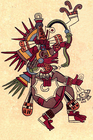
Cē Ācatl Topiltzin Quetzalcōātl is a mythologised figure appearing in 16th-century accounts of Nahua historical traditions, where he is identified as a ruler in the 10th century of the Toltecs— by Aztec tradition their predecessors who had political control of the Valley of Mexico and surrounding region several centuries before the Aztecs themselves settled there.

Alagüilac is an undocumented indigenous American language that is thought to have been spoken by the Alaguilac people of Guatemala at the time of the Spanish conquest.

<span class="mw-page-title-main">Spanish conquest of El Salvador</span> Campaign undertaken by the Spanish conquistadores

The Spanish conquest of El Salvador was the campaign undertaken by the Spanish conquistadores against the Late Postclassic Mesoamerican polities in the territory that is now incorporated into the modern Central American country of El Salvador. El Salvador is the smallest country in Central America, and is dominated by two mountain ranges running east–west. Its climate is tropical, and the year is divided into wet and dry seasons. Before the conquest the country formed a part of the Mesoamerican cultural region, and was inhabited by a number of indigenous peoples, including the Pipil, the Lenca, the Xinca, and Maya. Native weaponry consisted of spears, bows and arrows, and wooden swords with inset stone blades; they wore padded cotton armour.

<span class="mw-page-title-main">Nicarao people</span> Nahua ethnic group of Nicaragua

The Nicarao are a Nahua people who live in western Nicaragua and northwestern Costa Rica. They spoke the Nahuat language before it went extinct in both countries.

Gómez de Alvarado y Contreras was a Spanish conquistador and explorer. He was a member of the Alvarado family and the older brother of the famous conquistador Pedro de Alvarado.

The Battle of Tacuzcalco was a battle on 13 June 1524 fought between a Spanish army under the command of conquistador Pedro de Alvarado and Cuzcatlan fighters under Atlácatl.

References

  1. Page 64 in: Maxwell, Judith M.; Hill, Robert M., eds. (2006). "Linguistic Commentary". Kaqchikel Chronicles: The Definitive Edition. University of Texas Press. pp. 23–68. ISBN   978-0-292-71270-6. JSTOR   10.7560/712706.7. Project MUSE   chapter 1764951.
  2. 1 2 3 Sacolick, Robin (2018). "Cuzcatlán (El Salvador) and Maria de Baratta's Nahualismo". In Beezley, William H. (ed.). Cultural Nationalism and Ethnic Music in Latin America. University of New Mexico Press. pp. 97–128. ISBN   978-0-8263-5976-6. Project MUSE   chapter 2451565.
  3. Francis Polo Sifontes (1974). Los cakchiqueles en la conquista de Guatemala. Editorial Cultura. p. 70.
  4. Francisco Hernández Arana Xajilá; Francisco Díaz Gebuta Quej; Daniel Garrison Brinton (1885). The Annals of the Cakchiquels: The Original Text, with a Translation, Notes and Introduction. D. G. Brinton. p. 181.
  5. 1 2 3 4 5 6 7 Fowler, William R.; Card, Jeb J. (2019). "Material Encounters and Indigenous Transformations in Early Colonial El Salvador". Material Encounters and Indigenous Transformations in the Early Colonial Americas. pp. 197–220. doi:10.1163/9789004273689_010. ISBN   978-90-04-27368-9. JSTOR   10.1163/j.ctvrxk2gr.15.
  6. Rodríguez, Ana Patricia (2009). "The Power of Indigo: Testimonio, Historiography, and Revolution in Cuzcatl". Dividing the Isthmus: Central American Transnational Histories, Literatures, and Cultures. University of Texas Press. pp. 76–102. ISBN   978-0-292-79372-9. Project MUSE   chapter 63272.
  7. Jorge Lardé y Larín (1977). Toponimia autóctona de El Salvador occidental. Ediciones del Ministerio del Interior. p. 202.
  8. 1 2 "Drum (Teponaztli) | Aztec". The Metropolitan Museum of Art. Retrieved 2024-04-18.
  9. "Asociación de Fútbol Kuskatan Joins CONIFA". CONIFA. 2020-07-08. Retrieved 2023-12-27.

Consulted Web Sites

Sites in Spanish:

13°40′00″N89°14′00″W / 13.6667°N 89.2333°W / 13.6667; -89.2333