| Damt District | |
|---|---|
| District | |
| Country | |
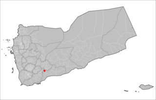
| Governorate | Dhale |
| Population (2003) | |
| • Total | 60,944 |
| Time zone | Yemen Standard Time (UTC+3) |
Damt District is a district of the Dhale Governorate, Yemen. As of 2003, the district had a population of 60,944 inhabitants. [1]

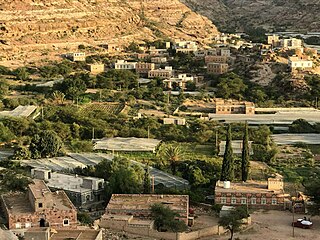
Dhale province is one of the governorates of Yemen that have been created after the announcement of Yemeni unification. The population of the province accounted for (2.4%) of the total population of the Republic, and allocated administratively into (9) districts. Dali city is the centre of the province. Dali is one of the provinces distinctive with agriculture, since most of the population works in the agricultural activity. The most important agricultural crops is coffee. The province land contains some metals, the most important are talc that is used in the manufacture of paper, paint, cosmetics and pesticides. The tourist attractions in the province are vary, the most important are Damt bath, and one of the ancient cities there is Jubn city that is famous for its castle and the historic Mansuria school, built by Tahrien. The province terrain is various and characterized by a relatively mild climate during the days of the year.

Yemen , officially known as the Republic of Yemen, is a country at the southern end of the Arabian Peninsula in Western Asia. Yemen is the second-largest Arab sovereign state in the peninsula, occupying 527,970 square kilometres. The coastline stretches for about 2,000 kilometres. It is bordered by Saudi Arabia to the north, the Red Sea to the west, the Gulf of Aden and Guardafui Channel to the south, and the Arabian Sea and Oman to the east. Yemen's territory includes more than 200 islands.