Robertson County is a county located in the U.S. Commonwealth of Kentucky. As of the 2010 census, the population was 2,282. Its county seat is Mount Olivet. The county is named for George Robertson, a Kentucky Congressman from 1817 to 1821. It is Kentucky's second-smallest county by total area and the least populous.

Marion County is a county in the U.S. state of Kentucky. Its county seat is Lebanon. The county was founded in 1834 and named for Francis Marion, the American Revolutionary War hero known as the "Swamp Fox".

Lyon County is a county located in the U.S. state of Kentucky. As of the 2020 census, the population was 8,680. Its county seat is Eddyville. The county was formed from Caldwell County, Kentucky in 1854 and named for former Congressman Chittenden Lyon.

Lincoln County is a county located in south-central Kentucky. Its county seat is Stanford. Lincoln is now a wet county. Lincoln County is part of the Danville, KY Micropolitan Statistical Area.

Fleming County is a county located in the U.S. state of Kentucky. As of the 2010 census, the population was 14,348. Its county seat is Flemingsburg. The county was formed in 1798 and named for Colonel John Fleming, an Indian fighter and early settler. It is a moist county. In 1998, the Kentucky General Assembly designated Fleming County as the Covered Bridge Capital of Kentucky.

Christian County is a county located in the U.S. state of Kentucky. As of the 2010 census, the population was 73,955. Its county seat is Hopkinsville. The county was formed in 1797. Christian County is part of the Clarksville, TN–KY Metropolitan Statistical Area.

Calloway County is a county located in the U.S. Commonwealth of Kentucky. As of the 2010 census, the population was 37,191. Its county seat is Murray. The county was founded in November 1822 and named for Colonel Richard Callaway, one of the founders of Boonesborough. Calloway County comprises the Murray, KY Micropolitan Statistical Area. As of July 18, 2012 Calloway County is a moist county: the sale of alcohol in the county is prohibited, with the exception of the city of Murray.

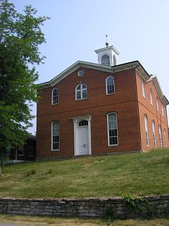
Boyle County is a county located in the U.S. state of Kentucky. Its county seat is Danville. The county was formed in 1842 and named for John Boyle (1774–1835), a U.S. Representative, chief justice of the Kentucky Court of Appeals and later federal judge for the District of Kentucky. Boyle county has a population of 30,614, and is part of the Danville, KY Micropolitan Statistical Area.

Anderson County is a county located in the U.S. state of Kentucky. Its county seat is Lawrenceburg. The county was formed in 1827 and named for Richard Clough Anderson Jr., a Kentucky legislator, U.S. Congressman and Minister to Colombia. Anderson County is part of the Frankfort, KY Micropolitan Statistical Area, which is also included in the Lexington-Fayette-Richmond-Frankfort, KY Combined Statistical Area.

Dexter is a town in Laurens County, Georgia, United States. As of the 2010 census it had a population of 575, up from 509 at the 2000 census. It is part of the Dublin Micropolitan Statistical Area.

Dexter is a city in Dexter Township, Mower County, Minnesota, United States. The population was 341 at the 2010 census.

Baker is an inactive incorporated village in Stoddard County, Missouri, United States. The population was 3 at the 2010 census. Although it is Missouri's smallest incorporated place Google Maps has never bothered to videograph it.

Dexter is a city in Stoddard County, Missouri, United States, founded in 1873. The population was 7,864 at the 2010 census.
Dexter is a village in Jefferson County, New York, United States. The population was 1,052 at the 2010 census. The name is derived from Simon Newton Dexter, one of the village's stockholders.
A census-designated place (CDP) is a concentration of population defined by the United States Census Bureau for statistical purposes only. CDPs have been used in each decennial census since 1980 as the counterparts of incorporated places, such as self-governing cities, towns, and villages, for the purposes of gathering and correlating statistical data. CDPs are populated areas that generally include one officially designated but currently unincorporated community, for which the CDP is named, plus surrounding inhabited countryside of varying dimensions and, occasionally, other, smaller unincorporated communities as well. CDPs include small rural communities, edge cities, colonias located along the Mexico–United States border, and unincorporated resort and retirement communities and their environs.

The Louisville metropolitan area is the 43rd largest metropolitan statistical area (MSA) in the United States. It had a population of 1,395,855 in 2020 according to the latest official census, and its principal city is Louisville, Kentucky.

The United States census of 1990, conducted by the Census Bureau, was the first census to be directed by a woman, Barbara Everitt Bryant. It determined the resident population of the United States to be 248,709,873, an increase of 9.8 percent over the 226,545,805 persons enumerated during the 1980 census.
The United States census of 1790 was the first census of the whole United States. It recorded the population of the United States as of Census Day, August 2, 1790, as mandated by Article I, Section 2 of the United States Constitution and applicable laws. In the first census, the population of the United States was enumerated to be 3,929,214.
Dexter is a census-designated place (CDP) comprising the main settlement within the town of Dexter in Penobscot County, Maine, United States. The population of the CDP was 2,158 at the 2010 census.

