Related Research Articles

Spruce Grove is a city that is 11 km (6.8 mi) west of Edmonton, Alberta in Canada. The city is adjacent to the Town of Stony Plain and is surrounded by Parkland County.

Leduc is a city in the province of Alberta, Canada. It is 33 km (21 mi) south of the provincial capital of Edmonton and is part of the Edmonton Metropolitan Region.

Cochrane is a town in the Canadian province of Alberta. The town is located 18 km (11 mi) west of the Calgary city limits along Highway 1A. Cochrane is one of the fastest growing communities in Canada, and with a population of 34,467 in 2021, it is one of the largest towns in Alberta. It is part of Calgary's census metropolitan area and a member community of the Calgary Metropolitan Region Board (CMRB). The town is surrounded by Rocky View County.
Airdrie is a city in Alberta, Canada within the Calgary Region. It is located north of Calgary within the Calgary–Edmonton Corridor at the intersection of Queen Elizabeth II Highway and Highway 567.
Brooks is a city in southeast Alberta, Canada, surrounded by the County of Newell. It is located on Highway 1 and the Canadian Pacific Railway, approximately 186 km (116 mi) southeast of Calgary, and 110 km (68 mi) northwest of Medicine Hat. The city has an elevation of 760 m (2,490 ft).

Stony Plain is a town in the Edmonton Metropolitan Region of Alberta, Canada within Parkland County. It is located west of Edmonton adjacent to the City of Spruce Grove.

Sexsmith is a town in northern Alberta, Canada. It is located on Highway 2, 20 kilometres (12 mi) north of the City of Grande Prairie.

Strathmore is a town located along the Trans-Canada Highway in southern Alberta, Canada within Wheatland County. It is approximately 50 kilometres (30 mi) east of the City of Calgary.

Lacombe is a city in central Alberta, Canada. It is located approximately 25 kilometres (16 mi) north of Red Deer, the nearest major city, and 125 kilometres (78 mi) south of Edmonton, the nearest metropolitan area. The city is set in the rolling parkland of central Alberta, between the Rocky Mountains foothills to the west and the flatter Alberta prairie to the east.

Beaumont is a city in Leduc County within the Edmonton Metropolitan Region of Alberta, Canada. It is located at the intersection of Highway 625 and Highway 814, adjacent to the City of Edmonton and 6.0 kilometres (3.7 mi) northeast of the City of Leduc. The Nisku Industrial Park and the Edmonton International Airport are located 4.0 kilometres (2.5 mi) to the west and 8.0 kilometres (5.0 mi) to the southwest respectively.
High River is a town within the Calgary Metropolitan Region of Alberta, Canada with a population of 13,584 (2016). It is 67.7 kilometres (42.1 mi) south of the City of Calgary, at the junction of Alberta Highways 2 and 23. High River is located approximately 54 km (34 mi) south of downtown Calgary.
Beaverlodge is a town in northern Alberta, Canada. It is located on Highway 43, 43 km (27 mi) west of Grande Prairie and 48 km (30 mi) east of the British Columbia border.

Kinuso is a hamlet in northern Alberta, Canada within Big Lakes County, and surrounded by the Swan River First Nation reserve. It is located approximately 48 kilometres (30 mi) west of Slave Lake and 71 km east of High Prairie along Highway 2, south of the southern shore of Lesser Slave Lake.

Rycroft is a village in northern Alberta, Canada. It is located 68 km north of the city of Grande Prairie and 7 km east of Spirit River. Dunvegan Provincial Park is located 20 km north of the community.
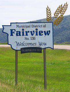
The Municipal District of Fairview No. 136 is a municipal district (MD) in northwestern Alberta, Canada. It is located in Census Division 19.

The Municipal District of Peace No. 135 is a municipal district (MD) in northwestern Alberta, Canada. Located in Census Division No. 19, its municipal office is located outside but adjacent to the Village of Berwyn.

The Municipal District of Spirit River No. 133 is a municipal district (MD) in northwest Alberta, Canada, north of Grande Prairie. Located in the Upper Peace Region, its municipal office is located in the Town of Spirit River. With an area of 683.6 km2 (263.9 sq mi), it is the smallest municipal district in Alberta.
According to the 2011 census, the City of Edmonton had a population of 812,201 residents, compared to 3,645,257 for all of Alberta, Canada. The total population of the Edmonton census metropolitan area (CMA) was 1,159,869, making it the sixth-largest CMA in Canada, while Statistics Canada estimated the CMA's 2011 population to be 1,196,342. In 2014, a municipal census indicated the city had a population of 877,926.

In the 2011 Census, the City of Calgary had a population of 1,096,833 residents, representing 30% of the 3,645,257 residents in all of Alberta, and 3% compared to a population of 33,476,688 in all of Canada. The total population of the Calgary census metropolitan area (CMA) was 1,214,839. Calgary is the largest city in Alberta, and the third-largest municipality and fourth-largest metropolitan area in Canada, as of 2016.
References
- ↑ Worton, David A. (1998). The Dominion Bureau of Statistics: A History of Canada's Central Statistical Office and Its Antecedents, 1841–1972. McGill-Queen's University Press. ISBN 978-077351660-1.
| | This Canadian government–related article is a stub. You can help Wikipedia by expanding it. |