
Rock County is a county at the southwestern corner of the U.S. state of Minnesota. As of the 2010 census, the population was 9,687. Its county seat is Luverne.

Blue Earth County is a county in the State of Minnesota. As of the 2010 United States Census, the population was 64,013. Its county seat is Mankato. The county is named for the Blue Earth River and for the deposits of blue-green clay once evident along the banks of the Blue Earth River.
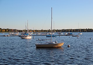
Bde Maka Ska is the largest lake in Minneapolis, Minnesota, United States, and part of the city's Chain of Lakes. Surrounded by city park land and circled by bike and walking trails, it is popular for many outdoor activities. The lake has an area of 401 acres (1.62 km2) and a maximum depth of 87 feet (27 m).

Bachelor Lake is a lake in Brown County, Minnesota in the northeastern part of Stark township. Covering 79.80 acres, it is an officially protected water of the State of Minnesota. The lake is within the Cottonwood River Major Watershed. The lake’s elevation is 1,004 feet (306 m), and it is zoned as a shoreland area which is regulated as a shoreland management water.
Lake Carlos State Park is a state park about 10 miles north of Alexandria, Minnesota, USA. The park was established in 1937 to provide a public recreational facility in one of Minnesota's summer resort centers, and attracts tourists from Minnesota and bordering states.

The Minnesota Department of Natural Resources is the agency of the U.S. state of Minnesota charged with conserving and managing the state's natural resources. The agency maintains areas such as state parks, state forests, recreational trails, and recreation areas as well as managing minerals, wildlife, and forestry throughout the state. The agency is divided into six divisions - Ecological & Water Resources, Enforcement, Fish & Wildlife, Forestry, Lands & Minerals, and Parks & Trails.
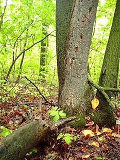
Big Woods refers to a type of temperate hardwood forest ecoregion found in western Wisconsin and south-central Minnesota. "Big Woods" is a direct translation of the name given to the region by French explorers: Grand Bois.
Christina Lake is a lake situated in west-central Minnesota. It is primarily situated in Douglas County, with its western part extending into Grant County. The lake measures 3,978 acres (16.10 km2), with an average depth of 4 ft (1.2 m). The lake is a designated Wildlife Management Lake and is nationally recognized for providing a staging area for migrating waterfowl, particularly the canvasback. Literally tens-of-thousands of waterfowl can be seen clustered in huge rafts across the expanse of the lake during peak migration, making the spot a primary destination for birders and waterfowlers.
The Nemadji State Forest is a state forest located primarily in Pine County, Minnesota. A small portion of the forest extends into neighboring Carlton County. The eastern perimeter of the forest borders the state of Wisconsin. It is managed by the Minnesota Department of Natural Resources. Gray wolves, white-tailed deer, and eagles are present in the forest.
The Paul Bunyan State Forest is a state forest located in Hubbard and Cass counties in Minnesota. The forest borders the Chippewa National Forest and the Welsh Lake State Forest to the east, and the Mississippi Headwaters State Forest to the northwest. The forest is managed by the Minnesota Department of Natural Resources and the land department for Hubbard County.

Greenleaf Lake State Recreation Area is a state park unit of Minnesota, USA, currently in development. It includes undeveloped shoreline on both Greenleaf and Sioux Lakes, halfway between the cities of Hutchinson and Litchfield in Meeker County. Portions of the state recreation area (SRA) are open to the public for day-use recreation, but there are no facilities yet on site. The park boundaries were set by the Minnesota Legislature and the state is still acquiring land from willing sellers; two-thirds of the property remain privately owned.
Amelia Lake is a lake in Pope County, Minnesota, United States, located 6.7 miles away from Glenwood. Amelia lake has an elevation of around 1,348 feet (411 m). The lake sits on a lot of 910 acres. The depth of Amelia Lake is 69 feet (21 m) and water clarity can approach 12 feet (3.7 m) during the summer. This lake is open to the public to fish with a proper fishing license.
Lily Lake is a lake in Washington County, in the U.S. state of Minnesota.
Minnesota Scientific and Natural Areas (SNAs) are public lands in the state of Minnesota that have been permanently protected to preserve any one or combination of the following:

Lake Byllesby is a 1,432-acre artificial lake on the Cannon River in Dakota and Goodhue counties, in the U.S. State of Minnesota. The lake was formed as a result of construction of the Byllesby Dam by the H.M. Byllesby & Company, which would later become Northern States Power Company for hydroelectric power generation. Today, the lake serves as a popular recreational destination and is the largest lake in Southern Dakota County, approximately 30 miles (48 km) southeast of the Twin Cities.

Medicine Lake is an inland lake located approximately 8 miles northwest of downtown Minneapolis, Minnesota. The lake lies within Hennepin County and is surrounded by two municipalities. At 902 acres, it is Hennepin County's second largest lake behind Lake Minnetonka and is popular among boaters, sailors, and fishers. Medicine Lake's most significant tributary is Plymouth Creek, which enters the lake at West Medicine Lake Park. The lake is also fed by rain and drainage from nearby cities, including Medicine Lake, Plymouth, New Hope, Golden Valley and Minnetonka.
The Rum River State Forest is a state forest located in Kanabec, Mille Lacs and Morrison counties in central Minnesota. The forest is nearby the city of Onamia and is along the Rum River, just downstream (south) of Mille Lacs Lake. The forest is managed by the Minnesota Department of Natural Resources. The forest is home to many Northern hardwoods such as maple, oak, ash, elm and basswood that occupy most of the upland areas while tamarack and black spruce are found in lowland and marshy areas.

Luce Line Trail is a 74.9-mile (120.5 km), shared-use path in Minnesota, United States, that stretches from Cosmos to Minneapolis. The trail system was built after 1995, when the Luce Line Railroad was abandoned west of Interstate 494. The previous line extended 104 miles (167 km) to Gluek. The multi-use trail has varying surface features, though it is primarily made up of crushed limestone or aggregate base, and the section from Cosmos to Cedar Mills is undeveloped, as are the sections from just west of Hutchinson to Winsted and east of Plymouth. The trail is maintained by the Minnesota Department of Natural Resources west of Vicksburg Lane where it is named Luce Line State Trail. East of Vicksburg Lane, it is maintained by the Three Rivers Park District and named Luce Line Regional Trail.

