
Turkmenistan, formerly known as Turkmenia, officially the Republic of Turkmenistan, is a country in Central Asia, bordered by Kazakhstan to the northwest, Uzbekistan to the north and east, Afghanistan to the southeast, Iran to the south and southwest, and the Caspian Sea to the west. Ashgabat is the capital and largest city. The population of the country is 5.6 million, the lowest of the Central Asian republics and one of the most sparsely populated in Asia.

Pebble Island is one of the Falkland Islands, lying north of West Falkland. It is probably named after the peculiarly spherical pebbles found at its western tip.

Touggourt is a city and commune, former sultanate and capital of Touggourt District, in Ouargla Province, Algeria, built next to an oasis in the Sahara. As of the 2008 census, the commune had a population of 39,409 people, up from 32,940 in 1998, and an annual growth rate of 1.8%. However, Touggourt's urban area includes the communes of Nezla, Tebesbest and Zaouia El Abidia, for a total population of 146,108.

Pyramiden is an abandoned Russian coal-mining settlement on the Norwegian archipelago of Svalbard. Founded by Sweden in 1910 and sold to the Soviet Union in 1927, Pyramiden was closed in 1998 and has since remained largely abandoned with most of its infrastructure and buildings still in place. Since 2007 there have been efforts to make it a tourist attraction.

Diébougou is a town in Burkina Faso, situated 136 kilometres (85 mi) south-east of Bobo-Dioulasso on the main highway to Ghana. It is located 74 kilometres north of Gaoua and 133 km west of Leo, Burkina Faso and is the capital of Bougouriba Province.

Batken Region is a region (oblast) of Kyrgyzstan. Its capital is Batken. It is bounded on the east by Osh Region, on the south, west and north by Tajikistan, and on the northeast by Uzbekistan. The northern part of the region is part of the flat, agricultural Ferghana Valley. The land rises southward to the mountains on the southern border: the Alay Mountains in the east, and the Turkestan Range in the west.

Kasane is a town in Botswana, close to Africa's 'Four Corners', where four countries almost meet: Botswana, Namibia, Zambia and Zimbabwe. It is at the far north-eastern corner of Botswana where it serves as the administrative center of the Chobe District. The population of Kasane was 7,638 in 2001 census.

Myinmu is a river town in the south-east of the Sagaing Division in Burma. The town has a rich history linked to World War II during the Burma Campaign against the Japanese, in 1944. It was also under the control of the Portuguese Missionaries in the 19th century. One of the first agricultural cooperatives was established here in 1905.

Serakhs is an oasis city in Ahal Province of Turkmenistan. It is located at latitude 36°31' North; longitude 61°12' East and an altitude of 285m above sea level. It is one of the oases of the ancient Silk Road lying between Merv to the east and Mashhad to the west. In 1989 the city had a population of 9,585.

Ravensbourne is a suburb of the New Zealand city of Dunedin. It is located on the steep southeastern slopes of Signal Hill above the Otago Harbour. It lies on the harbour's northern shore, 4.5 kilometres (2.8 mi) east-northeast of the city centre. Ravensbourne's 2001 population was 1,269.
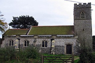
Swanton Novers is a village and a civil parish in the English county of Norfolk. The village is 15.1 miles (24.3 km) west-south-west of Cromer, 23.1 miles (37.2 km) north-north-west of Norwich and 123 kilometres (76 mi) north-north-east of London. The village lies 6 miles (9.7 km) south-west of the town of Holt. The nearest railway station is at Sheringham for the Bittern Line which runs between Sheringham, Cromer and Norwich. The nearest airport is Norwich International Airport.
The Turkmen Carpet Museum or the National Carpet Museum is a national museum, situated on 5 Gorogly Street in Ashgabat, Turkmenistan.
Ulug Depe is an ancient Bronze Age site in the foothills of the Kopet Dag Mountains in the Karakum Desert of Kaka District (Kaahka) in the Ahal Province of south-eastern Turkmenistan. It covers around 13 acres (53,000 m2) and lies on a mound at a height of about 30 meters.

Hanhowuz, also known as Khauz-Khan, is a reservoir in Ahal Province of southeastern Turkmenistan. It is located at 37°13′56″N61°14′37″E. The M37 highway passes nearby and the village of Hanhowuz stands on the northwestern shore, with the city of Tejen not too far away in that direction.

Bagani is a settlement on the south-western banks of the Okavango River in the Kavango East Region, Namibia, 200 kilometres (120 mi) east of Rundu and near the Popa Falls on the Okavango River. Bagani has a population of around 2.000 inhabitants and is homestead of the local Mbukushu kings.

Imperia is a coastal city and comune in the region of Liguria, Italy. It is the capital of the Province of Imperia, and historically it was capital of the Intemelia district of Liguria. Mussolini created the city of Imperia on 21 October 1923 by combining Porto Maurizio and Oneglia and the surrounding village communes of Piani, Caramagna Ligure, Castelvecchio di Santa Maria Maggiore, Borgo Sant'Agata, Costa d'Oneglia, Poggi, Torrazza, Moltedo and Montegrazie.

The Congo-Nile Divide region of Rwanda and Burundi is a mountainous area in the southern section of the Congo-Nile Divide, to the east of the Albertine Rift. The region includes the Nyungwe and Kibira national parks. The Bugoyi people live in the region.

Aroa is the capital of the municipality of Bolívar in the state of Yaracuy, Venezuela. It grew up to serve the Aroa copper mines, now defunct.
Miana is a large village in Ahal Province, Turkmenistan, not far from the Iranian border. The eleventh century Abu Said Meikhene Mausoleum, dedicated to Abū-Sa'īd Abul-Khayr lies to the northwest.


