
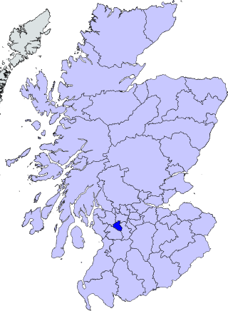
East Renfrewshire is one of 32 council areas of Scotland. It was formed in 1996, as a successor to the Eastwood district of the Strathclyde region. The northeastern part of the council area is close to Glasgow and many of the council area's northern settlements fall into the Greater Glasgow urban area.

Glasgow City Council is the local government authority for Glasgow City council area, Scotland. In its modern form it was created in 1996. Glasgow was formerly governed by a corporation, also known as the town council, from the granting of its first burgh charter in the 1170s until 1975. From 1975 until 1996 the city was governed by City of Glasgow District Council, a lower-tier authority within the Strathclyde region.

Dunbartonshire or the County of Dumbarton is a historic county, lieutenancy area and registration county in the west central Lowlands of Scotland lying to the north of the River Clyde. Dunbartonshire borders Perthshire to the north, Stirlingshire to the east, Lanarkshire and Renfrewshire to the south, and Argyllshire to the west.

Pollokshaws is an area on the South side of the city of Glasgow, Scotland. It is bordered by the residential neighbourhoods of Auldhouse to the east, Eastwood and Hillpark to the south and Shawlands to the north, with the Glasgow South Western Line railway and the open lands of Pollok Country Park to the west. The White Cart Water flows through the area.
Eastwood was a local government district in the Strathclyde region. It was derived from the civil parish of Eastwood which had been within the county of Renfrewshire, though latterly included areas which had become annexed Lanarkshire and the expanding city of Glasgow. Established in 1975, it covered the parts of the parish outside Glasgow, plus adjoining areas to the south; it was abolished in 1996 to become part of East Renfrewshire.

Barrhead is a town in East Renfrewshire, Scotland, thirteen kilometres (8 mi) southwest of Glasgow city centre on the edge of the Gleniffer Braes. At the 2011 census its population was 17,268.

Newton Mearns is a suburban town and the largest settlement in East Renfrewshire, Scotland. It lies 7 miles (11 km) southwest of Glasgow City Centre on the main road to Ayrshire, 410 feet (125 m) above sea level. It has a population of approximately 26,993, stretching from Whitecraigs and Kirkhill in the northeast to Maidenhill in the southeast, to Westacres and Greenlaw in the west and Capelrig/Patterton in the northwest.

Shawlands is a Southside suburb of Glasgow, Scotland, located two miles south of the River Clyde. The area, considered the "Heart of the Southside", is known for its independent restaurants and cafés, art scene, public parks, period terraces, and red and blond sandstone tenements. Shawlands was named one of the best places to live in Scotland in 2022 and 2023 by The Sunday Times, and one of the world's coolest neighbourhoods by Time Out Magazine with judges describing it as "the city's best area to live and socialise”. It is located between Pollok Country Park – the home of the Burrell Collection and Pollok House – and the acclaimed Victorian park Queen's Park.
Crookston is a residential suburb on the southwestern edge of the city of Glasgow, Scotland.

Renfrew District was, between 1975 and 1996, one of nineteen local government districts in the Strathclyde region of Scotland.
Arden is a medium-sized housing estate on the south-western edge of the city of Glasgow, Scotland. The M77 motorway runs directly to the west of the neighbourhood, with Junction 3 serving the area; a small industrial estate is located to the south-east. The residential area of Carnwadric is to the north-east of Arden, and the Jenny Lind part of Deaconsbank to the south, while the land to the north is open ground and woodland.

Thornliebank is a suburban area in East Renfrewshire, in the west central Lowlands of Scotland. Part of the Greater Glasgow conurbation, it is located on the Auldhouse Burn about six miles south of Glasgow city centre, and just outside the city's administrative boundaries. The neighbouring East Renfrewshire town of Giffnock lies directly to the east, with Rouken Glen Park to the south.

Newlands is an affluent suburb in the south side of Glasgow, Scotland. The area is mainly residential in character. Shawlands and Langside lie to the north of the district, Pollokshaws and Auldhouse to the west, Giffnock to the south, and Merrylee and Cathcart to the east.
Mansewood is a residential district in the Scottish city of Glasgow. It is situated south of the River Clyde and is surrounded by the districts of Eastwood, Hillpark, Pollokshaws in Glasgow, and Thornliebank and Giffnock in East Renfrewshire.

Renfrewshire or the County of Renfrew is a historic county, registration county and lieutenancy area in the west central Lowlands of Scotland. The lieutenancy area covers the three modern council areas of Inverclyde, Renfrewshire and East Renfrewshire, and this area is occasionally termed Greater Renfrewshire to distinguish it from the modern council area called Renfrewshire. The historic county additionally included territory on the south-western edge of Glasgow which was gradually transferred to the administrative area of the city as it grew.

Deaconsbank is a neighbourhood in the Scottish city of Glasgow. It is situated south of the River Clyde. The main feature of the area, which falls into the Greater Pollok ward of Glasgow City Council and directly borders the East Renfrewshire council region, is an estate of around 639 private houses built in the late 1970s by Barratt Developments, prior to which the area was open farmland. Deaconsbank is bordered by the M77 motorway to the west and by Rouken Glen Park and golf course to the east. The northern parts of the suburban town of Newton Mearns are a short distance to the south, as is Patterton railway station.
Newlands/Auldburn is one of the 23 wards of Glasgow City Council. Situated south of the city and the River Clyde, it is represented by 3 members as of May 2022, one each from the Scottish National Party, Scottish Labour, and Scottish Green Party.

Saint Conval (Conwall) was an Irish-born missionary who, according to legend recorded in the Aberdeen Breviary, as he was praying on the sea shore "to be borne, by whatsoever means, to the regions beyond the sea", was miraculously carried by the stone he stood on across the Irish Sea to Inchinnan in Scotland. He was active in the Kingdom of Strathclyde in the area of East Renfrewshire, where there were “Conval wells” in Barrhead and Thornliebank. He is believed to have founded churches at Inchinnan, Pollokshaws and Fereneze. His bones were preserved in an impressive sarcophagus at the Inchinnan church.

Eastwood is a residential neighbourhood in the city of Glasgow, Scotland. It is situated south of the River Clyde, and is part of the Newlands/Auldburn ward under Glasgow City Council.
Pollok Football Club was a Scottish football team, based in Pollokshaws, now part of Glasgow.
