Eching, Freising

Last updated
Eching
KircheStAndreas Eching-01.jpg
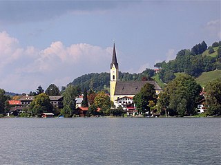
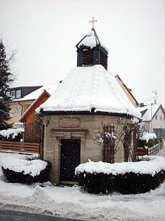
Church of Saint Andrew
Wappen von Eching (Landkreis Freising).svg
Coat of arms
Location of Eching
Germany adm location map.svg
Red pog.svg
Eching
Bavaria location map.svg
Red pog.svg
Eching
Coordinates: 48°18′N11°37′E / 48.300°N 11.617°E / 48.300; 11.617 Coordinates: 48°18′N11°37′E / 48.300°N 11.617°E / 48.300; 11.617
Country Germany
State Bavaria
Admin. region Oberbayern
District Freising
Government
   Mayor Sebastian Thaler (Ind.)
Area
  Total37.83 km2 (14.61 sq mi)
Elevation
469 m (1,539 ft)
Population
(2017-12-31) [1]
  Total13,856
  Density370/km2 (950/sq mi)
Time zone CET/CEST (UTC+1/+2)
Postal codes
85386, 85379
Dialling codes 089, 08165, 08133
Vehicle registration FS
Website www.eching.de

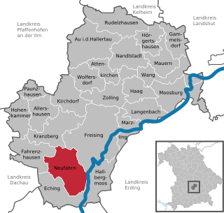
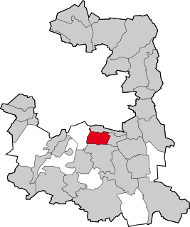
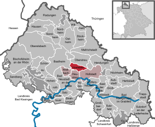
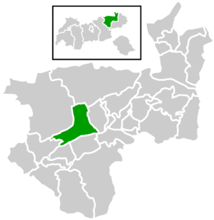
Eching is a municipality in the district of Freising, in Upper Bavaria, Germany.

Municipalities of Germany the lowest official level of territorial division in Germany

Municipalities are the lowest level of official territorial division in Germany. This is most commonly the third level of territorial division, ranking after the Land (state) and Kreis (district). The Gemeinde which is one level lower in those states also includes Regierungsbezirke as an intermediate territorial division. The Gemeinde is one level higher if it is not part of a Samtgemeinde. Only 10 municipalities in Germany have fifth level administrative subdivisions and all of them are in Bavaria. The highest degree of autonomy may be found in the Gemeinden which are not part of a Kreis. These Gemeinden are referred to as Kreisfreie Städte or Stadtkreise, sometimes translated as having "city status". This can be the case even for small municipalities. However, many smaller municipalities have lost this city status in various administrative reforms in the last 40 years when they were incorporated into a Kreis. In some states they retained a higher measure of autonomy than the other municipalities of the Kreis. Municipalities titled Stadt are urban municipalities while those titled Gemeinde are classified as rural municipalities.

Freising (district) District in Bavaria, Germany

Freising is a Landkreis (district) in Bavaria, Germany. Following a recent ranking of the German magazine Focus-Money comparing all German districts it is number one concerning economic growth abilities. It is bounded by the districts of Kelheim, Landshut, Erding, Munich, Dachau and Pfaffenhofen. The district is located north of the Munich metropolitan area. The Isar and Amper rivers run in parallel from southwest to northeast. North of the rivers there is the Hallertau, a hilly region mainly used for hop growing.

Upper Bavaria Regierungsbezirk in Bavaria, Germany

Upper Bavaria is one of the seven administrative districts of Bavaria, Germany.

Contents

Geography

Eching is located 18 km north of Munich (centre) and 15 km southwest of Freising.

Munich Place in Bavaria, Germany

Munich is the capital and most populous city of Bavaria, the second most populous German federal state. With a population of around 1.5 million, it is the third-largest city in Germany, after Berlin and Hamburg, as well as the 12th-largest city in the European Union. The city's metropolitan region is home to 6 million people. Straddling the banks of the River Isar north of the Bavarian Alps, it is the seat of the Bavarian administrative region of Upper Bavaria, while being the most densely populated municipality in Germany. Munich is the second-largest city in the Bavarian dialect area, after the Austrian capital of Vienna.

Districts

The municipality Eching has existed since 1978 and consists of Eching, Günzenhausen, Ottenburg, Deutenhausen, Dietersheim and Gut Hollern. Hollern (to the west of the federal road B 13) has been incorporated with Unterschleißheim since 1990.

Unterschleißheim Place in Bavaria, Germany

Unterschleißheim is a town in Bavaria, Germany. It is located about 17 km north of the city limits of Munich, and has a population of 28,697.

History

The first documented evidence of "Ehingas" appears in 773 in a deed of donation from the Freising Bishop. Eching has belonged to the closed jurisdiction of Ottenburg for centuries. During an administrative reform in 1818 Eching Bavaria attained its autonomy as a municipality. With the building of the autobahn from 1936 to 1938 the area evolved from an agricultural into a more industrial structure. After the administrative reform of 1978 Günzenhausen, Ottenburg and Deutenhausen were brought into the municipality Eching. The establishment of the business park Eching, which was founded together with the neighboring municipality Neufahrn bei Freising and the link to the Munich International Airport via the Munich S-Bahn developed Eching into a modern suburban municipality.

A bishop is an ordained, consecrated, or appointed member of the Christian clergy who is generally entrusted with a position of authority and oversight.

Bavaria State in Germany

Bavaria, officially the Free State of Bavaria, is a landlocked federal state of Germany, occupying its southeastern corner. With an area of 70,550.19 square kilometres, Bavaria is the largest German state by land area comprising roughly a fifth of the total land area of Germany. With 13 million inhabitants, it is Germany's second-most-populous state after North Rhine-Westphalia. Bavaria's main cities are Munich and Nuremberg.

Neufahrn bei Freising Place in Bavaria, Germany

Neufahrn bei Freising is a municipality in the district of Freising, in Bavaria, Germany. It has about 20,000 inhabitants and is situated near the river Isar, 12 km southwest of Freising and 20 km northeast of Munich.

Coat of arms

The coat of arms of Eching shows the Freising blackamoor and heath blossoms flanking St. Andrew's Cross. The coat of arms has been used by Eching since 1967.

A Maure, since the 11th century, is the symbol of a Moor's head. The term has Phoenician and Greek origins; see Moors.

Saltire heraldic symbol in the form of a diagonal cross

A saltire, also called Saint Andrew's Cross or the crux decussata, is a heraldic symbol in the form of a diagonal cross, like the shape of the letter X in Roman type. The word comes from the Middle French sautoir, Middle Latin saltatoria ("stirrup").

Town twinning

Trezzano sul Naviglio Comune in Lombardy, Italy

Trezzano sul Naviglio is a comune (municipality) in the Metropolitan City of Milan in the Italian region Lombardy, located about 9 km (6 mi) southwest of Milan.

Italy republic in Southern Europe

Italy, officially the Italian Republic, is a country in Southern and Western Europe. Located in the middle of the Mediterranean Sea, Italy shares open land borders with France, Switzerland, Austria, Slovenia and the enclaved microstates San Marino and Vatican City. Italy covers an area of 301,340 km2 (116,350 sq mi) and has a largely temperate seasonal and Mediterranean climate. With around 61 million inhabitants, it is the fourth-most populous EU member state and the most populous country in Southern Europe.

Urubamba, Peru Town in Cusco Region, Peru

Urubamba is a small town in Peru, located near the Urubamba River under the snow-capped mountain Chicón. Located one hour from Cusco, Urubamba is the largest town in the Sacred Valley of the Incas. It is also located near a number of significant ruins of the Inca Empire, including Machu Picchu. The sparse remains of the Inca palace, Quispiguanca, are within the town. Tourists often come through the town on their way to visit these sites.

Culture and sights

The Community Center Eching is an important venue in Eching comprising a cabaret stage, an exhibition area and a restaurant.

The recreation area "Echinger See" (English: Eching Lake) is located to the south of Eching. The bathing season lasts from May 15 until September 15 of each year. The recreation area covers 33 hectares, of which 12.6 hectares is covered by the lake. The lake originated in the 1960s from a gravel quarry. Between Eching and Hollern are several other gravel quarry lakes for bathing, all which are planned to be developed into a recreational area close to town.

In the area of the municipality you can find several nature reserves: The Garchinger Heide, the Echinger Lohe created in 1951 and Mallertshofer Holz mit Heiden created in 1995.

Related Research Articles

Abensberg Place in Bavaria, Germany

Abensberg is a town in the Lower Bavarian district of Kelheim, in Bavaria, Germany, lying around 30 km southwest of Regensburg, 40 km east of Ingolstadt, 50 northwest of Landshut and 100 km north of Munich. It is situated on the Abens river, a tributary of the Danube.

Unterhaching Place in Bavaria, Germany

Unterhaching is the second largest municipality in the district of Munich in Bavaria, Germany.

Corbinian Frankish bishop

Saint Corbinian was a Frankish bishop. After living as a hermit near Chartres for fourteen years, he made a pilgrimage to Rome. Pope Gregory II sent him to Bavaria. His opposition to the marriage of Duke Grimoald to his brother's widow, Biltrudis, caused Corbinian to go into exile for a time. His feast day is 8 September. The commemoration of the translation of his relics is 20 November.

Gröbenzell Place in Bavaria, Germany

Gröbenzell is a municipality near Munich in the district Fürstenfeldbruck, in Bavaria, Germany. It was founded in 1952, and has a population of 19,202. Gröbenzell is often called a garden city, which is also illustrated by the two flowers in the coat of arms.

Schliersee Place in Bavaria, Germany

Schliersee is a small town (Markt) and a municipality in the district of Miesbach in Bavaria in Germany. It is named after the nearby Lake Schliersee. It comprises the districts Schliersee (town), Westenhofen, Neuhaus, Fischhausen, Josefsthal and Spitzingsee.

Krumbach, Bavaria Place in Bavaria, Germany

Krumbach is a town with 13,000 residents in the district Günzburg in Swabia, Bavaria, Germany. It is the second biggest town in the district.

Ostrach Place in Baden-Württemberg, Germany

Ostrach is a municipality in the district of Sigmaringen in Baden-Württemberg in Germany.

Moosach Place in Bavaria, Germany

Moosach is a municipality in the Upper Bavarian district of Ebersberg and a member of the Verwaltungsgemeinschaft of Glonn.

Oberding Place in Bavaria, Germany

Oberding is a municipality in the district of Erding in Upper Bavaria in Germany, and member of the same administrative community. Almost half of the area of Munich Airport, including both terminals, falls within the municipal bounds.

Kleinsendelbach Place in Bavaria, Germany

Kleinsendelbach is a municipality in the district of Forchheim in Bavaria in Germany. It is located about 17 Kilometers south of the town of Forchheim and 15 Kilometers to the east of the city of Erlangen, and is part of the administration community Dormitz.

Langenbach, Bavaria Place in Bavaria, Germany

Langenbach is a municipality in the district of Freising in Bavaria in Germany.

Irschenberg Place in Bavaria, Germany

Irschenberg is a municipality in the district of Miesbach in the German state of Bavaria, about 46 km (29 mi) southeast of Munich. It consists of numerous hamlets situated on the Irschenberg hill range.

Pullach Place in Bavaria, Germany

Pullach, officially Pullach i. Isartal, is a municipality in the district of Munich in Bavaria in Germany. It is on the Isar Valley Railway and is served by the S 7 line of the Munich S-Bahn, at the Großhesselohe Isartalbahnhof, Pullach and Höllriegelskreuth railway stations.

Unsleben Place in Bavaria, Germany

Unsleben is a municipality in the district of Rhön-Grabfeld in Bavaria in Germany.

Breitenbach am Inn Place in Tyrol, Austria

Breitenbach am Inn is a municipality in the Kufstein district in the Austrian state of Tyrol located 5.5 km west of Wörgl and 19 km southwest of Kufstein. The village has five parts and received new parts and house numbers in 2006. It was founded in the middle of the 19th century.

Schondorf Place in Bavaria, Germany

Schondorf am Ammersee is a municipality in the district Landsberg am Lech, Bavaria, Germany and is a member of the municipal association Schondorf am Ammersee The municipal association based in Schondorf.

Langwieder lake district lake in Germany

The Langwieder lake district is composed of three lakes west of Munich in Bavaria, Germany. It opened in the year 2000 as a recreational area enclosing the Langwieder See, the Lußsee, and the Birkensee. The entire site spans 120 hectares ; 40 of which are the lakes and 80 are land; 27 hectares of which are lawns for sunbathing.

Zinzenzell Ortsteil of Wiesenfelden in Bavaria, Germany

Zinzenzell is a village and a former municipality with about 350 inhabitants in Lower Bavaria, Germany. The village and most of the former municipality have been part of the municipality Wiesenfelden since 1978.

References

  1. "Fortschreibung des Bevölkerungsstandes". Bayerisches Landesamt für Statistik und Datenverarbeitung (in German). September 2018.