
Casselman is a village in eastern Ontario, Canada, in the United Counties of Prescott and Russell on the South Nation River.

Gloucester is a suburb in the City of Ottawa. Gloucester Township was established in 1792 and originally included lands east of the Rideau River from the Ottawa River south to Manotick. It was incorporated as a township in 1850 and became a city in 1981. Gloucester was one of the 11 municipalities that merged in 2001 to form the new city of Ottawa. As of the Canada 2016 Census, the former city of Gloucester had a population of 133,280.
Whitewater Region is a township on the Ottawa River in Renfrew County, located within the scenic Ottawa Valley in eastern Ontario, Canada. Whitewater Region is made up of the former municipalities of Beachburg, Cobden, Ross and Westmeath, which were amalgamated into the current township on January 1, 2001.

Old Ottawa South is an older urban neighbourhood in Capital Ward in Ottawa, Ontario, Canada. Old Ottawa South is a relatively small and compact neighbourhood, located between the Rideau Canal and the Rideau River. The eastern boundary is Avenue Road. Bronson Avenue forms the western border of the residential neighbourhood. Carleton University is on the other (western) side of Bronson but the campus can be considered to be geographically within Old Ottawa South as the campus is also nestled between the river and the canal.

Eastern Ontario is a secondary region of Southern Ontario in the Canadian province of Ontario which lies in a wedge-shaped area between the Ottawa River and St. Lawrence River. It shares water boundaries with Quebec to the north and New York State to the east and south, as well as a small land boundary with the Vaudreuil-Soulanges region of Quebec to the east.

Greely is a suburban-rural ward of Ottawa, Ontario, Canada. Located south of the city in Osgoode Ward, it was part of the Township of Osgoode prior to amalgamation in 2001. Greely is currently the largest rural village in terms of land area and the third largest in terms of population in the City of Ottawa. According to the Greely Community Association, it is bounded on the east by Sale Barn Road and Greyscreek Road, on the north by Mitch Owens on the west by Manotick Station Road, and on the south by Snake Island Road. According to the Canada 2011 Census, the population within these boundaries was 9,049.

The Senate of Canada Building is a building located at 2 Rideau Street in downtown Ottawa, Ontario, Canada that serves as the temporary seat of the Senate of Canada. The building includes the temporary Senate chamber, as well as some Senate offices and committee rooms. The building served as Ottawa's central railway station until 1966, and from 1966 to 2018 it was operated by the federal government as the Government Conference Centre.

Rockland is a bilingual community located about 40 km (25 mi) east of downtown Ottawa, Ontario, Canada, part of the city of Clarence-Rockland. Rockland has a population of 11,099. It is home to a large part of the francophone community in Eastern Ontario along with the towns situated to the east and the Ottawa suburb of Orleans to the west.

Bourget is a village in Eastern Ontario, Canada, near the Cobbs Lake Creek, in the city of Clarence-Rockland in the United Counties of Prescott and Russell.

Australia House in Ottawa, Ontario, Canada is the official residence of the Australian High Commissioner to Canada. The house is located on a corner lot at 407 Wilbrod Street in the Sandy Hill neighbourhood of Ottawa, near to a number of other embassies and official residences. The house was built in 1910 by William Davis, and is believed to have been designed by John W.H. Watts. Davis died under inauspicious circumstances in 1916 and it lay vacant for several years before being purchased by Colonel Cameron Macpherson Edwards, who had earlier lived at 24 Sussex Drive. The Edwards left in 1937 and rented the house to Germany to house the Consul General Dr. Erich Windels, who was friendly with Canadian Prime Minister William Lyon Mackenzie King, who lived nearby. Windels was expelled from Canada upon the declaration of war in September 1939.

Stittsville is a suburban community, part of the Canadian capital of Ottawa, Ontario. It is within the former Goulbourn Township. A part of the National Capital Region, Stittsville is immediately to the southwest of Kanata, and about 31 km (19 mi) west of Downtown Ottawa. The urban part of the community corresponds to Stittsville Ward on Ottawa City Council. Three school boards are represented in the area: Ottawa Catholic School Board, Ottawa-Carleton District School Board and Centre-East French Catholic School Board; Sacred Heart Catholic High School, Frederick Banting Secondary Alternate Program and École secondaire catholique Paul-Desmarais are the high schools.

Osgoode Township is a former township that is now a part of the city of Ottawa, Ontario, Canada. The township along the Rideau River was established in 1798 and incorporated in 1850. It was an independent township in Carleton County until its amalgamation with the city in 2001. It remains a largely rural area with only some 23,285 inhabitants as of the 2016 census. On Ottawa city council it is represented by George Darouze.
March Township is a geographic township and former municipality originally part of Carleton County in eastern Ontario, Canada. It is currently part of the City of Ottawa. It is located in the western part of the county, bordered to the northwest by Torbolton Township, to the southwest by Huntley Township, to the east by Nepean, to the south by Goulbourn Township and to the north by the Ottawa River. According to the Canada 2001 Census, the Township had a population of approximately 26,650.

Metcalfe is a population centre located in Osgoode Ward, in the rural south-end of the city of Ottawa, Ontario, Canada. Prior to amalgamation in 2001, the community was in Osgoode Township. According to the Canada 2016 Census, it has a population of 1,776.

Bells Corners is a suburban community in College Ward in the city of Ottawa, Ontario, Canada. It is located in the former city of Nepean within Ottawa's western Greenbelt. As of the Canada 2016 Census, the community had a population of 9,272.

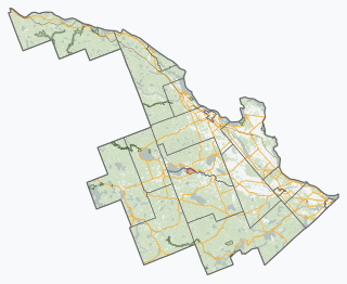
The Township of Russell is a municipal township, located south-east of Canada's capital of Ottawa in eastern Ontario, in the United Counties of Prescott and Russell, on the Castor River.
Kars is a village on the Rideau River within Rideau-Goulbourn Ward in the city of Ottawa, Ontario. Prior to joining the city in 2000 it was part of Rideau Township.
Kenmore is a rural community in Osgoode Ward in the southeastern corner of the City of Ottawa, Ontario, Canada. Prior to amalgamation in 2001, it was located in Osgoode Township. It consists of two small residential neighbourhoods and farmland. Notable features include Kenmore Bicentennial Park, Kenmore Community Centre, and the Castor River, a tributary of the South Nation River. According to the Canada 2011 Census, the population of the surrounding blocks was 501.
Grenfell Glen is a small neighbourhood in Knoxdale-Merivale Ward in the city of Ottawa in Ontario, Canada.

The Jean Talon Building is a federal government office building in Ottawa, Ontario, Canada. It forms part of the complex of three buildings, including the R. H. Coats Building and the Main Building, that houses the headquarters of Statistics Canada. Jean Talon was also the first intendant of the New France project
