Related Research Articles

The Province of East Jersey, along with the Province of West Jersey, between 1674 and 1702 in accordance with the Quintipartite Deed, were two distinct political divisions of the Province of New Jersey, which became the U.S. state of New Jersey. The two provinces were amalgamated in 1702. East Jersey's capital was located at Perth Amboy. Determination of an exact location for a border between West Jersey and East Jersey was often a matter of dispute.

The Province of New Jersey was one of the Middle Colonies of Colonial America and became the U.S. state of New Jersey in 1776. The province had originally been settled by Europeans as part of New Netherland but came under English rule after the surrender of Fort Amsterdam in 1664, becoming a proprietary colony. The English renamed the province after the island of Jersey in the English Channel. The Dutch Republic reasserted control for a brief period in 1673–1674. After that it consisted of two political divisions, East Jersey and West Jersey, until they were united as a royal colony in 1702. The original boundaries of the province were slightly larger than the current state, extending into a part of the present state of New York, until the border was finalized in 1773.
The Province of Pennsylvania, also known as the Pennsylvania Colony, was a British North American colony founded by William Penn, who received the land through a grant from Charles II of England in 1681. The name Pennsylvania was derived from "Penn's Woods", referring to William's father Admiral Sir William Penn.

The territory of the United States and its overseas possessions has evolved over time, from the colonial era to the present day. It includes formally organized territories, proposed and failed states, unrecognized breakaway states, international and interstate purchases, cessions, and land grants, and historical military departments and administrative districts. The last section lists informal regions from American vernacular geography known by popular nicknames and linked by geographical, cultural, or economic similarities, some of which are still in use today.

North Jersey comprises the northern portions of the U.S. state of New Jersey between the upper Delaware River and the Atlantic Ocean. As a distinct toponym, North Jersey is a colloquial one rather than an administrative one, reflecting geographical and perceived cultural and other differences between it and the southern part of the state.

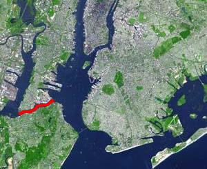
Paulus Hook is a community on the Hudson River waterfront in Jersey City, New Jersey. It is located one mile across the river from Manhattan. The name Hook comes from the Dutch word "hoeck", which translates to "point of land." This "point of land" has been described as an elevated area, the location of which today is bounded by Montgomery, Hudson, Dudley, and Van Vorst Streets.
Daniel Denton was an early American colonist. Denton led an expedition into the interior of northern New Jersey. He was one of the purchasers of what is known as the Elizabethtown Tract in 1664, in the area of present day Elizabeth, New Jersey. In 1670 he wrote the first English-language description of the area.
Bergen Township was a township that existed in the U.S. state of New Jersey, from 1661 to 1862, first as Bergen, New Netherland, then as part Bergen County, and later as part of Hudson County. Several places still bear the name: the township of North Bergen; Bergen Square, Old Bergen Road, Bergen Avenue, Bergen Junction, Bergen Hill and Bergen Arches in Jersey City; Bergen Point in Bayonne; and Bergenline Avenue and Bergen Turnpike in North Hudson.
The Horseneck Tract was an area in present-day Essex County, New Jersey, United States, that consisted of what are now the municipalities of Caldwell, West Caldwell, North Caldwell, Fairfield, Verona, Cedar Grove, Essex Fells, Roseland, and portions of Livingston and West Orange.
Elizabeth Township, also called Elizabethtown, was a township that existed in Essex County, in the U.S. state of New Jersey, from 1664 until 1855.

Pavonia was the first European settlement on the west bank of the North River that was part of the seventeenth-century province of New Netherland in what would become the present Hudson County, New Jersey.

Achter Kol was the name given to the region around the Newark Bay and Hackensack River in northeastern New Jersey by the first European settlers to it and was part of the 17th century province of New Netherland, administered by the Dutch West India Company. At the time of their arrival, the area was inhabited by the Hackensack and Raritan groups of Lenape natives.
Bergen was a part of the 17th century province of New Netherland, in the area in northeastern New Jersey along the Hudson and Hackensack Rivers that would become contemporary Hudson and Bergen Counties. Though it only officially existed as an independent municipality from 1661, with the founding of a village at Bergen Square, Bergen began as a factory at Communipaw circa 1615 and was first settled in 1630 as Pavonia. These early settlements were along the banks of the North River across from New Amsterdam, under whose jurisdiction they fell.
Hackensack was the exonym given by the Dutch colonists to a band of the Lenape, or Lenni-Lenape, a Native American tribe. The name is a Dutch derivation of the Lenape word for what is now the region of northeastern New Jersey along the Hudson and Hackensack rivers. While the Lenape people occupied much of the mid-Atlantic area, Europeans referred to small groups of native people by the names associated with the places where they lived.
Curries Woods is a neighborhood in the southern part of Greenville in Jersey City, New Jersey bordering Bayonne. It was named after James Curie, who was on the town Committee for Greenville when it was its own Township in the 19th century. The area remained rural until the later part of the century when the Central Railroad of New Jersey built a line connecting ferries to Elizabeth, New Jersey and New York City. Currie's Woods still remained untouched through the late part of the century and it was valued for its woods, rocky shore and dunes on Newark Bay. A lot of the land was eventually lost, but a tract was set aside in the early part of the 20th century. A small cemetery, the Old Greenville Cemetery, was nearby. This park lost much of its land to the city's largest Housing Authority project in 1959, except a small tract in Bayonne, Mercer Park.
The English Neighborhood was the colonial-era name for the towns in eastern Bergen County, New Jersey, along the Hudson Palisades between the Hudson River and the Hackensack River, particularly around its main tributary, Overpeck Creek. The region had been part of the Dutch New Netherland colony of Bergen, whose main town was located at Bergen Square in modern Jersey City. The name refers to the geography of the region, bergen being the Dutch word for hills. Earlier attempts at settlement at Achter Col and Vriessendael had been compromised in conflicts with the precolonial population, bands of the Lenape known by their exonyms, the Hackensacks and the Tappans.
Jonathan Hampton was an American colonial surveyor, merchant, and militia officer involved with New Jersey's frontier fortifications and defenses along the Delaware River during the French and Indian War (1755-1763).
The Monmouth Tract, also known as the Monmouth Patent, Navesink Tract or Navesink Patent was a large triangular tract of land granted as a land patent to settlers of New Jersey during the early American colonial period.

Warinanco Park is a county park in Union County, New Jersey. It is 204 acres (83 ha) in size. It is located in Roselle at the border with the neighboring cities of Elizabeth and Linden.
References
- ↑ Grabas, Joseph A. "Land Speculation and Proprietary Beginnings of New Jersey" (PDF). The Advocate. New Jersey Land Title Association. XVI (4): 3, 20, 14. Archived from the original (PDF) on April 3, 2017. Retrieved April 2, 2017.
- ↑ "Records Concerning the Founding of Elizabethtown, New Jersey". Archived from the original on 2008-08-02. Retrieved 2008-08-02.