Equivalent Lands

Last updated
Map of New England showing much of the affected areas circa 1755 A map of the most inhabited part of New England (2674889207).jpg
Map of New England showing much of the affected areas circa 1755

The Equivalent Lands were several large tracts of land that the Province of Massachusetts Bay made available to settlers from the Connecticut Colony after April 1716. This was done as compensation for an equivalent area of territory that was under Connecticut's jurisdiction but had been inadvertently settled by citizens of Massachusetts. [1] [2] :137 The problem had arisen due to errors and imprecise surveys made earlier in the seventeenth century. The Equivalent Lands were never mapped. [3]

Contents

Background

Settlers in Springfield, Massachusetts, had several disagreements with settlers from Hartford, Connecticut, during the late 1630s when the Connecticut Colony was just getting established. The Springfield settlers decided to align themselves with the Massachusetts Bay Colony instead of Connecticut. [4] As a result, Massachusetts Bay surveyed the border between Massachusetts and Connecticut in 1642, and took control of land as far south as Warehouse Point at Windsor Locks, Connecticut, the northernmost point on the Connecticut River controlled by the tides.

In the 1690s, Connecticut Colony officials performed their own survey and discovered errors that were made in Massachusetts's 1642 survey, but it was not until 1713 that the two colonies co-operated to survey correct boundaries. At that time, the surveyors found that Massachusetts Bay had offered Springfield settlers the right to 105,793 acres (428.13 km2) that actually belonged to Connecticut. The settlers had established themselves in and around the towns of Springfield, Westfield, Suffield, and other areas west of the Connecticut River and believed themselves to be in lands belonging to Massachusetts Bay. [5] Most of those inhabiting the area did not want to change jurisdiction from Massachusetts to Connecticut, so they agreed that Massachusetts would retain administration over the settled lands. In return, Connecticut would be granted property rights (but not sovereignty) for an equal number of acres within Massachusetts, "as an equivalent to the said colony".:137–138 Connecticut began to auction off the "Equivalent Lands" in 1716, using most of the proceeds to fund the establishment of Yale College.

Settlement and further development

The surveys laying out the new tracts were concluded on November 10, 1715. One tract was in the area around Pelham and Hadley, another in the area encompassing Putney, Brattleboro, and Dummerston, and another along the east side of the Connecticut River. The commissioners appointed to locate these lands were Massachusetts Governor Joseph Dudley; Connecticut Governor Gurdon Saltonstall; Massachusetts residents Elisha Hutchinson and Isaac Addington; and Connecticut residents William Pitkin and William Whiting. These tracts, known as the Equivalent Lands, were then made available for purchase at Hartford on April 24–25, 1716, with the proceeds going to establish Yale. [2] :137–138 These auctioned lands were grouped in at least three known parcels; however, since there are no extant maps of the Equivalent Lands, [6] there may have been additional areas not auctioned at that time.

One group of land speculators purchased a 44,000-acre (180 km2) parcel. This group included William Brattle, Jr. for whom Brattleboro, Vermont was named. [3] Other initial purchasers of the lands included Paul Dudley, Thomas Fitch III, and Jonathan Belcher. [7]

Founding of Brattleboro

The Massachusetts General Court voted on December 27, 1723 to build a blockhouse and stockade north of its Northfield settlement in order to defend the Province of Massachusetts Bay against Chief Gray Lock and others during Dummer's War. Lieutenant-governor William Dummer signed the measure, and construction of Fort Dummer began on February 3, 1724. It was completed before summer, and a force of about 70 Native Americans, of the French-allied Abenaki tribe, attacked it on October 11, killing three or four defenders. [8] [9] The settlement surrounding the fort was called "Brattleborough". [8]

The fort was converted into a trading post in 1728 for commerce with friendly Indians. It was once again manned by soldiers during King George's War from 1744 to 1748. A small body of troops remained at the fort until 1750, after which it was considered unnecessary. Brattleborough itself was only scarcely populated until after the 1763 Treaty of Paris, when France abandoned its attempts to colonize North America. [8]

Other settlements

The Ashuelot Valley towns of Upper Ashuelot and Arlington were established prior to 1740, with several families living in each of the settlements. [9] Richard Hazzen was sent to survey the area in the winter of 1740–41 to try to determine the boundary line between New Hampshire and Massachusetts Bay Colony. [3]

Some settlements in the Equivalent Lands were temporarily abandoned in the mid- to late-1740s due to renewed conflicts with the French and their allied tribes. [9] These areas around Fort Dummer at the time were regarded to be in the New Hampshire colony, although maintenance and protection of the settlements were paid for by Massachusetts Bay. Therefore, another survey team was sent out in 1749, to once again clarify provincial lines, resulting in the New Hampshire Grants and the subsequent territorial disputes with the New York Colony concerning jurisdiction over parts of the area and its inhabitants. [9]

In 1752, a large section of the area came under the dominion of the Province of New Hampshire, but eventually fell under Vermont jurisdiction. [2] :252

The Equivalent Lands encompass parts of what are now Vermont, New Hampshire, Connecticut, and Massachusetts. [2] :278–80

Related Research Articles

<span class="mw-page-title-main">Suffield, Connecticut</span> Town in Connecticut, United States

Suffield is a town in Hartford County, Connecticut, United States. The town is part of the Capitol Planning Region, and located in the Connecticut River Valley. As of the 2020 census, the population was 15,752. The town center is a census-designated place listed as Suffield Depot.

<span class="mw-page-title-main">Dummerston, Vermont</span> Town in Vermont, United States

Dummerston is a town in Windham County, Vermont, United States. The population was 1,865 at the 2020 census. It is home to the longest covered bridge still in use in Vermont. Its borders include three main villages: Dummerston Center, West Dummerston, and East Dummerston.

<span class="mw-page-title-main">Connecticut River</span> River in the New England region of the United States

The Connecticut River is the longest river in the New England region of the United States, flowing roughly southward for 406 miles (653 km) through four states. It rises 300 yards south of the U.S. border with Quebec, Canada, and discharges at Long Island Sound. Its watershed encompasses 11,260 square miles (29,200 km2), covering parts of five U.S. states and one Canadian province, via 148 tributaries, 38 of which are major rivers. It produces 70% of Long Island Sound's fresh water, discharging at 18,400 cubic feet (520 m3) per second.

<span class="mw-page-title-main">Hinsdale, New Hampshire</span> Town in New Hampshire, United States

Hinsdale is a town in Cheshire County, New Hampshire, United States. The population was 3,948 at the 2020 census. Hinsdale is home to part of Pisgah State Park in the northeast, and part of Wantastiquet Mountain State Forest in the northwest.

<span class="mw-page-title-main">Winchester, New Hampshire</span> Town in New Hampshire, United States

Winchester is a town in Cheshire County, New Hampshire, United States. The population was 4,150 at the 2020 census. The primary community in the town, where 1,606 people resided at the 2020 census, is defined by the U.S. Census Bureau as the Winchester census-designated place (CDP). The town also includes the village of Ashuelot and part of Pisgah State Park.

<span class="mw-page-title-main">Brattleboro, Vermont</span> Town in Vermont, United States

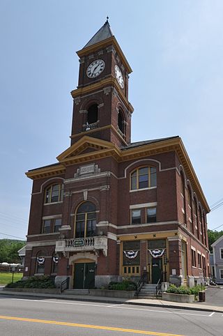
Brattleboro, originally Brattleborough, is a town in Windham County, Vermont, United States, located about 10 miles (16 km) north of the Massachusetts state line at the confluence of Vermont's West River and Connecticut. With a 2022 Census population of 12,106, it is the most populous municipality abutting Vermont's eastern border with New Hampshire, which is the Connecticut River.

<span class="mw-page-title-main">Province of New Hampshire</span> British colony in North America (1629–1641, 1679–1686, 1689–1776)

The Province of New Hampshire was a colony of England and later a British province in New England. The name was first given in 1629 to the territory between the Merrimack and Piscataqua rivers on the eastern coast of North America, and was named after the county of Hampshire in southern England by Captain John Mason, its first named proprietor. In 1776 the province established an independent state and government, the State of New Hampshire, and joined with twelve other colonies to form the United States.

<span class="mw-page-title-main">New Hampshire Grants</span> Land grants in colonial New Hampshire (1749-64); later became the Republic of Vermont

The New Hampshire Grants or Benning Wentworth Grants were land grants made between 1749 and 1764 by the colonial governor of the Province of New Hampshire, Benning Wentworth. The land grants, totaling about 135, were made on land claimed by New Hampshire west of the Connecticut River, territory that was also claimed by the Province of New York. The resulting dispute led to the eventual establishment of the Vermont Republic, which later became the U.S. state of Vermont.

<span class="mw-page-title-main">Joseph Dudley</span> Royal governor of Massachusetts

Joseph Dudley was a colonial administrator, a native of Roxbury in Massachusetts Bay Colony, and the son of one of its founders. He had a leading role in the administration of the Dominion of New England (1686–1689), which was overthrown in the 1689 Boston revolt. He served briefly on the council of the Province of New York, from which he oversaw the trial which convicted Jacob Leisler, the ringleader of Leisler's Rebellion. He then spent eight years in England in the 1690s as Lieutenant-Governor of the Isle of Wight, including one year as a Member of Parliament for Newtown. In 1702, he returned to New England after being appointed governor of the Province of Massachusetts Bay and Province of New Hampshire, posts that he held until 1715.

<span class="mw-page-title-main">Fort Dummer</span> First permanent European settlement in Vermont

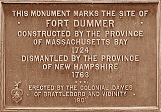
Fort Dummer was built in the winter of 1724 in what is now the Town of Brattleboro in southeastern Vermont. Today, it is notable as the first permanent European settlement in Vermont. The original site of the fort is now lost below the waters of the Connecticut River impoundment of the Vernon Dam.

<span class="mw-page-title-main">William Dummer</span> Politician in colonial Massachusetts

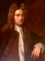
William Dummer was a politician in the Province of Massachusetts Bay. He served as its lieutenant governor for fourteen years (1716–1730), including an extended period from 1723 to 1728 when he acted as governor. He is remembered for his role in leading the colony during what is sometimes called Dummer's War, which was fought between the British colonies of northeastern North America and a loose coalition of native tribes in what is now New Hampshire, Maine, New Brunswick, and Nova Scotia.

<span class="mw-page-title-main">History of Vermont</span>

The geologic history of Vermont begins more than 450 million years ago during the Cambrian and Devonian periods.

<span class="mw-page-title-main">Fort at Number 4</span> Historic fort in New Hampshire

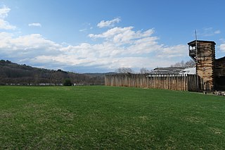
The Fort at Number 4 was a mid-18th century stockade fortification protecting Plantation Number 4, the northernmost British settlement along the Connecticut River in the Province of New Hampshire until after the French and Indian War. It was located in the present-day town of Charlestown, New Hampshire. A recreation of the fort, dating to 1960, now functions as an open-air museum, and was added to the New Hampshire State Register of Historic Places in July 2020.

<span class="mw-page-title-main">History of Massachusetts</span> Overview of the history of Massachusetts

The area that is now Massachusetts was colonized by English settlers in the early 17th century and became the Commonwealth of Massachusetts in the 18th century. Before that, it was inhabited by a variety of Native American tribes. Massachusetts is named after the Massachusett tribe that inhabited the area of present-day Greater Boston. The Pilgrim Fathers who sailed on the Mayflower established the first permanent settlement in 1620 at Plymouth Colony which set precedents but never grew large. A large-scale Puritan migration began in 1630 with the establishment of the Massachusetts Bay Colony, and that spawned the settlement of other New England colonies.

Lygonia was a proprietary province in pre-colonial Maine, created through a grant from the Plymouth Council for New England in 1630 to lands then under control of Sir Ferdinando Gorges. The province was named for his mother, Cicely (Lygon) Gorges. It was one of the early provinces of Maine and was absorbed by the Massachusetts Bay Colony by 1658.

<span class="mw-page-title-main">Union Station (Brattleboro, Vermont)</span> Railway station in Brattleboro, Vermont

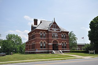
Union Station is an Amtrak intercity rail station located in downtown Brattleboro, Vermont, United States. It is served by the one daily round trip of the Vermonter service. Most of the 1915-built station is occupied by the 1972-opened Brattleboro Museum and Art Center, while Amtrak uses a waiting room on the lower floor. The building was added to the National Register of Historic Places in 1974.

The Connecticut River Railroad was a railroad located along the Connecticut River in western Massachusetts, formed in 1845 from the merger of two unfinished railroads. Its main line from Springfield to East Northfield, Massachusetts, opened in stages between 1845 and 1849. It built several branches and over the years acquired additional lines in Vermont. The railroad was acquired by the Boston and Maine Railroad in 1893.

<span class="mw-page-title-main">Gray Lock</span> Western Abenaki warrior chieftain (1670-1750)

Gray Lock, , was a Western Abenaki warrior chieftain of Woronoco/Pocumtuck ancestry who came to lead the Missisquoi Abenaki band, and whose direct descendants have led the Missisquoi Abenaki until the current day. Born around 1670 near what is now Westfield, Massachusetts, he eventually became the most illustrious and prominent leader to arise among the dwindling Waranoak, once the predominant original inhabitants of the central Connecticut River Valley in today's New England region.

The siege of Fort at Number Four was a frontier action at present-day Charlestown, New Hampshire, during King George's War. The Fort at Number 4, was unsuccessfully besieged by a French and Native force under the command of Ensign Joseph Boucher de Niverville. The British defenders were alerted to the presence of the besiegers by their dogs, and were well-prepared to defend the fort. They successfully fought off attempts to burn the fort down, and turned down demands that they surrender. Some of Boucher de Niverville's Natives, short on provisions, attempted to bargain with the fort's defenders for supplies, but were rejected.

Samuel Knight was a legal and political figure in Vermont during its period as an independent republic and the early years of its statehood. Among the offices in which he served were Associate Justice of the Vermont Supreme Court, and Chief Justice (1791-1793).

References

  1. Records held in office of the Secretary of the State of Connecticut; Colonial Boundaries, Vol. III; Massachusetts, 1670–1827.
  2. 1 2 3 4 Crockett, Walter Hill (1921). Vermont: The Green Mountain State. Vol. 1. New York: The Century History Company, Inc.
  3. 1 2 3 "The Equivalent Lands and Fort Dummer". Brattleboro History. Valley Historians. Retrieved March 10, 2017.
  4. Barrows, Charles Henry (1911). The History of Springfield in Massachusetts for the Young: Being also in some part the history of other towns and cities in the county of Hampden. Connecticut Valley Historical Society. pp. 46–48.
  5. Connecticut Boundary Survey; part 1 of 2 Archived 2014-07-14 at the Wayback Machine
  6. Note: There is a written description of some of the Equivalent Lands in the Connecticut Archives.
  7. Hyde, William (1847). An Address, Delivered at the Opening of the New Town-Hall, Ware, Mass., March 31, 1847, Containing Sketches of the Early History of That Town, and Its First Settlers. Brookfield, Mass: Merriam and Cooke, Printers.
  8. 1 2 3 Coolidge, A. J.; Mansfield, J. B. (1859). A History and Description of New England, General & Local. Vol. 1. Boston, Massachusetts: Austin J. Coolidge.
  9. 1 2 3 4 Equivalent Lands; webpage; Vermont History on-line; accessed April 26, 2020