Estuarine water circulation

Last updated

Estuarine water circulation is controlled by the inflow of rivers, the tides, rainfall and evaporation, the wind, and other oceanic events such as an upwelling, an eddy, and storms. Estuarine water circulation patterns are influenced by vertical mixing and stratification, and can affect residence time and exposure time.

Contents

Residence time

Model of Estuary EstauryModel.JPG
Model of Estuary

The residence time of water is a key variable determining the health of an estuary, particularly from human-induced stresses. Rapid flushing ensures that there is insufficient time for sediment accumulation or dissolved oxygen depletion in the estuary; thus a well flushed estuary is intrinsically more robust than a poorly flushed estuary. [1] Residence time also affects other parameters such as heavy metals, dissolved nutrients, suspended solids, and algal blooms that may affect the health of estuaries. [2]

A simple way to calculate residence time is using a simple classic estuary model, which can be useful for acquiring a conceptual understanding of an estuary, but is coarse in time and space. A classic estuary has the following components: 1) freshwater inflow with a discharge Qf and a salinity Sf (generally Sf = 0); 2) oceanic inflow with a discharge Qin and salinity S0; and 3) outflow to the ocean with a discharge of Qout and a salinity S1. The inflow and outflow of water is equal because mass is conserved. Salt is also a conserved, therefore, the inflow and outflow fluxes of salinity are also equal. If groundwater inputs and evaporation are ignored, the continuity equation is:

QinS0 + QfSf = QoutS1

The residence time T is the volume of freshwater within the estuary divided by the flow rate of the river, and can be approximated as: [1]

T = (Vol/ Qf )(1 - S1/ S0 - Sf / S0)

where Vol is the total volume of water within the estuary.

Exposure time

Residence time considers the time it takes for the water particles to leave the estuary, however, some water particles that leave the estuary during an ebb tide may re-enter the system during a flood tide. The amount of time a water particle spends in the estuary until it never returns is called exposure time. The exposure time can be much larger than the residence time if the water particles are leaving with the ebb tides and returning with the rising tide. The ratio between the number of water particles returning to the estuary and the number of water particles leaving is known as the return coefficient, r.

In order to quantify exposure time, the water circulation outside of the estuary must be determined. However, the circulation near the mouth of the estuary is complex due to the tidal mixing processes that occur between the estuarine and ocean waters. If the coast is rugged with headlands, a mosaic of complex flow fields consisting of eddies, jets, and stagnation zones will occur, further complicating the circulation patterns outside of the estuary. [1]

In cases involving deltas or wetlands that drain into multiple tidal creeks, such as Missionary Bay, Australia, water leaving one creek at the ebb tide may enter another estuary during the flood tide. [3] When there is a series of estuaries involved, a large exposure time (larger than that of the individual estuaries), will occur if the tidal outflow from one estuary re-enters a different estuary during the flood tide. Along a rugged coastline with headlands, however, mixing of estuary and oceanic waters can be intense. When estuarine water leaves the estuary, it gets flushed out to coastal waters, so exposure time and residence time are close equal. [4]

In some cases it is possible to measure the fluxes of volume, salt, and temperature across the mouth of an estuary through a tidal cycle. Using this data, (1-r) can be calculated (r is the return coefficient): it is equal to the fraction of the volume of water VTP (mean tidal prism volume) leaving the estuary during the ebb tide that is replaced with coastal waters prior to re-entering the system. When r = 1, the same water is re-entering the estuary, and if r = 0, the estuarine water that has left the estuary during the ebb tide has been replaced with coastal waters entering the estuary during the rising tide. [1] The exposure time τ' is estimated by:

τ' = VestuaryTtide / (1-r) VTP

Vestuary is defined as the mean estuarine volume and Ttide is the tidal period. [5]

The total fluxes of brackish water through the river mouth during tidal events is often much higher (often by a factor of 10 to 100) than the volume flux from riverine inflow. Therefore, if measurements are not precise, the estimate of the net flux will be unreliable. Direct measurements of the return coefficient are often complicated by unsteady oceanic events such an upwelling, the passage of an eddy, or storms, so the success of a correct direct measurement of the return coefficient is rare. [1]

Vertical mixing and stratification

Salt Wedge Estuary SaltWedgeEstuary.JPG
Salt Wedge Estuary
Partially Mixed Estuary PartiallyMixedEstuary.JPG
Partially Mixed Estuary
Vertically Homogeneous Estuary Vertically Homogeneous Estuary.JPG
Vertically Homogeneous Estuary
Fjord FjordCirculation.JPG
Fjord

The residence time of water in an estuary is dependent on the circulation within the estuary that is driven by density differences due to changes in salinity and temperature. Less dense freshwater floats over saline water and warmer water floats above colder water (temperatures greater than 4 °C). As a result, near-surface and near-bottom waters can have different trajectories, resulting in different residence times.

Vertical mixing determines how much the salinity and temperature will change from the top to the bottom, profoundly affecting water circulation. Vertical mixing occurs at three levels: from the surface downward by wind forces, the bottom upward by boundary generated turbulence (estuarine and oceanic boundary mixing), and internally by turbulent mixing caused by the water currents which are driven by the tides, wind, and river inflow. [1]

Different types of estuarine circulation result from vertical mixing:

Salt wedge estuary

These estuaries are characterized by a sharp density interface between the upper layer of freshwater and the bottom layer of saline water. River water dominates in this system, and tidal effects have a small role in the circulation patterns. The freshwater floats on top of the seawater and gradually thins as it moves seaward. The denser seawater moves along the bottom up the estuary forming a wedge shaped layer and becoming thinner as it moves landward. As a velocity difference develops between the two layers, shear forces generate internal waves at the interface, mixing the seawater upward with the freshwater. [6] An example is the Mississippi estuary.[ citation needed ]

Partially stratified estuary

As tidal forcing increases, the control of river flow on the pattern of circulation in the estuary becomes less dominating. Turbulent mixing induced by the current creates a moderately stratified condition. Turbulent eddies mix the water column, creating a mass transfer of freshwater and seawater in both directions across the density boundary. Therefore, the interface separating the upper and lower water masses is replaced with a water column with a gradual increase in salinity from surface to bottom. A two layered flow still exists however, with the maximum salinity gradient at mid depth. Partially stratified estuaries are typically shallow and wide, with a greater width to depth ratio than salt wedge estuaries. [6] An example is the Thames.[ citation needed ]

Vertically homogeneous estuary

In these estuaries, tidal flow is greater relative to river discharge, resulting in a well mixed water column and the disappearance of the vertical salinity gradient. The freshwater-seawater boundary is eliminated due to the intense turbulent mixing and eddy effects. The width to depth ratio of vertically homogeneous estuaries is large, with the limited depth creating enough vertical shearing on the seafloor to mix the water column completely. If tidal currents at the mouth of an estuary are strong enough to create turbulent mixing, vertically homogeneous conditions often develop. [6]

Fjords

Fjords are examples of highly stratified estuaries; they are basins with sills and have freshwater inflow that greatly exceeds evaporation. Oceanic water is imported in an intermediate layer and mixes with the freshwater. The resulting brackish water is then exported into the surface layer. A slow import of seawater may flow over the sill and sink to the bottom of the fjord (deep layer), where the water remains stagnant until flushed by an occasional storm. [1]

Inverse estuary

Inverse estuaries occur in dry climates where evaporation greatly exceeds the inflow of freshwater. A salinity maximum zone is formed, and both riverine and oceanic water flow close to the surface towards this zone. [7] This water is pushed downward and spreads along the bottom in both the seaward and landward direction. The maximum salinity can reach extremely high values and the residence time can be several months. In these systems, the salinity maximum zone acts like a plug, inhibiting the mixing of estuarine and oceanic waters so that freshwater does not reach the ocean. The high salinity water sinks seaward and exits the estuary. [8] [9]

Inverse estuaries also occur in humid climates with high precipitation, where freshwater input to a coastal region is greater at the seaward end of the estuary. An example is Saanich Inlet (a fjord) on the southeast coast of Vancouver Island. Here, freshwater inputs from the Fraser and Cowichan Rivers, which are nearby and outside of the fjord, are greater than from the smaller rivers emptying into the fjord. The resulting circulation within the fjord is very week, and generally reverse that of positive estuarine circulation.

Related Research Articles

<span class="mw-page-title-main">Brackish water</span> Water with salinity between freshwater and seawater

Brackish water, sometimes termed brack water, is water occurring in a natural environment that has more salinity than freshwater, but not as much as seawater. It may result from mixing seawater and fresh water together, as in estuaries, or it may occur in brackish fossil aquifers. The word comes from the Middle Dutch root brak. Certain human activities can produce brackish water, in particular civil engineering projects such as dikes and the flooding of coastal marshland to produce brackish water pools for freshwater prawn farming. Brackish water is also the primary waste product of the salinity gradient power process. Because brackish water is hostile to the growth of most terrestrial plant species, without appropriate management it is damaging to the environment.

A mediterranean sea is, in oceanography, a mostly enclosed sea that has limited exchange of water with outer oceans and whose water circulation is dominated by salinity and temperature differences rather than by winds or tides. The eponymous Mediterranean Sea, for example, is almost completely enclosed by Asia, Europe, and Africa.

<span class="mw-page-title-main">Estuary</span> Partially enclosed coastal body of brackish water

An estuary is a partially enclosed coastal body of brackish water with one or more rivers or streams flowing into it, and with a free connection to the open sea. Estuaries form a transition zone between river environments and maritime environments and are an example of an ecotone. Estuaries are subject both to marine influences such as tides, waves, and the influx of saline water, and to fluvial influences such as flows of freshwater and sediment. The mixing of seawater and freshwater provides high levels of nutrients both in the water column and in sediment, making estuaries among the most productive natural habitats in the world.

<span class="mw-page-title-main">Lagoon</span> Shallow body of water separated from a larger one by a narrow landform

A lagoon is a shallow body of water separated from a larger body of water by a narrow landform, such as reefs, barrier islands, barrier peninsulas, or isthmuses. Lagoons are commonly divided into coastal lagoons and atoll lagoons. They have also been identified as occurring on mixed-sand and gravel coastlines. There is an overlap between bodies of water classified as coastal lagoons and bodies of water classified as estuaries. Lagoons are common coastal features around many parts of the world.

<span class="mw-page-title-main">Physical oceanography</span> Study of physical conditions and processes within the ocean

Physical oceanography is the study of physical conditions and physical processes within the ocean, especially the motions and physical properties of ocean waters.

<span class="mw-page-title-main">Thermohaline circulation</span> Part of large-scale ocean circulation

Thermohaline circulation (THC) is a part of the large-scale ocean circulation that is driven by global density gradients created by surface heat and freshwater fluxes. The adjective thermohaline derives from thermo- referring to temperature and -haline referring to salt content, factors which together determine the density of sea water. Wind-driven surface currents travel polewards from the equatorial Atlantic Ocean, cooling en route, and eventually sinking at high latitudes. This dense water then flows into the ocean basins. While the bulk of it upwells in the Southern Ocean, the oldest waters upwell in the North Pacific. Extensive mixing therefore takes place between the ocean basins, reducing differences between them and making the Earth's oceans a global system. The water in these circuits transport both energy and mass around the globe. As such, the state of the circulation has a large impact on the climate of the Earth.

<span class="mw-page-title-main">Narragansett Bay</span> Bay in the state of Rhode Island

Narragansett Bay is a bay and estuary on the north side of Rhode Island Sound covering 147 square miles (380 km2), 120.5 square miles (312 km2) of which is in Rhode Island. The bay forms New England's largest estuary, which functions as an expansive natural harbor and includes a small archipelago. Small parts of the bay extend into Massachusetts.

<span class="mw-page-title-main">Coos Bay</span> Estuary in Oregon, United States

Coos Bay is an estuary where the Coos River enters the Pacific Ocean, the estuary is approximately 12 miles long and up to two miles wide. It is the largest estuary completely within Oregon state lines. The Coos Bay watershed covers an area of about 600 square miles and is located in northern Coos County, Oregon, in the United States. The Coos River, which begins in the Oregon Coast Range, enters the bay from the east. From Coos River, the bay forms a sharp loop northward before arching back to the south and out to the Pacific Ocean. Haynes Inlet enters the top of this loop. South Slough branches off from the bay directly before its entrance into the Pacific Ocean. The bay was formed when sea levels rose over 20,000 years ago at the end of the Last Glacial Maximum, flooding the mouth of the Coos River. Coos Bay is Oregon's most important coastal industrial center and international shipping port, with close ties to San Francisco, the Columbia River, Puget Sound and other major ports of the Pacific rim.

In oceanography, a halocline is a cline, a subtype of chemocline caused by a strong, vertical salinity gradient within a body of water. Because salinity affects the density of seawater, it can play a role in its vertical stratification. Increasing salinity by one kg/m3 results in an increase of seawater density of around 0.7 kg/m3.

A tidal river is a river whose flow and level are caused by tides. A section of a larger river affected by the tides is a tidal reach, but it may sometimes be considered a tidal river if it had been given a separate and another title name.

<span class="mw-page-title-main">Ocean</span> Body of salt water covering the majority of Earth

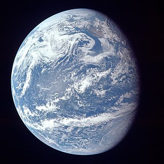
The world ocean or ocean sea is the body of salt water that covers ~70.8% of the Earth. In English, the term ocean also refers to any of the large bodies of water into which the world ocean is conventionally divided. Distinct names are used to identify five different areas of the ocean: Pacific, Atlantic, Indian, Antarctic/Southern, and Arctic. The ocean contains 97% of Earth's water and is the primary component of the Earth's hydrosphere, thus the ocean is essential to life on Earth. The ocean influences climate and weather patterns, the carbon cycle, and the water cycle by acting as a huge heat reservoir.

A tidal prism is the volume of water in an estuary or inlet between mean high tide and mean low tide, or the volume of water leaving an estuary at ebb tide.

<span class="mw-page-title-main">Marine habitat</span> Habitat that supports marine life

A marine habitat is a habitat that supports marine life. Marine life depends in some way on the saltwater that is in the sea. A habitat is an ecological or environmental area inhabited by one or more living species. The marine environment supports many kinds of these habitats.

In oceanography, a front is a boundary between two distinct water masses. The formation of fronts depends on multiple physical processes and small differences in these lead to a wide range of front types. They can be as narrow as a few hundreds of metres and as wide as several tens of kilometres. While most fronts form and dissipate relatively quickly, some can persist for long periods of time.

Estuary freshwater inflow is the freshwater that flows into an estuary. Other types of environmental flows include instream flow, the freshwater water flowing in rivers or streams, and estuary outflow, the outflow from an estuary to the ocean.

<span class="mw-page-title-main">Lough Furnace</span> Lake in County Mayo, Ireland

Lough Furnace is a tidally-influenced, meromictic, saline lagoon in County Mayo, Ireland, located south of Lough Feeagh. It receives freshwater inflow from the upstream Lough Feeagh at the base of the Burrishoole Catchment and tidal input of saline water from Clew Bay, through the Burrishoole Estuary.

<span class="mw-page-title-main">River plume</span> Mix of fresh river water and seawater

A river plume is a freshened water mass that is formed in the sea as a result of mixing of river discharge and saline seawater. River plumes are formed in coastal sea areas at many regions in the World. River plumes generally occupy wide, but shallow sea surface layer bounded by sharp density gradient. The area of a river plume is 3-5 orders of magnitude greater than its depth, therefore, even small rivers with discharge rates ~1–10 m/s form river plumes with horizontal spatial extents ~10–100 m. Areas of river plumes formed by the largest World rivers are ~100–1000 km2. Despite relatively small volume of total freshwater runoff to the World Ocean, river plumes occupy up to 21% of shelf areas of the World Ocean, i.e., several million square kilometers.

<span class="mw-page-title-main">Stratification (water)</span> Layering of a body of water due to density variations

Stratification in water is the formation in a body of water of relatively distinct and stable layers by density. It occurs in all water bodies where there is stable density variation with depth. Stratification is a barrier to the vertical mixing of water, which affects the exchange of heat, carbon, oxygen and nutrients. Wind-driven upwelling and downwelling of open water can induce mixing of different layers through the stratification, and force the rise of denser cold, nutrient-rich, or saline water and the sinking of lighter warm or fresher water, respectively. Layers are based on water density: denser water remains below less dense water in stable stratification in the absence of forced mixing.

<span class="mw-page-title-main">Coastal hydrogeology</span> Branch of hydrogeology

Coastal Hydrogeology is a branch of Hydrogeology that focuses on the movement and the chemical properties of groundwater in coastal areas. Coastal Hydrogeology studies the interaction between fresh groundwater and seawater, including seawater intrusion, sea level induced groundwater level fluctuation, submarine groundwater discharge, human activities and groundwater management in coastal areas.

An anchialine system is a landlocked body of water with a subterranean connection to the ocean. Depending on its formation, these systems can exist in one of two primary forms: pools or caves. The primary differentiating characteristics between pools and caves is the availability of light; cave systems are generally aphotic while pools are euphotic. The difference in light availability has a large influence on the biology of a given system. Anchialine systems are a feature of coastal aquifers which are density stratified, with water near the surface being fresh or brackish, and saline water intruding from the coast at depth. Depending on the site, it is sometimes possible to access the deeper saline water directly in the anchialine pool, or sometimes it may be accessible by cave diving.

References

  1. 1 2 3 4 5 6 7 Wolanski, E. (2007) "Estuarine Ecohydrology." Amsterdam, the Netherlands: Elsevier. ISBN   978-0-444-53066-0
  2. Balls, B.W. (1994) "Nutrient inputs to estuaries from nine Scottish East Coast Rivers: influence of estuarine processes on inputs to the North Sea." Estuarine, Coastal and Shelf Science, 39, 329-352.
  3. Wolanski, E., Jones, M., Bunt, J.S. (1980). "Hydrodynamics of a tidal creek-mangrove swamp system," Australian Journal Marine Freshwater Research 31, 431-450.
  4. Wolanski, E. Ridd, P. (1990). "Coastal trapping and mixing in tropical Australia". pp. 165-183 in Cheng, R.T. (ed.), Long-term currents and residual circulation in estuaries and coastal seas. Springer-Verlag, New York.
  5. MacDonald, D.G. (2006). "Estimating an estuarine mixing and exchange ratio from boundary data with application to Mt. Hope Bay." Estuarine, Coastal and Shelf Science 70, 326-322.
  6. 1 2 3 Kennish, M.J. (1986) "Ecology of Estuaries. Volume I: Physical and Chemical Aspects." Boca Raton, FL: CRC Press, Inc. ISBN   0-8493-5892-2
  7. Wolanski, E. (1986). "An evaporation-driven salinity maximum zone in Australian tropical estuaries" Estuarine, Coastal and Shelf Science 22, 415-424.
  8. Nunes, R.A., Lennon, G.W. (1986)> "Physical property distributions and seasonal trends in Spencer Gulf, South Australia: an inverse estuary". Australian Journal of Marine and Freshwater Research 37, 39-53.
  9. deCastro, M., Gomez-Gesteira, M., Alvarez, I., Prego, R. (2004). "Negative estuarine circulation in the Ria of Pontevedra". Estuarine, Coastal and Shelf Science 60, 301-312.