ExactEarth

Last updated

exactEarth Ltd
TypeSubsidiary
FoundedJune 2009
HeadquartersCambridge, Canada
Key people
Peter Mabson, CEO
ProductsSatellite AIS Data Services and Solutions
Parent Spire Global
Website https://www.exactEarth.com

exactEarth Ltd is a Canadian company that specializes in data services that deliver real-time global location-based maritime vessel tracking information utilizing patented satellite AIS detection technology.

Contents

exactEarth provides satellite AIS data services to commercial markets as well as government customers in India, Canada, United States, Australia and across Europe. [1] [2]

Founded in 2009, exactEarth is based in Cambridge, Ontario, Canada. The company was publicly traded until 2021 when Spire Global acquired the company.

History

In 2005, COM DEV International first recognized that the AIS messages being transmitted by major ships could potentially be received from space. COM DEV validated its AIS detection capability through aircraft trials in 2007 and launched a nanosatellite (EV0) in April 2008. [3]

exactEarth commenced commercial operations in June 2009. [3] In September 2010, Hisdesat acquired a 27% equity interest in the company for a cash investment of approximately CA$15 million, with COM DEV retaining a 73% equity interest. [3]

On 23 June 2015, exactEarth filed a Preliminary Prospectus with Canadian Securities Administrators, announcing their intentions to launch an Initial public offering (IPO). [3] However, on 5 November 2015, exactEarth's largest shareholder, COM DEV, announced plans for an acquisition by Honeywell with exactEarth spinning out into its own publicly traded company. [4] exactEarth's prospectus was abandoned. COM DEV shareholders approved the acquisition on 21 January 2016, with each COM DEV shareholder receiving 0.1977 exactEarth stock for every COM DEV stock held. [5] Final court approval of the acquisition came on 25 January 2016. [6]

On 9 February 2016, exactEarth became a publicly traded company, trading on the Toronto Stock Exchange with the ticker symbol of XCT. [7] For a while, HISDESAT Servicios Estratégicos S.A. [8] was the largest stakeholder. However, in December 2021, the company was acquired by Spire Global and its stock were de-listed from the TSX. [9]

Satellites

On 8 June 2015, exactEarth announced a partnership with Harris Corporation to build 58 AIS detecting payloads to be launched on board the Iridium NEXT satellite constellation. [10] It is expected that this constellation will provide global average revisit times and customer data latency of less than one minute. [11]

As of October 2015, exactEarth operates a satellite constellation consisting of 9 satellites. [12]

Name Satellite Catalog Number Launch dateLaunch vehicleConstructorNotes
CANX 6 (EV0)3278428 April 2008Polar Satellite Launch VehicleRetired, used for R&D
ExactView-1 (EV1)3870922 July 2012Soyuz-FG Surrey Satellite Technology Limited [13]
Resourcesat-2 (EV2)3738720 April 2011Polar Satellite Launch Vehicle-G
AprizeSat-6 (EV6)3779317 August 2011Dnepr-1
AprizeSat-7 (EV5R)3941621 November 2013Dnepr-1
AprizeSat-8 (EV12)3942521 November 2013Dnepr-1
AprizeSat-9 (EV11)4001819 June 2014Dnepr-1
AprizeSat-10 (EV13)4001919 June 2014Dnepr-1
ExactView-9 (EV9)4093628 September 2015Polar Satellite Launch Vehicle-XL
M3MSat (EV7)4160522 June 2016Polar Satellite Launch Vehicle-XL
PAZ (EV10)4321522 February 2018Falcon 9 Full Thrust

Projects

exactEarth satellite AIS data was used in security efforts at the 2010 Olympics and Paralympics. [14]

exactEarth satellite AIS data was used in the ship emission modelling project of the Finnish Meteorological Institute. [15]

exactEarth satellite AIS data aids ScanEx RDC in identifying illegal shipping within marine protected natural areas. [16]

Awards

In 2009, exactEarth technology was recognized at the Ontario Premier's Innovation Awards for developing a satellite system for their work on satellite AIS. [17]

Related Research Articles

<span class="mw-page-title-main">Satellite constellation</span> Group of artificial satellites working together as a system

A satellite constellation is a group of artificial satellites working together as a system. Unlike a single satellite, a constellation can provide permanent global or near-global coverage, such that at any time everywhere on Earth at least one satellite is visible. Satellites are typically placed in sets of complementary orbital planes and connect to globally distributed ground stations. They may also use inter-satellite communication.

<span class="mw-page-title-main">TMX Group</span> Canadian financial services company

TMX Group Limited is a Canadian financial services company that operates equities, fixed income, derivatives, and energy markets exchanges. The company provides services encompassing listings, trading, clearing, settling and depository facilities, information services as well as technology services for the international financial community.

<span class="mw-page-title-main">Telesat</span> Canadian satellite communications company

Telesat, formerly Telesat Canada, is a Canadian satellite communications company founded on May 2, 1969. The company is headquartered in Ottawa.

<span class="mw-page-title-main">Automatic identification system</span> Automatic tracking system that uses transceivers on ships

The automatic identification system (AIS) is an automatic tracking system that uses transceivers on ships and is used by vessel traffic services (VTS). When satellites are used to receive AIS signatures, the term Satellite-AIS (S-AIS) is used. AIS information supplements marine radar, which continues to be the primary method of collision avoidance for water transport. Although technically and operationally distinct, the ADS-B system is analogous to AIS and performs a similar function for aircraft.

Surrey Satellite Technology Ltd, or SSTL, is a company involved in the manufacture and operation of small satellites. A spin-off company of the University of Surrey, it is presently wholly owned by Airbus Defence and Space.

<span class="mw-page-title-main">RADARSAT</span>

RADARSAT is a Canadian remote sensing Earth observation satellite program overseen by the Canadian Space Agency (CSA). The program has consisted of:

<span class="mw-page-title-main">SES S.A.</span> Communications satellite owner and operator

SES S.A. is a Luxembourgish satellite telecommunications network provider supplying video and data connectivity worldwide to broadcasters, content and internet service providers, mobile and fixed network operators, governments and institutions.

ORBCOMM is an American company that offers industrial internet and machine to machine (M2M) communications hardware, software and services designed to track, monitor, and control fixed and mobile assets in markets including transportation, heavy equipment, maritime, oil and gas, utilities and government. The company provides hardware devices, modems, web applications, and data services delivered over multiple satellite and cellular networks.

<span class="mw-page-title-main">Inmarsat</span> British satellite communications company

Inmarsat is a British satellite telecommunications company, offering global mobile services. It provides telephone and data services to users worldwide, via portable or mobile terminals which communicate with ground stations through fourteen geostationary telecommunications satellites.

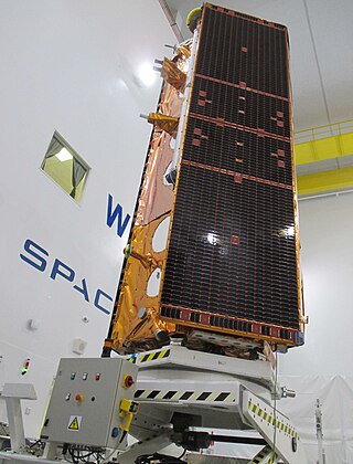
The RADARSAT Constellation Mission (RCM) is a three-spacecraft fleet of Earth observation satellites operated by the Canadian Space Agency. The RCM's goal is to provide data for climate research and commercial applications including oil exploration, fishing, shipping, etc. With satellites smaller than RADARSAT-2, the RCM will provide new applications—made possible through the constellation approach—as well as continuing to provide C-band radar data to RADARSAT-2 users. One of its most significant improvements is in its operational use of synthetic-aperture radar (SAR) data. The primary goal of RCM is to provide continuous C-band SAR data to RADARSAT-2 users, as SAR imagery at a high temporal resolution is required by several users in the Canadian government. Other improvements include more frequent area coverage of Canada and reduced risk of a service interruption. The RCM will provide the world's most advanced, comprehensive method of maintaining Arctic sovereignty, conducting coastal surveillance, and ensuring maritime security.

<span class="mw-page-title-main">London Stock Exchange Group</span> British financial services company

London Stock Exchange Group plc (LSEG) is a United Kingdom-based stock exchange and financial information company headquartered in the City of London, England. It owns the London Stock Exchange, Refinitiv, LSEG Technology, FTSE Russell, and majority stakes in LCH and Tradeweb.

O3b Networks Ltd. was a network communications service provider building and operating a medium Earth orbit (MEO) satellite constellation primarily intended to provide voice and data communications to mobile operators and Internet service providers. O3b Networks became a wholly owned subsidiary of SES S.A. in 2016 and the operator name was subsequently dropped in favour of SES Networks, a division of SES. The satellites themselves, now part of the SES fleet, continue to use the O3b name.

<span class="mw-page-title-main">Iridium satellite constellation</span> Satellite constellation providing voice and data coverage

The Iridium satellite constellation provides L band voice and data information coverage to satellite phones, satellite messenger communication devices and integrated transceivers, as well as two-way satellite messaging service to supported Android smartphones, over the entire surface of Earth. Iridium Communications owns and operates the constellation, additionally selling equipment and access to its services. It was conceived by Bary Bertiger, Raymond J. Leopold and Ken Peterson in late 1987 and then developed by Motorola on a fixed-price contract from July 29, 1993, to November 1, 1998, when the system became operational and commercially available.

<span class="mw-page-title-main">O3b</span> Satellite constellation designed for telecommunications and data backhaul from remote locations

O3b is a satellite constellation in Medium Earth orbit (MEO) owned and operated by SES, and designed to provide low-latency broadband connectivity to remote locations for mobile network operators and internet service providers, maritime, aviation, and government and defence. It is often referred to as O3b MEO to distinguish these satellites from SES's forthcoming O3b mPOWER constellation.

The Maritime Monitoring and Messaging Microsatellite (M3MSat) is a tele-detection satellite developed by the Canadian Space Agency and launched in 2016. Its mission is to demonstrate and test the technology to assess the utility of having in space an Automatic Identification System (AIS) for reading signals from vessels to better manage marine transport in Canadian waters. The system will be supported by an instrument called a Low Data Rate Service (LDRS), which transmits AIS messages to ground sensors.

Spaceflight Industries, Inc. is an American private aerospace company based out of Herndon, Virginia, that specializes in geospatial intelligence services. It sold its satellite rideshare business, Spaceflight, Inc., in June 2020.

<span class="mw-page-title-main">Planet Labs</span> American company specializing in satellite imaging of Earth

Planet Labs PBC is an American public Earth imaging company based in San Francisco, California. Their goal is to image the entirety of the Earth daily to monitor changes and pinpoint trends.

Honeywell Aerospace is a satellite technology, space sciences, and telecommunications company based in Cambridge, Ontario, Canada. The company has branches and offices in Ottawa, the United States, the United Kingdom, China and India.

Spire Global, Inc. is a space-to-cloud data and analytics company that specializes in the tracking of global data sets powered by a large constellation of nanosatellites, such as the tracking of maritime, aviation and weather patterns.

<span class="mw-page-title-main">Paz (satellite)</span> Spanish military Earth observation satellite

Paz is a Spanish Earth observation and reconnaissance satellite launched on 22 February 2018. It is Spain's first spy satellite. The satellite is operated by Hisdesat. Paz was previously referred to as SEOSAR.

References

  1. "exactEarth receives CA$19.2 million AIS data contract from the Government of Canada". Canada News Wire (CNW). Archived from the original on 4 December 2014. Retrieved 30 September 2014.
  2. Magan, Veronica (23 December 2016). "exactEarth to Provide India's Navy with satellite-AIS". Via Satellite.
  3. 1 2 3 4 "Preliminary long form prospectus". p. 33. Retrieved 6 July 2015.
  4. "COM DEV announces acquisition by Honeywell and spinout of exactEarth" (PDF).[ permanent dead link ]
  5. "COM DEV shareholders approve Arrangement with Honeywell" (PDF).[ permanent dead link ]
  6. "COM DEV receives final Court approval of Arrangement with Honeywell" (PDF).[ permanent dead link ]
  7. "exactEarth to Commence Trading Today on the Toronto Stock Exchange". Archived from the original on 11 June 2016. Retrieved 1 June 2016.
  8. "COM DEV's exactEarth and Spain's HISDESAT join forces to tackle the space-based AIS Market" . Retrieved 20 May 2015.
  9. "Spire Global, Inc. Completes Acquisition of exactEarth Ltd" (Press release). Business Wire. 30 November 2021.
  10. "exactEarth and Harris Corporation Form Strategic Alliance to Provide Real-Time Global Maritime Tracking and Information Solutions". Archived from the original on 18 July 2018. Retrieved 1 June 2016.
  11. "The Next Generation Satellite AIS Constellation Provides Real-Time Global Ship Tracking" . Retrieved 1 June 2016.
  12. "The exactView™ Constellation" (PDF). Retrieved 26 May 2015.
  13. "Ahoy! Your ship is being tracked from orbit". BBC News. Jonathan Amos. 20 July 2012. Retrieved 20 July 2012.
  14. "exactEarth space-based AIS data makes contribution to security efforts for 2010 Olympics and Paralympics". Canada News Wire (CNW). Retrieved 9 June 2010.[ permanent dead link ]
  15. "Ship emission modeling" (PDF). Retrieved 19 May 2015.
  16. "Satellites Detect Illegal Vessels in Komandorsky Nature Reserve". Sensors & Systems. Archived from the original on 23 July 2015. Retrieved 9 October 2013.
  17. "AIS Recognized at Ontario Premier's Innovation Awards". exactEarth.[ permanent dead link ]