Fairhope, Alabama

Last updated

Fairhope
This is a photo of downtown Fairhope,Alabama in 2021.jpg
Downtown Fairhope
Motto: 
"You've arrived"
Baldwin County Alabama Incorporated and Unincorporated areas Fairhope Highlighted 0125240.svg
Location in Baldwin County, Alabama
Coordinates: 30°31′35″N87°53′44″W / 30.52639°N 87.89556°W / 30.52639; -87.89556
CountryUnited States
State Alabama
County Baldwin
FoundedNovember 15, 1894
Incorporated April 25, 1908 [1]
Government
  Type Mayor–council
   Mayor Sherry Sullivan
  Council membersJack Burrell
Corey Martin
Jimmy Conyers
Robert Brown
Kevin Boone
Area
[2]
   City 14.53 sq mi (37.64 km2)
  Land14.47 sq mi (37.49 km2)
  Water0.06 sq mi (0.14 km2)
Elevation
[3]
121 ft (37 m)
Population
 (2020) [4]
   City 22,477
  Estimate 
(2022) [5]
23,859
  Density1,552.82/sq mi (599.53/km2)
   Urban
76,807
   Metro
246,435 (US: 194th)
Time zone UTC–6 (Central (CST))
  Summer (DST) UTC–5 (CDT)
ZIP codes
36532-36533
Area code 251
Sales tax 9.0% [6]
GNIS feature ID0118120 [3]
Website fairhopeal.gov

Fairhope is a city in Baldwin County, Alabama, United States, located on the eastern shoreline of Mobile Bay. The population was 22,477 at the 2020 census. [4] Fairhope is a principal city of the Daphne-Fairhope-Foley metropolitan area, which includes all of Baldwin County.

Contents

History

Fairhope was founded on November 15, 1894, on the site of the former Alabama City as a Georgist "Single-Tax" colony by the Fairhope Industrial Association, a group of 28 followers of economist Henry George who had incorporated earlier that year in Des Moines, Iowa. [7] Their corporate constitution explained their purpose in founding a new colony:

to establish and conduct a model community or colony, free from all forms of private monopoly, and to secure to its members therein equality of opportunity, the full reward of individual efforts, and the benefits of co-operation in matters of general concern. [8]

In forming their demonstration project, they pooled their funds to purchase land at "Stapleton's pasture" on the eastern shore of Mobile Bay and then divided it into a number of long-term leaseholds.[ citation needed ] The corporation paid all governmental taxes from rents paid by the lessees, thus simulating a single-tax. The purpose of the single-tax colony was to eliminate disincentives for productive use of land and thereby retain the value of land for the community. [9]

"Fairhope Avenue" was one of the properties on the 1910 version of the board game The Landlord's Game , a precursor of Monopoly. [10]

In 1907, educator Marietta Johnson founded the School for Organic Education in Fairhope. The school was praised in John Dewey's influential 1915 book Schools of Tomorrow. Dewey and Johnson were founding members of the Progressive Education Association.

Fairhope became a popular wintering spot for artists and intellectuals. Sherwood Anderson, Clarence Darrow, Wharton Esherick, Carl Zigrosser, and Upton Sinclair were among its notable visitors. [11]

The Fairhope Single-Tax Corporation still operates, with 1,800 leaseholds covering more than 4,000 acres (16 km2) in and around the current city of Fairhope. Despite the ideals of the corporation, the town has transitioned from utopian experiment to artists' and intellectuals' colony to boutique resort and affluent suburb of Mobile. [8] White flight from nearby Mobile has caused the population of Baldwin County to almost triple since the 1940s, [12] and particularly since desegregation, contributing to the mostly-White demographics of Daphne, Fairhope, and Spanish Fort. [13]

In 2019 the New York Times termed Fairhope to be "A Southern Town That’s Been Holding On to Its Charm, for More Than a Century". [14]

Geography

Fairhope is located on the shore of Mobile Bay. It is located 6 miles (10 km) south of Daphne and 10 miles (16 km) south of Spanish Fort. U.S. Route 98 (Greeno Road) runs north–south through the city. It lies on a sloping plateau.

According to the United States Census Bureau, the city has a total area of 12.0 square miles (31.1 km2), of which 0.019 square mile (0.05 km2), or 0.16%, is water. Its elevation ranges from sea level at the bay to 122 feet (37 m) in the city center. [15]

Climate

Fairhope has a humid subtropical climate. It experiences hot, humid summers and generally mild winters, with average temperatures ranging from 90 °F (32 °C) in the summer to 50.4 °F (10.2 °C) during winter.

Climate data for Fairhope, Alabama (1991–2020 normals, extremes 1917–present)
MonthJanFebMarAprMayJunJulAugSepOctNovDecYear
Record high °F (°C)85
(29)
88
(31)
88
(31)
97
(36)
98
(37)
103
(39)
105
(41)
103
(39)
105
(41)
97
(36)
94
(34)
89
(32)
105
(41)
Mean daily maximum °F (°C)61.8
(16.6)
65.4
(18.6)
71.8
(22.1)
77.9
(25.5)
85.0
(29.4)
89.4
(31.9)
91.1
(32.8)
91.1
(32.8)
88.2
(31.2)
80.5
(26.9)
71.0
(21.7)
64.3
(17.9)
78.1
(25.6)
Daily mean °F (°C)49.2
(9.6)
52.6
(11.4)
58.8
(14.9)
64.9
(18.3)
72.6
(22.6)
78.5
(25.8)
80.3
(26.8)
80.0
(26.7)
76.5
(24.7)
67.4
(19.7)
57.6
(14.2)
51.7
(10.9)
65.8
(18.8)
Mean daily minimum °F (°C)36.6
(2.6)
39.8
(4.3)
45.9
(7.7)
51.9
(11.1)
60.3
(15.7)
67.5
(19.7)
69.6
(20.9)
69.0
(20.6)
64.7
(18.2)
54.3
(12.4)
44.2
(6.8)
39.1
(3.9)
53.6
(12.0)
Record low °F (°C)5
(−15)
10
(−12)
19
(−7)
29
(−2)
29
(−2)
52
(11)
58
(14)
60
(16)
41
(5)
32
(0)
21
(−6)
8
(−13)
5
(−15)
Average precipitation inches (mm)5.48
(139)
4.65
(118)
5.06
(129)
5.51
(140)
4.93
(125)
6.78
(172)
9.03
(229)
7.16
(182)
6.60
(168)
4.38
(111)
4.57
(116)
5.16
(131)
69.31
(1,760)
Average precipitation days (≥ 0.01 in)10.99.69.07.58.112.614.415.010.97.17.710.5123.3
Source: NOAA [16] [17]

Demographics

Historical population
CensusPop.Note
1910 590
1920 85344.6%
1930 1,54981.6%
1940 1,84519.1%
1950 3,35481.8%
1960 4,85844.8%
1970 5,72017.7%
1980 7,28627.4%
1990 8,48516.5%
2000 12,48047.1%
2010 15,32622.8%
2020 22,47746.7%
2022 (est.)23,859 [5] 6.1%
U.S. Decennial Census [18]
2020 Census [4]

2020 census

Fairhope racial composition [19]
RaceNumberPercent
White (non-Hispanic)19,45686.56%
Black or African American (non-Hispanic)1,0834.82%
Native American 600.27%
Asian 2030.9%
Pacific Islander 200.09%
Other/Mixed 7913.52%
Hispanic or Latino 8643.84%

As of the census of 2020, there were 22,477 people, 7,790 households, and 5,606 families residing in the city.

2010 census

As of the census of 2010, there were 15,326 people, 6,732 households, and 4,395 families residing in the city. Its population density was 1,271 per square mile (491/km2). There were 7,659 housing units at an average density of 634.5 per square mile (245.0/km2). The racial makeup of the city was 91.1% White, 6.2% Black, 0.7% Asian, 0.2% Native American, 0.0% Pacific Islander, 0.9% from other races, and 0.8% from two or more races. 2.8% of the population were Hispanic or Latino of any race.

There were 6,732 households, out of which 25.9% had children under the age of 18 living with them, 53.6% were married couples living together, 9.1% had a female householder with no husband present, and 34.7% were non-families. 31.2% of all households were made up of individuals, and 17.1% had someone living alone who was 65 years of age or older. The average household size was 2.26 and the average family size was 2.84.

21.4% of the population was under the age of 18, 4.9% from 18 to 24, 20.4% from 25 to 44, 28.5% from 45 to 64, and 23.7% who were 65 years of age or older. The median age was 46 years. For every 100 females, there were 86.4 males. For every 100 females age 18 and over, there were 86.3 males. The median income for a household in the city was $66,157, and the median income for a family was $93,549. Males had a median income of $60,591 versus $36,218 for females. The per capita income for the city was $35,086. About 5.0% of families and 5.9% of the population were below the poverty line, including 9.8% of those under age 18 and 4.6% of those age 65 or over.

Government

Fairhope is governed by a mayor and five-person city council which was last elected in 2016. The mayor serves as the full-time city executive, while council members serve part-time.

Mayor: Sherry Sullivan.
Council members:

Development

Episcopal Church in Fairhope Episcopal Church in Fairhope, Alabama.png
Episcopal Church in Fairhope

Local and national real estate developers have built commercial facilities in the downtown area that are larger than have been historically allowed. [20]

Fairhope's building and zoning ordinances overlap with those of Baldwin County. Residents of the city want more control of construction projects near, but still outside the city limits, while residents outside the city limits want less city control of their property. [21]

Education

Fairhope's public schools are part of the Baldwin County Public Schools system:

Other schools in Fairhope include:

Notable people

See also

Related Research Articles

<span class="mw-page-title-main">Baldwin County, Alabama</span> County in Alabama, United States

Baldwin County is a county located in the southwestern part of the U.S. state of Alabama, on the Gulf coast. It is one of only two counties in Alabama that border the Gulf of Mexico, along with Mobile County. As of the 2020 census, the population was 231,767, making it the fourth-most populous county in Alabama. The county seat is Bay Minette. The county is named after the founder of the University of Georgia, Senator Abraham Baldwin.

<span class="mw-page-title-main">Mobile County, Alabama</span> County in Alabama, United States

Mobile County is located in the southwestern corner of the U.S. state of Alabama. It is the second most-populous county in the state after Jefferson County. As of the 2020 census, its population was 414,809. Its county seat is Mobile, which was founded as a deepwater port on the Mobile River. The only such port in Alabama, it has long been integral to the economy for providing access to inland waterways as well as the Gulf of Mexico.

<span class="mw-page-title-main">Washington County, Alabama</span> County in Alabama, United States

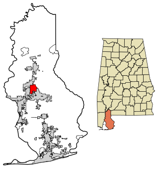
Washington County is a county located in the southwestern part of the U.S. state of Alabama. As of the 2020 census, the population was 15,388. The county seat is Chatom. The county was named in honor of George Washington, the first President of the United States. In September 2018 The United States Office of Management and Budget (OMB) added Washington County to the Mobile, Alabama Metropolitan Statistical Area. It is also part of the larger Mobile-Daphne-Fairhope, AL Combined Statistical Area.

<span class="mw-page-title-main">Bay Minette, Alabama</span> City in and county seat of Baldwin County, Alabama

Bay Minette is a city in and the county seat of Baldwin County, Alabama, United States. As of the 2010 census, the population of the city was 8,044.

<span class="mw-page-title-main">Daphne, Alabama</span> City in Alabama, United States

Daphne is a city in Baldwin County, Alabama, United States, on the eastern shoreline of Mobile Bay. The city is located along I-10, 11 miles east of Mobile and 170 miles southwest of the state capital of Montgomery. The 2010 United States Census lists the population of the city as 21,570, making Daphne the most populous city in Baldwin County. It is a principal city of the Daphne-Fairhope-Foley metropolitan area, which includes all of Baldwin County.

<span class="mw-page-title-main">Elberta, Alabama</span> Town in Alabama, United States

Elberta is a town in Baldwin County, Alabama, United States. At the 2010 census the population was 1,498, up from 552 at the 2000 census. It is part of the Daphne-Fairhope-Foley metropolitan area.

<span class="mw-page-title-main">Foley, Alabama</span> City in Alabama, United States

Foley is a city in Baldwin County, Alabama, United States. The 2010 census lists the population of the city as 14,618. Foley is a principal city of the Daphne-Fairhope-Foley metropolitan area, which includes all of Baldwin County.

<span class="mw-page-title-main">Loxley, Alabama</span> City in Alabama, United States

Loxley is a city in Baldwin County, Alabama, United States. As of the 2010 census, the population of the town was 1,632. It is part of the Daphne-Fairhope-Foley metropolitan area. Loxley is becoming a popular location for the expansion of the suburbs from Daphne and Spanish Fort, Alabama, because it is served by an Interstate 10 exit and is almost directly between the cities of Mobile, Alabama, and Pensacola, Florida.

<span class="mw-page-title-main">Robertsdale, Alabama</span> City in Alabama, United States

Robertsdale is a city in Baldwin County, Alabama, United States, which includes the community of Rosinton. At the 2020 census, the population was 6,708. It is part of the Daphne-Fairhope-Foley metropolitan area.

<span class="mw-page-title-main">Silverhill, Alabama</span> Town in Alabama, United States

Silverhill is a town in Baldwin County, Alabama, United States. As of the 2010 census, the population was 706. It is part of the Daphne-Fairhope-Foley metropolitan area.

<span class="mw-page-title-main">Spanish Fort, Alabama</span> City in Alabama, United States

Spanish Fort is a city in Baldwin County, Alabama, United States, located on the eastern shore of Mobile Bay. The 2020 census lists the population of the city as 10,049. It is a suburb of Mobile and is part of the Daphne-Fairhope-Foley metropolitan area.

<span class="mw-page-title-main">Summerdale, Alabama</span> Town in Alabama, United States

Summerdale is a rural town in south-central Baldwin County, Alabama, United States. It is the site of the Naval Outlying Landing Field Summerdale. At the 2020 census, the population was 1,468. It is part of the Daphne–Fairhope–Foley Metropolitan Statistical Area.

<span class="mw-page-title-main">Creola, Alabama</span> City in Alabama, United States

Creola is a city in Mobile County, Alabama, United States. Incorporated in 1978, the city had a population of 1,936 at the 2020 census. It is part of the Mobile metropolitan area.

<span class="mw-page-title-main">Mobile metropolitan area</span>

The Mobile Metropolitan Area comprises Mobile and Washington counties in the southwest corner of Alabama in the United States. As of the 2020 census the metropolitan area had a population of 430,197. The Mobile metropolitan area is the third-largest metropolitan area in the state of Alabama, after Birmingham and Huntsville.

Fairhope High School (FHS) is a public secondary school located in Fairhope, Alabama. Fairhope High School is a part of the Baldwin County Public Schools system. They service grades 9–12. Fairhope High school offers not only sports, but a band program.

<span class="mw-page-title-main">Magnolia Springs, Alabama</span> Town in Alabama, United States

Magnolia Springs is a town in south Baldwin County, Alabama, United States, in the Daphne-Fairhope-Foley metropolitan area. The town voted to incorporate in 2006. As of the 2010 census it had a population of 723.

<span class="mw-page-title-main">Stapleton, Alabama</span> Unincorporated community in Alabama, United States

Stapleton is a small unincorporated community in northern Baldwin County, Alabama, United States, with a population of 519.. It is part of the Daphne-Fairhope-Foley metropolitan area. Stapleton lies along U.S. Route 31 and State Route 59 and has been considered for incorporation within the cities of Loxley and Bay Minette. There is a bluegrass music festival held at Stapleton Elementary School every fall. There are about 250 students at the school that runs from Pre-K to the 6th grade.

<span class="mw-page-title-main">Stockton, Alabama</span> Unincorporated community in Alabama, United States

Stockton is an unincorporated community in Baldwin County, Alabama, United States. It is the nearest community to Bottle Creek Indian Mounds, a National Historic Landmark.

Malbis is an unincorporated community in Baldwin County, Alabama, United States. The community lies at the crossroads of U.S. 90 and Alabama State Route 181 just south of I-10. Portions of the settlement are today within the city limits of both Daphne and Spanish Fort. The city of Loxley lies to the east.

<span class="mw-page-title-main">Baldwin County Board of Education</span> School district in Alabama

The Baldwin County Board of Education oversees most public schools in Baldwin County, Alabama, and is based in Bay Minette, Alabama. The Board serves the entire county. Over 30,000 students are within the supervision of the Board. 3,400 employees including 2,100 classroom teachers, serve the students at its campuses. The Board of Education is the largest single employer in Baldwin County.

References

  1. "Municipalities of Alabama Incorporation Dates" (PDF). Alabama League of Municipalities. Retrieved December 30, 2023.
  2. "2020 U.S. Gazetteer Files". United States Census Bureau. Retrieved July 24, 2022.
  3. 1 2 U.S. Geological Survey Geographic Names Information System: Fairhope, Alabama
  4. 1 2 3 "Explore Census Data". United States Census Bureau . Retrieved December 29, 2023.
  5. 1 2 "City and Town Population Totals: 2020-2022". United States Census Bureau. December 30, 2023. Retrieved December 30, 2023.
  6. "Fairhope (AL) sales tax rate" . Retrieved December 30, 2023.
  7. "Fairhope Single Tax Corporation - Fairhope, Alabama 36532". Archived from the original on May 15, 2011. Retrieved April 29, 2011.
  8. 1 2 "Fairhope Single Tax Corporation". Fairhope Single Tax Corporation. Archived from the original on September 19, 2017. Retrieved October 22, 2017.
  9. "Fairhope Single Tax Corporation - Fairhope, Alabama 36532". Archived from the original on May 15, 2011. Retrieved April 29, 2011.
  10. "Game Rules – The Landlord's Game – Economic Game Company". landlordsgame.info. Archived from the original on August 9, 2017. Retrieved October 22, 2017.
  11. Lauren Coodley. (2013) Upton Sinclair: California Socialist, Celebrity Intellectual. Lincoln, Nebraska: University of Nebraska Press. 2013
  12. Tynes, Gabriel (October 22, 2015). "Baldwin's population soars as whites flee Mobile". Lagniappe Mobile. Retrieved July 16, 2020.
  13. Bagley, Joseph (2018). The Politics of White Rights: Race, Justice, and Integrating Alabama's Schools. U of Georgia P. p. 212. ISBN   9780820354194.
  14. Brendan Spiegel (March 1, 2019). "A Southern Town That's Been Holding On to Its Charm, for More Than a Century: Fairhope, in Alabama, thrives as a place for artists, intellectuals and people of outsize character". New York Times.
  15. "Archived copy". Census Gazetteer. 2010. Archived from the original on January 12, 2012. Retrieved November 25, 2012.{{cite web}}: CS1 maint: archived copy as title (link)
  16. "NowData - NOAA Online Weather Data". National Oceanic and Atmospheric Administration. Retrieved June 9, 2021.
  17. "Station: Fairhope 2 NE, AL". U.S. Climate Normals 2020: U.S. Monthly Climate Normals (1991-2020). National Oceanic and Atmospheric Administration. Retrieved June 9, 2021.
  18. United States Census Bureau. "Census of Population and Housing" . Retrieved August 10, 2013.
  19. "Explore Census Data". data.census.gov. Retrieved December 17, 2021.
  20. History of Fairhope 1954-present Mobile: Putman, 2006
  21. Knight, Paul (June 29, 2007). "Residents call for increased accountability". Mobile Register (Mobile) (newspaper). Advance Publications. p. Baldwin Register, 01.
  22. "Fairhope High School / Homepage" (PDF). www.bcbe.org. Retrieved December 30, 2023.
  23. "For Thompson Square, Nashville is Work and Fairhope is Home". The Southern Rambler. January 30, 2017. Archived from the original on December 15, 2017. Retrieved February 2, 2017.
  24. "Harold William (Bill) Varney". Press-Register. Archived from the original on July 24, 2011. Retrieved April 9, 2011.

Further reading