Panchkula district was formed as the 17th district of the Indian state of Haryana on 15 August 1995. It comprises two sub divisions and two tehsils: Panchkula and Kalka. It has 264 villages, out of which 12 are uninhabited and ten wholly merged with towns or treated as census towns according to the 1991 census. There are five towns in the district: Barwala, Kalka, Panchkula, Pinjore and Raipur Rani. The total population of the district is 319,398 out of which 173,557 are males and 145,841 are females.

Bhiwani district is one of the 22 districts of the northern Indian state of Haryana. Created on 22 December 1972, it was the largest district of the state by area, before the creation of Charkhi Dadri as a separate district, as it occupied an area of 4,778 square kilometres (1,845 sq mi) and administered 442 villages with a population of 1,634,445. Sirsa is now the largest district of the state.

Faridabad(Hindi pronunciation:[fəɾiːdɑːbɑːd]) is the most populous city in the Indian state of Haryana and a part of Delhi National Capital Region. It is one of the major satellite cities around Delhi and is located 284 kilometres south of the state capital Chandigarh. The river Yamuna forms the eastern district boundary with Uttar Pradesh. The Government of India included it in the second list of Smart Cities Mission on 24 May 2016. As per the 2021 Delhi Regional Plan, Faridabad is a part of the (CNCR) Central National Capital Region or (DMA) Delhi metropolitan area.

Jind district is one of the 22 districts of Haryana state in northern India. Jind town is the administrative headquarters of the district. It is part of Hisar Division and was created in 1966.

Mahendragarh district is one of the 22 districts of Haryana state in northern India. The district occupies an area of 1,899 km² and has a population of 922,088 (2021census). District have 3 Sub-divisions : Narnaul, Mahendragarh and Kanina

Agra district is one of the 75 Districts of Uttar Pradesh, India. The district headquarters is the historical city of Agra. Agra district is a part of Agra division.

Bagpat district, also spelled as Baghpat district, is one of the 75 districts of the Indian state of Uttar Pradesh, with headquarters at the town of Baghpat. It is within the National Capital Region. Created in 1997, the district has an area of 1,321 square kilometres (510 sq mi). Bhagpat has a population of 1,303,048 as of 2011 census.

Gurgaon district, officially known as Gurugram district, is one of the 22 districts of Haryana in northern India. The city of Gurgaon is the administrative headquarters of the district. The population is 1,514,432. It is one of the southern districts of Haryana. On its north, it is bounded by the district of Jhajjar and the Union Territory of Delhi. Faridabad district lies to its east. To its south lie the districts of Palwal and Nuh. To the west lies Rewari district.

Karnal district is one of the 22 districts of Haryana, a state in North India which constitutes the National Capital Region (NCR) of the country. The city of Karnal is a part of the National Capital Region (NCR) and is the administrative headquarters of the district.

Panipat district is one of the 22 districts of Haryana in north India. The historical city of Panipat is the administrative headquarters of the district. The district occupies an area of 1,268 km2 (490 sq mi), making it the nineteenth largest in the state with Gurugram and Panchkula following it.

Alwar is a district in the state of Rajasthan in northern India, whose district headquarters is Alwar city. The district covers 8,380 km2. It is bound on the north by Rewari district of Haryana, on the east by Bharatpur district of Rajasthan and Nuh district of Haryana, on the south by Dausa district, and on the west by Jaipur district.

Bharatpur District is a district in Rajasthan state in western India. The city of Bharatpur is the District Headquarters, Division Headquarters and Headquarters of Bharatpur Police Range of Rajasthan Police. Bharatpur District is a part of National Capital Region of India Delhi.

Nuh district is one of the 22 districts in the Indian state of Haryana. There are four sub-divisions in this district: Nuh, Ferozepur Jhirka, Punahana, and Taoru. The district is known for having the largest Muslim population in Haryana.

Ballabgarh, officially Balramgarh, is a large town, nearby Faridabad city and a tehsil (subdistrict) in Faridabad district of Haryana, India, and is part of the National Capital Region. The town was founded by Raja Balram Singh, in 1739, who also built the Nahar Singh Mahal palace in the same year. Raja Nahar Singh (1823–1858) was the last king of the princely state. He was executed for taking part in the 1857 war of independence in 1858. The town of Ballabhgarh is only 17 miles (27 km) from Delhi, and today lies on the National Highway 19, a major portion of historical Grand Trunk Road. It is connected to Faridabad and south-east Delhi by the Delhi Metro. Ballabhgarh is the fourth city in Haryana to get metro connectivity after Gurgaon, Faridabad and Bahadurgarh.

Haryana, formed on 1 November 1966, is a state in North India. For the administrative purpose, Haryana is divided into 6 revenue divisions which are further divided into 22 districts. For Law and Order maintenance, it is divided into 5 Police Ranges and 4 Police Commissionerates.

Palwal district was created on 15 August 2008. It is the 21st district of Haryana state in northern India. Palwal City is the headquarters of the district. It is part of the Braj region.
Badarpur is a historical town situated in the South East Delhi district of Delhi, India. The area of Badarpur encompasses both an NTPC thermal power station and an ancient village known as Badarpur village.

Hisar Urban Agglomeration is an extended area of the city of Hisar which includes the area under the Municipal Corporation of Hisar and the campus of Chaudhary Charan Singh Haryana Agricultural University along with the Mini Secretariat. It is the second biggest urban agglomeration in Haryana after Faridabad.
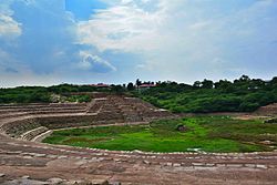
Tourism in Haryana relates to tourism in the state of Haryana, India. There are 21 tourism hubs created by Haryana Tourism Corporation (HTC), which are located in Ambala, Bhiwani Faridabad, Fatehabad, Gurgaon, Hisar, Jhajjar, Jind, Kaithal, Karnal, Kurukshetra, Panchkula, Sirsa, Sonipat, Panipat, Rewari, Rohtak, Yamunanagar, Palwal and Mahendergarh.
Pali is an Indian village in the NIT area of Faridabad city of Faridabad district under Faridabad Lok Sabha constituency of Haryana state, well known for being biggest crusher zone of Asia, that also has a seasonal waterfall. It is the part of the Northern Aravalli leopard wildlife corridor, an important wildlife corridor which starts from the Sariska National Park in Rajasthan, passes through Nuh, Faridabad and Gurugram districts of Haryana and ends at Delhi Ridge.