Lake County may refer to:

Yellow Medicine County is a county in the State of Minnesota. Its eastern border is formed by the Minnesota River. As of the 2010 United States Census, the population was 10,438. Its county seat is Granite Falls.

Lake of the Woods County is a county in the U.S. state of Minnesota. As of the 2010 United States Census, the population was 4,045, making it the second-least populous county in Minnesota. Its county seat is Baudette.
Kanabec County is a county in the U.S. state of Minnesota. As of the 2010 United States Census, the population was 16,239. Its county seat is Mora.

Freeborn County is a county in the state of Minnesota. As of the 2010 United States Census, the population was 31,255. Its county seat is Albert Lea.

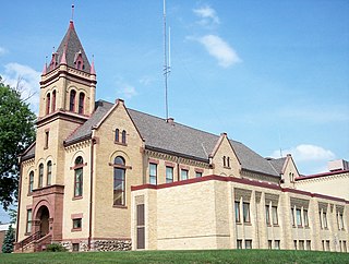
Blue Earth County is a county in the State of Minnesota. As of the 2010 United States Census, the population was 64,013. Its county seat is Mankato. The county is named for the Blue Earth River and for the deposits of blue-green clay once evident along the banks of the Blue Earth River.

Bemidji is a city in Beltrami County, in northern Minnesota, United States. According to the 2012–2016 American Community Survey 5-year estimates, the United States Census Bureau estimates the total population of Bemidji as of 2018 to be 15,404, making it the largest commercial center between Grand Forks, North Dakota and Duluth, Minnesota. Bemidji houses many Native American services, including the Indian Health Service. The city is the central hub of the Red Lake Indian Reservation, White Earth Indian Reservation and the Leech Lake Indian Reservation. Bemidji lies on the south west shore of Lake Bemidji, the northernmost lake feeding the Mississippi River and as such is deemed "The First City On The Mississippi." Bemidji is also the self-proclaimed "curling capital" of the U.S. and alleged birthplace of Paul Bunyan.
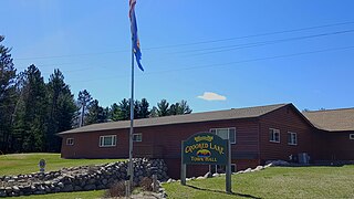
Crooked Lake Township is a township in Cass County, Minnesota, United States. The population was 498 as of the 2000 census. It is named after Roosevelt Lake, formerly known as Crooked Lake, a large lake located in this township. Crooked Lake is a translation from the Ojibwe Wewaagigamaag-zaaga'igan.

The Northwest Angle, known simply as the Angle by locals, and coextensive with Angle Township, is a part of northern Lake of the Woods County, Minnesota. Except for minor surveying errors, it is the only place in the contiguous United States that is north of the 49th parallel, which forms the border between the U.S. and Canada from the Northwest Angle westward to the Strait of Georgia. The land area of the Angle is separated from the rest of Minnesota by Lake of the Woods, but shares a land border with Canada. It is one of only six non-island locations in the 48 contiguous states that are practical exclaves of the U.S. It is the northernmost township in Minnesota and contains the northernmost point in the contiguous 48 states. The unincorporated community of Angle Inlet is located in the Northwest Angle.

Lake of the Woods is a lake occupying parts of the Canadian provinces of Ontario and Manitoba and the U.S. state of Minnesota. It separates a small land area of Minnesota from the rest of the United States. The Northwest Angle and the town of Angle Township can be reached from the rest of Minnesota only by crossing the lake or by traveling through Canada. The Northwest Angle is the northernmost part of the contiguous United States. Its "northwesternmost point" served as a problematic landmark in treaties defining the international border.
Bois Forte Indian Reservation is an Indian reservation formed for the Bois Forte Band of Chippewa.

The Leech Lake Indian Reservation is an Indian reservation located in the north-central Minnesota counties of Cass, Itasca, Beltrami, and Hubbard. The reservation forms the land base for the federally recognized Leech Lake Band of Ojibwe, one of six bands comprising the Minnesota Chippewa Tribe, organized in 1934. The Leech Lake Reservation has the highest population of any reservation in Minnesota, with a resident population of 10,660 indicated by the 2010 United States census.

Zippel Bay State Park is a state park in Lake of the Woods County, Minnesota in the United States. It is on the white sand beach shoreline of the Lake of the Woods, near the United States border with Canada. The park is open for year-round recreation including camping, hiking, fishing and cross-country skiing.

Graceton is an unincorporated community in Lake of the Woods County, Minnesota, United States.
Wheeler's Point is an unincorporated community in Wheeler Township, Lake of the Woods County, Minnesota, United States. It is 12 miles north of Baudette.
Hackett is a small unincorporated community in Wheeler Township, Lake of the Woods County, Minnesota, United States. It lies 10 miles north of Baudette.
The Lake of the Woods State Forest is a state forest located south of Lake of the Woods in Beltrami, Koochiching, Lake of the Woods, and Roseau counties, Minnesota. The forest borders the Pine Island State Forest to the east and the Beltrami Island State Forest to the west.

The Northwest Angle State Forest is a state forest located in Lake of the Woods County, Minnesota. The name of the forest is derived from its location near the Northwest Angle, the northernmost point of the contiguous United States. The forest borders the Canadian provinces of Manitoba and Ontario, and the Red Lake Indian Reservation. The forest is managed by the Minnesota Department of Natural Resources.
Birch Beach is a small unincorporated community approximately 15 miles north of Williams, Lake of the Woods County, Minnesota, United States. It lies along the southern shore of Lake of the Woods, southeast of Long Point.

Faunce is an unincorporated community in Clearfield County, Pennsylvania, United States.


