Fort Chiswell, Virginia

Last updated

Fort Chiswell, Virginia
CDP
VAMap-doton-FortChiswell.PNG
Location of Fort Chiswell, Virginia
Coordinates: 36°56′37″N80°56′25″W / 36.94361°N 80.94028°W / 36.94361; -80.94028
CountryUnited States
State Virginia
County Wythe
Area
  Total12.1 sq mi (31.4 km2)
  Land12.1 sq mi (31.4 km2)
  Water0.0 sq mi (0.0 km2)
Elevation
2,054 ft (626 m)
Population
 (2010)
  Total939
  Density78/sq mi (30/km2)
Time zone UTC−5 (Eastern (EST))
  Summer (DST) UTC−4 (EDT)
ZIP code
24360
Area code 276
FIPS code 51-29040 [1]
GNIS feature ID1495556 [2]

Fort Chiswell is a census-designated place (CDP) in Wythe County, Virginia, United States. The population was 939 at the 2010 census.

Contents

Fort Chiswell is located at the junction of Interstates 77 and 81. Going west from Fort Chiswell, drivers find themselves on a double wrong-way concurrency - one of few in the nation. Interstate 77 northbound is overlapped with Interstate 81 southbound, drivers will find themselves oriented the right way again when exiting I-81 back to I-77 north towards Charleston or south to Charlotte.

Sign on I-81/I-77 indicating a double wrong-way concurrency near Fort Chiswell, Virginia. DoubleWrongWayConcurrencyVA.jpg
Sign on I-81/I-77 indicating a double wrong-way concurrency near Fort Chiswell, Virginia.

History

The community name is derived from a frontier fort built in 1758 as an outpost during the French and Indian War. The fort, which was of strategic importance during the American Revolution as the guardpost over a small deposit of lead used to mold bullets, was situated at the junction of the Great Trading Path and the Richmond Road, near the New River. The fort fell into disrepair in the 18th century as both the county seat and courthouse were moved from Fort Chiswell to the county seat of Wytheville, 12 miles to the west. The remaining foundations of the Fort and its surrounding buildings were completely covered over during the construction of I-77 in Wythe County during the 1970s. There is a pyramid shaped historical marker of sandstone situated approximately 200 yards west-northwest of the fort's original location next to the old chicken house.

The Fort Chiswell Site, The Mansion at Fort Chiswell, and McGavock Family Cemetery are listed on the National Register of Historic Places. [3]

Schools

Fort Chiswell has a few different forms of both private and public schools, however there is only one private school in the town, which is named 'Kiddy Centre' which only allows for pre-school and daycare education. The public sector has two schools including the Fort Chiswell Middle School (FCMS) and the Fort Chiswell High school (FCHS) which have been merged into one secular school building. The current principals there are for the middle school are Tammy J. Watson and Vice Principal Chelsea R. Buchanan. Current Principals of the High School are James C. Suma and vice principal Holly L. Luper.

The Fort Chiswell Historic Marker near the site of the original fort in Wythe County, Virginia. FortChiswellVAMonument.jpg
The Fort Chiswell Historic Marker near the site of the original fort in Wythe County, Virginia.
Ft. Chiswell plaque on the above Historic Marker. Ft. Chiswell, VA Marker Inscription.JPG
Ft. Chiswell plaque on the above Historic Marker.
Wilderness Road plaque on the above Historic Marker. Wilderness Road Inscription, Ft. Chiswell Historic Marker.JPG
Wilderness Road plaque on the above Historic Marker.
One of three millstones from the mill at old Ft. Chiswell which are mounted on the above Historic Marker. Millstone from Mill at Ft. Chiswell - one of 3 on the marker (see Ft. Chiswell inscription image).JPG
One of three millstones from the mill at old Ft. Chiswell which are mounted on the above Historic Marker.

Geography

Fort Chiswell is located at 36°56′37″N80°56′25″W / 36.94361°N 80.94028°W / 36.94361; -80.94028 (36.943670, 80.940335). [4]

According to the United States Census Bureau, the CDP has a total area of 12.1 square miles (31.3 km2), all land.

Demographics

As of the census [1] of 2000, there were 911 people, 357 households, and 263 families residing in the CDP. The population density was 75.3 people per square mile (29.1/km2). There were 380 housing units at an average density of 31.4/sq mi (12.1/km2). The racial makeup of the CDP was 98.02% White, 0.77% African American, 0.11% Native American, 0.11% from other races, and 0.99% from two or more races. Hispanic or Latino of any race were 0.22% of the population.

There were 357 households, out of which 35.3% had children under the age of 18 living with them, 61.9% were married couples living together, 8.1% had a female householder with no husband present, and 26.1% were non-families. 21.0% of all households were made up of individuals, and 8.7% had someone living alone who was 65 years of age or older. The average household size was 2.54 and the average family size was 2.94.

In the CDP, the population was spread out, with 24.1% under the age of 18, 9.7% from 18 to 24, 32.7% from 25 to 44, 23.6% from 45 to 64, and 9.9% who were 65 years of age or older. The median age was 36 years. For every 100 females, there were 98.5 males. For every 100 females age 18 and over, there were 94.1 males.

The median income for a household in the CDP was $37,273, and the median income for a family was $40,417. Males had a median income of $35,464 versus $20,385 for females. The per capita income for the CDP was $15,614. About 7.7% of families and 8.5% of the population were below the poverty line, including 12.4% of those under age 18 and 14.6% of those age 65 or over.

Related Research Articles

<span class="mw-page-title-main">Wythe County, Virginia</span> County in Virginia, United States

Wythe County is a county located in the southwestern part of the U.S. state of Virginia. As of the 2020 census, the population was 28,290. Its county seat is Wytheville.

<span class="mw-page-title-main">Solana, Florida</span> Census-designated place in Florida, United States

Solana is an unincorporated community and census-designated place (CDP) in Charlotte County, Florida, United States. The population was 671 at the 2020 census. It is part of the Sarasota-Bradenton-Punta Gorda Combined Statistical Area.

<span class="mw-page-title-main">Three Oaks, Florida</span> Census-designated place in Florida, United States

Three Oaks is a census-designated place (CDP) in Lee County, Florida, United States. The population was 3,592 at the 2010 census, up from 2,255 at the 2000 census. It is part of the Cape Coral-Fort Myers, Florida Metropolitan Statistical Area.

<span class="mw-page-title-main">Tice, Florida</span> Census-designated place in Florida, United States

Tice is an unincorporated community and census-designated place (CDP) in Lee County, Florida, United States. As of the 2020 census, the CDP population was 4,853. It is part of the Cape Coral-Fort Myers, Florida Metropolitan Statistical Area.

<span class="mw-page-title-main">Ives Estates, Florida</span> Census-designated place in Florida

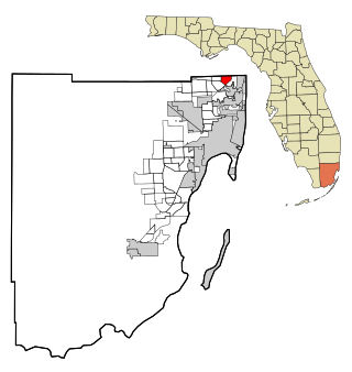
Ives Estates is a census-designated place (CDP) in Miami-Dade County, Florida. It is part of the Miami metropolitan area of South Florida. The population was 25,005 at the 2020 census, up from 19,525 in 2010.

<span class="mw-page-title-main">Friendly, Maryland</span> Census-designated place in Maryland

Friendly is an unincorporated area and census-designated place (CDP) in Prince George's County, Maryland, United States, with an African-American majority population, located a few miles south of Washington, D.C. The population was 9,937 at the 2020 census.

<span class="mw-page-title-main">Gray Summit, Missouri</span> Census-designated place in Missouri, United States

Gray Summit is an unincorporated community and census-designated place (CDP) in Franklin County, Missouri, United States. The population was 2,701 at the 2010 census. Also called "Gray's Summit", it was founded by Daniel Gray of New York, who built a hotel here in 1845. It is located on Missouri Route 100 just north of Interstate 44.

<span class="mw-page-title-main">Silver Springs, Nevada</span> Census-designated place in Nevada, United States

Silver Springs is a census-designated place (CDP) in Lyon County, Nevada, United States at the intersection of US 50 and US 95A. The population was 5,296 at the 2010 census. Lahontan Reservoir, Lahontan State Recreation Area and historic Fort Churchill State Historic Park are all located nearby. The area is served by the Silver Springs Airport.

<span class="mw-page-title-main">Mesita, New Mexico</span> Census-designated place in New Mexico, United States

Mesita is a census-designated place (CDP) in Cibola County, New Mexico, United States. The population was 804 at the 2010 census.

Leeds is a hamlet and census-designated place (CDP) in Greene County, New York, United States. The population was 377 at the 2010 census.

Calcium is a census-designated place (CDP) in Jefferson County, New York, United States. The population was 3,573 as of the 2020 census. The CDP is in the town of Le Ray and includes the hamlets of Calcium and Sanfords Four Corners.

<span class="mw-page-title-main">Zion, Pennsylvania</span> Census-designated place in Pennsylvania, United States

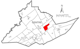
Zion is an unincorporated community and census-designated place (CDP) in Centre County, Pennsylvania, United States.

<span class="mw-page-title-main">Lime Ridge, Pennsylvania</span> Census-designated place in Pennsylvania, United States

Lime Ridge is a census-designated place (CDP) in Columbia County, Pennsylvania, United States. It is part of Northeastern Pennsylvania. The population was 890 at the 2010 census. It is part of the Bloomsburg-Berwick micropolitan area.

<span class="mw-page-title-main">Fort Davis, Texas</span> Census-designated place in Texas, United States

Fort Davis is an unincorporated community and census-designated place (CDP) in Jeff Davis County, Texas, United States. The population was 1,201 at the 2010 census, up from 1,050 at the 2000 census. It is the county seat of Jeff Davis County.

<span class="mw-page-title-main">Lincolnia, Virginia</span> Census-designated place in Virginia, United States

Lincolnia is a census-designated place (CDP) in Fairfax County, Virginia, United States. The population was 22,828 at the 2010 census, an increase of over 44% from 2000.

<span class="mw-page-title-main">Newington, Virginia</span> Census-designated place in Virginia, United States

Newington is a census-designated place (CDP) in Fairfax County, Virginia, United States. The population was 12,943 at the 2010 census. The 2010 census showed a significant decrease after half the population was split off to the newly created Newington Forest CDP.

<span class="mw-page-title-main">Max Meadows, Virginia</span> CDP in Virginia, United States

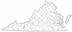
Max Meadows is a census-designated place (CDP) in Wythe County, Virginia, United States. The population was 562 at the 2010 census.

<span class="mw-page-title-main">Wytheville, Virginia</span> Town in Virginia, United States

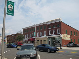
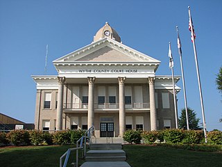
Wytheville is a town in, and the county seat of, Wythe County, Virginia, United States. It is named after George Wythe, a signer of the United States Declaration of Independence, and mentor to Thomas Jefferson. Wytheville's population was 8,211 at the 2010 census. Interstate Highways 77 and 81 were constructed to intersect at the town, long a crossroads for travelers.

<span class="mw-page-title-main">Lake Koshkonong, Wisconsin</span> Census-designated place in Wisconsin, United States

Lake Koshkonong is a census-designated place (CDP) in the towns of Koshkonong and Sumner, Jefferson County, Wisconsin, United States. The population was 1,239 at the 2020 census. Lake Koshkonong is in the area.

<span class="mw-page-title-main">Brewerton, New York</span> Census-designated place in New York, United States

Brewerton is a census-designated place (CDP) in the town of Cicero in Onondaga County and the town of Hastings in Oswego County in the U.S. state of New York. It lies at the west end of Oneida Lake at its outlet into the Oneida River. The population was 4,549 at the 2020 census. Maps of the 19th century indicate that this area was once known as Fort Brewerton, while Brewerton meant the Cicero portion.

References

  1. 1 2 "U.S. Census website". United States Census Bureau . Retrieved January 31, 2008.
  2. "US Board on Geographic Names". United States Geological Survey. October 25, 2007. Retrieved January 31, 2008.
  3. "National Register Information System". National Register of Historic Places . National Park Service. July 9, 2010.
  4. "US Gazetteer files: 2010, 2000, and 1990". United States Census Bureau. February 12, 2011. Retrieved April 23, 2011.