Aargau, more formally the Canton of Aargau, is one of the 26 cantons forming the Swiss Confederation. It is composed of eleven districts and its capital is Aarau.

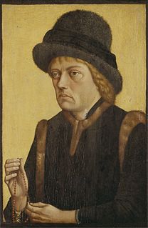
Sigismund, a member of the House of Habsburg, was Duke of Austria from 1439 until his death. As a scion of the Habsburg Leopoldian line, he ruled over Further Austria and the County of Tyrol from 1446 until his resignation in 1490.

The Old Swiss Confederacy began as a late medieval alliance between the communities of the valleys in the Central Alps, at the time part of the Holy Roman Empire, to facilitate the management of common interests such as free trade and to ensure the peace along the important trade routes through the mountains. The Hohenstaufen emperors had granted these valleys reichsfrei status in the early 13th century. As reichsfrei regions, the cantons of Uri, Schwyz, and Unterwalden were under the direct authority of the emperor without any intermediate liege lords and thus were largely autonomous.

Frederick IV, also known as Frederick of the Empty Pockets, a member of the House of Habsburg, was Duke of Austria from 1402 until his death. As a scion of the Habsburg Leopoldian line, he ruled over Further Austria and the County of Tyrol from 1406 onwards.

Further Austria, Outer Austria or Anterior Austria was the collective name for the early possessions of the House of Habsburg in the former Swabian stem duchy of south-western Germany, including territories in the Alsace region west of the Rhine and in Vorarlberg.
Rheinfelden is a municipality in the canton of Aargau in Switzerland, seat of the district of Rheinfelden. It is located 15 kilometres east of Basel. The name means the fields of the Rhine, as the town is located on the High Rhine. It is home to Feldschlösschen, the most popular beer in Switzerland. The city is across the river from Rheinfelden in Baden-Württemberg; the two cities were joined until Napoleon Bonaparte fixed the Germany–Switzerland border on the Rhine in 1802 and are still socially and economically tied.

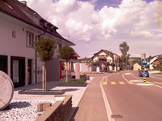
Zuzgen is a municipality in the Rheinfelden District of canton Aargau in Switzerland. It is located in the West of the Fricktal region, around three kilometers southwest of the border with Germany, and has a border with Canton Basel-Landschaft.

Laufenburg is a municipality in the Swiss canton of Aargau. It is the seat of the district of the same name. On 1 January 2010 the municipality Sulz merged into Laufenburg.

The High Rhine is the name used for the part of the Rhine that flows westbound from Lake Constance to Basel. The High Rhine begins at the outflow of the Rhine from the Untersee in Stein am Rhein and turns into the Upper Rhine in Basel. In contrast to the Alpine Rhine and Upper Rhine, the High Rhine flows mostly to the west.

Frick is a municipality in the district of Laufenburg in the canton of Aargau in Switzerland.

Gipf-Oberfrick is a municipality in the district of Laufenburg in the canton of Aargau in Switzerland.

Herznach is a municipality in the district of Laufenburg in the canton of Aargau in Switzerland.
Oeschgen is a municipality in the district of Laufenburg in the canton of Aargau in Switzerland.

Hellikon is a municipality in the Rheinfelden district of canton Aargau in Switzerland. It is located in the West of the Fricktal region, around four kilometers Southwest of the border with Germany and has a border with Canton Basel-Landschaft.

Fricktal was a canton of the Helvetic Republic from February 1802 to February 1803, consisting of that part of the Breisgau south of the Rhine. Now, the territories of Fricktal form the districts of Rheinfelden and Laufenburg in the canton of Aargau.

The Freiamt or Freie Ämter is a region in Switzerland and is located in the southeast of Canton of Aargau. It comprises the area between the Lindenberg and Heitersberg and from the terminal moraine at Othmarsingen to Reuss river in Dietwil. Today the area of the Bremgarten and Muri Districts are called the Freiamt. Previously, the area around Affoltern District in the canton of Zurich was called the (Zurich) Freiamt.
The Kyburg family was a noble family of grafen (counts) in the Duchy of Swabia, a cadet line of the counts of Dillingen, who in the late 12th and early 13th centuries ruled the County of Kyburg, corresponding to much of what is now Northeastern Switzerland.

The Möhlintal is a 10-kilometre long valley running between Möhlin and Wegenstetten in the Rheinfelden district of Canton Aargau, Switzerland. The five municipalities in the valley have a total population of around 14,000 people.

The Basel S-Bahn has provided an S-Bahn-style rail service connecting the Basel metropolitan area since 1997 in Switzerland, Germany and France. It consists of eight suburban train lines, including four that operate across borders.
The Rappenkrieg was a conflict that lasted from July 1612 until September 1614 in the Further Austrian district of Breisgau. It involved the Austrian rulers putting down a peasant uprising. The uprising occurred in what is now the Swiss Canton of Aargau and in the southern portion of what is now the German State of Baden-Württemberg. It is not to be confused with the Rappenkrieg in Basel-Stadt, Switzerland (1591–1594), although it had similar causes.


