Gaston, North Carolina

Last updated

Gaston, North Carolina
NCMap-doton-Gaston.PNG
Location of Gaston, North Carolina
Coordinates: 36°29′47″N77°38′41″W / 36.49639°N 77.64472°W / 36.49639; -77.64472
Country United States
State North Carolina
County Northampton
Area
[1]
  Total1.83 sq mi (4.74 km2)
  Land1.69 sq mi (4.38 km2)
  Water0.14 sq mi (0.36 km2)
Elevation
[2]
131 ft (40 m)
Population
 (2020)
  Total1,008
  Density596.10/sq mi (230.20/km2)
Time zone UTC-5 (Eastern (EST))
  Summer (DST) UTC-4 (EDT)
ZIP code
27832
Area code 252
FIPS code 37-25560 [3]
GNIS feature ID2406550 [2]

Gaston is a town in Northampton County, North Carolina, United States. The population was 1,152 at the 2010 census. It is part of the Roanoke Rapids, North Carolina Micropolitan Statistical Area.

Contents

History

The Gaston School was listed on the National Register of Historic Places in 2012. [4]

Geography

According to the United States Census Bureau, the town has a total area of 1.8 square miles (4.7 km2), of which 1.7 square miles (4.4 km2) is land and 0.1 square miles (0.26 km2) (7.65%) is water.

Demographics

Historical population
CensusPop.Note
1850 274
1870 11
1950 1,218
1960 1,214−0.3%
1970 1,105−9.0%
1980 883−20.1%
1990 1,00313.6%
2000 973−3.0%
2010 1,15218.4%
2020 1,008−12.5%
U.S. Decennial Census [5]

2020 census

Gaston racial composition [6]
RaceNumberPercentage
White (non-Hispanic)50249.8%
Black or African American (non-Hispanic)44744.35%
Native American 100.99%
Other/Mixed 343.37%
Hispanic or Latino 151.49%

As of the 2020 United States census, there were 1,008 people, 567 households, and 341 families residing in the town.

2000 census

As of the census [3] of 2000, there were 973 people, 429 households, and 296 families residing in the town. The population density was 575.5 inhabitants per square mile (222.2/km2). There were 479 housing units at an average density of 283.3 per square mile (109.4/km2). The racial makeup of the town was 66.39% White, 31.76% African American, 0.31% Native American, 0.31% from other races, and 1.23% from two or more races. Hispanic or Latino of any race were 1.03% of the population.

There were 429 households, out of which 27.7% had children under the age of 18 living with them, 43.6% were married couples living together, 22.6% had a female householder with no husband present, and 30.8% were non-families. 27.7% of all households were made up of individuals, and 11.9% had someone living alone who was 65 years of age or older. The average household size was 2.27 and the average family size was 2.73.

In the town, the population was spread out, with 24.7% under the age of 18, 8.8% from 18 to 24, 28.8% from 25 to 44, 23.1% from 45 to 64, and 14.6% who were 65 years of age or older. The median age was 37 years. For every 100 females, there were 82.2 males. For every 100 females age 18 and over, there were 80.5 males.

The median income for a household in the town was $23,824, and the median income for a family was $29,375. Males had a median income of $27,500 versus $18,819 for females. The per capita income for the town was $14,247. About 18.2% of families and 21.1% of the population were below the poverty line, including 35.5% of those under age 18 and 18.4% of those age 65 or over.

Education

The elementary and middle schools serving Gaston are Gaston Elementary and Gaston Middle. The high school serving Gaston is Northampton County High School. [7] Also located in Gaston is KIPP Pride High School, a charter school part of the Knowledge is Power Program commonly known as KIPP. [8]

Related Research Articles

<span class="mw-page-title-main">Hampshire County, Massachusetts</span> County in Massachusetts, United States

Hampshire County is a historical and judicial county located in the U.S. state of Massachusetts. As of the 2020 census, the population was 162,308. Its most populous municipality is Amherst, its largest town in terms of landmass is Belchertown, and its traditional county seat is Northampton. The county is named after the county Hampshire, in England. Hampshire County is part of the Springfield, MA Metropolitan Statistical Area. Together with Hampden County, Hampshire County municipalities belong to the Pioneer Valley Planning Commission.

<span class="mw-page-title-main">Northampton County, North Carolina</span> County in North Carolina, United States

Northampton County is a county located in the U.S. state of North Carolina. As of the 2020 census, the population was 17,471. Its county seat is Jackson.

<span class="mw-page-title-main">Gaston, Indiana</span> Town in Indiana, United States

Gaston is a town in Washington Township, Delaware County, Indiana, United States. The population was 796 at the 2020 census. It is part of the Muncie Metropolitan Statistical Area.

<span class="mw-page-title-main">Dallas, North Carolina</span> Town in North Carolina, United States

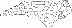
Dallas is a town in Gaston County, North Carolina, United States, and a suburb of Charlotte, located north of Gastonia. The population was 4,488 at the 2010 census. It was named for George M. Dallas, Vice President of the United States under James K. Polk.

<span class="mw-page-title-main">High Shoals, North Carolina</span> City in North Carolina, United States

High Shoals is a city in Gaston County, North Carolina, United States, named for the high rocky shoal across the Catawba River. The population was 696 at the 2010 census.

<span class="mw-page-title-main">McAdenville, North Carolina</span> Town in North Carolina, United States

McAdenville is a small town in Gaston County, North Carolina, United States. It is a suburb of Gastonia and located east of Gastonia. The population was 890 at the 2020 census.

<span class="mw-page-title-main">Stanley, North Carolina</span> Town in North Carolina, United States

Stanley is a town in Gaston County, North Carolina, United States. The population was 3,556 at the 2010 census.

<span class="mw-page-title-main">Stokesdale, North Carolina</span> Town in North Carolina, United States

Stokesdale is a town in Guilford County, North Carolina, United States with small parts in the counties of Rockingham, Forsyth, and Stokes. The population was 5,924 at the 2020 census. Belews Lake is located nearby, and North Carolina Highway 68 and North Carolina Highway 65 both intersect U.S. Route 158 near the town's center.

<span class="mw-page-title-main">Weldon, North Carolina</span> Town in North Carolina, United States

Weldon is a town in Halifax County, North Carolina, United States. The population was 1,655 at the 2010 census. It is part of the Roanoke Rapids, North Carolina Micropolitan Statistical Area.

<span class="mw-page-title-main">Conway, North Carolina</span> Town in North Carolina, United States

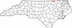
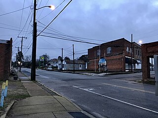
Conway is a town in Northampton County, North Carolina, United States. The population was 836 at the 2010 census. It is part of the Roanoke Rapids, North Carolina Micropolitan Statistical Area.

<span class="mw-page-title-main">Garysburg, North Carolina</span> Town in North Carolina, United States

Garysburg is a town in Northampton County, North Carolina, United States. The population was 1,057 at the 2010 census. It is part of the Roanoke Rapids, North Carolina Micropolitan Statistical Area.

<span class="mw-page-title-main">Jackson, North Carolina</span> Town in North Carolina, United States

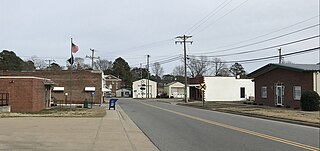
Jackson is a town in Northampton County, North Carolina, United States. The population was 513 at the 2010 census. It is the county seat of Northampton County.

<span class="mw-page-title-main">Lasker, North Carolina</span> Town in North Carolina, United States

Lasker is a town in Northampton County, North Carolina, United States. The population was 122 at the 2010 census. It is part of the Roanoke Rapids, North Carolina Micropolitan Statistical Area.

<span class="mw-page-title-main">Seaboard, North Carolina</span> Town in North Carolina, United States

Seaboard is a township in Northampton County, North Carolina, United States, created as a company town by the Seaboard and Roanoke Railroad, approximately 10 miles northeast of Weldon in the mid-1840s as a place for railroad employees to live.

<span class="mw-page-title-main">Severn, North Carolina</span> Town in North Carolina, United States

Severn is a town in Northampton County, North Carolina, United States. The population was 276 at the 2010 census. It is part of the Roanoke Rapids, North Carolina Micropolitan Statistical Area. Severn is the home of Severn Peanut Corporation, the owners of the Hampton Farms brand of roasted peanuts.

<span class="mw-page-title-main">Woodland, North Carolina</span> Town in North Carolina, United States

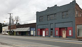
Woodland is a town in Northampton County, North Carolina, United States. The population was 809 at the 2010 census. It is part of the Roanoke Rapids, North Carolina Micropolitan Statistical Area.

<span class="mw-page-title-main">Gaston, South Carolina</span> Town in South Carolina, United States

Gaston is a town in Lexington County, South Carolina, United States. The population was 1,645 at the 2010 census. It is part of the Columbia, South Carolina Metropolitan Statistical Area.

<span class="mw-page-title-main">Swansea, South Carolina</span> Town in South Carolina, United States

Swansea is a town in Lexington County, South Carolina, United States. The population was 827 at the 2010 census. It is part of the Columbia, South Carolina Metropolitan Statistical Area.

<span class="mw-page-title-main">Clover, South Carolina</span> Town in South Carolina, United States

Clover is a town in York County, South Carolina, United States. It is located in the greater Charlotte metropolitan area. As of 2020, the population was at 6,671 within the town limits. Clover is twinned with the Northern Irish town of Larne on County Antrim's East Coast.

<span class="mw-page-title-main">Melfa, Virginia</span> Town in Virginia, United States

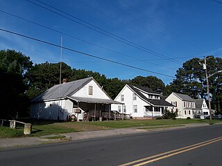
Melfa is a town in Accomack County on the Eastern Shore of Virginia in the United States. The population was 408 at the 2010 census.

References

  1. "ArcGIS REST Services Directory". United States Census Bureau. Retrieved September 20, 2022.
  2. 1 2 U.S. Geological Survey Geographic Names Information System: Gaston, North Carolina
  3. 1 2 "U.S. Census website". United States Census Bureau. Archived from the original on December 27, 1996. Retrieved January 31, 2008.
  4. "National Register of Historic Places Listings". Weekly List of Actions Taken on Properties: 4/09/12 through 4/13/12. National Park Service. April 20, 2012. Archived from the original on April 3, 2015. Retrieved March 4, 2015.
  5. "Census of Population and Housing". Census.gov. Archived from the original on April 26, 2015. Retrieved June 4, 2015.
  6. "Explore Census Data". data.census.gov. Archived from the original on December 24, 2021. Retrieved December 24, 2021.
  7. Northampton County Schools Archived April 30, 2022, at the Wayback Machine . Retrieved June 21, 2020.
  8. KIPP Pride High School Archived May 8, 2021, at the Wayback Machine . Retrieved June 21, 2020.