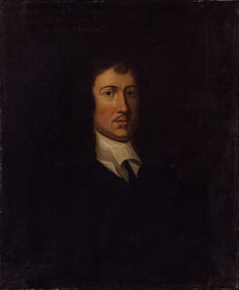
James Harrington was an English political theorist of classical republicanism. He is best known for his controversial publication The Commonwealth of Oceana (1656). This work was an exposition of an ideal constitution, a utopia, designed to facilitate the development of the English republic established after the regicide, the execution of Charles I in 1649.
Sir Francis Tanfield was Proprietary governor of the South Falkland colony of Henry Cary, 1st Viscount Falkland, his cousin's husband. Tanfield was to establish a colony at Renews and left England in 1623 with an unknown number of colonists. The settlers were harassed by migratory fishermen who used the harbour. He was the leader of the colony of South Falkland from 1623 to 1625. The colony was still in existence in 1626 when it was visited by Sir Richard Whitbourne but the settlers likely returned to England shortly afterwards. By 1630, Tanfield was back in England about to embark to Ireland on a mission for King Charles I.
Richard FitzRoy was the illegitimate son of King John of England and was feudal baron of Chilham, in Kent. His mother was Adela, his father's first cousin and a daughter of Hamelin de Warenne by his wife Isabel de Warenne, 4th Countess of Surrey.

Chelveston is a small village in North Northamptonshire. It is about 2 miles (3.2 km) east of Higham Ferrers and 7 miles (11.3 km) east of Wellingborough on the B645 from Higham Ferrers to St Neots. To the south is the hamlet of Caldecott and the settlement of Chelston Rise which together comprise the civil parish of Chelveston cum Caldecott. The population is now included in the civil parish of Chelveston cum Caldecott.

Dinton is a village, civil parish and former manor in Wiltshire, England, in the Nadder valley on the B3089 road about 8 miles (13 km) west of Salisbury. The parish population was 696 at the 2011 census, estimated at 733 in 2019. The civil parish includes the village of Baverstock, about 1 mile (1.6 km) east of Dinton village.

Astwell is a hamlet in Northamptonshire, England. With Falcutt, it is part of the civil parish of Helmdon, but formerly Astwell was split between the parishes of Syresham and Wappenham. The hamlet is 6 miles (10 km) northeast of Brackley and 17+1⁄2 miles (28 km) by road southwest of the county town of Northampton. Today the hamlet contains little more than the Astwell Castle and a mill.

Gayton is a rural village and civil parish in West Northamptonshire, England, 5 miles (8 km) south-west of Northampton town centre. The village is situated on a hill close to the larger villages of Bugbrooke, Milton Malsor and Blisworth, with a linked public footpath network. At the 2011 Census, the population of the parish was 544.

Sisland is a very small village, manor and parish in the county of Norfolk, England, about a mile west of Loddon. The Parish covers an area of 1.90 km2 (0.73 sq mi) and had a population of 44 in 16 households at the 2001 census. Its church is dedicated to St Mary.

Astwell Castle is a manor house in Northamptonshire, England about 1.5 miles (2.4 km) south-west of Wappenham. It is a Grade II listed building and part of the parish of Helmdon, a village 1 mile (1.6 km) west.

White Roding is a village and civil parish in the Uttlesford district of Essex, England. The village is included in the eight hamlets and villages called The Rodings. White Roding is 8 miles (13 km) north-west from the county town of Chelmsford.

The Parish Church of the Annunciation to the Blessed Virgin Mary is the Church of England parish church of Souldern, a village in Oxfordshire about 7 miles (11 km) northwest of Bicester and a similar distance southeast of Banbury.
Sulby Abbey was a Premonstratensian house in Northamptonshire, England, founded in 1155 as daughter house of the Abbey of St. Mary and St. Martial in Newsham.
Everdon Priory was a priory in Northamptonshire, England. The village of Everdon is located about 6 km south-east of the town of Daventry.

Sir Thomas Green was a member of the English gentry who died in the Tower of London, where he had been imprisoned for treason. He is best known as the grandfather of Catherine Parr, last wife of King Henry VIII.

Grafton Manor was established before the Norman Conquest. Grafton means "settlement at or near the wood" and may indicate a role in woodland management within a larger estate, for instance.
Francis Tate (1560–1616) was an English antiquary and politician, Member of Parliament for Northampton and Shrewsbury.

Members of the Basset family were amongst the early Norman settlers in the Kingdom of England. It is currently one of the few ancient Norman families who has survived through the centuries in the paternal line. They originated at Montreuil-au-Houlme in the Duchy of Normandy.

Holcombe Burnell is a civil parish in Devon, England, the church of which is about 4 miles west of Exeter City centre. There is no village clustered around the church, rather the nearest village within the parish is Longdown. Only the manor house and two cottages are situated next to the church. The former manor house next to the church is today known as Holcombe Burnell Barton having subsequently been used as a farmhouse. The manor was in the historical Hundred of Wonford.
Eversley Manor is a manor in Eversley, Hampshire, England. Mentioned in the Domesday Book, in 1669, it was purchased by Sir Andrew Henley of Bramshill House, who then ran it.

Finedon Hall is a Victorian country house in Finedon, Northamptonshire. It is a Grade II listed building.


