Girardot Municipality, Aragua

Last updated
Girardot Municipality

Municipio Girardot
Maracay.JPG
Skyline of Maracay, shire town of the Girardot Municipality.
Bandera de Maracay.svg
Flag
Escudo de Maracay.svg
Seal
Venezuela - Aragua - Girardot.svg
Location in Aragua
Venezuela location map (+claimed).svg
Red pog.svg
Girardot Municipality
Location in Venezuela
Coordinates: 10°15′06″N67°36′05″W / 10.2517°N 67.6014°W / 10.2517; -67.6014 Coordinates: 10°15′06″N67°36′05″W / 10.2517°N 67.6014°W / 10.2517; -67.6014
CountryFlag of Venezuela.svg  Venezuela
State Aragua
Municipal seat Maracay
Government
   Mayor Pedro Bastidas (PSUV)
Area
  Total302 km2 (117 sq mi)
Population
 (2011)
  Total407,109
  Density1,300/km2 (3,500/sq mi)
Time zone UTC−04:00 (VET)
Area code(s) 0243
Website Official website

The Girardot Municipality is one of the 18 municipalities (municipios) that makes up the Venezuelan state of Aragua. According to the 2011 census by the National Institute of Statistics of Venezuela, the municipality has a population of 407,109. [1] The city of Maracay is the shire town of the Girardot Municipality. [2]

Contents

History

The city of Maracay was officially established on March 5, 1701, by Bishop Diego de Baños y Sotomayor in the valleys of Tocopio and Tapatapa (what is known today as the central valley of Aragua) in northern Venezuela. According to the most accepted explanation, it was named after a local indigenous chief, and refers to the "Maracayo" (Felis mitis), a small tiger. Alternative etymologies cite a local aromatic tree called Mara.

Maracay experienced rapid growth during Juan Vicente Gómez's dictatorship (1908 - 1935). Gómez saw Maracay as a suitable place to make his residence during his rule, and ordered the construction of an Arc of Triumph, a bull plaza (a near replica of the one in Seville, Spain), an opera house, a zoo, and, most notably, the Hotel Jardín (Garden Hotel), a majestic, tourist attraction with very large gardens. The city is home to the Mausoleo de Gómez (Gómez's mausoleum), where the dictator's remains are stored.

Geography

The mountains on the north side of Maracay, that separate it from the coast, make up the Henri Pittier National Park, named after the Swiss naturalist that studied them. The park is a very lush rainforest, with a great variety of ferns. Two very winding roads cut through the park over the mountains to the coast. One, beginning at the North-Central part of the city known as Urbanización El Castaño, goes to the beach town of Choroní. The other, beginning at the North-Western part of the city known as Urbanización El Limón, goes to Ocumare de la Costa and the beaches of Cata and Catica.

Maracay & the Military

Maracay is a city heavily influenced by the military. Maracay is the cradle of Venezuelan aviation, and it is home to the two largest Air Force bases in the country. The Venezuelan F-16 fighter planes are stationed here, as well as the new Sukhoi-30MKEs acquired by the Venezuelan Government.

Other military facilities include the Fourth Armored Division of the Army and the Venezuelan Paratroopers main base and training center.

It is also home to the government-owned ammunition and weapons factory (CAVIM) that produces the Venezuelan version of the FN FAL (Fusil Automatique Leger - Light Automatic Rifle) rifle and will produce the newly acquired AK-103s; as well as the ammunition for both models.

Economy

One of the most important cities in Venezuela, Maracay is primarily an industrial and commercial center, the city produces paper, textiles, chemicals, tobacco, cement, cattle derived foods, such as milk or meat conserves, as well as soap and perfumes.

Even though it is an industrial center, the surroundings of Maracay live of an intensive agriculture, where sugarcane, tobacco, coffee, and cocoa stand out as the main products. There are also cattle-herding and timber-cutting activities.

Activity by the Venezuelan Military also adds a great deal to Maracay's economy.

Demographics

The Girardot Municipality, according to a 2007 population estimate by the National Institute of Statistics of Venezuela, has a population of 439,947 (up from 407,862 in 2000). This amounts to 26.4% of the state's population. [3] The municipality's population density is 1,456.78 inhabitants per square kilometre (3,773.0/sq mi). [4]

Government

The mayor of the Girardot Municipality is Pedro Bastidas, elected on November 23, 2008 with 46% of the vote. [5] He replaced Humberto Prieto shortly after the elections. The municipality is divided into eight parishes; Choroní, Urbana Las Delicias, Urbana Madre María de San José, Urbana Joaquín Crespo, Urbana Pedro José Ovalles, Urbana José Casanova Godoy, Urbana Andrés Eloy Blanco, and Urbana Los Tacariguas (the Urbana Las Delicias, Urbana Madre María de San José, Urbana Joaquín Crespo, Urbana Pedro José Ovalles, Urbana José Casanova Godoy, Urbana Andrés Eloy Blanco, and Urbana Los Tacariguas parishes once conformed the Capital Girardot Municipality, which was disestablished effective December 16, 1997). [2]

Education

Maracay houses the Faculty of Veterinarians and Agronomy of the Universidad Central de Venezuela, and an extension of the Universidad de Carabobo.

The main Campus of the UNEFA (a military university open to civilians) is located here. Career choices include Electronics, Aeronautical and Civil Engineering, as well as other disciplines such as avionics.

The main museums are:

Transportation

Maracay has good transportation facilities and infrastructure that effectively connects it to the rest of the country, it is linked to most other important localities by the Autopista Regional del Centro (Central Regional Highway), it also has good access to the only, small railway system in the country. The city boasts the national Hidroplane airport, located on the shore of the Lago de Valencia (Lake Valencia). The city does not have a Subway system, but one is in the planning stages.

Culture

Media

TV Stations

  • TVS
  • TRV (Orbivisión)
  • Coloewr TV
  • Televisión Informativa del Centro (TIC TV)
  • Novavisión TV
  • Aragua TV

Newspapers

See also

Related Research Articles

Aragua State of Venezuela

Aragua State is located in the north-central region of Venezuela. It has plains and jungles and Caribbean beaches. The most popular are Cata and Choroni. It has Venezuela's first national park which is called Henri Pittier.

Maracay Place in Aragua, Venezuela

Maracay is a city in north-central Venezuela, near the Caribbean coast, and is the capital and most important city of the state of Aragua. Most of it falls under the jurisdiction of Girardot Municipality. The population of Maracay and its surroundings in the 2011 census was 955,362. In Venezuela, Maracay is known as "Ciudad Jardín".

Municipalities of Venezuela

Municipalities of Venezuela are subdivisions of the States of Venezuela. There are 335 municipalities dividing the 23 states and Capital District.

Camatagua Municipality Municipality in Aragua, Venezuela

The Camatagua Municipality is one of the 18 municipalities (municipios) that makes up the Venezuelan state of Aragua and, according to the 2011 census by the National Institute of Statistics of Venezuela, the municipality has a population of 16,627. The town of Camatagua is the shire town of the Camatagua Municipality.

José Rafael Revenga Municipality Municipality in Aragua, Venezuela

The José Rafael Revenga Municipality is one of the 18 municipalities (municipios) that makes up the Venezuelan state of Aragua and, according to the 2011 census by the National Institute of Statistics of Venezuela, the municipality has a population of 48,800. The town of El Consejo is the shire town of the José Rafael Revenga Municipality. The municipality is named for José Rafael Revenga.

José Angel Lamas Municipality Municipality in Aragua, Venezuela

The José Angel Lamas Municipality is one of the 18 municipalities (municipios) that makes up the Venezuelan state of Aragua and, according to the 2011 census by the National Institute of Statistics of Venezuela, the municipality has a population of 32,981. The town of Santa Cruz is the municipal seat of the José Angel Lamas Municipality. The municipality is named for the Venezuelan composer José Ángel Lamas.

Ocumare de la Costa de Oro Municipality Municipality in Aragua, Venezuela

The Ocumare de la Costa de Oro Municipality is one of the 18 municipalities (municipios) that makes up the Venezuelan state of Aragua and, according to the 2011 census by the National Institute of Statistics of Venezuela, the municipality has a population of 12,816. The town of Ocumare de la Costa is the shire town of the Ocumare de la Costa de Oro Municipality.

Sucre Municipality, Aragua Municipality in Aragua, Venezuela

Sucre Municipality is one of the 18 municipalities (municipios) that makes up the Venezuelan state of Aragua and, according to the 2011 census by the National Institute of Statistics of Venezuela, the municipality has a population of 114,509. The town of Cagua is the shire town of the Sucre Municipality.

Páez Municipality, Miranda Municipality in Miranda, Venezuela

Páez is one of the 21 municipalities (municipios) that makes up the Venezuelan state of Miranda and, according to a 2007 population estimate by the National Institute of Statistics of Venezuela, the municipality has a population of 39,097. The town of Río Chico is the municipal seat of the Páez Municipality.

Pedro Zaraza Municipality Municipality in Guárico, Venezuela

The Pedro Zaraza Municipality is one of the 15 municipalities (municipios) that makes up the central Venezuelan state of Guárico and, according to a 2007 population estimate by the National Institute of Statistics of Venezuela, the municipality has a population of 60,595. The town of Zaraza is the shire town of the Pedro Zaraza Municipality.

Aragua Municipality Municipality in Anzoátegui, Venezuela

The Aragua Municipality is one of the 21 municipalities (municipios) that makes up the eastern Venezuelan state of Anzoátegui and, according to the 2011 census by the National Institute of Statistics of Venezuela, the municipality has a population of 29,268. The town of Aragua de Barcelona is the shire town of the Aragua Municipality.

Río Negro Municipality Municipality in Amazonas, Venezuela

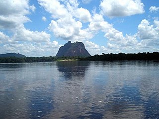
The Río Negro Municipality is one of the seven municipalities (municipios) that makes up the southern Venezuelan state of Amazonas and, according to the 2011 census by the National Institute of Statistics of Venezuela, the municipality has a population of 2,300.The town of San Carlos de Río Negro is the shire town of the Río Negro Municipality.

Diego Bautista Urbaneja Municipality Municipality in Anzoátegui, Venezuela

The Diego Bautista Urbaneja Municipality is one of the 21 municipalities (municipios) that makes up the eastern Venezuelan state of Anzoátegui and, according to the 2011 census by the National Institute of Statistics of Venezuela, the municipality has a population of 37,829. The town of Lechería is the shire town of the Diego Bautista Urbaneja Municipality. The municipality is named for the independence hero Diego Bautista Urbaneja.

Biruaca Municipality Municipality in Apure, Venezuela

The Biruaca Municipality is one of the seven municipalities (municipios) that makes up the Venezuelan state of Apure and, according to the 2011 census by the National Institute of Statistics of Venezuela, the municipality has a population of 54,323. The town of Biruaca is the municipal seat of the Biruaca Municipality.

Muñoz Municipality Municipality in Apure, Venezuela

The Muñoz Municipality is one of the seven municipalities (municipios) that makes up the Venezuelan state of Apure and, according to the 2011 census by the National Institute of Statistics of Venezuela, the municipality has a population of 27,542. The town of Bruzual is the municipal seat of the Muñoz Municipality.

Páez Municipality, Apure Municipality in Apure, Venezuela

Páez is one of the seven municipalities (municipios) that makes up the Venezuelan state of Apure and, according to the 2011 census by the National Institute of Statistics of Venezuela, the municipality has a population of 100,125. The town of Guasdualito is the municipal seat of the Páez Municipality.

Pedro Camejo Municipality Municipality in Apure, Venezuela

The Pedro Camejo Municipality is one of the seven municipalities (municipios) that makes up the Venezuelan state of Apure and, according to the 2011 census by the National Institute of Statistics of Venezuela, the municipality has a population of 28,966. The town of San Juan de Payara is the municipal seat of the Pedro Camejo Municipality. The municipality is named for Venezuelan independence hero Pedro Camejo.

Rómulo Gallegos Municipality, Apure Municipality in Apure, Venezuela

The Rómulo Gallegos Municipality is one of the seven municipalities (municipios) that makes up the Venezuelan state of Apure and, according to the 2011 census by the National Institute of Statistics of Venezuela, the municipality has a population of 24,418. The town of Elorza is the shire town of the Rómulo Gallegos Municipality.

Francisco Linares Alcántara Municipality Municipality in Aragua, Venezuela

The Francisco Linares Alcántara Municipality is one of the 18 municipalities (municipios) that makes up the Venezuelan state of Aragua and, according to the 2011 census by the National Institute of Statistics of Venezuela, the municipality has a population of 123,122. The town of Santa Rita is the shire town of the Francisco Linares Alcántara Municipality.

Francisco de Miranda Municipality, Anzoátegui Municipality in Anzoátegui, Venezuela

Francisco de Miranda is one of the 21 municipalities (municipios) that makes up the eastern Venezuelan state of Anzoátegui and, according to the 2011 census by the National Institute of Statistics of Venezuela, the municipality has a population of 43,173. The town of Pariaguán is the shire town of the Francisco de Miranda Municipality.

References

  1. http://www.geohive.com/cntry/venezuela_ext.aspx
  2. 1 2 http://www.ocei.gov.ve/secciones/division/Aragua.zip%5B%5D
  3. http://www.ocei.gov.ve/sintesisestadistica/estados/aragua/cuadros/Poblacion5.xls%5B%5D
  4. http://www.ocei.gov.ve/sintesisestadistica/estados/aragua/cuadros/Poblacion4.xls%5B%5D
  5. http://www.cne.gob.ve/divulgacion_regionales_2008/index.php?e=04&m=00&p=00&c=00&t=00&ca=00&v=02