Granby, Quebec

Last updated

Granby
Ville de Granby
Granby-Rue Principale-1.jpg
Rue Principal, Granby
Blason ville ca Granby.svg
Logo Granby.png
Motto: 
Pour y parvenir (To get there)
Granby Quebec location diagram.PNG
Location within La Haute-Yamaska RCM
Canada Southern Quebec location map.png
Red pog.svg
Granby
Location in southern Quebec
Coordinates: 45°24′N72°44′W / 45.400°N 72.733°W / 45.400; -72.733 [1]
Country Canada
Province Quebec
Region Estrie [2]
RCM La Haute-Yamaska
ConstitutedJanuary 1, 2007
Government
  Mayor Julie Bourdon
   Federal riding Shefford
   Prov. riding Granby
Area
   Town 156.10 km2 (60.27 sq mi)
  Land152.72 km2 (58.97 sq mi)
  Urban
[6]
90.53 km2 (34.95 sq mi)
  Metro
[7]
396.52 km2 (153.10 sq mi)
Population
 (2021)
   Town 69,025
  Density194.4/km2 (503/sq mi)
Time zone UTC−5 (EST)
  Summer (DST) UTC−4 (EDT)
Postal code(s)
Area code(s) 450 and 579
HighwaysQc112.svg R-112
Qc137.svg R-137
Qc139.svg R-139
Website www.ville.granby.qc.ca OOjs UI icon edit-ltr-progressive.svg

Granby is a town in the southwestern region of Quebec east of Montreal. According to the latest statistics from the 2021 Canadian Census, Granby has a population of 69,025. It is the administrative center of La Haute-Yamaska Regional County Municipality and is the second most populous city in The Eastern Townships after Sherbrooke. The town's name is derived from John Manners, Marquess of Granby. One of the town's main attractions is the Granby Zoo, and its well-known Lac Boivin fountain, also a notable landmark of the area. The mayor, Julie Bourdon was elected on November 7th, 2021, being the first female mayor of Granby.

Contents

History

The town of Granby seen in 1883. View of the town of Granby - 1883.jpg
The town of Granby seen in 1883.

Granby’s terrain, frequently characterized as a natural prairie, historically dotted with natural meadows and a rich tapestry of forests, was home to a variety of trees such as ash, fir, maple, hemlock, and birch. Not far from these woods, a small swamp could be found, nestled a short distance uphill. Over time, This land was traversed by Indigenous peoples, whose presence was intertwined with the area’s nomadic history. [8] [9]

In 1792, the Eastern Townships were officially opened for colonization by Loyalists. Subsequently, on January 29, 1803, Colonel Henry Caldwell and his 97 associates were granted the Township of Granby by the Executive Council of Quebec. The township’s first settler, John Horner, arrived in 1813 and established a sawmill adjacent to the Yamaska River. By 1825, Horner, in partnership with Richard Frost, expanded his enterprise to include a general store. That same year, Frost was responsible for drafting the township’s official plans. [10]

Granby received official incorporation as a municipality in the year of 1816, marking its status as a town in 1971.

Field areas have been exploited for agricultural use and the North Yamaska river's flow has been used for its hydraulic energy since the construction of a first dam in 1815 by large industrial companies; the use of dams along the stream has provoked the formation of a large shallow swamp, called Lac Boivin, often cited as one of Granby's landmarks.

In May 2006, the citizens of Granby and Granby Township held a referendum on a possible merger. A majority of citizens of the two municipalities approved the merger, which took effect on January 1, 2007. [11]

Geography

Granby is a flat region located approximately halfway between Montreal and Sherbrooke along Autoroute 10; historically a land covered by forests and prairies, it has transformed into an urbanized core surrounded by fields and suburban neighborhoods. The North Yamaska river, which crosses lake Boivin (this lake took shape after the construction of a series of dams and later changed into a large swamp praised for its biodiversity. [8] It connects to nearby villages by a network of roads and has two access points from the highway at exit 68 (through Saint-Alphonse-de-Granby) and 74 (via Bromont).

Parks and green spaces

A panorama of lake Boivin and its bicycle track. Panorama lac Boivin - tour d'y voir CINLB.jpg
A panorama of lake Boivin and its bicycle track.

Granby has many parks and fountains, including the Daniel-Johnson, Victoria, Terry Fox, Miner, Pelletier, and Kennedy parks.

Climate

Granby has a humid continental climate [14] (Dfb). It has significant variations of temperature with four distinct seasons. Summers are warm but short and winters are very cold. Transitional seasons have significant variations of temperature between adjacent months. Precipitation is quite high, resulting in rainy summers and snowy winters.

Climate data for Granby
MonthJanFebMarAprMayJunJulAugSepOctNovDecYear
Record high °C (°F)17.5
(63.5)
16.5
(61.7)
23.9
(75.0)
29.0
(84.2)
31.1
(88.0)
34.4
(93.9)
36.1
(97.0)
35.6
(96.1)
32.2
(90.0)
28.9
(84.0)
23.9
(75.0)
18
(64)
36.1
(97.0)
Mean daily maximum °C (°F)−5.5
(22.1)
−4.0
(24.8)
1.9
(35.4)
10.0
(50.0)
18.1
(64.6)
22.6
(72.7)
25.0
(77.0)
23.6
(74.5)
18.5
(65.3)
11.8
(53.2)
4.5
(40.1)
−2.2
(28.0)
10.4
(50.7)
Daily mean °C (°F)−10.0
(14.0)
−8.5
(16.7)
−2.3
(27.9)
5.4
(41.7)
12.9
(55.2)
17.6
(63.7)
20.1
(68.2)
18.9
(66.0)
14.0
(57.2)
7.7
(45.9)
1.1
(34.0)
−6.3
(20.7)
5.9
(42.6)
Mean daily minimum °C (°F)−14.5
(5.9)
−12.9
(8.8)
−6.6
(20.1)
0.7
(33.3)
7.7
(45.9)
12.6
(54.7)
15.2
(59.4)
14.1
(57.4)
9.4
(48.9)
3.6
(38.5)
−2.4
(27.7)
−10.3
(13.5)
1.4
(34.5)
Record low °C (°F)−37.0
(−34.6)
−35.0
(−31.0)
−31.1
(−24.0)
−17.2
(1.0)
−5.0
(23.0)
−1.0
(30.2)
1.7
(35.1)
2.0
(35.6)
−3.0
(26.6)
−8.9
(16.0)
−18.9
(−2.0)
−33.0
(−27.4)
−37.0
(−34.6)
Average precipitation mm (inches)103.9
(4.09)
74.5
(2.93)
92.8
(3.65)
88.4
(3.48)
93.2
(3.67)
107.4
(4.23)
128.1
(5.04)
124.9
(4.92)
110.2
(4.34)
99.1
(3.90)
105.8
(4.17)
104.3
(4.11)
1,236.6
(48.69)
Average rainfall mm (inches)34.1
(1.34)
22.0
(0.87)
43.7
(1.72)
68.7
(2.70)
92.3
(3.63)
107.4
(4.23)
128.1
(5.04)
124.9
(4.92)
110.2
(4.34)
96.1
(3.78)
75.1
(2.96)
38.9
(1.53)
941.5
(37.07)
Average snowfall cm (inches)69.8
(27.5)
52.5
(20.7)
49.1
(19.3)
19.7
(7.8)
0.9
(0.4)
0
(0)
0
(0)
0
(0)
0
(0)
3.0
(1.2)
30.7
(12.1)
65.4
(25.7)
291.2
(114.6)
Average precipitation days (≥ 0.2 mm)1914.814.813.514.214.514.013.613.313.816.918.1180.5
Average rainy days (≥ 0.2 mm)4.43.96.911.014.114.514.013.613.313.311.66.0126.6
Average snowy days (≥ 0.2 cm)16.612.610.14.20.1700000.827.314.165.89
Source: Environment Canada [15]

Demographics

Granby Population
YearPop.±%
19014,750    
19216,785+42.8%
193110,587+56.0%
194114,197+34.1%
195121,989+54.9%
196131,463+43.1%
197134,385+9.3%
198137,725+9.7%
199142,804+13.5%
1996 43,316+1.2%
2001 44,121+1.9%
2006 47,637+8.0%
2011 63,433 [lower-alpha 1] +33.2%
2016 66,222+4.4%
2021 69,025+4.2%

In the 2021 Census of Population conducted by Statistics Canada, Granby had a population of 69,025 living in 31,850 of its 32,766 total private dwellings, a change of

In 2021, [17] 92.5% of the population were white/European, 5.5% were visible minorities and 2.0% were Indigenous. The largest visible minority groups were Black (1.8%), Latin American (1.6%), Arab (0.8%), and West Asian (0.5%).

91.8% of residents spoke French as a mother tongue. Other common first languages were English (2.1%), Spanish (1.6%), Arabic (0.6%), and Persian languages (0.4%). 1.0% of residents listed both French and English as their mother tongues, while 0.4% listed both French and a non-official language.

69.0% of residents were Christian, down from 87.2% in 2011. [18] 61.6% were Catholic, 4.3% were Christian n.o.s., and 1.4% were Protestant. Other Christian denominations and Christian-related traditions accounted for 1.6% of the population. Non-religious and secular people were 28.9% of the population, up from 11.3% in 2011. 2.1% of residents followed other religions, up from 1.5% in 2011. The largest non-Christian religion was Islam (1.7%).

Mother tongue language (2021)
LanguagePopulationPct (%)
French only62,15091.8%
English only1,4352.1%
Both English and French7051.0%
Other languages3,0254.5%

Economy

Granby is a regional centre for industries (textile, lumber, dairy products) and commercial zone, but is also a tourist town, due to the presence of the important Granby Zoo, founded by the Mayor Horace Boivin. It hosts a Fête des Mascottes ("Mascot Festival") each year in July.

Attractions

St. George's Anglican Church. Granby-St-George's anglican church.jpg
St. George's Anglican Church.
Eglise Sainte-Famille. Granby-Ste-Famille.jpg
Église Sainte-Famille.

Granby is the host of the yearly "Festival de la chanson de Granby" ("Granby Song Festival") in which many well-known artists, such as Jean Leloup and Luc De Larochellière, have first gained public exposure.

The international classic car show takes place at parc Daniel-Johnston, with over 2500 antiques, vintage, hot rods, muscle cars and classic imports cars every summer. Granby's annual classic car show

Granby is also home to the Galeries de Granby regional shopping mall which has 106 stores. [19]

The Autodrome Granby, one of Canada's largest dirt oval racing tracks, hosts professional racing teams every Friday night from May to September. Winner of many prizes Autodrome Granby is known worldwide in the racing community.

Sports

Granby is the location of the annual Challenger Banque Nationale de Granby of the ATP Challenger Tour, which takes place at the Club de Tennis des Loisirs de Granby.

The Granby Inouk of the Quebec Junior AAA Hockey League are based in Granby. The Inouk play their home games at the Leonard Grondin Arena.

Granby is also home to the Ligue de Baseball Senior Élite du Québec's Granby Guerriers. The Guerriers play their home games at Napoléon Fontaine Stadium.

From 1981 to 1997, Granby was home to a QMJHL team, originally called the Granby Bisons but changed to the Granby Prédateurs in 1995. The team won the Memorial Cup in 1996. In 1997, the franchise relocated to Sydney, Nova Scotia and became the Cape Breton Screaming Eagles. Both teams played at Léonard Grondin Arena.

Infrastructure

The public transit department of the town is Transport urbain Granby. Until 1956, it was the eastern terminus of the Montreal and Southern Counties Railway's Montreal-Granby Line.

Sister cities

Granby's twinned are:

Notable people

See also

Notes

  1. Amalgamation of the city and the township of Granby into the town of Granby on January 1, 2007.

Related Research Articles

<span class="mw-page-title-main">Estrie</span> Administrative region in Quebec, Canada

Estrie is an administrative region of Quebec that comprises the Eastern Townships. Estrie, a French neologism, was coined as a derivative of est, "east". Originally settled by anglophones, today it is about 90 per cent francophone. Anglophones are concentrated in Lennoxville, home of the region's only English-speaking university, Bishop's University. The Eastern Townships School Board runs 20 elementary schools, three high schools, and a learning centre.

<span class="mw-page-title-main">Baie-Comeau</span> City in Quebec, Canada

Baie-Comeau is a city located approximately 420 km (260 mi) north-east of Quebec City in the Côte-Nord region of the province of Quebec, Canada. It is located on the shores of the Saint Lawrence River near the mouth of the Manicouagan River, and is the seat of Manicouagan Regional County Municipality.

<span class="mw-page-title-main">La Haute-Yamaska Regional County Municipality</span> Regional county municipality in Quebec, Canada

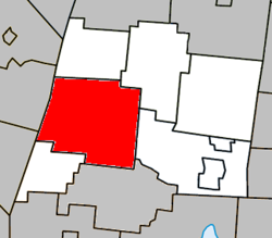
La Haute-Yamaska is a regional county municipality in the Estrie region of Quebec, Canada. Its seat is Granby.

<span class="mw-page-title-main">La Tuque, Quebec</span> City in north-central Quebec, Canada

La Tuque is a city located in north-central Quebec, Canada, on the Saint-Maurice River, between Trois-Rivières and Chambord. The population was 11,129 at the 2021 Canadian census, most of which live within the urban area. At over 28,000 km2 (11,000 sq mi), it is the largest city in Canada by area.

<span class="mw-page-title-main">Mékinac Regional County Municipality</span> Regional county municipality in Quebec, Canada


Mékinac is a regional county municipality (RCM) of 5,607 km2 located in the administrative region of Mauricie, along the Saint-Maurice River, which also crosses the RCM from one end to the other, and the Matawin River, a tributary of the Saint-Maurice. Located in the province of Quebec, Canada.

<span class="mw-page-title-main">Dolbeau-Mistassini</span> City in Quebec, Canada

Dolbeau-Mistassini is a town in northern Quebec, Canada, at the confluence of the Mistassibi River, Riviere aux Rats and the Mistassini River, on Lac Saint-Jean. Dolbeau-Mistassini is in the Maria-Chapdelaine Regional County Municipality and is the commercial hub of Lac-St-Jean with big stores and shopping centres.

<span class="mw-page-title-main">Cowansville</span> City in Quebec, Canada

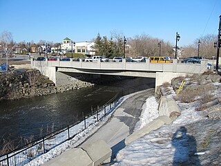
Cowansville is a town in south-central Quebec, Canada, located on Lac Davignon 20 kilometres (12 mi) north of the U.S. border. It is the seat of Brome-Missisquoi, a regional county municipality. The population as of the Canada 2021 Census was 15,234.

<span class="mw-page-title-main">Brome Lake, Quebec</span> Town in Quebec, Canada

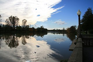
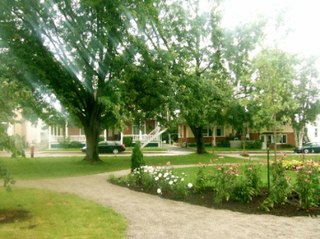
The Town of Brome Lake is a town in southern Quebec, Canada. The population as of the Canada 2011 Census was 5,609. Tourism is a major industry in the village of Knowlton because of skiing in the winter, lake activities in summer, and autumn leaf colour.

<span class="mw-page-title-main">Bromont</span> City in Quebec, Canada

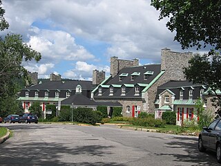
Bromont is a city in southern Quebec, Canada, at the base of Mont Brome; it is in the Brome-Missisquoi Regional County Municipality. The Bromont area and its resort, Ski Bromont, is well known as a tourist destination for its downhill skiing, mountain biking, BMX-riding and water slides. It also features golf and equestrian events in moderate weather. Bromont also boasts a high-tech industrial park, which includes IBM, General Electric, and Teledyne DALSA. Bromont Airport serves the region.

<span class="mw-page-title-main">Yamaska River</span> River in Quebec, Canada

The Yamaska River is a river in southern Quebec, Canada.

<span class="mw-page-title-main">Notre-Dame-du-Mont-Carmel, Quebec</span> Parish municipality in Quebec, Canada

Notre-Dame-du-Mont-Carmel in the Mauricie region of the province of Quebec in Canada.

<span class="mw-page-title-main">Hérouxville</span> Parish municipality in Quebec, Canada

Hérouxville is a parish municipality in the Mékinac Regional County Municipality in the administrative region of Mauricie, in the province of Quebec, Canada. Its watershed is mainly part of the Batiscanie.

<span class="mw-page-title-main">Saint-Narcisse</span> Parish municipality in Quebec, Canada

Saint-Narcisse is a parish municipality located in the regional county municipality (MRC) Chenaux, in the administrative region of Mauricie, in the province of Quebec, in Canada. Located on the North Shore of the Saint Lawrence River, about 30 km (19 mi) from downtown Trois-Rivières, the parish of Saint-Narcisse is the heart of the Mauricie region.

<span class="mw-page-title-main">Shefford, Quebec</span> Township municipality in Quebec, Canada

Shefford is a township municipality located in the province of Quebec. It is part of the Haute-Yamaska Regional County Municipality in the administrative area of Estrie. The population as of the Canada 2021 Census was 7,253. The township completely encircles the city of Waterloo and the city of Warden.

<span class="mw-page-title-main">Sainte-Anne-du-Lac</span> Municipality in Quebec, Canada

Sainte-Anne-du-Lac is a municipality and village in the Laurentides region of Quebec, Canada, part of the Antoine-Labelle Regional County Municipality.

<span class="mw-page-title-main">Roxton Pond</span> Municipality in Quebec, Canada

Roxton Pond is a municipality in the Canadian province of Quebec, located within La Haute-Yamaska Regional County Municipality. The population as of the 2021 Canadian Census was 4,224. The municipality was created in 1997 with the merger of the Parish and the Village of Roxton Pond.

<span class="mw-page-title-main">Saint-Alphonse-de-Granby</span> Municipality in Quebec, Canada

Saint-Alphonse-de-Granby is a municipality in the Canadian province of Quebec, located within La Haute-Yamaska Regional County Municipality. The population as of the 2011 Canadian Census was 3,125.

<span class="mw-page-title-main">Métabetchouan–Lac-à-la-Croix</span> City in Quebec, Canada

Métabetchouan–Lac-à-la-Croix is a city in Quebec, Canada, in the Saguenay–Lac-Saint-Jean region.

<span class="mw-page-title-main">Lac-Pikauba, Quebec</span> Unorganized territory in Quebec, Canada

Lac-Pikauba is an unorganized territory in the Capitale-Nationale region of Quebec, Canada. It is a large, unpopulated, undeveloped territory that makes up two-thirds of the Charlevoix Regional County Municipality.

<span class="mw-page-title-main">North Yamaska River</span> River in Montérégie, Quebec, Canada

The North Yamaska river is a tributary of the Yamaska river. It flows over 47.8 kilometres (29.7 mi) on the south shore of the Saint Lawrence river in Quebec, Canada and passes through five municipalities, some of them sourcing their fresh water from it.

References

  1. "Banque de noms de lieux du Québec: Reference number 26164". toponymie.gouv.qc.ca (in French). Commission de toponymie du Québec.
  2. "La Haute-Yamaska et Brome-Missisquoi entrent dans le giron de l'Estrie". La Tribune. 8 July 2021. Retrieved October 15, 2021.
  3. 1 2 "Ministère des Affaires municipales, des Régions et de l'Occupation du territoire: Granby". Archived from the original on 2013-09-29. Retrieved 2012-03-11.
  4. "Parliament of Canada Federal Riding History: SHEFFORD (Quebec)". Archived from the original on 2009-06-05. Retrieved 2009-04-20.
  5. 2011 Statistics Canada Census Profile: Granby, Quebec
  6. "2011 Statistics Canada Census Profile: Granby, Quebec (population centre)". 2012-10-22. Retrieved 3 November 2012.
  7. 2011 Statistics Canada Census Profile: Granby (Census agglomeration), Quebec. The census agglomeration consists of Granby, Bromont, Saint-Alphonse-de-Granby, Saint-Paul-d'Abbotsford. In the 2006 census, the census agglomeration had not included Saint-Paul-d'Abbotsford.
  8. 1 2 Gendron, Mario (July 14, 2014). "Le lac Boivin, 1815-1980". SOCIÉTÉ D'HISTOIRE DE LA HAUTE-YAMAKS. Société d'histoire de la Haute-Yamaska. Retrieved March 16, 2016.
  9. "Société d'histoire de la Haute-Yamaska". Société d'histoire de la Haute-Yamaska. Retrieved 2016-03-16.
  10. Mario Gendron, Johanne Rochon et Richard Racine, Granby : Patrimoine et histoire, Société d'histoire de la Haute-Yamaska, 2009, 154 p. ( ISBN   978-2-9807338-6-4)
  11. La ville et le canton de Granby fusionnent - LCN - Régional
  12. "Parc Victoria". Commission de toponymie Québec. Commission de toponymie Québec. Retrieved March 17, 2016.
  13. Tassé, Michel (October 6, 2011). "L'Atelier 19 transforme le parc Miner en galerie d'art communautaire publique". LA VOIX DE L'EST. La Voix de l'Est. Retrieved March 17, 2016.
  14. "Granby, Quebec Canada Climate Summary". Weatherbase. Retrieved 20 April 2015.
  15. "Canadian Climate Normals 1971-2000 - Canada's National Climate Archive". Environment Canada . Retrieved 2012-07-30.
  16. "Population and dwelling counts: Canada, provinces and territories, and census subdivisions (municipalities), Quebec". Statistics Canada. February 9, 2022. Retrieved August 29, 2022.
  17. Government of Canada, Statistics Canada (2022-02-09). "Profile table, Census Profile, 2021 Census of Population - Granby, Ville (V) [Census subdivision], Quebec". www12.statcan.gc.ca. Retrieved 2023-01-14.
  18. Government of Canada, Statistics Canada (2013-05-08). "2011 National Household Survey Profile - Census subdivision". www12.statcan.gc.ca. Retrieved 2023-01-14.
  19. "Les Galeries de Granby". The Westcliff Group of Companies. 2007. Archived from the original on 23 October 2011. Retrieved 4 December 2012.
  20. "Coventry's twin towns and cities – Granby, Canada". Coventry City Council. Retrieved 2020-06-13.
  21. "Our Twin Cities". City of Windsor. Retrieved 2020-06-13.