Grand Tower, Illinois

Last updated
Grand Tower, Illinois
Grand Tower, Illinois, Front Street.jpg
Front Street
Jackson County Illinois Incorporated and Unincorporated areas Grand Tower Highlighted.svg
Location of Grand Tower in Jackson County, Illinois
Illinois in United States (US48).svg
Location of Illinois in the United States
Coordinates: 37°37′57″N89°30′7″W / 37.63250°N 89.50194°W / 37.63250; -89.50194 Coordinates: 37°37′57″N89°30′7″W / 37.63250°N 89.50194°W / 37.63250; -89.50194
CountryUnited States
StateIllinois
County Jackson
Township Grand Tower
Area
[1]
  Total1.25 sq mi (3.24 km2)
  Land1.25 sq mi (3.23 km2)
  Water0.00 sq mi (0.01 km2)
Population
 (2020)
  Total479
  Density383.81/sq mi (148.16/km2)
Time zone UTC-6 (CST)
  Summer (DST) UTC-5 (CDT)
ZIP code
62942
Area code 618
FIPS code 17-30770
Wikimedia CommonsGrand Tower, Illinois

Grand Tower is a city in Jackson County, Illinois, United States. The population was 605 at the 2010 census. [2] The town gets its name from Tower Rock, a landmark island in the Mississippi River. [3]

Contents

History

Former names of this town include La Tour ("The Tower"), Jenkins Landing, Cochran's Woodyard Landing, and Evans' Landing. [4] [5]

The earliest inhabitants were a band of river pirates, who settled here after being driven off Spanish soil west of the Mississippi River, near the pirate ambush spot of Tower Rock. This outlaw settlement was destroyed by the United States Army dragoons in 1803. A subsequent settler was a man named Walker, who is the namesake of Walker Hill. [6] [7]

Severe flooding struck the town in 1947. [8]

Geography

Grand Tower is located in southwestern Jackson County at 37°37′57″N89°30′7″W / 37.63250°N 89.50194°W / 37.63250; -89.50194 (37.632599, -89.501944). [9] The city is bordered to the west by the Mississippi River, which forms the Missouri–Illinois boundary. The northern edge of the city borders Shawnee National Forest.

Illinois Route 3 runs through an eastern extension of the city limits, leading north (upriver) 32 miles (51 km) to Chester, where the Chester Bridge crosses the Mississippi, and south 25 miles (40 km) to Illinois Route 146, which crosses the Mississippi to Cape Girardeau, Missouri. There are no other road bridges over the Mississippi closer to Grand Tower.

According to the 2010 census, Grand Tower has a total area of 1.253 square miles (3.25 km2), of which 1.25 square miles (3.24 km2) (or 99.76%) is land and 0.003 square miles (0.01 km2) (or 0.24%) is water. [10]

Grand Tower Natural Gas Pipeline Bridge Grand Tower Pipeline Bridge, view from Illinois highway 166.JPG
Grand Tower Natural Gas Pipeline Bridge

Immediately to the south of the city is a small portion of Perry County, Missouri, which is known as "Grand Tower Island". The island's sole road connection terminates in Grand Tower. [11] The Grand Tower Pipeline Bridge connects a natural gas pipeline across the Mississippi River between Wittenberg, Missouri and Grand Tower.

Economy

The Grand Tower Energy Center is a 478 megawatt combined cycle gas-fired facility which produces power for the region. It is owned by Ameren Energy Generating Company, or Genco. [12]

Grand Tower Energy Center Grand Tower Energy Center, near Grand Tower, Illinois along the Mississippi River.JPG
Grand Tower Energy Center

Community

Devil's Backbone Park sign Grand Tower, Illinois, Devil's Backbone Park sign.jpg
Devil's Backbone Park sign

Shawnee Elementary School, North - Once a public school, now (since 2015) a private residence.

A local post office with zip code 62942 provides mail service. [13] Four churches, the First United Presbyterian Church, the Grand Tower United Methodist Church, First Baptist Church, and Light House Christian Assembly Church offer religious services. [14] A work of levees protects the community from flooding when the Mississippi River water levels rise. [15] The Devil's Backbone Park, named after a limestone ridge which created a natural bottleneck in the Mississippi River, provided easy opportunity for river pirates to attack keelboats and barges. This park provides RV camping, playgrounds, picnic facilities, and a shower house. [16]

Demographics

Historical population
CensusPop.
1880 966
1890 624−35.4%
1900 88141.2%
1910 873−0.9%
1920 750−14.1%
1930 95327.1%
1940 1,0439.4%
1950 963−7.7%
1960 847−12.0%
1970 664−21.6%
1980 74812.7%
1990 7753.6%
2000 624−19.5%
2010 605−3.0%
2020 479−20.8%
U.S. Decennial Census [17]

As of the census [18] of 2000, there were 624 people, 268 households, and 169 families residing in the city. The population density was 496.0 inhabitants per square mile (191.5/km2). There were 309 housing units at an average density of 245.6 per square mile (94.8/km2). The racial makeup of the city was 98.24% White, 0.16% African American, 0.32% Native American, 0.64% from other races, and 0.64% from two or more races. Hispanic or Latino of any race were 0.96% of the population.

There were 268 households, out of which 32.1% had children under the age of 18 living with them, 49.3% were married couples living together, 8.6% had a female householder with no husband present, and 36.9% were non-families. 33.6% of all households were made up of individuals, and 16.8% had someone living alone who was 65 years of age or older. The average household size was 2.33 and the average family size was 2.99.

In the city, the population was spread out, with 26.1% under the age of 18, 8.5% from 18 to 24, 27.2% from 25 to 44, 22.8% from 45 to 64, and 15.4% who were 65 years of age or older. The median age was 39 years. For every 100 females, there were 95.0 males. For every 100 females age 18 and over, there were 91.3 males.

The median income for a household in the city was $27,135, and the median income for a family was $40,000. Males had a median income of $34,375 versus $23,750 for females. The per capita income for the city was $14,525. About 11.3% of families and 20.9% of the population were below the poverty line, including 29.4% of those under age 18 and 16.1% of those age 65 or over.

Notable people

Related Research Articles

<span class="mw-page-title-main">Jackson County, Illinois</span> County in Illinois, United States

Jackson County is a county located in the U.S. state of Illinois with a population of 52,974 at the 2020 census. Its county seat is Murphysboro, and its most populous city is Carbondale, home to the main campus of Southern Illinois University. The county was incorporated on January 10, 1816, and named for Andrew Jackson. The community of Brownsville served as the fledgling county's first seat.

<span class="mw-page-title-main">Warsaw, Illinois</span> City in Illinois, United States

Warsaw is a city in Hancock County, Illinois, United States. The population was 1,607 at the 2010 census, a decline from 1,793 in 2000. The city is notable for its historic downtown and the Warsaw Brewery, which operated for more than 100 years beginning in 1861 and, after renovation, reopened as a bar, restaurant and microbrewery in 2006.

<span class="mw-page-title-main">Grafton, Illinois</span> City in Illinois, United States

Grafton is the oldest city in Jersey County, Illinois, United States. It is located near the confluence of the Illinois and Mississippi Rivers. As of the 2020 census, the city had a total population of 626. Prior to the Great Flood of 1993, Grafton had enjoyed a stable population of nearly 1,000 residents.

<span class="mw-page-title-main">Hartford, Illinois</span> Village in Illinois, United States

Hartford is a village in Madison County, Illinois, United States, on the Mississippi River near the mouth of the Missouri River. The population was 1,429 at the 2010 census. Lewis and Clark spent the winter of 1803-1804 there, near what has been designated the Lewis and Clark State Historic Site.

<span class="mw-page-title-main">Madison, Illinois</span> City in Illinois, United States

Madison is a city in Madison and St. Clair counties in the U.S. state of Illinois. The population was 3,891 at the 2010 census. It is home to World Wide Technology Raceway at Gateway and the first Bulgarian Orthodox church in the United States.

<span class="mw-page-title-main">Wood River, Illinois</span> City in Illinois, United States

Wood River is a city in Madison County, Illinois. The population was 10,657 according to the 2010 census.

<span class="mw-page-title-main">Kell, Illinois</span> Village in Illinois, United States

Kell is a village in Marion County, Illinois, United States. The population was 231 at the 2000 census.

<span class="mw-page-title-main">Kinmundy, Illinois</span> City in Illinois, United States

Kinmundy is a city in Marion County, Illinois, United States. The population was 796 at the 2010 census.

<span class="mw-page-title-main">Meredosia, Illinois</span> Village in Illinois, United States

Meredosia is a village in Morgan County, Illinois, United States. The population was 1,044 at the 2010 census. It is part of the Jacksonville Micropolitan Statistical Area.

<span class="mw-page-title-main">Pinckneyville, Illinois</span> City in Illinois, United States

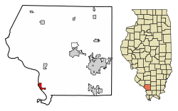
Pinckneyville is a city in and the county seat of Perry County, Illinois, United States. The population was 5,066 at the 2020 census. It is named for Charles Cotesworth Pinckney, an early American diplomat and presidential candidate.

<span class="mw-page-title-main">Port Byron, Illinois</span> Village in Illinois, United States

Port Byron is a village in Rock Island County, Illinois, United States and part of the Quad Cities Metropolitan Area. The population was 1,647 at the 2010 census.

<span class="mw-page-title-main">Cahokia, Illinois</span> Village in Illinois, United States

Cahokia was a village in St. Clair County, Illinois, United States. It was located east of the Mississippi River in the Greater St. Louis metropolitan area. As of the 2010 census, 15,241 people lived in the village, a decline from 16,391 in 2000. On May 6, 2021, the village ceased to exist, being incorporated into the new city of Cahokia Heights.

<span class="mw-page-title-main">Keokuk, Iowa</span> City in Iowa, United States

Keokuk is a city in and a county seat of Lee County, Iowa, United States, along with Fort Madison. It is Iowa's southernmost city. The population was 9,900 at the time of the 2020 census. The city is named after the Sauk chief Keokuk, who is thought to be buried in Rand Park. It is in the extreme southeast corner of Iowa, where the Des Moines River meets the Mississippi. It is at the junction of U.S. Routes 61, 136 and 218. Just across the rivers are the towns of Hamilton and Warsaw, Illinois, and Alexandria, Missouri. Keokuk, along with the city of Fort Madison, is a principal city of the Fort Madison-Keokuk micropolitan area, which includes all of Lee County, Iowa, Hancock County, Illinois and Clark County, Missouri.

<span class="mw-page-title-main">Bardwell, Kentucky</span> City in Kentucky, United States

Bardwell is a home rule-class city in and the county seat of Carlisle County, Kentucky, United States. The city was formally incorporated by the state assembly in 1878. The population was 723 at the 2010 census, down from 799 in 2000.

<span class="mw-page-title-main">Squaw Lake, Minnesota</span> City in Minnesota, United States

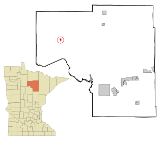
Squaw Lake is a city in Itasca County, Minnesota, United States. The population was 107 at the 2010 census.

<span class="mw-page-title-main">Hernando, Mississippi</span> City in Mississippi, United States

Hernando is a city in, and the county seat of, DeSoto County, which is on the northwestern border of Mississippi, United States. The population was 14,090 at the 2010 census, up from 6,812 in 2000. DeSoto County is the second-most-populous county in the Memphis metropolitan area, which includes counties in Tennessee and Mississippi.

<span class="mw-page-title-main">Kahoka, Missouri</span> City in Missouri, United States

Kahoka is a city in and the county seat of Clark County, in the northeast tip of Missouri, United States. As of the 2020 census, its population was 1,961.

<span class="mw-page-title-main">Wilson City, Missouri</span> Village in Virginia, United States

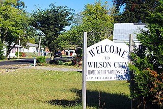
Wilson City is a village in Mississippi County, Missouri, United States. The population was 77 at the 2020 census.

<span class="mw-page-title-main">Caruthersville, Missouri</span> City in Missouri, United States

Caruthersville is a city in and the county seat of Pemiscot County, Missouri, United States, located along the Mississippi River in the Bootheel region of the state's far southeast. The population was 5,562, according to the 2020 census.

<span class="mw-page-title-main">Celina, Tennessee</span> City in Tennessee, United States

Celina is a city in and the county seat of Clay County, Tennessee, United States. The population was 1,495 at the 2010 census.

References

  1. "2020 U.S. Gazetteer Files". United States Census Bureau. Retrieved March 15, 2022.
  2. "Geographic Identifiers: 2010 Census Summary File 1 (G001): Grand Tower city, Illinois". American Factfinder. U.S. Census Bureau. Archived from the original on February 13, 2020. Retrieved May 9, 2018.
  3. Gannett, Henry (1905). The Origin of Certain Place Names in the United States. Govt. Print. Off. p. 141.
  4. "Visitors Guide to Grand Tower Jackson County, Illinois" . Retrieved 2015-07-15.
  5. "Tower Rock: Sentinel of the Mississippi". 1994. Retrieved 2015-07-15.
  6. "Visitors Guide to the Mississippi River Museum" . Retrieved 2015-07-15.
  7. "DROUGHT PUTS LEGENDARY ROCK WITHIN REACH". 1988-08-14. Retrieved 2015-07-15.
  8. "The Unluckiest Town in America". Time . 2015-07-15. Retrieved 2008-06-20.
  9. "US Gazetteer files: 2010, 2000, and 1990". United States Census Bureau. 2011-02-12. Retrieved 2011-04-23.
  10. "G001 - Geographic Identifiers - 2010 Census Summary File 1". United States Census Bureau. Archived from the original on 2020-02-13. Retrieved 2015-12-27.
  11. DeLorme. Illinois Atlas & Gazetteer. 6th ed. Yarmouth: DeLorme, 2010, 88. ISBN   978-0-89933-321-2.
  12. "Ameren Corporation Receives Approval from Federal Energy Regulatory Commission to Divest Its Merchant Generation Business" . Retrieved October 14, 2013.
  13. "GRAND TOWER POST OFFICE" . Retrieved 2015-07-15.
  14. "CHURCHES IN GRAND TOWER IL" . Retrieved 2015-07-15.
  15. Murray, Josh (2015-02-15). "Grand Tower: Living in the shadow of crumbling levees". The Southern.
  16. "Visitors Guide to the Devil's Backbone Park" . Retrieved 2015-07-15.
  17. "Census of Population and Housing". Census.gov. Retrieved June 4, 2015.
  18. "U.S. Census website". United States Census Bureau . Retrieved 2008-01-31.