Great Lakes and Ohio River Division

Last updated
USACE Great Lakes and Ohio River Division, shown in fuchsia USACE-District-Map.jpg
USACE Great Lakes and Ohio River Division, shown in fuchsia

The United States Army Corps of Engineers Great Lakes and Ohio River Division (LRD) is one of the eight permanent divisions of the Army organization, providing civil works and military water resource services/infrastructure. It also supports economically viable and environmentally sustainable watershed management and water resources development in its territory.

United States Army Corps of Engineers federal agency under the Department of Defense and a major Army command

The United States Army Corps of Engineers (USACE) is a U.S. federal agency under the Department of Defense and a major Army command made up of some 37,000 civilian and military personnel, making it one of the world's largest public engineering, design, and construction management agencies. Although generally associated with dams, canals and flood protection in the United States, USACE is involved in a wide range of public works throughout the world. The Corps of Engineers provides outdoor recreation opportunities to the public, and provides 24% of U.S. hydropower capacity.

Contents

The Division, headquartered in Cincinnati, Ohio, covers the American industrial heartland, stretching from the St Lawrence Seaway, across all of the Great Lakes, down the Ohio River Valley to the Tennessee and Cumberland Rivers. It covers 355,300 square miles (920,000 km2), parts of 17 states, and serves 56 million people.

Great Lakes lakes in North America

The Great Lakes, also called the Laurentian Great Lakes and the Great Lakes of North America, are a series of interconnected freshwater lakes primarily in the upper mid-east region of North America, on the Canada–United States border, which connect to the Atlantic Ocean through the Saint Lawrence River. They consist of Lakes Superior, Michigan, Huron, Erie, and Ontario, although hydrologically, there are four lakes, Superior, Erie, Ontario, and Michigan-Huron. The connected lakes form the Great Lakes Waterway.

Tennessee River river in the United States, its largest city is Knoxville, TN

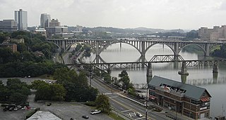
The Tennessee River is the largest tributary of the Ohio River. It is approximately 652 miles (1,049 km) long and is located in the southeastern United States in the Tennessee Valley. The river was once popularly known as the Cherokee River, among other names, as many of the Cherokee had their territory along its banks, especially in eastern Tennessee and northern Alabama. Its current name is derived from the Cherokee village Tanasi.

Cumberland River river in the United States of America

The Cumberland River is a major waterway of the Southern United States. The 688-mile-long (1,107 km) river drains almost 18,000 square miles (47,000 km2) of southern Kentucky and north-central Tennessee. The river flows generally west from a source in the Appalachian Mountains to its confluence with the Ohio River near Paducah, Kentucky, and the mouth of the Tennessee River. Major tributaries include the Obey, Caney Fork, Stones, and Red rivers.

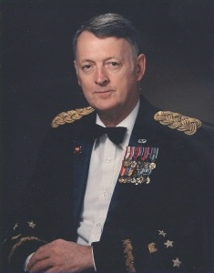
The Division Commander is directly responsible to the Chief of Engineers. The LRD Commander directs and supervises the individual District Commanders, and also serves on two national and international decision-making bodies: co-chair of the Lake Superior, Niagara, and Ontario/St Lawrence Seaway boards of control; and the Mississippi River Commission. In September 2011 Margaret W. Burcham became the first woman to command a USACE division when she was appointed commander of the Great Lakes and Ohio River Division. [1]

Margaret W. Burcham Brigadier-general in the U.S. Army Corps of Engineers

Margaret W. Burcham is a retired American brigadier general. She was the first female brigadier general in the U.S. Army Corps of Engineers.

LRD duties include:

Districts

The Division's seven districts are headquartered in:

Buffalo, New York City in Western New York

Buffalo is the second largest city in the U.S. state of New York and the largest city in Western New York. As of July 2016, the population was 256,902. The city is the county seat of Erie County and a major gateway for commerce and travel across the Canada–United States border, forming part of the bi-national Buffalo Niagara Region.

Chicago City in Illinois, United States

Chicago, officially the City of Chicago, is the most populous city in Illinois, as well as the third most populous city in the United States. With an estimated population of 2,716,450 (2017), it is the most populous city in the Midwest. Chicago is the principal city of the Chicago metropolitan area, often referred to as Chicagoland, and the county seat of Cook County, the second most populous county in the United States. The metropolitan area, at nearly 10 million people, is the third-largest in the United States, and the fourth largest in North America and the third largest metropolitan area in the world by land area.

Illinois State of the United States of America

Illinois is a state in the Midwestern region of the United States. It has the fifth largest gross domestic product (GDP), the sixth largest population, and the 25th largest land area of all U.S. states. Illinois is often noted as a microcosm of the entire United States. With Chicago in northeastern Illinois, small industrial cities and immense agricultural productivity in the north and center of the state, and natural resources such as coal, timber, and petroleum in the south, Illinois has a diverse economic base, and is a major transportation hub. Chicagoland, Chicago's metropolitan area, encompasses over 65% of the state's population. The Port of Chicago connects the state to international ports via two main routes: from the Great Lakes, via the Saint Lawrence Seaway, to the Atlantic Ocean and from the Great Lakes to the Mississippi River, via the Illinois Waterway to the Illinois River. The Mississippi River, the Ohio River, and the Wabash River form parts of the boundaries of Illinois. For decades, Chicago's O'Hare International Airport has been ranked as one of the world's busiest airports. Illinois has long had a reputation as a bellwether both in social and cultural terms and, through the 1980s, in politics.

Related Research Articles

Saint Lawrence Seaway canal

The Saint Lawrence Seaway is a system of locks, canals, and channels in Canada and the United States that permits oceangoing vessels to travel from the Atlantic Ocean to the Great Lakes of North America, as far inland as the western end of Lake Superior. The seaway is named for the Saint Lawrence River, which flows from Lake Ontario to the Atlantic Ocean. Legally, the seaway extends from Montreal, Quebec, to Lake Erie and includes the Welland Canal.

Saint Lawrence River Large river in eastern Canada and the United States, flowing into the Gulf of Saint Lawrence

The Saint Lawrence River is a large river in the middle latitudes of North America. The Saint Lawrence River flows in a roughly north-easterly direction, connecting the Great Lakes with the Atlantic Ocean and forming the primary drainage outflow of the Great Lakes Basin. It traverses the Canadian provinces of Quebec and Ontario, and is part of the international boundary between Ontario, Canada, and the U.S. state of New York. This river also provides the basis of the commercial Saint Lawrence Seaway.

Great Lakes Waterway

The Great Lakes Waterway (GLW) is a system of natural channels and canals which enable navigation between the North American Great Lakes. Though all of the lakes are naturally connected as a chain, water travel between the lakes was impeded for centuries by obstacles such as Niagara Falls and the rapids of the St. Marys River.

Elvin R. Heiberg III United States Army general (1932–2013)

Elvin Ragnvald Heiberg III was a United States Army general who was Chief of Engineers between 1984 and 1988.

Mississippi Valley Division

The United States Army Corps of Engineers Mississippi Valley Division (MVD) is responsible for the Corps water resources programs within 370,000-square-miles of the Mississippi River Valley, as well as the watershed portions of the Red River of the North that are within the United States. It excludes the entire watersheds of the Missouri River and Ohio River, and portions of the Arkansas River and the Red River of the South, but otherwise encompasses the entire Mississippi River from Lake Itasca, Minnesota, to the Gulf of Mexico. The district includes all or parts of 13 states: Arkansas, Illinois, Iowa, Kentucky, Louisiana, Michigan, Minnesota, Mississippi, Missouri, North Dakota, Tennessee, Wisconsin, and South Dakota.

South Pacific Division

The United States Army Corps of Engineers South Pacific Division (SPD) is an Army organization providing civil works and military water resource services/infrastructure. It also supports economically viable and environmentally sustainable watershed management and water resources development in California, Arizona, Nevada, Utah and New Mexico and is also responsible for parts of Oregon, Idaho, Wyoming, Colorado and Texas. It is headquartered in San Francisco, California.

Inland waterways of the United States

The inland waterways of the United States include more than 25,000 mi (40,000 km) of navigable waters. Much of the commercially important waterways of the United States consist of the Mississippi River System—the Mississippi River and connecting waterways.

Gavins Point Dam

Gavins Point Dam is a 1.9 mi (3 km) long embankment rolled-earth and chalk-fill dam which spans the Missouri River and impounds Lewis and Clark Lake. The dam joins Cedar County, Nebraska with Yankton County, South Dakota a distance of 811.1 river miles upstream of St. Louis, Missouri, where the river joins the Mississippi River. The dam and hydroelectric power plant were constructed as the Gavins Point Project from 1952 to 1957 by the United States Army Corps of Engineers as part of the Pick-Sloan Plan. The dam is located approximately 4 miles west or upstream of Yankton, South Dakota.

The Water Resources Development Act of 1986 is part of Pub.L. 99–662, a series of acts enacted by Congress of the United States on November 17, 1986.

Rivers and Harbors Act may refer to one of many pieces of legislation and appropriations passed by the United States Congress since the first such legislation in 1824. At that time Congress appropriated $75,000 to improve navigation on the Ohio and Mississippi rivers by removing sandbars, snags, and other obstacles. Like when first passed, the legislation was to be administered by the United States Army Corps of Engineers (USACE), under its Chief Engineer and the Secretary of War.

Southwestern Division

The United States Army Corps of Engineers Southwestern Division (SWD) is one of the eight permanent divisions of the Army organization, providing civil works and military water resource services and infrastructure. It also supports economically viable and environmentally sustainable watershed management and water resources development in Texas, Arkansas, Oklahoma, Louisiana and New Mexico.

Northwestern Division

The United States Army Corps of Engineers Northwestern Division (NWD) is one of the eight permanent divisions of the Army organization, providing civil works and military water resource services/infrastructure. It also supports economically viable and environmentally sustainable watershed management and water resources development in its territory.

South Atlantic Division

The United States Army Corps of Engineers South Atlantic Division (SAD) is one of the eight permanent divisions of the Army organization, providing civil works and military water resource services/infrastructure. lolIt also supports economically viable and environmentally sustainable watershed management and water resources development in its territory.

Pacific Ocean Division

The United States Army Corps of Engineers Pacific Ocean Division (POD) is an Army organization providing Military and Host Nation Construction services, and civil works in the American states and territories in the Pacific: Alaska, Hawaii, Guam, American Samoa and the Commonwealth of the Northern Mariana Islands. Projects include navigation, flood damage reduction, shore protection, and environmental restoration.

Brookville Lake Dam

Brookville Lake Dam is a dam in Brookville Township, Franklin County, Indiana, just north of Brookville, in the southeastern part of the state.

The Indonesian Army Corps of Engineers, abbreviated Ditziad, or simply Zeni is an Indonesian Army Central Executive Agency made up of some 15,000 civilian and military personnel, making it one of Southeast Asia's and the ASEAN's, largest public engineering, design, and construction management agencies.The Corps is involved in a wide range of disaster relief and public works projects within the republic, as well as in combat support operations. The Indonesian term for military engineers, Zeni, is derived from the Dutch East Indies Genie, meaning sapper.

References

  1. Somers, Meredith (August 12, 2014). "Women shattering glass ceiling, reaching new heights in 2014". The Washington Times . Retrieved November 25, 2017.