Related Research Articles

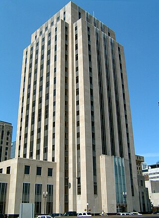
Saint Paul is the capital of the U.S. state of Minnesota and the county seat of Ramsey County. Situated on high bluffs overlooking a bend in the Mississippi River, Saint Paul is a regional business hub and the center of Minnesota's government. The Minnesota State Capitol and the state government offices all sit on a hill close to the city's downtown district. One of the oldest cities in Minnesota, Saint Paul has several historic neighborhoods and landmarks, such as the Summit Avenue Neighborhood, the James J. Hill House, and the Cathedral of Saint Paul. Like the adjacent city of Minneapolis, Saint Paul is known for its cold, snowy winters and humid summers.
Ramsey County is a county located in the U.S. state of Minnesota. As of the 2020 census, the population was 552,352, making it the second-most populous county in Minnesota. Its county seat and largest city is Saint Paul, the state capital and the twin city of Minneapolis. The county was founded in 1849 and is named for Alexander Ramsey, the first governor of the Minnesota Territory.

Norwood, also known as Bainbridge, is a working-class residential neighborhood in the northwest Bronx, New York City. It is bound by Van Cortlandt Park and Woodlawn Cemetery to the north, the Bronx River to the east, and Mosholu Parkway to the southwest. The area is dominated topographically by what was once Valentine's Hill, the highest point being near the intersection of 210th Street and Bainbridge Avenue, where Gun Hill Road intersects, and around the Montefiore Medical Center, the largest landowner and employer of the neighborhood. Norwood's main commercial arteries are Gun Hill Road, Jerome Avenue, Webster Avenue, and Bainbridge Avenue.

Lakewood is a neighborhood in East Dallas, Texas (USA). It is adjacent to White Rock Lake and Northeast of Downtown Dallas. Lakewood is bound by Mockingbird Lane to the north, Abrams Road to the west, Gaston Avenue to the south, and White Rock Lake to the east.

Bedford Park is a residential neighborhood in the northwest Bronx, New York City, adjacent to the New York Botanical Garden. Its boundaries, starting from the north and moving clockwise are: Mosholu Parkway to the north, Webster Avenue to the east, East 196th Street to the south, and Jerome Avenue to the west.

Cedar-Riverside, also referred to as the West Bank, or simply Riverside, is a neighborhood within Minneapolis, Minnesota. Its boundaries are the Mississippi River to the north and east, Interstate 94 to the south, and Hiawatha Avenue and Interstate 35W to the west. It has a longstanding tradition of cultural diversity and settlement, with a robust arts tradition.

Hmong Americans are Americans of Hmong ancestry. Many Hmong Americans immigrated to the United States as refugees in the late 1970s. Over half of the Hmong population from Laos left the country, or attempted to leave, in 1975, at the culmination of the Laotian Civil War.

The East Side is a district of Milwaukee, Wisconsin consisting of several neighborhoods encompassing an area just north of Downtown Milwaukee to the village of Shorewood, bordered by the Milwaukee River to the west and Lake Michigan to the east. The area encompasses residences, museums, bars, shops, theaters, live music clubs and the University of Wisconsin–Milwaukee campus.
Northeast is a defined community in the U.S. city of Minneapolis that is composed of 13 smaller neighborhoods whose street addresses end in "NE". Unofficially it also includes the neighborhoods of the University community which have "NE" addresses, and the entirety of the Old Saint Anthony business district, which sits on the dividing line of "NE" and "SE" addresses. In the wider community, this business district, which is the oldest settlement in the city, is often identified as the heart of Northeast, in part because it lies across the Mississippi River from Downtown Minneapolis. Northeast is sometimes referred to as "Nordeast", reflecting the history of northern and eastern European immigrants and their language influence.

Como is a neighborhood within the University community of Minneapolis. It is sometimes referred to as Southeast Como, due to many of its streets ending in SE, and possibly to differentiate it from the Como neighborhood in neighboring Saint Paul. Its boundaries are East Hennepin Avenue to the north, 33rd Avenue Southeast to the east, the Southeast Industrial Area to the south, and Interstate 35W to the west.

The demographics of Minnesota are tracked by the United States Census Bureau, with additional data gathered by the Minnesota State Demographic Center. According to the most recent estimates, Minnesota's population as of 2020 was approximately 5.7 million, making it the 22nd most populous state in the United States. The total fertility rate in Minnesota was roughly 1.87 in 2019, slightly below the replacement rate of 2.1.

Saint Anthony Park is a neighborhood in northwest Saint Paul, Minnesota. It is adjacent to the University of Minnesota's St. Paul Campus, bordering Prospect Park, Minneapolis on the west, the Minnesota State Fairgrounds on the east, and the suburbs of Falcon Heights and Lauderdale to the north.
The East Side Review was an American, English language newspaper headquartered in St. Paul, Minnesota, until publication ceased in September 2019. While it was published, it was the only neighborhood-focused, general-interest weekly newspaper in either Minneapolis or St. Paul.

Saint Paul Public Schools (SPPS) is a school district (ISD #625) that operates in Saint Paul, Minnesota.

Saint Paul, Minnesota, consists of 17 officially defined city districts or neighborhoods.

Saint Paul is the second largest city in the U.S. state of Minnesota, the county seat of Ramsey County, and the state capital of Minnesota. The origin and growth of the city were spurred by the proximity of Fort Snelling, the first major United States military installation in the area, as well as by the city's location on the northernmost navigable port of the Upper Mississippi River.

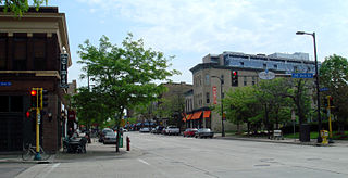
Frogtown is a neighborhood in Saint Paul in the U.S. state of Minnesota. Built around University Avenue, the Thomas-Dale neighborhood is colloquially known as Frogtown. Historically, Frogtown was a subsection of the current Thomas-Dale neighborhood. It is bordered by University Avenue on the south, the Burlington Northern Railroad tracks to the north, Lexington Parkway on the west and Rice Street on the east.

Grace University Lutheran Church is a church in Minneapolis, Minnesota, United States, adjacent to the University of Minnesota East Bank campus. The church was built in 1915–1917 by a Swedish Lutheran congregation to serve neighborhood families and university students. It was designed by Chapman and Magney and built in the Gothic Revival style.
The East Side Freedom Library is an independent, non-profit library in the East Side neighborhood of Saint Paul, Minnesota, United States. Founded in 2013 by Beth Cleary and Peter Rachleff, it has occupied the Arlington Hills Carnegie library building since leasing it from the city of Saint Paul in 2014. The library's collections and programming focus on the labor history and diverse immigrant communities of the neighborhood.
References
- ↑ District 2 – Greater East Side District Plan Retrieved February 1st, 2024
- ↑ Greater East Side at Niche.com Retrieved February 1st, 2024
- ↑ About Prosperity Park Retrieved February 1st, 2024
- ↑ Eastside Freedom Library Retrieved February 2nd, 2024
- ↑ Hmong-Americans in Minnesota: Overview Retrieved February 1st, 2024
- ↑ East Side Employment xChange Retrieved February 1st, 2024
- ↑ Greater East Side neighborhood data Retrieved February 1st, 2024