Greater Victoria

Last updated

Greater Victoria
Victoria BC Downtown skyline.jpg
Greater Victoria
Interactive Map of Greater Victoria, BC CMA [1]
Canada Vancouver Island location map.svg
Red pog.svg
Greater Victoria
Canada British Columbia location map 2.svg
Red pog.svg
Greater Victoria
Coordinates: 48°30′40″N123°24′47″W / 48.511°N 123.413°W / 48.511; -123.413
Country Flag of Canada (Pantone).svg  Canada
Province Flag of British Columbia.svg  British Columbia
Area
 (2021) [2]
  Total696.15 km2 (268.79 sq mi)
Population
 (2021) [2]
   CMA
397,237
   CMA density571.3/km2 (1,480/sq mi)
Gross Metropolitan Product
  Victoria CMA CA$22.5 billion (2020)< [3]
Time zone UTC-8 (PST)
  Summer (DST) UTC-7 (PDT)

Greater Victoria (also known as the Greater Victoria Region) is located in British Columbia, Canada, on the southern tip of Vancouver Island. It is usually defined as the thirteen municipalities of the Capital Regional District (CRD) on Vancouver Island as well as some adjacent areas and nearby islands.

Contents

The Capital Regional District administers some aspects of public administration for the whole metro region; other aspects are administered by the individual member municipalities of Greater Victoria. Roughly, Greater Victoria consists of all land and nearby islands east of a line drawn from the southern end of Finlayson Arm to the eastern shore of Sooke Harbour, along with some lands on the northern shore of Sooke Harbour.

Many places, buildings, and institutions associated with Victoria such as the University of Victoria, Victoria International Airport, and the Swartz Bay Ferry Terminal, are outside the City of Victoria itself, which has an area of just 19.5 square kilometres (7.5 sq mi) on the southern tip of Greater Victoria. Victoria is the locality indicated in the mailing addresses of several CRD municipalities and localities adjacent to Victoria. The central city of Victoria lends its name and cultural influence to many places and organizations in the metro region.

Municipalities

There are 13 cities, towns, and district municipalities in Greater Victoria.

"Core" municipalities
West Shore
Saanich Peninsula

This breakdown is roughly mirrored by the three school districts in Greater Victoria.

Greater Victoria is the southernmost urban area in Western Canada; it is located south of the 49th parallel.

Neighbourhoods

This list is similar to, but not identical with, that used by the Greater Victoria real estate sales industry. Neighbourhoods with official status are italicized. Others may have no official definition, hence other lists of neighbourhoods in the Victoria area may differ. Other sources may give different boundaries as well.

Climate

Climate data for Victoria Phyllis Street, British Columbia (1971-2000)
MonthJanFebMarAprMayJunJulAugSepOctNovDecYear
Record high °C (°F)14.5
(58.1)
15.0
(59.0)
18.5
(65.3)
22.0
(71.6)
27.5
(81.5)
30.5
(86.9)
28.5
(83.3)
29.5
(85.1)
27.5
(81.5)
23.0
(73.4)
16.1
(61.0)
15.0
(59.0)
30.5
(86.9)
Mean daily maximum °C (°F)7.2
(45.0)
8.2
(46.8)
10.2
(50.4)
12.8
(55.0)
15.6
(60.1)
18.2
(64.8)
20.1
(68.2)
20.1
(68.2)
17.5
(63.5)
13.2
(55.8)
9.4
(48.9)
7.4
(45.3)
13.3
(56.0)
Daily mean °C (°F)5.5
(41.9)
6.1
(43.0)
7.5
(45.5)
9.5
(49.1)
11.9
(53.4)
14.2
(57.6)
15.7
(60.3)
15.8
(60.4)
13.9
(57.0)
10.6
(51.1)
7.5
(45.5)
5.7
(42.3)
10.3
(50.6)
Mean daily minimum °C (°F)3.7
(38.7)
4.0
(39.2)
4.8
(40.6)
6.2
(43.2)
8.1
(46.6)
10.1
(50.2)
11.3
(52.3)
11.4
(52.5)
10.1
(50.2)
8.0
(46.4)
5.6
(42.1)
4.0
(39.2)
7.3
(45.1)
Record low °C (°F)−8.0
(17.6)
−11.0
(12.2)
−4.0
(24.8)
0.6
(33.1)
3.0
(37.4)
5.6
(42.1)
8.0
(46.4)
7.0
(44.6)
5.0
(41.0)
−2.0
(28.4)
−10.5
(13.1)
−10.0
(14.0)
−11.0
(12.2)
Average precipitation mm (inches)102.2
(4.02)
76.7
(3.02)
51.5
(2.03)
36.1
(1.42)
34.2
(1.35)
25.5
(1.00)
16.1
(0.63)
23.8
(0.94)
25.9
(1.02)
66.9
(2.63)
130.8
(5.15)
109.2
(4.30)
698.9
(27.51)
Average rainfall mm (inches)99.4
(3.91)
72.7
(2.86)
50.9
(2.00)
36.1
(1.42)
34.2
(1.35)
25.5
(1.00)
16.1
(0.63)
23.8
(0.94)
25.9
(1.02)
66.7
(2.63)
129.0
(5.08)
105.8
(4.17)
686.1
(27.01)
Average snowfall cm (inches)2.8
(1.1)
4.0
(1.6)
0.2
(0.1)
0.0
(0.0)
0.0
(0.0)
0.0
(0.0)
0.0
(0.0)
0.0
(0.0)
0.0
(0.0)
0.2
(0.1)
1.9
(0.7)
3.4
(1.3)
12.5
(4.9)
Average precipitation days (≥ 0.2 mm)17.015.215.012.210.98.96.15.97.313.619.018.3149.4
Average rainy days (≥ 0.2 mm)16.714.915.012.210.98.96.15.97.313.618.817.7148
Average snowy days (≥ 0.2 cm)0.881.00.110.00.00.00.00.00.00.070.390.963.41
Source: Environment Canada [5]

Demographics

The Greater Victoria region has a combined population of 397,237 according to the 2021 Canadian census. [2] The region comprises two of the fifteen most populous municipalities in British Columbia (Saanich, at number seven, and Victoria at number thirteen). The Canadian Census ranks Greater Victoria as the 15th largest metropolitan area in Canada, by population. The combined population of the cities, municipalities, unincorporated areas and First-Nation Reserves in the region are as follows:

  1. Saanich 117,735
  2. Victoria 91,867
  3. Langford 46,584
  4. Colwood 18,961
  5. Oak Bay 17,990
  6. Esquimalt 17,533
  7. Central Saanich 17,385
  8. Sooke 15,086
  9. Sidney 12,318
  10. North Saanich 12,235
  11. View Royal 11,575
  12. Juan de Fuca (Part 1) 5,132
  13. Metchosin 5,067
  14. Highlands 2,482
  15. New Songhees 1A First-Nation Reserve 1,839
  16. East Saanich 2 First-Nation Reserve 1,790
  17. South Saanich 1 First-Nation Reserve 712
  18. Cole Bay 3 First-Nation Reserve 266
  19. T'Sou-ke First-Nation Reserve 230
  20. Becher Bay 1 First-Nation Reserve 221
  21. Esquimalt First-Nation Reserve 120
  22. Union Bay 4 First-Nation Reserve 109

Ethnicity

In comparison to the Lower Mainland (Vancouver and environs), the region does not have a great deal of racial diversity. Most of the population is of European descent. A substantial community of those of Chinese descent has existed in Greater Victoria since the Fraser Gold Rush of 1858–60, which saw the first significant influx, arriving first via San Francisco then directly from China. There is also a substantial First Nations (indigenous) population whose ancestors have lived in the area for thousands of years. Numerous First Nations reserves, forming distinct communities, exist in the region primarily on the Saanich Peninsula, in Esquimalt, and in the Western Communities although the majority of the First Nations population live off-reserve.

The largest ethnic groups in Greater Victoria, according to the 2016 census, [6] are:

  1. English - 140,510
  2. Scottish - 98,475
  3. Canadian - 86,000
  4. Irish - 73,170
  5. German - 50,440
  6. French - 38,775
  7. Ukrainian - 19,410
  8. Chinese - 17,825
  9. Dutch - 17,790
  10. First Nations - 15,430
  11. Welsh - 14,140
  12. Polish - 13,610
  13. Norwegian - 12,130
  14. Italian - 11,665
  15. Swedish - 9,380
  16. Indian - 9,180
  17. Russian - 8,565
  18. American - 8,485
  19. Metis - 7,135
  20. Filipino - 6,650

The same information, although grouped more geographically, is below. The largest sub-grouping is included.

European origins279,965 (includes 215,945 with British Isles origins)
Other North American origins92,140 (includes 86,000 Canadian)
Asian origins46,940 (includes 17,825 Chinese)
North American Aboriginal origins21,925 (includes 15,430 First Nations)
African origins5,070 (includes 1,140 South African)
Latin, Central and South American origins4,965 (includes 1,880 Mexican)
Oceania origins2,560 (includes 1,330 Australian)
Caribbean origins2,245 (includes 980 Jamaican)

Culture

Many Victoria Region municipalities have their own fairs: Oak Bay's Tea Party, Esquimalt's Buccaneer Days, Sidney's Sidney Days, Sooke's Sooke Days, Western Communities' Luxton Rodeo, and Central Saanich's Saanich Fair. The Saanich Fair is the oldest and largest of all the Greater Victoria local fair venues; it is considered a de facto regional fair because of its greater size, content, and famous reputation. The Saanich Fair has the largest number of attendees of all the Victoria area fairs.

There is a wide variety of entertainment and recreational facilities and activities. The mild coastal climate ensures less extreme weather changes. Outdoor and indoor recreational areas are abundant throughout the region. The Rifflandia Music Festival takes place downtown in mid to late September. The Victoria Tall Ships Festival showcase sailing vessels and the sailing life. The Victoria Symphony performs over 100 concerts a year, including the renowned Symphony Splash, an annual free concert in the Inner Harbour on the August Sunday preceding B.C Day. The orchestra is on a barge playing to an audience of over 40,000. The Electronic Music Festival also takes place at Centennial Square, where DJs can show off their music mixing skills.

These regional positive qualities, along with new transportation links, international high-profile events (2007 NATO meeting, 2007 FIFA U-20 World Cup, 1994 Commonwealth Games), could have helped produce a socio-economic effect in terms of: attractiveness as a place of residency, low unemployment, high real estate development potential for profit, increasing immigration of new people(s), and expanding opportunities for business or economic development. High-profile international attention performs its duty as a marketing, public relations, and sales catalyst for further activity. Boaters from around the world gather annually in the waters off of Vancouver Island for the Swiftsure International Yacht Race.

An example of this economic opportunity also lies in Victoria's geography. The April 19, 2008 Victoria Times Colonist newspaper printed a section, sponsored by the Downtown Victoria Business Association, focusing on the area's downtown selection of goods and service providers. As it was in the early days with merchants supplying and outfitting gold rush prospectors, today's modern merchants supply outdoor recreation seekers before they head to other parts of Vancouver Island for surfing, kayaking, hiking, camping, swimming, cycling or whatever activities they seek.

In June 2010, the Canadian Navy celebrated its 100th anniversary with a Fleet Review in the waters off of Greater Victoria, by Canada's former Governor General Michaëlle Jean. The review was attended by warships from Canada, France, New Zealand, Australia, Japan, the United States along with US and Canadian Coast Guard vessels. These celebration activities coincided with the Esquimalt Buccaneer Days Fair and the 2010 FIFA World Cup activities in local bars.

The 2010 Olympic Torch Relay started in Greater Victoria and proceeded to other communities across Canada. The conclusion of the torch relay began the 2010 Winter Olympics in Vancouver BC.

Victoria's world-famous Butchart Gardens are actually located in Central Saanich Sunken Garden.jpg
Victoria's world-famous Butchart Gardens are actually located in Central Saanich

Notable places

Educational institutions

Hospitals

Military installations

(Department of National Defence)

Parks and natural features

Scientific facilities

Sites of interest

Historical

Political

Cultural

Sports facilities

Golf

Other

Transportation and ports

Highways Greater Victoria is served by 3 provincial highways

Highway 17 Connects Greater Victoria to Victoria International Airport and BC Ferries service to Vancouver. A four lane highway with mix of freeway, expressway and arterial standards.

Highway 1 (Trans Canada Highway) Connects the core eastern municipalities to the western municipalities as a 12km freeway with 7 interchanges.

Highway 14 Connects Greater Victoria to Sooke, mostly a two lane highway.

Ports

Media outlets

Print

Social Media Communities

AM Radio

FM Radio

Television

Regional organisations

See also

Related Research Articles

<span class="mw-page-title-main">Victoria, British Columbia</span> Capital city of British Columbia, Canada

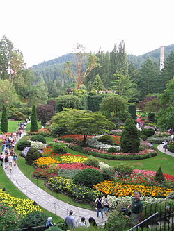
Victoria is the capital city of the Canadian province of British Columbia, on the southern tip of Vancouver Island off Canada's Pacific coast. The city has a population of 91,867, and the Greater Victoria area has a population of 397,237. The city of Victoria is the seventh most densely populated city in Canada with 4,406 inhabitants per square kilometre (11,410/sq mi).

British Columbia Highway 14, named the West Coast (Sooke) Highway is the southernmost numbered route in the province of British Columbia. An east–west highway on the southwestern coast of Vancouver Island in the Capital Regional District, it is sometimes known as the Juan de Fuca Highway, as well as Sooke Road, Sooke being one of the largest communities that the highway passes through. Highway 14 first opened in 1953, extending west from Colwood, a suburb of Victoria, to the coastal community of Jordan River, and was extended all the way west to the remote community of Port Renfrew by 1975. The highway's eastern terminus was relocated to northern Langford in 2002.

<span class="mw-page-title-main">Sooke</span> District municipality in British Columbia, Canada

Sooke is a district municipality on the southern tip of Vancouver Island, Canada, 38 kilometres (24 mi) by road from Victoria, the capital of British Columbia. Sooke, the westernmost of Greater Victoria's Western Communities, is to the north and west of the Sooke Basin. It is a regional centre for residents in neighbouring communities, including Otter Point, Shirley and Jordan River.

<span class="mw-page-title-main">Index of British Columbia–related articles</span>

The following is an alphabetical list of articles related to the Canadian province of British Columbia.

<span class="mw-page-title-main">Langford, British Columbia</span> City in British Columbia, Canada

Langford is a city on southern Vancouver Island in the province of British Columbia, Canada. Langford is one of the 13 component municipalities of Greater Victoria and is within the Capital Regional District. Langford was incorporated in 1992 and has a population of over 40,000 people. Its municipal neighbours are Colwood to the southeast, Highlands to the north, Metchosin to the southwest, and View Royal to the northeast.

<span class="mw-page-title-main">Colwood, British Columbia</span> City in British Columbia, Canada

Colwood is a city located on Vancouver Island to the southwest of Victoria, capital of British Columbia, Canada. Colwood was incorporated in 1985 and has a population of approximately 19,000 people. Colwood lies within the boundaries of the Greater Victoria area or Capital Regional District, in a region called the Western Communities, or the West Shore. It is one of the 13 component municipalities of Greater Victoria.

<span class="mw-page-title-main">Galloping Goose Regional Trail</span> Rail trail in British Columbia, Canada

The Galloping Goose Regional Trail is a 55-kilometre (34 mi) rail trail between Victoria, British Columbia, Canada, and the ghost town of Leechtown, north of Sooke, where it meets the old Sooke Flowline. Maintained by the Capital Regional District (CRD), the trail forms part of the Trans-Canada Trail, and intersects the Lochside Regional Trail. The section from Harbour Road in Esquimalt to the Veterans Memorial Parkway in Langford is also part of the Vancouver Island Trail.

<span class="mw-page-title-main">Victoria Regional Transit System</span> Transit system of Greater Victoria, British Columbia, Canada

The Victoria Regional Transit System provides public transportation in the Greater Victoria region of British Columbia, Canada. Its operations are governed by the Victoria Regional Transit Commission in association with BC Transit. There were more than 16.8 million riders in 2021.

Saanich Peninsula is located north of Victoria, British Columbia, Canada. It is bounded by Saanich Inlet on the west, Satellite Channel on the north, the small Colburne Passage on the northeast, and Haro Strait on the east. The exact southern boundary of what is referred to as the "Saanich Peninsula" is somewhat fluid in local parlance.

The Western Communities, also called the West Shore or Westshore, is the suburban municipalities of Colwood, Langford, Metchosin and The Highlands, Langford and unincorporated districts west of Esquimalt Harbour and Portage Inlet, and south of the Malahat in the Capital Regional District of British Columbia, Canada. The Town of View Royal, which straddles Esquimalt Harbour, may also be included. It is an area of growing residential subdivisions and commercial centres.

<span class="mw-page-title-main">Randall Garrison</span> Canadian politician

Randall C. Garrison is a Canadian politician. Elected to the House of Commons in the 2011 federal election, he represents the electoral district of Esquimalt—Saanich—Sooke and is a member of the New Democratic Party. He serves as the party's critic for lesbian, gay, bisexual, and transgender issues, succeeding former MP Bill Siksay, and for National Defence. Since becoming an MP, he has introduced legislation to amend the Canadian Human Rights Act and the Criminal Code, return federal environmental protection to the Goldstream River, and lobbied the government to implement an action plan concerning the endangered Southern resident killer whales. A former criminology and political science instructor at Camosun College, Garrison is openly gay and lives in Esquimalt, British Columbia, with his partner, Teddy Pardede.

Happy Valley is an unincorporated settlement in the Western Communities area of Greater Victoria on southern Vancouver Island in British Columbia, Canada. Happy Valley, which is located south of Glen Lake and west of Triangular Hill, had its own post office from 1896 to 1922.

<span class="mw-page-title-main">Greater Victoria Film Commission</span>

The Vancouver Island South Film and Media Commission (VISFMC) was established as a non-profit organization in 1996 with the objective to promote the Southern Vancouver Island as an international filming destination.

<span class="mw-page-title-main">Esquimalt—Saanich—Sooke</span> Federal electoral district in British Columbia, Canada

Esquimalt—Saanich—Sooke is a federal electoral district in Greater Victoria, on the southern tip of Vancouver Island in British Columbia, Canada.

An electoral redistribution in British Columbia was undertaken by the BC Electoral Boundaries Commission beginning in 2014 and was formalized by the passage of Bill 42, the 2015 Electoral Districts Act, during the 40th British Columbia Parliament. The act came into effect on November 17, 2015. The redistribution added two seats to the previous total, increasing the number of MLAs in the province from 85 to 87. The electoral boundaries came into effect for the 2017 election. The next redistribution is required to occur following the 2020 British Columbia general election.

<span class="mw-page-title-main">2022 British Columbia municipal elections</span>

The 2022 British Columbia municipal elections were held on 15 October 2022. Municipal elections took place in all municipalities and regional district electoral areas in the Canadian province of British Columbia to elect mayors, school board trustees, rural directors and city councillors. Elections BC administered campaign financing, disclosure and advertisement of candidates; however, voting, ballots and candidate nominations were administered by each jurisdiction's local electoral officer.

An electoral redistribution in British Columbia is underway by the BC Electoral Boundaries Commission. On October 21, 2021, the Government of British Columbia appointed Justice Nitya Iyer, Linda Tynan and Chief Electoral Officer Anton Boegman to serve as the 2021 commissioners. Justice Iyer was appointed the chair.

References

  1. The Juan de Fuca (Part 1) RDA and three Indian reserves could not be presented on the interactive map due to wikidata code unavailable on OpenStreetMap application,
  2. 1 2 3 "Census Profile, 2021 Census, Victoria [Census metropolitan area], British Columbia and British Columbia [Province]". Statistics Canada. February 9, 2022. Retrieved February 11, 2022.
  3. "Statistics Canada. Table 36-10-0468-01 Gross domestic product (GDP) at basic prices, by census metropolitan area (CMA) (x 1,000,000)". Statistics Canada.
  4. Neighbourhoods | Victoria Archived January 1, 2014, at the Wayback Machine . Victoria.ca (2012-10-04). Retrieved on 2013-07-12.
  5. "Canadian Climate Normals 1971-2000". Government of Canada. Retrieved May 19, 2016.
  6. Census Profile, 2016 Census: Victoria (Census metropolitan area), British Columbia and British Columbia (Province). Statistics Canada. Retrieved on 2017-12-30.