Related Research Articles
The Cape Cod National Seashore (CCNS) encompasses 43,607 acres on Cape Cod, in Massachusetts. CCNS was created on August 7, 1961, by President John F. Kennedy, when he signed a bill enacting the legislation he first co-sponsored as a Senator a few years prior. It includes ponds, woods and beachfront of the Atlantic coastal pine barrens ecoregion. The CCNS includes nearly 40 miles (64 km) of seashore along the Atlantic-facing eastern shore of Cape Cod, in the towns of Provincetown, Truro, Wellfleet, Eastham, Orleans and Chatham. It is administered by the National Park Service.

In the United States, a conservation easement is a power invested in a qualified land conservation organization called a "land trust", or a governmental entity to constrain, as to a specified land area, the exercise of rights otherwise held by a landowner so as to achieve certain conservation purposes. It is an interest in real property established by agreement between a landowner and land trust or unit of government. The conservation easement "runs with the land", meaning it is applicable to both present and future owners of the land. The grant of conservation easement, as with any real property interest, is part of the chain of title for the property and is normally recorded in local land records.
This is an index of conservation topics. It is an alphabetical index of articles relating to conservation biology and conservation of the natural environment.

Conroe is a city in and the county seat of Montgomery County, Texas, United States, about 40 miles (64 km) north of Houston. It is a principal city in the Houston–The Woodlands–Sugar Land metropolitan area.
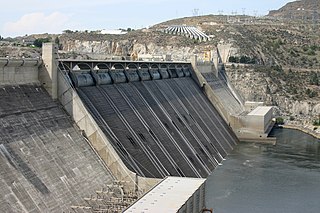
Land use planning is the process of regulating the use of land by a central authority. Usually, this is done to promote more desirable social and environmental outcomes as well as a more efficient use of resources. More specifically, the goals of modern land use planning often include environmental conservation, restraint of urban sprawl, minimization of transport costs, prevention of land use conflicts, and a reduction in exposure to pollutants. In the pursuit of these goals, planners assume that regulating the use of land will change the patterns of human behavior, and that these changes are beneficial. The first assumption, that regulating land use changes the patterns of human behavior is widely accepted. However, the second assumption - that these changes are beneficial - is contested, and depends on the location and regulations being discussed.

Wicken Fen is a 254.5-hectare (629-acre) biological Site of Special Scientific Interest west of Wicken in Cambridgeshire. It is also a National Nature Reserve, and a Nature Conservation Review site. It is protected by international designations as a Ramsar wetland site of international importance, and part of the Fenland Special Area of Conservation under the Habitats Directive.

The Midstate Trail is a scenic footpath which runs 92 miles (148 km) through Worcester County, Massachusetts, from the Rhode Island border to the New Hampshire border, approximately 45 miles (72 km) west of Boston. The trail is considered highly accessible, scenic, and remarkably rural despite its proximity to urban Boston. The trail includes the summits of Mount Wachusett and Mount Watatic, as well as many interesting geologic, historic, and natural features.

The Urban Land Institute, or ULI, is a global nonprofit research and education organization with regional offices in Washington, D.C., Hong Kong, and London. ULI aims to help its members and their partners build more equitable, sustainable, healthy and resilient communities.

Edington is a rural village, situated on the north side of the Polden Hills in Somerset, England.
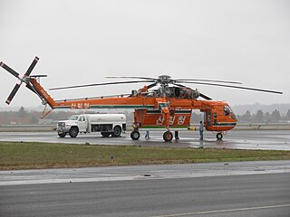
The Korea Forest Service is a central administrative agency under the Ministry of Agriculture, Food and Rural Affairs (MAFR), responsible for protecting and nurturing forests, increasing forest resources, developing forest products, conducting research on forest management and improvement, and is located in Daejeon Government Complex. In the past, during the national forestation campaign from 1973 to 1986, it was temporarily under the Ministry of Home Affairs, but returned to the Ministry of Agriculture, Forestry and Fisheries in 1987. However, as the agency's work was focused solely on maintaining and managing successful national forestation policies, questions were raised about its necessity for a period of time. Currently, the agency has transformed its identity into one that strives to generate continuous income through forest resources.
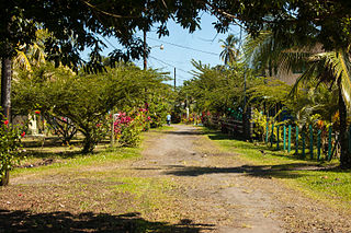
Conservation development, also known as conservation design, is a controlled-growth land use development that adopts the principle for allowing limited sustainable development while protecting the area's natural environmental features in perpetuity, including preserving open space landscape and vista, protecting farmland or natural habitats for wildlife, and maintaining the character of rural communities. A conservation development is usually defined as a project that dedicates a minimum of 50 percent of the total development parcel as open space. The management and ownership of the land are often formed by the partnership between private land owners, land-use conservation organizations and local government. It is a growing trend in many parts of the country, particularly in the Western United States. In the Eastern United States, conservation design has been promoted by some state and local governments as a technique to help preserve water quality.

The Trust for Public Land is a U.S. nonprofit organization with a mission to "create parks and protect land for people, ensuring healthy, livable communities for generations to come". Since its founding in 1972, the Trust for Public Land has completed 5,000 park-creation and land conservation projects across the United States, protected over 3 million acres, and helped pass more than 500 ballot measures—creating $70 billion in voter-approved public funding for parks and open spaces. The Trust for Public Land also researches and publishes authoritative data about parks, open space, conservation finance, and urban climate change adaptation. Headquartered in San Francisco, the organization is among the largest U.S. conservation nonprofits, with approximately 30 field offices across the U.S., including a federal affairs function in Washington, D.C.
American Farmland Trust (AFT) is a non-profit organization in the United States with a mission to protect farmland, promote environmentally sound farming practices, and keep farmers on the land. AFT is staffed by farmers, policy experts, researchers, and scientists, and governed by a board of directors. Its headquarters are in Washington, D.C., and it has regional offices throughout the country. AFT also runs the Farmland Information Center, an online collection of information on farmland and ranchland protection and stewardship established as a public-private partnership with the USDA Natural Resources Conservation Service.
The Sanctuary Forest is a non-profit conservation land trust in the Mattole River headwaters on the northern California coast. Established in 1987, as a community effort, its goal was to preserve a 2000-year-old redwood named “Big Red." The area also contains spawning grounds for Chinook salmon and steelhead in a tributary of the river.
Pacific Forest Trust is an accredited non-profit conservation land trust that advances forest conservation and stewardship solutions. Its mission is to sustain America's forests for their public benefits of wood, water, wildlife, and people's wellbeing, in cooperation with landowners and communities.
The Big Sur Land Trust is a private 501(c)(3) non-profit located in Monterey, California, that has played an instrumental role in preserving land in California's Big Sur and Central Coast regions. The trust was the first to conceive of and use the "conservation buyer" method in 1989 by partnering with government and developers to offer tax benefits as an inducement to sell land at below-market rates. Since 1978, with the support of donors, funders and partners, it has conserved over 40,000 acres through conservation easements, acquisition and transfer of land to state, county and city agencies. It has placed conservation easements on 7,000 acres and has retained ownership of over 4,000 acres.

The Department of Biodiversity, Conservation and Attractions (DBCA) is the Western Australian government department responsible for managing lands and waters described in the Conservation and Land Management Act 1984, the Rottnest Island Authority Act 1987, the Swan and Canning Rivers Management Act 2006, the Botanic Gardens and Parks Authority Act 1998, and the Zoological Parks Authority Act 2001, and implementing the state's conservation and environment legislation and regulations. The Department reports to the Minister for Environment and the Minister for Tourism.
References
- ↑ "Living Melbourne: Greenprinting a Metropolis". The Nature Conservatory. Retrieved 14 March 2024.