Grover Beach, California | |
---|---|
City of Grover Beach | |
Motto: "A great place to spread your wings" [1] | |
Coordinates: 35°7′15″N120°37′10″W / 35.12083°N 120.61944°W | |
Country | United States |
State | California |
County | San Luis Obispo |
Incorporated | December 21, 1959 [2] |
Named for | D.W. Grover |
Government | |
• Type | Council–manager [3] |
• Body | Grover Beach City Council |
• Mayor | Karen Bright [4] |
• City Manager | Matthew Bronson [5] |
• Council Members [4] | List |
• Assemblymember | Dawn Addis (D) |
• State Senator | John Laird (D) [6] |
Area | |
• Total | 2.32 sq mi (6.00 km2) |
• Land | 2.31 sq mi (5.99 km2) |
• Water | 0.00 sq mi (0.01 km2) 0.19% |
Elevation | 59 ft (18 m) |
Population | |
• Total | 12,701 |
• Density | 5,493.5/sq mi (2,121.1/km2) |
Time zone | UTC-8 (Pacific) |
• Summer (DST) | UTC-7 (PDT) |
ZIP codes | 93433, 93483 |
Area code | 805 |
FIPS code | 06-31393 |
GNIS feature ID | 1652833 |
Website | www |
Grover Beach is a city in San Luis Obispo County, California, United States. The population was 12,701 at the 2020 census, down from 13,156 in 2010. Grover Beach is the location of the Pacific Crossing cable Landing station. This is where trans-pacific submarine communications cables come ashore and interface with the North American telecom network. [10]
Grover Beach was originally known as Town of Grover, which was founded on August 1, 1887. The town was named for its founder, D.W. Grover. [11]
Grover filed his plans at the San Luis Obispo County Court House and eventually founded what was to be known as City of Grover City. There was a popular vote that allowed incorporating on December 21, 1959, as City of Grover City. However, the name seemed redundant so some people sought better names, especially ocean-oriented names. In 1992, there was another popular vote, in which the town's name was officially changed from "City of Grover City" to "Grover Beach" to emphasize the seaside location. [12]
Grover Beach is part of the 5 Cities Metropolitan Area. The "5 Cities" includes 3 cities; Grover Beach, Pismo Beach, and Arroyo Grande along with Oceano and Shell Beach (part of Pismo Beach). The city extends from Arroyo Grande in the east to Pismo State Beach.
According to the United States Census Bureau, the city has a total area of 2.3 square miles (6.0 km2), of which 99.81% is land and 0.19% is water.
This region experiences warm and dry summers, with no average monthly temperatures above 71.6 °F. According to the Köppen Climate Classification system, Grover Beach has a warm-summer Mediterranean climate, abbreviated "Csb" on climate maps. [13]
Climate data for Grover Beach, California | |||||||||||||
---|---|---|---|---|---|---|---|---|---|---|---|---|---|
Month | Jan | Feb | Mar | Apr | May | Jun | Jul | Aug | Sep | Oct | Nov | Dec | Year |
Mean daily maximum °F (°C) | 61.5 (16.4) | 62.3 (16.8) | 63.6 (17.6) | 66.4 (19.1) | 68.7 (20.4) | 71.1 (21.7) | 72.6 (22.6) | 74.0 (23.3) | 74.1 (23.4) | 72.1 (22.3) | 67.3 (19.6) | 61.6 (16.4) | 67.9 (19.9) |
Mean daily minimum °F (°C) | 42.9 (6.1) | 44.3 (6.8) | 45.6 (7.6) | 46.7 (8.2) | 48.8 (9.3) | 51.8 (11.0) | 54.3 (12.4) | 54.7 (12.6) | 54.1 (12.3) | 51.1 (10.6) | 46.6 (8.1) | 42.3 (5.7) | 48.6 (9.2) |
Average precipitation inches (mm) | 3.44 (87) | 3.53 (90) | 3.23 (82) | 1.05 (27) | 0.37 (9.4) | 0.06 (1.5) | 0.03 (0.76) | 0.02 (0.51) | 0.31 (7.9) | 0.69 (18) | 1.55 (39) | 2.47 (63) | 16.75 (426.07) |
Source 1: [14] | |||||||||||||
Source 2: [15] |
Census | Pop. | Note | %± |
---|---|---|---|
1960 | 5,210 | — | |
1970 | 5,939 | 14.0% | |
1980 | 8,827 | 48.6% | |
1990 | 11,656 | 32.0% | |
2000 | 13,067 | 12.1% | |
2010 | 13,156 | 0.7% | |
2020 | 12,701 | −3.5% | |
2022 (est.) | 12,619 | [16] | −0.6% |
U.S. Decennial Census [17] |
At the 2010 census Grover Beach had a population of 13,156. The population density was 5,684.2 inhabitants per square mile (2,194.7/km2). The racial makeup of Grover Beach was 9,964 (75.7%) White, 146 (1.1%) African American, 186 (1.4%) Native American, 542 (4.1%) Asian, 35 (0.3%) Pacific Islander, 1,582 (12.0%) from other races, and 701 (5.3%) from two or more races. Hispanic or Latino of any race were 3,840 persons (29.2%). [18]
The census reported that 12,967 people (98.6% of the population) lived in households, 185 (1.4%) lived in non-institutionalized group quarters, and 4 (0.0%) were institutionalized.
There were 5,111 households, 1,656 (32.4%) had children under the age of 18 living in them, 2,178 (42.6%) were opposite-sex married couples living together, 735 (14.4%) had a female householder with no husband present, 335 (6.6%) had a male householder with no wife present. There were 428 (8.4%) unmarried opposite-sex partnerships, and 54 (1.1%) same-sex married couples or partnerships. 1,330 households (26.0%) were one person and 439 (8.6%) had someone living alone who was 65 or older. The average household size was 2.54. There were 3,248 families (63.5% of households); the average family size was 3.04.
The age distribution was 2,928 people (22.3%) under the age of 18, 1,264 people (9.6%) aged 18 to 24, 3,809 people (29.0%) aged 25 to 44, 3,603 people (27.4%) aged 45 to 64, and 1,552 people (11.8%) who were 65 or older. The median age was 36.9 years. For every 100 females, there were 95.7 males. For every 100 females age 18 and over, there were 93.6 males.
There were 5,748 housing units at an average density of 2,483.5 per square mile, of the occupied units 2,390 (46.8%) were owner-occupied and 2,721 (53.2%) were rented. The homeowner vacancy rate was 2.0%; the rental vacancy rate was 3.7%. 5,719 people (43.5% of the population) lived in owner-occupied housing units and 7,248 people (55.1%) lived in rental housing units.
At the 2000 census there were 13,067 people in 5,023 households, including 3,305 families, in the city. The population density was 5,637.4 inhabitants per square mile (2,176.6/km2). There were 5,382 housing units at an average density of 2,321.9 per square mile (896.5/km2). The racial makeup of the city was 79.75% White, 1.03% African American, 1.69% Native American, 3.75% Asian, 0.30% Pacific Islander, 9.23% from other races, and 4.25% from two or more races. Hispanic or Latino of any race were 22.51%. [19]
Of the 5,023 households 32.8% had children under the age of 18 living with them, 46.9% were married couples living together, 14.1% had a female householder with no husband present, and 34.2% were non-families. 24.6% of households were one person and 8.2% were one person aged 65 or older. The average household size was 2.58 and the average family size was 3.07.
The age distribution was 25.6% under the age of 18, 9.1% from 18 to 24, 32.0% from 25 to 44, 21.7% from 45 to 64, and 11.5% 65 or older. The median age was 35 years. For every 100 females, there were 94.1 males. For every 100 females age 18 and over, there were 89.9 males.
The median household income was $38,087 and the median family income was $41,859. Males had a median income of $31,045 versus $26,506 for females. The per capita income for the city was $18,812. About 8.8% of families and 11.3% of the population were below the poverty line, including 12.0% of those under age 18 and 8.1% of those age 65 or over.
In the California State Legislature, Grover Beach is in the 17th Senate District , represented by Democrat John Laird, and in the 30th Assembly District , represented by Democrat Dawn Addis. [20]
In the United States House of Representatives, Grover Beach is in California's 24th congressional district , represented by Democrat Salud Carbajal. [21]
The Grover Beach station is the only rail station in the five cities area, and is located at the intersection of Grand Avenue and State Highway 1, adjacent to Pismo State Beach.
Amtrak Thruway 18 provides a daily connection to Visalia on the east, and Santa Maria on the west, with several stops in between. [22] These buses depart from the stop situated directly across the tracks.
San Luis Obispo Regional Transit Authority operates additional bus lines that run from Grover Beach to most cities in San Luis Obispo county, as well as Santa Maria.
San Luis Obispo County, officially the County of San Luis Obispo, is a county on the Central Coast of California. As of the 2020 census, the population was 282,424. The county seat is San Luis Obispo.
Hawaiian Gardens is a city in Los Angeles County, California, United States. It is the smallest city in the county in area and was incorporated on April 9, 1964. The population was 14,149 at the 2020 census, down slightly from 14,254 at the 2010 census.
Laguna Woods is a city in Orange County, California, United States. The population was 17,644 at the 2020 census, up from 16,192 at the 2010 census, with a median age of 74.5.
Westminster is a city in western Orange County, California, United States. Westminster was founded in 1870 by Rev. Lemuel Webber as a Presbyterian temperance colony and was incorporated in 1957.
Highland is a city in San Bernardino County, California, United States. The city's population was 56,999 at the 2020 census.
Lemon Grove is a city in San Diego County, California, United States. The population was 27,627 at the 2020 census, up from 25,320 at the 2010 census.
Arroyo Grande is a city in San Luis Obispo County, California, United States. The population was 18,441 as of the 2020 census, up from 17,252 as of the 2010 Census.
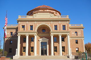
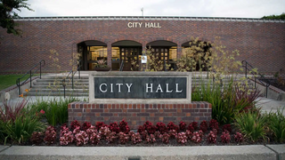
Atascadero is a city in San Luis Obispo County, California, United States, located on U.S. Route 101. Atascadero is part of the San Luis Obispo-Paso Robles metropolitan statistical area, which encompasses the extents of the county. Atascadero is farther inland than most other cities in the county, and as a result, usually experiences warmer, drier summers, and cooler winters than other nearby cities such as San Luis Obispo and Pismo Beach. The main freeway through town is U.S. 101. The nearby State Routes 41 and 46 provide access to the Pacific Coast and the Central Valley of California.
Cayucos is an unincorporated coastal town in San Luis Obispo County, California, along California State Route 1 between Cambria to the north and Morro Bay to the south. The population was 2,505 at the 2020 census, down from 2,592 at the 2010 census.
Lake Nacimiento is a census-designated place (CDP) in northern San Luis Obispo County, California, United States.
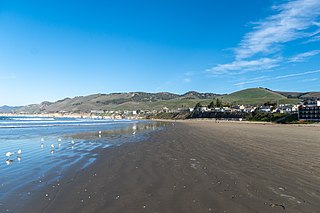
Morro Bay is a seaside city in San Luis Obispo County, California. Located on the Central Coast of California, the city population was 10,757 as of the 2020 census, up from 10,234 at the 2010 census. The town overlooks Morro Bay, a natural embayment with an all-weather small craft commercial and recreational harbor.
Nipomo is an unincorporated town in San Luis Obispo County, California, United States. The population was 16,714 for the 2010 census and grew to 18,176 for the 2020 census. For statistical purposes, the United States Census Bureau has defined Nipomo as a census-designated place (CDP).
Oceano is a census-designated place (CDP) in San Luis Obispo County, California, United States. The population was 7,183 at the 2020 census, down from 7,286 at the 2010 census.
Pismo Beach is a city in the southern portion of San Luis Obispo County, in the Central Coast area of California, United States. Its estimated population was 8,072 at the 2020 census, up from 7,655 in the 2010 census. It is part of the Five Cities area, a cluster of cities in that area. The Five Cities area historically is made up of Arroyo Grande, Grover City, Halcyon, Fair Oaks, and Nipomo. Now most people refer to the Five Cities as Grover Beach, Pismo Beach, Shell Beach, Arroyo Grande, and Oceano.
Moss Beach is a coastal census-designated place in San Mateo County, California, with a year 2020 census population of 3,214. Located in Moss Beach are the Fitzgerald Marine Reserve, a marine sanctuary; the Half Moon Bay Airport, the historic Moss Beach Distillery; and the Seal Cove Inn, a destination lodging property. Moss Beach is a cool coastal microclimate that gives one a sense of separation from the nearby metropolitan San Francisco Bay Area and assures that summer temperatures are generally mild.
Carpinteria is a small seaside city in southeastern Santa Barbara County, California. Located on the Central Coast of California, it had a population of 13,264 at the 2020 census. Carpinteria is a popular surf destination; the city embraced the slogan "World's Safest Beach" in 1912, which it still uses today.
Ida Grove is a city in Ida County, Iowa, United States. The population was 2,051 at the time of the 2020 census. It is the county seat of Ida County.
Salton Sea Beach is a census-designated place (CDP) in Imperial County, California, located 2.5 miles (4 km) southeast of Desert Shores. The population was 508 at the 2020 census, up from 422 at the 2010 census, up from 392 at the 2000 census. It is part of the El Centro, California Metropolitan Statistical Area. It was the location of the Naval Auxiliary Air Station Salton Sea.
Del Monte Forest is a census-designated place (CDP) in Monterey County, California, United States. As of the 2020 census, the CDP had a total population of 4,204, down from 4,514 at the 2010 census. The census area includes the separate well-known community of Pebble Beach.
North Myrtle Beach is a city in Horry County, South Carolina, United States. It was created in 1968 from four existing municipalities, and is located about 15 miles (24 km) northeast of Myrtle Beach. It serves as one of the primary tourist destinations along the Grand Strand.