Harden Beck

Last updated

Harden Beck
Waterfall, Harden Beck - geograph.org.uk - 387252.jpg
Goit Stock Waterfall in Goit Stock Wood
Location
Country England
Counties West Yorkshire
District Bradford
Physical characteristics
Source 
  location Hewenden Reservoir, West Yorkshire
Mouth  
  location
Beckfoot, Bingley, West Yorkshire
Length14.55 km (9.04 mi)
Basin size33.228 [1]  km2 (12.829 sq mi)
Discharge 
  location River Aire
Basin features
Tributaries 
  leftCow House Beck, Midgram Beck
  rightMytholmes Beck

Harden Beck is a stream that flows from Hewenden Reservoir, over Goit Stock Waterfall to the River Aire in Bingley, West Yorkshire. The route starts out further up the valley as Denholme Beck, Hewenden Beck and Hallas Beck. Its waters are fed by Thornton Moor Reservoir, Stubden Reservoir, Doe Park Reservoir and Hewenden Reservoir.

Contents

Harden Beck is an overflow channel of Glacial Erosion which was carved out during the last ice age. [2] The section after the waterfall down to the bridge under the road to Wilsden, is locally referred to as 'The Hidden Valley.' [3]

Mapping lists Harden Beck as starting where Hallas Beck and Cow House Beck meet, but documents from Bradford Council and the Yorkshire Invasive Species Forum list the beck as starting at the dam head from Hewenden reservoir [4] [5]

In his book, Chronicles of Old Bingley, Harry Speight says that the Beck does start at the confluence of Hallas and Cow House Becks and that Harden Beck was a dividing line in the parishes, deaneries and the Wapentakes. [6]

History

In a book on the place names of West Yorkshire, Harden and Harden Beck are listed as Heredene, Heredenbroc and Hardenbrok which translates as either Rock Valley or Hare Valley Beck. [7] In the Topographical Dictionary of England, Lewis describes the Beck as "powerful Harden Beck, which abounds with trout, runs through a hamlet, and propels the machinery of three worsted mills in which the greater part of the population is employed." [8]

There were actually six mills on the beck; (from upstream down) Hewenden Mill, Bents Mill, Hallas Bridge Mill, Goit Stock Mill, Harden Bridge Mill and Beckfoot Mill. Hewenden, Bents and Beckfoot mills [9] have all since been converted into private accommodation buildings. Hallas Bridge Mill was destroyed by fire. Goit Stock Mill was later utilised as a café and ballroom. It too burnt down (in 1927) with no reports of casualties. Its chimney and flue are still extant, with the chimney being built on the northern ridge to aid the dispersal of smoke from the narrow valley. [10] [11] Harden Bridge Mill is still in private use as a printers.

Hewenden Reservoir was built as a compensation reservoir for the mill owners on Harden Beck who demanded a structure of its type when the Bradford Corporation started abstracting water from Manywells Spring to their reservoirs, 7 miles (11 km) away at Chellow Dean. [12]

Description of route

The watercourse starts at the eastern edge of the A629 Keighley to Halifax road in Denholme. Here, several springs feed Denholme beck which flows into Doe Park Reservoir. Doe Park is also fed by Stubden and Thornton Moor reservoirs via Stubden Beck. [13] The outflow from the reservoir flows northwards into Hewenden Reservoir, where it in turns flows north eastwards as Hewenden Beck as far as Hallas Bridge where it becomes Hallas Beck. On entering Goit Stock Wood, the course becomes Harden Beck at the confluence of Cow House Beck and Hallas Beck. [14]

Form here it flows mostly eastwards with Midgram Beck and Mytholmes Beck joining the course adjacent to Ruin Bank Wood. The Beck skirts the northern edge of Shipley Golf Course, through the ford and then under the bridge at Beckfoot before joining the River Aire in Bingley.

Bridges

Hewenden Viaduct is to the immediate north east of the dam head of Hewenden Reservoir and was built by the Great Northern Railway in 1884 [15] and after the railway closed became part of the Great Northern Trail. [16] Hallas and Goit Stock have footbridges. There is a bridge over the beck by The Malt Shovel Public House in Harden which links Harden village with Wilsden. This bridge is a Grade II listed structure from the 18th century. [17]

Where the Beck curves between Ruin Bank Wood and Harden Grange is a Grade II listed footbridge. The footbridge is on the north west corner of Shipley Golf Course and was listed in 1974. [18]

Another Grade II listed crossing is Beckfoot Bridge. It was listed in 1974 [19] and spans the beck just before it enters into the right fork of the River Aire in Bingley. The bridge here dates from at least 1723 and is a Packhorse Bridge. [20] There is a ford adjacent as the bridge is only wide enough for a single horse. The ford is deceptively deep and the water is fast flowing. People have had their vehicles washed downstream whilst trying to cross here and it would be unwise to cross, even in a 4 x 4. [21]

Ecology and environment

The beck flows through Goit Stock Wood, which is known for being a good example of broadleaf woodland. The water cascades over Goit stock waterfall which is 20 ft (6.1 m) high. [22] The waterfall was known as Hallas Lumb until the early 1820s when its name was changed to Goit Stock. [23]

The beck has seen pollution over its history, but trout and crayfish have been observed in the water. [24] Goit Stock Woods and Harden Beck are listed as an SEGI (Site of Ecological and Geological Importance) by Bradford Council. [25] The beck is subject to the invasive plants of Himalayan Balsam and Japanese Knotweed in a 0.5 km section upstream of Harden Beck Bridge in Harden village. [4]

In 2017, the weir at Beckfoot Mill was removed in the central portion to allow grayling to navigate upstream. As the mill is now private dwellings, its goit was no longer necessary and as the weir was a barrier to fish passage, it was cut open. [26]

The beck is not navigable to boats at any point. The reservoirs upstream are deep and wide enough to allow boating, although there is no evidence of this on Hewenden Reservoir.

Literary connections

Harden Beck was home to John Nicholson, The Airedale Poet, in the early nineteenth century. He was often out walking alongside the beck, looking for inspiration. [27] He is said to have written many works beside the beck and by Goit Stock Waterfall, which he often visited in the dead of night. [23]

In 2012, as part of the Ilkley literature festival, the walk alongside Harden Beck became part of the Stanza Stones Poetry Trail. Developed by poet Simon Armitage and Tom Lonsdale, the walk takes in 47 miles (76 km) across moorland and water to inspire walkers. [28]

Related Research Articles

<span class="mw-page-title-main">Bingley</span> Town in West Yorkshire, England

Bingley is a market town and civil parish in the metropolitan borough of the City of Bradford, West Yorkshire, England, on the River Aire and the Leeds and Liverpool Canal, which had a population of 18,294 at the 2011 Census.

<span class="mw-page-title-main">River Don, Yorkshire</span> River in South Yorkshire and the East Riding of Yorkshire, England

The River Don is a river in South Yorkshire and the East Riding of Yorkshire, England. It rises in the Pennines, west of Dunford Bridge, and flows for 69 miles (111 km) eastwards, through the Don Valley, via Penistone, Sheffield, Rotherham, Mexborough, Conisbrough, Doncaster and Stainforth. It originally joined the Trent, but was re-engineered by Cornelius Vermuyden as the Dutch River in the 1620s, and now joins the River Ouse at Goole. Don Valley is a UK parliamentary constituency near the Doncaster stretch of the river.

<span class="mw-page-title-main">Wilsden</span> Village and civil parish in West Yorkshire, England

Wilsden is a village and civil parish in west Bradford, in West Yorkshire, England. Wilsden is 6 miles (9.7 km) west of Bradford and is close to the Aire Valley and the nearby villages of Denholme, Cullingworth, Harden, Cottingley and Allerton. Wilsden re-acquired civil parish status in 2004. The 2001 census revealed a population of 3,697, increasing to 4,807 at the 2011 Census.

<span class="mw-page-title-main">Airedale</span> Valley in North and West Yorkshire, England

Airedale is a valley, or dale, in North Yorkshire and West Yorkshire, England. It is named after the River Aire, which flows through it. The upper valley, from Malham Cove to Airton, is known as Malhamdale, named after the village of Malham. At Airton the valley widens and becomes Airedale proper. The river flows past Skipton on to Keighley, Bingley, Shipley, and Leeds.

<span class="mw-page-title-main">River Worth</span> River in West Yorkshire, England

The River Worth is a river in West Yorkshire, England. It flows from minor tributaries on the moors above Watersheddles Reservoir down the Worth Valley to Haworth, where it is joined by Bridgehouse Beck which flows from Oxenhope. The River Worth is itself a tributary of the River Aire, which it joins at the end of the Worth Valley in Keighley.

<span class="mw-page-title-main">Cullingworth</span> Village and civil parish in West Yorkshire, England

Cullingworth is a village and civil parish in the City of Bradford, West Yorkshire, England. Within the boundaries of the historic West Riding of Yorkshire, it is 7 miles (11 km) west of Bradford and 3 miles (5 km) south of Keighley. The surrounding countryside is mainly used for sheep and cattle farming, with areas of moorland lying to the north and west.

<span class="mw-page-title-main">Ireland Bridge</span> Listed bridge in West Yorkshire, England

Bingley's Ireland Bridge is a Grade II* listed structure and a historically significant crossing point over the River Aire in West Yorkshire, England. It is now the main route between Bingley & the nearby villages of Harden, Wilsden & Cullingworth.

<span class="mw-page-title-main">Beckfoot Bridge</span> Historically a significant crossing point over Harden Beck, West Yorkshire, England

Beckfoot Bridge was historically a significant crossing point over Harden Beck in Bingley, West Yorkshire, England.

<span class="mw-page-title-main">Cottingley, Bradford</span> Village in West Yorkshire, England

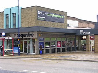
Cottingley is a suburban village within the City of Bradford district in West Yorkshire, England between Shipley and Bingley. It is known for the Cottingley Fairies, which appeared in a series of photographs taken there during the early 20th century.

<span class="mw-page-title-main">Bingley St Ives</span>

Bingley St. Ives, or St. Ives Estate is a 550-acre (2.2 km2) country park and former estate between Bingley and Harden in West Yorkshire, England now owned by Bradford Council. The park has Grade II listing in the English Heritage National Register of Historic Parks and Gardens of Special Interest. The park has been given Accredited Country Park status by Natural England.

Harden is a civil parish and village within the City of Bradford Metropolitan District, West Yorkshire, England, 2 miles (3.2 km) west of Bingley. It had a population of 1,615 in the 2001 census, but by 2011 this had risen to 1,900.

<span class="mw-page-title-main">Nidd Aqueduct</span> A freshwater aqueduct in Yorkshire, England

The Nidd Aqueduct is an aqueduct or man-made watercourse in North Yorkshire, England. It feeds water from Angram and Scar House reservoirs in upper Nidderdale, North Yorkshire 32 mi (51 km) to Bradford in West Yorkshire. The aqueduct supplies 21,000,000 imp gal (95,000 m3) of water per day to Chellow Heights water treatment works. The aqueduct and the reservoirs it connects to are all maintained by Yorkshire Water.

<span class="mw-page-title-main">Harden Moor</span> Moorland in West Yorkshire, England

Harden Moor is an expanse of moorland that lies north of the village of Harden in West Yorkshire, England. The moor encompasses stretches of heather, woodland and former quarry workings and is bordered by Airedale to the east, the Worth Valley to the north and Catstones Moor and the village of Cullingworth to the west. Historically, Harden Moor occupied the high ground between Bingley, Keighley, Cullingworth and Harden. Altar Lane, an unmade road which runs from the Brown Cow Inn in Bingley to Keighley Road on Harden Moor is an unofficial border between the estate of St Ives and Harden Moor, but when the St Ives Estate was created, a large swathe of Harden Moor was taken over.

<span class="mw-page-title-main">The Great Northern Railway Trail</span> Footpath in England

The Great Northern Railway Trail is a cycleway and footpath in the Bradford District of West Yorkshire, England. The path follows the route of a former railway, that of the Great Northern railway line between Bradford and Keighley that went via Queensbury and Cullingworth. The path has been designated as part of the National Cycle Route number 69.

<span class="mw-page-title-main">Bradford Dale (Yorkshire)</span> Valley in West Yorkshire, England

Bradford Dale, is a side valley of Airedale that feeds water from Bradford Beck across the City of Bradford into the River Aire at Shipley in West Yorkshire, England. Whilst it is in Yorkshire and a dale, it is not part of the Yorkshire Dales and has more in common with Lower Nidderdale and Lower Airedale for its industrialisation.

<span class="mw-page-title-main">Hainworth</span> Hamlet in West Yorkshire, England

Hainworth is a hamlet 1 mile (2 km) south of Keighley in West Yorkshire, England. The hamlet faces north across the lower end of the Worth Valley with a steep wooded incline towards Keighley.

<span class="mw-page-title-main">Worth Valley (dale)</span> Valley in West Yorkshire, England

The Worth Valley is a geographic area in West Yorkshire, England, that extends eastwards from Crow Hill and Oxenhope Moor, providing drainage for the River Worth for nearly 10 miles (16 km) to the River Aire. It is a side valley to Airedale, with the River Worth being a major tributary of the River Aire. The Worth Valley was important for its contribution to the textiles industry of the West Riding of Yorkshire and was furnished with several reservoirs to allow mills to operate within the valley. Most of the reservoirs are still in use into the modern day.

Bingley is a civil parish in the metropolitan borough of the City of Bradford, West Yorkshire, England. It contains 102 listed buildings that are recorded in the National Heritage List for England. Of these, one is listed at Grade I, the highest of the three grades, six are at Grade II*, the middle grade, and the others are at Grade II, the lowest grade. The parish contains the town of Bingley and the surrounding countryside to the north, east and south, including the villages and settlements of Cottingley, Eldwick, Gilstead, and Micklethwaite.

<span class="mw-page-title-main">Hewenden Reservoir</span> Reservoir in West Yorkshire, England

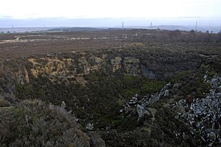
Hewenden Reservoir is a fresh-water reservoir near to Cullingworth in West Yorkshire, England. The Bradford Corporation built the reservoir, which was flooded in 1845, and is now part of the Yorkshire Water portfolio.

References

  1. "Harden Beck from Source to River Aire". Catchment Data Explorer. Environment Agency. Retrieved 16 October 2016.
  2. "Landscape Character SPD Wilsden" (PDF). Bradford Council. Bradford Council. October 2008. p. 3. Retrieved 12 November 2015.
  3. "The Hidden Valley". The Hidden Valley Website. Retrieved 12 November 2015.
  4. 1 2 "Harden Beck, From Source to River Aire". Yorkshire Invasive Species Forum. 23 August 2015. Retrieved 12 November 2015.
  5. Doveston, Mark. "Bradford Birding" (PDF). Bradford Birding. p. 2. Retrieved 12 November 2015.
  6. Speight, Harry (1898). Chronicles of Old Bingley. Eliot Stock. p. 96. Retrieved 4 December 2015.
  7. Smith, A H (1961). The place names of the West Riding of Yorkshire Pt 4. p. 329. Retrieved 4 December 2015.
  8. Lewis, Samuel (1848). "British History Online". BHO. S Lewis. pp. 404–407. Retrieved 11 November 2015.
  9. Historic England. "Rievaulx Cottage – Alternative Name Beckfoot Mill (944234)". Research records (formerly PastScape). Retrieved 12 November 2015.
  10. "Goit Stock Woods and Harden Beck" (PDF). Bradford Council. Retrieved 11 November 2015.
  11. "Goit Stock – The Hidden Valley". My Community Hub. 20 February 2014. Retrieved 11 November 2015.
  12. Cudworth, William (1896). Manningham, Heaton, and Allerton : (townships of Bradford) treated historically and topographically. Bradford: Cudworth. p.  324. OCLC   1069555989.
  13. Airey (2008). "Bradford Area Reservoirs' Group – Flood Routing Remedial" (PDF). British Dams. p. 2. Retrieved 11 November 2015.
  14. Hansen, Astrid (26 June 2014). "The Mills of the Hewenden Valley 3". My Community Hub Bingley. Retrieved 12 November 2015.
  15. "Hewenden Viaduct". Forgotten relics of an enterprising age. Retrieved 12 November 2015.
  16. "Great Northern Railway Trail". sustrans. Retrieved 12 November 2015.
  17. Historic England. "Harden Beck bridge to west of Malt Shovel Inn (1200795)". National Heritage List for England . Retrieved 12 November 2015.
  18. "Footbridge over Harden Beck to South East of the Lodge to Harden Grange, Bingley". British Listed Buildings. Retrieved 12 November 2015.
  19. Historic England. "Details from listed building database (1199392)". National Heritage List for England . Retrieved 12 November 2015.
  20. "Bingley and the St Ive's Estate". AA. AA. Retrieved 12 November 2015.
  21. Griffiths, Kathie (16 June 2007). "Downpours bring chaos to rivers and transport". Telegraph and Argus. Retrieved 11 November 2015.
  22. "The Broadleafed Woodlands of Harden Beck". AA. Retrieved 12 November 2015.
  23. 1 2 Hird, W G (1876). The Poetic Works of John Nicholson. London: Simpkin, Marshall & Co. p. xxxix. Retrieved 27 November 2015.
  24. "'Beck dead? We've seen 12-inch trout!'". Telegraph and Argus. 11 November 2000. Retrieved 11 November 2015.
  25. "Landscape Character SPD Wilsden" (PDF). Bradford Council. Bradford Council. October 2008. p. 5. Retrieved 12 November 2015.
  26. Robinson, Wendy (9 September 2017). "Harden Beck just got better! | Aire Rivers Trust". aireriverstrust.org.uk. Retrieved 6 January 2018.
  27. Hird, W G (1876). The Poetical Works of John Nicholson. London: Simpkin, Marshall & Co. p. xxxviii. Retrieved 27 November 2015.
  28. Lonsdale, Tom. "Stanza Stones" (2012). Ilkley Literature Festival. ILF. pp. 1–40. Retrieved 27 November 2015.

53°49′02.6″N1°53′25.7″W / 53.817389°N 1.890472°W / 53.817389; -1.890472