Harlow District Council

Last updated

Harlow District Council
Harlow Council logo.svg
Type
Type
History
Founded1 April 1974
Leadership
Andrew Johnson,
Conservative
since 26 May 2022 [1] [2]
Dan Swords,
Conservative
since 25 May 2023
Andrew Bramidge
since 16 December 2022 [3]
Structure
Seats33
Political groups
Administration (21)
  Conservative (21)
Opposition (12)
  Labour (12)
Elections
Last election
4 May 2023
Next election
2024
Meeting place
Harlow Civic Centre.jpg
Harlow Civic Centre, The Water Gardens, College Square, Harlow, CM20 1WG
Website
www.harlow.gov.uk

Harlow District Council is the local authority for Harlow in Essex, England. Harlow is a non-metropolitan district, covering just the town of Harlow itself. The council generally styles itself Harlow Council.

Contents

The neighbouring districts are Epping Forest District and East Hertfordshire.

History

Harlow was designated a new town on 25 March 1947. [4] The area for the new town was within the Epping Rural District at the time it was designated, and broadly covered the parishes of Harlow, Latton, Netteswell, Great Parndon, and Little Parndon. As work on the new town got underway the smaller parishes were abolished in stages. On 1 April 1949 Latton was absorbed into Harlow parish and Little Parndon was absorbed into Netteswell parish. On 1 April 1955, the three remaining parishes of Harlow, Great Parndon and Netteswell were merged into a single parish called Harlow, with some adjustments to the boundaries with neighbouring parishes of Epping Upland, Matching, North Weald Bassett, Roydon and Sheering, so as to bring the development area into a single parish. [5] On the same date the enlarged Harlow parish was made an urban district, making it independent from Epping Rural District. [6]

Urban districts were abolished in 1974 under the Local Government Act 1972. A new non-metropolitan district called Harlow was created covering the same area as the former Harlow Urban District. [7] [8]

Governance

Harlow Council provides district-level services. County-level services are provided by Essex County Council. [9] There are no civil parishes in Harlow; the entire district is an unparished area. [10]

Political control

The council has been under Conservative control since the 2021 election. [11]

The first election to the council was held in 1973, initially operating as a shadow authority alongside the outgoing authorities until the new arrangements came into effect on 1 April 1974. Political control of the council since 1974 has been as follows: [12] [13]

Party in controlYears
Labour 1974–2002
No overall control 2002–2008
Conservative 2008–2012
Labour 2012–2021
Conservative 2021–present

Leadership

The leaders of the council since 2008 have been: [14]

CouncillorPartyFromTo
Andrew Johnson Conservative 200824 May 2012
Mark Wilkinson Labour 24 May 201212 Jun 2014
Jon Clempner Labour 12 Jun 201411 Jan 2018
Emma Toal Labour 1 Feb 201824 May 2018
Mark Ingall Labour 24 May 20189 May 2021
Andrew Johnson [15] Conservative 20 May 20214 Oct 2021
Russell Perrin [16] Conservative 28 Oct 202125 May 2023
Dan Swords [17] Conservative 25 May 2023

Composition

Following the 2023 election, the composition of the council was: [18]

PartyCouncillors
Conservative 21
Labour 12
Total33

The next election is due in 2024.

Premises

The old Town Hall from the Water Gardens. Town Hall from the Water Gardens - geograph.org.uk - 2804714.jpg
The old Town Hall from the Water Gardens.

The council was initially based at the Town Hall, a tower block on The High in the town centre, which had been completed in 1960 for the old Harlow Urban District Council. [19] In 2004 the council moved to Harlow Civic Centre as part of a wider retail development around the town's Water Gardens. The new building was formally opened in May 2004 by Prince Richard, Duke of Gloucester. [20] The old Town Hall was demolished shortly afterwards.

Elections

Since the last boundary changes in 2002, 33 councillors have been elected from 11 wards. Elections are held three years out of every four for a third of the council at a time. Election to Essex County Council are held in the fourth year of the cycle when there are no district council elections. [21]

Related Research Articles

<span class="mw-page-title-main">Welwyn Hatfield</span> District in Hertfordshire, England

Welwyn Hatfield is a local government district with borough status in the county of Hertfordshire, England. Its council is based in Welwyn Garden City. The borough borders Hertsmere, St Albans, North Hertfordshire, East Hertfordshire, Broxbourne, and the London Borough of Enfield.

<span class="mw-page-title-main">Harlow</span> Town and Borough in Essex, England

Harlow is a town and local government district located in the west of Essex, England. Founded as a new town, it is situated on the border with Hertfordshire, Harlow occupies a large area of land on the south bank of the upper Stort Valley, which has been made navigable through other towns and features a canal section near its watermill.

<span class="mw-page-title-main">Castle Point</span> Non-metropolitan district and borough in England

Castle Point is a local government district with borough status in south Essex, England, lying around 30 miles (48 km) east of London. The borough comprises the towns of South Benfleet, Hadleigh and Thundersley on the mainland, and the adjoining Canvey Island in the Thames Estuary, which is connected to the mainland by bridges.

<span class="mw-page-title-main">Uttlesford</span> Non-metropolitan district in England

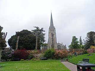
Uttlesford is a local government district in Essex, England. Its council is based in the town of Saffron Walden. The district also includes the town of Great Dunmow and numerous villages, including Stansted Mountfitchet, Takeley, Elsenham, Thaxted, and Newport. The district covers a largely rural area in the north-west of Essex. London Stansted Airport lies within the district.

<span class="mw-page-title-main">Tendring District</span> Non-metropolitan district in England

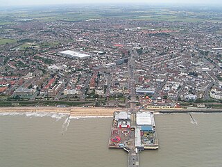
Tendring District is a local government district in north-east Essex, England. Its council is based in Clacton-on-Sea, the largest town. Other towns are Brightlingsea, Harwich, Frinton-on-Sea and Walton-on-the-Naze.

<span class="mw-page-title-main">Borough of Broxbourne</span> Place in England

The Borough of Broxbourne is a local government district with borough status in Hertfordshire, England. Its council is based in Cheshunt. Other settlements in the borough include Broxbourne, Hoddesdon and Waltham Cross. The eastern boundary of the district is the River Lea. The borough covers 20 square miles (52 km2) in south east Hertfordshire, and had an estimated population of 99,000 in 2021.

<span class="mw-page-title-main">East Hertfordshire</span> Non-metropolitan district in England

East Hertfordshire is one of ten local government districts in Hertfordshire, England. Its council is based in Hertford, the county town of Hertfordshire. The largest town in the district is Bishop's Stortford, and the other main towns are Ware, Buntingford and Sawbridgeworth. At the 2011 Census, the population of the district was 137,687. By area it is the largest of the ten local government districts in Hertfordshire. The district borders North Hertfordshire, Stevenage, Welwyn Hatfield and Broxbourne in Hertfordshire, and Epping Forest, Harlow and Uttlesford in Essex.

<span class="mw-page-title-main">Braintree District</span> Non-metropolitan district in England

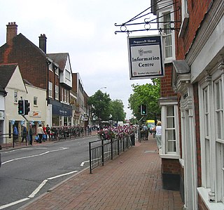
Braintree District is a local government district in Essex, England. The district is named after the town of Braintree, where the council is based. The district also includes the towns of Halstead and Witham and surrounding rural areas.

<span class="mw-page-title-main">City of Colchester</span> Place in England

The City of Colchester is a local government district with city status in Essex, England, named after its main settlement, Colchester. The district also includes the towns of West Mersea and Wivenhoe and the surrounding rural areas stretching from Dedham Vale on the Suffolk border in the north to Mersea Island in the Colne Estuary in the south.

<span class="mw-page-title-main">Epping Forest District</span> Non-metropolitan district in England

Epping Forest District is a local government district in Essex, England. It is named after the ancient woodland of Epping Forest, a large part of which lies within the district. The district covers northeastern parts of the urban area of London, including the suburban towns of Epping, Loughton, Waltham Abbey, Chigwell, and Buckhurst Hill, as well as rural areas beyond it. The district is situated in the west of the county, bordering north-eastern Greater London.

<span class="mw-page-title-main">Borough of Basildon</span> Non-metropolitan district and borough in England

The Borough of Basildon is a local government district with borough status in Essex, England. It is named after its largest town, Basildon, where the council is based. The borough also includes the towns of Billericay and Wickford and surrounding rural areas.

<span class="mw-page-title-main">Rochford District</span> Non-metropolitan district in England

Rochford is a local government district in Essex, England. It is named after one of its main settlements, Rochford, where the council is based. The largest town in the district is Rayleigh. Other places in the district include Hockley, Ashingdon, Great Wakering, Canewdon and Hullbridge.

<span class="mw-page-title-main">City of Chelmsford</span> City and borough in Essex, England

The City of Chelmsford is a local government district with borough and city status in Essex, England. It is named after its main settlement, Chelmsford, which is also the county town of Essex. As well as the settlement of Chelmsford itself, the district also includes the surrounding rural area and the town of South Woodham Ferrers.

<span class="mw-page-title-main">Borough of Brentwood</span> District in Essex, England

The Borough of Brentwood is a local government district with borough status in Essex, England. The borough is named after its main town of Brentwood, where the council is based; it includes several villages and the surrounding rural area.

<span class="mw-page-title-main">Mansfield District</span> Non-metropolitan district in England

Mansfield District is a local government district in Nottinghamshire, England. It is named after the town of Mansfield, where the council is based. The district also contains Mansfield Woodhouse and Warsop.

Epping and Ongar Rural District was a rural district in the county of Essex, England from 1955 to 1974.

<span class="mw-page-title-main">Epping, Essex</span> Town and parish in Essex, England

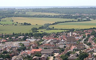
Epping is a market town and civil parish in the Epping Forest District of Essex, England. Part of the metropolitan and urban area of London, it is 17 miles (30 km) north-east of Charing Cross. It is surrounded by the northern end of Epping Forest, and on a ridge of land between the River Roding and River Lea valleys.

<span class="mw-page-title-main">1996 Harlow District Council election</span> English local election

The 1996 Harlow District Council election took place on 2 May 1996 to elect members of Harlow District Council in Essex, England. This was on the same day as other local elections. The Labour Party retained control of the council, which it had held continuously since the council's creation in 1973.

<span class="mw-page-title-main">2023 Harlow District Council election</span>

The 2023 Harlow District Council election took place on 4 May 2023 to elect members of Harlow District Council in Essex, England. This was on the same day as other local elections across England. One third of the council was up for election.

References

  1. "Council minutes, 26 May 2022" (PDF). Harlow Council. Retrieved 6 June 2023.
  2. "Andrew Johnson takes on historic second term as Chair of Harlow Council". Your Harlow. 27 May 2023. Retrieved 6 June 2023.
  3. "Andrew Bramidge appointed Chief Executive". Harlow Council. Retrieved 6 June 2023.
  4. "No. 37198". The London Gazette . 28 March 1947. p. 1451.
  5. Youngs, Frederic A. (1979). Guide to the Local Administrative Units of England Volume I: Southern England. London: Royal Historical Society. pp. 139–147. ISBN   0-901050-67-9.
  6. "Harlow Urban District". A Vision of Britain through Time. GB Historical GIS / University of Portsmouth. Retrieved 6 June 2023.
  7. "The English Non-metropolitan Districts (Definition) Order 1972", legislation.gov.uk , The National Archives, SI 1972/2039, retrieved 31 May 2023
  8. "The English Non-metropolitan Districts (Names) Order 1973", legislation.gov.uk , The National Archives, SI 1973/551, retrieved 31 May 2023
  9. "Local Government Act 1972", legislation.gov.uk , The National Archives, 1972 c. 70, retrieved 31 May 2023
  10. "Election maps". Ordnance Survey. Retrieved 6 June 2023.
  11. "Local elections 2021: Conservatives take Harlow from Labour". BBC News. 8 May 2021. Retrieved 6 June 2023.
  12. "Compositions calculator". The Elections Centre. 4 March 2016. Retrieved 1 June 2023.
  13. "Harlow". BBC News Online . Retrieved 28 December 2014.
  14. "Council minutes". Harlow District Council. Retrieved 26 May 2022.
  15. "Harlow Council leader steps down to 'pursue dreams'". BBC News. 4 October 2021. Retrieved 19 August 2022.
  16. "Leader of Harlow Council resigns over work life balance". BBC News. 12 May 2023. Retrieved 6 June 2023.
  17. Meyler, Piers (26 May 2023). "Harlow councillor, 22, becomes one of youngest council leaders in the country". Essex Live. Retrieved 6 June 2023.
  18. "Local elections 2023: live council results for England". The Guardian.
  19. "Earl Attlee opens new town hall". Hertfordshire Mercury. Hertford. 15 July 1960. p. 4. Retrieved 6 June 2023.
  20. "HRH the Duke of Gloucester to open Harlow Council's Civic Centre". Harlow Council. 17 May 2004. Archived from the original on 24 May 2004. Retrieved 6 June 2023.
  21. "The District of Harlow (Electoral Changes) Order 2001", legislation.gov.uk , The National Archives, SI 2001/2437, retrieved 6 June 2023