Bembridge is a village and civil parish located on the easternmost point of the Isle of Wight. It had a population of 3,848 according to the 2001 census of the United Kingdom, leading to the implausible claim by some residents that Bembridge is the largest village in England. Bembridge is home to many of the Island's wealthiest residents. The population had reduced to 3,688 at the 2011 Census.

Golden Hill Fort was a defensible barracks at Freshwater, Isle of Wight, England, built as part of the Palmerston defences by the 1859 Royal Commission on the Defence of the United Kingdom to provide manpower to man the defences at the western end of the Isle of Wight, England. Built in hexagonal form, it accommodated 8 officers and 128 men, and had its own hospital.

The River Yar on the Isle of Wight, England, rises in a chalk coomb in St. Catherine's Down near Niton, close to the southern tip of the island. It flows across the Lower Cretaceous rocks of the eastern side of the island, through the gap in the central Upper Cretaceous chalk ridge of the Island at Yarbridge, then across the now drained Brading Haven to Bembridge Harbour in the north east.

Nunwell is the location of Nunwell House, near Brading on the Isle of Wight, which was the home of the Oglander family for many centuries. It is in the civil parish of Newchurch. The present family are not direct descendants through the male line and thus the baronetcy has died out.

Brading Town Football Club is an English football club based in Brading, Isle of Wight. They are currently members of the Isle of Wight League Division One and play at the Peter Henry Ground.

Brading railway station is a Grade II listed railway station serving Brading on the Isle of Wight, England. It is located on the Island Line from Ryde to Shanklin. Owing to its secluded location and single operational platform, it is one of the quietest stations on the Island.

Yarbridge is a hamlet on the Isle of Wight, England. It is at the southern tip of the parish of Brading. It has a popular pub restaurant called the Yarbridge Inn. There is also a small hotel with a swimming pool, Oaklands House. The bridge over the River Yar, defended by a Second World War pillbox, was constructed in the Middle Ages by Sir Theobald Russell who was killed fighting a French invasion, dying of his wounds at Knighton Gorges. Until the bridge's construction, Bembridge had been an island accessible only at low tide. The bridge also crosses the railway and is bordered by an RSPB reserve on Brading Marshes.

Brading Roman Villa was a Roman courtyard villa which has been excavated and put on public display in Brading on the Isle of Wight.

Shide is a small settlement on the Isle of Wight, some of which is considered to be in the Newport conurbation.

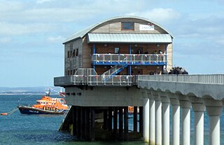
Bembridge was the terminus of the 2¾ mile branch line that connected it to the main line at Brading. On holiday Saturdays the sector table revolved continuously because the station area was too small to contain points. Opened in 1882, when the area contained the Island's main port, it ran with ever-dwindling passengers until 1953. The station is long since demolished and a new development in place.
Brading Marshes to St. Helen's Ledges is a 488.5 hectare Site of special scientific interest which stretches from Brading along the Yar valley between Bembridge and St Helens, Isle of Wight through to the sea at Priory Bay on the north east coast of the Isle of Wight. It encompasses the Brading Marshes RSPB reserve, Bembridge harbour and the inter tidal sand, mud flats and rocky ledges exposed off the coast at low water, including the land around St Helens Fort which is not attached to the mainland. It is the second largest SSSI on the Isle of Wight. The site was notified in 1951 for both its biological and geological features.

St Mary's Church is a parish church in the Church of England located in Brading, Isle of Wight.
Morton Manor is a manor house originating in the 13th century, in Brading, Isle of Wight, England. It is located 1 mile (1.6 km) southwest of Sandown Road. The 14th century fairly small house was modified in the 19th century. Constructed of varied materials, it was refurbished and extended in the early 20th century in an Arts and Crafts style. A Tudor fireplace is in the dining room, with William De Morgan green glazed tiles. The manor includes a small museum of rural life.

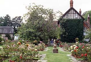
Nunwell House, also Nunwell Manor, is a historic English country house in Brading, Isle of Wight. Located 3 miles (4.8 km) south of Ryde, the Tudor and Jacobean style house also has later additions. The house contains family militaria. It was occupied by the Oglander family from Norman times until 1980. Nunwell House is a Grade II* listed building.
Pidford Manor is a manor house in Rookley, on the Isle of Wight, England. It is a five-bay Georgian style home on 11 acres (4.5 ha), accessed from the A3020 roadway.
Billingham Manor is a manor house lying about a mile south of the village of Chillerton on the Isle of Wight.
Mirables is an English country house on the Isle of Wight in South East England. It was built by George Arnold of Ashby Lodge, Northamptonshire.
Appley Towers, also called Appley Tower or Appley Tower House was an English country house near Appley House in Appley, Isle of Wight. It was the home of the Hutt family, who bought it in the 1870s, and later of Sir Hedworth Williamson. The house has been demolished, but a number of its estate buildings survive.

Standen House is an English country house located 1 mile (1.6 km) south of Newport, Isle of Wight. The 18th-century house has a brick front and features seven-bay windows, a porch with Doric columns, and triglyph frieze. Made of brick, it is located at the base of Pan Down. To its right is situated the park of Gatcombe, which itself lies in a valley which includes the winding River Medina. Gatcombe House lies opposite Standen House, separated by the river and woods. Great East Standen Manor is nearby.


