Tiltonsville is a village in southern Jefferson County, Ohio, United States, along the Ohio River. The population was 1,259 at the 2020 census. It is a part of the Weirton–Steubenville metropolitan area.

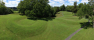
The Great Serpent Mound is a 1,348-foot-long (411 m), three-foot-high prehistoric effigy mound located in Peebles, Ohio. It was built on what is known as the Serpent Mound crater plateau, running along the Ohio Brush Creek in Adams County, Ohio. The mound is the largest serpent effigy in the world.

The Grave Creek Mound in the Ohio River Valley in West Virginia is one of the largest conical-type burial mounds in the United States, now standing 62 feet (19 m) high and 240 feet (73 m) in diameter. The builders of the site, members of the Adena culture, moved more than 60,000 tons of dirt to create it about 250–150 BC.

The Mathew Mound is a Native American mound in the southwestern part of the U.S. state of Ohio. Located off Oak Road near the village of Evendale, the mound is believed to have been built by members of the Adena or Hopewell peoples during the Woodland period.

The Odd Fellows' Cemetery Mound is a Native American mound in the southwestern part of the U.S. state of Ohio. Located in the village of Newtown in Hamilton County, the mound is an oval approximately 110 feet (34 m) long and 90 feet (27 m) wide; its height is 11.3 feet (3.4 m). It is believed to have been built by the Adena culture.

The State Line Archeological District is a complex of archaeological sites and national historic district located west of Elizabethtown, Ohio, United States. Located on both sides of the Indiana/Ohio border, the historic district is composed of five contributing properties spread out across 8 acres (3.2 ha) of land. It is believed to have been the site of a village of the Fort Ancient culture of prehistoric Native Americans.

Prehistory of Ohio provides an overview of the activities that occurred prior to Ohio's recorded history. The ancient hunters, Paleo-Indians, descended from humans that crossed the Bering Strait. There is evidence of Paleo-Indians in Ohio, who were hunter-gatherers that ranged widely over land to hunt large game. For instance, mastodon bones were found at the Burning Tree Mastodon site that showed that it had been butchered. Clovis points have been found that indicate interaction with other groups and hunted large game. The Paleo Crossing site and Nobles Pond site provide evidence that groups interacted with one another. The Paleo-Indian's diet included fish, small game, and nuts and berries that gathered. They lived in simple shelters made of wood and bark or hides. Canoes were created by digging out trees with granite axes.

The Carl Potter Mound is a historic Native American mound in southern Champaign County, Ohio, United States. Located near Mechanicsburg, it lies on a small ridge in a pasture field in southeastern Union Township. In 1974, the mound was listed on the National Register of Historic Places as a potential archaeological site, primarily because of its use as a burial mound.

The Bone Mound II is a Native American mound in the southwestern part of the U.S. state of Ohio. Located northwest of the unincorporated community of Oregonia, the mound sits in an area of light woodland.

The Bone Stone Graves are a prehistoric cemetery in the southwestern part of the U.S. state of Ohio. Located northwest of the unincorporated community of Oregonia in northwestern Washington Township, Warren County, the cemetery is composed of an uncertain number of graves of individuals from the Fort Ancient culture of Native Americans.

The Horn Mound is a Native American mound in eastern Pickaway County, Ohio, United States. Located near the village of Tarlton, the mound sits along a stream at a significant distance from any other prehistoric sites. It is believed to have been built by people of the Adena culture, who constructed many burial mounds and other ceremonial earthworks in prehistoric Ohio. Although erosion by the nearby stream has the potential of damaging the mound, it appears to be virtually undisturbed by human exploration. Because of its pristine state, the Horn Mound is a likely archaeological site, and for this reason it was listed on the National Register of Historic Places in 1974.
The Zaleski Mound Group is a collection of three burial mounds in the village of Zaleski, Ohio, United States. Built by people of the prehistoric Adena culture, these earthworks are valuable archaeological sites.

The W.C. Clemmons Mound is a Native American mound in the south central portion of the U.S. state of Ohio. Located near the unincorporated community of Fox, it lies in the middle of a farm field near a creek. A cone measuring approximately 22 feet (6.7 m) high and 144 feet (44 m) in diameter, its shape is almost exactly circular.
The Snead Mound is a Native American mound in the southwestern portion of the U.S. state of Ohio. Located off U.S. Route 52 near the community of Neville, it lies in woodland atop a bluff. The mound is a conical structure measures approximately 5 feet (1.5 m) high and 55 feet (17 m) in diameter at the base; except for a small hole that may have been dug by a hunter, the mound appears never to have been disturbed since white settlement of the region.

The Coon Hunters Mound is a Native American mound in the central part of the U.S. state of Ohio. Located near the village of Carroll, it sits on the grounds of the Central Ohio Coonhunters Association.
The Edith Ross Mound is a Native American mound and archaeological site in the southeastern part of the U.S. state of Ohio. Located near the village of Laurelville in Hocking County, the mound is a circular structure that measures 40 feet (12 m) in diameter at its base and 4.6 feet (1.4 m) high at the center. It is constructed primarily of earth, with large stones placed on various parts of the surface. Few changes have been made to the mound since white settlement of the region; a small depression in the northwestern corner may be the result of someone digging, but no significant damage was done.

The Cary Village Site is an archaeological site in the west-central portion of the U.S. state of Ohio. Located southeast of the village of Plain City in Madison County, the site occupies a group of grassy terraces located amid two farm fields. In this grassy area, archaeologists have discovered a wide range of artifacts, including stone tools, materials made of flint, and various types of pottery.
Stone box graves were a method of burial used by Native Americans of the Mississippian culture in the Midwestern United States and the Southeastern United States. Their construction was especially common in the Cumberland River Basin, in settlements found around present-day Nashville, Tennessee.

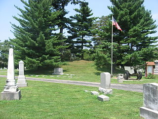
The McLaughlin Mound, also called Cemetery Mound, is a Native American mound in the central part of the U.S. state of Ohio. Located in Mound View Cemetery near the city of Mount Vernon in Knox County, it is an important archaeological site.

The Hartley Mound is a Native American burial mound in Columbus, Ohio. The mound was created around 2,000 years ago by the Pre-Columbian Native American Adena culture. The site was added to the National Register of Historic Places in 1974. The mound measures 2 ft. high and 43 ft. in diameter. The site's location near a tributary to a major waterway, artifacts found nearby, and the small subconical form of the mound, suggests that it was built by the Adena culture. It is one of few mounds not seriously disturbed by agriculture, industry, or illegal excavation. Upon archaeological excavation, the site should provide information on Adena burial customs and domestic or mortuary structures.


