Mounds State Park

Last updated

Mounds State Park
MoundsSign.jpg
Mounds State Park entrance sign.
USA Indiana location map.svg
Archaeological site icon (red).svg
Site of park in U.S. state of Indiana
Location Anderson, Indiana,  Madison County, Indiana, Flag of the United States.svg  USA
Region Madison County, Indiana
Coordinates 40°6′1.39″N85°37′14.60″W / 40.1003861°N 85.6207222°W / 40.1003861; -85.6207222
History
Founded160 BCE
Cultures Adena culture, Hopewell tradition
Site notes
Architecture
Architectural styles earthworks
Architectural detailsNumber of monuments: 10
Mounds State Park
Area251.8 acres (101.9 ha)
Visitation394,815 (2018–2019) [1]
NRHP reference No. 73000022 [2]
Added to NRHPJanuary 18, 1973
Responsible body: Indiana Department of Natural Resources

Mounds State Park is a state park near Anderson, Madison County, Indiana featuring Native American heritage, and ten ceremonial mounds built by the prehistoric Adena culture indigenous peoples of eastern North America, and also used centuries later by Hopewell culture inhabitants. It is separate from (and about 79 miles northwest of) the similarly named Mounds State Recreation Area (near Brookville, Franklin County, Indiana). The park receives about 400,000 visitors annually. [1]

Contents

The park is 1 of 14 Indiana State Parks that are in the path of totality for the 2024 solar eclipse, with the park having 3 minutes and 45 seconds of totality. [3]

Earthworks

The term earthworks includes any structure made from the earth. In Native American studies, there are three primary types: mounds, circular enclosures, and complexes. All are found in Central Indiana and in the state park. [4] Mounds State Park has a complex of enclosures, both circular and rectangular. There are seven enclosures and four additional earthworks, which have been divided into two groups, the northern complex and the southern complex. The Great Mound enclosure is the dominant structure in the park and the southern group. [4]

Mounds

Circular mound at Mounds State Park, Anderson Mounds SP 1.jpg
Circular mound at Mounds State Park, Anderson

These earthworks were created as a dedication to the Sun God and Earth Mother. The mounds were used as gathering places for religious ceremonies as well as viewing astronomical alignments.[ citation needed ]

When working at the Anderson mounds, archeologists learned that the maps used since the late 1800s were inaccurate. Research showed that the earthworks had been misrepresented in the map. This issue is significant since it affects the context of the site. Archaeological surveys of the park have shown that people have used the land for about 10,000 years, beginning as early as 8000 B.C. and continuing through about 1400 AD.[ citation needed ]

There are believed to be 8 circular earthworks in the park, but only 4 are visible today. This area was used for rituals and has been targeted by looters in the past, who caused significant damage to the artifacts and their stratigraphy. Estimates by radiocarbon dating suggest the rituals began around 250 B.C. Another feature of this site is the fiddle-back enclosure. Although there has been no evidence of astronomical activities here, it marks the spot where the sun sets on the summer solstice. [5]

Great Mound

The Great Mound MoundsSP GreatMound.jpg
The Great Mound
Ditch surrounding the Great Mound. Mounds SP P8070002.JPG
Ditch surrounding the Great Mound.

The Great Mound is the largest of the ten earthworks in the Mounds State Park. The Great Mound is approximately 390 feet (120 m) across and consists of a circular outer embankment 9 feet (2.7 m) high and 63 feet (19 m) wide, surrounding a 60 feet (18 m) wide ditch that is 10.5 feet (3.2 m) deep. The central platform, 138 feet (42 m) is diameter with a central mound, 4 feet (1.2 m) high and 30 metres (98 ft) in diameter. [4] The central mound was excavated in 1968/69 and found to have three clay layers, each with ashes, showing a succession of use periods. [4] [6]

The complex has been dated to 160 BCE through 50 CE These dates are obtained through radiocarbon dating and some artifacts. [4] A nearby log tomb was found with a platform pipe typical of Hopewell styles from 50 C.E. Post hole remnants were dated to 60 BCE and 230 CE. Radiocarbon dates from excavated material of the Great Mound established 160 BCE +/- 90 for the embankment. The neighboring ‘Fiddleback Mound was dated to 120 BCE +/- 70. [4]

The three floors of the Great Mound were created by a repeated process that included adding a layer of subsoil, burning the ground, then covering the floor in a layer of powdered white calcite, made from bone, shell, and limestone. This gave the floor a clay consistency as well as deep purple color. Each floor had basins and pits of unknown purposes. Near the gateway of the mound platform, a large pit was found containing various artifacts. These artifacts included chipped stone, flakes, burned bone, a fragment of shell, fragments of mica, and burned clay chunks. Built above this pit was a log tomb, called so because the floor of the tomb was laid with logs. When excavated, two human burials were found inside the tomb; a 50-year-old adult male, and the redeposited partial remains of a cremated individual. Also, artifacts such as a limestone platform pipe, flakes, fire-cracked rocks, mica fragments, pottery, burned and unburned bone, and seven deer bone awls were found in the tomb.[ citation needed ]

A hundred years after the mound was started, the construction of the Great Mound's platform was started. Although the embankment appears random and irregular, it was carefully crafted.[ citation needed ]

The only other aboriginal features on the platform were numerous small post holes encircling the top. These holes most likely held a brush fence erected to hide sacred activities carried out on the platform. After the mound was completed, several more pits were dug, some of them spanning from the surface to the lowest floor. One pit was possibly looted, while two other pits contained human burials. No other artifacts were found in these pits. [7] [8]

History

The late 19th century Bronnenberg House, built by one of the area's early residents and landowner of the mounds MoundsHouse.jpg
The late 19th century Bronnenberg House, built by one of the area's early residents and landowner of the mounds

In 1900, a series of strange misshapen skeletons were unearthed from similar mounds in nearby Alexandria, Indiana. This brought thousands of tourists from around the Midwest. In 1910, several locals admitted to stealing chimpanzee skeletons from the nearby Muncie Zoo's monkey house. In 1915 the skeletons were sold to a local museum which burned down in 1919. [9]

What is now Mounds State Park was the location of an amusement park that operated from 1897 until 1929. While the amusement park exploited the native-made mounds, it also helped to protect them by making them a point of regional pride and a destination; otherwise they might have been plundered or otherwise destroyed. When the Great Depression hit, the property was sold to the Madison County Historical Society, which transferred ownership to the State of Indiana, after which it became Mounds State Park. [10]

Canoeing is also available in Mounds State Park on the White River.

See also

Related Research Articles

<span class="mw-page-title-main">Hopewell tradition</span> Ancient North American indigenous civilization

The Hopewell tradition, also called the Hopewell culture and Hopewellian exchange, describes a network of precontact Native American cultures that flourished in settlements along rivers in the northeastern and midwestern Eastern Woodlands from 100 BCE to 500 CE, in the Middle Woodland period. The Hopewell tradition was not a single culture or society but a widely dispersed set of populations connected by a common network of trade routes.

<span class="mw-page-title-main">Pinson Mounds</span> Archaeological park

The Pinson Mounds comprise a prehistoric Native American complex located in Madison County, Tennessee, in the region that is known as the Eastern Woodlands. The complex, which includes 17 mounds, an earthen geometric enclosure, and numerous habitation areas, was most likely built during the Middle Woodland period. The complex is the largest group of Middle Woodland mounds in the United States. Sauls' Mound, at 72 feet (22 m), is the second-highest surviving mound in the United States.

<span class="mw-page-title-main">Serpent Mound</span> Prehistoric effigy mound in Ohio, United States

The Great Serpent Mound is a 1,348-feet-long (411 m), three-feet-high prehistoric effigy mound located in Peebles, Ohio. It was built on what is known as the Serpent Mound crater plateau, running along the Ohio Brush Creek in Adams County, Ohio. The mound is the largest serpent effigy known in the world.

<span class="mw-page-title-main">Timber circle</span> Rings of upright wooden posts

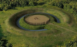
In archaeology, timber circles are rings of upright wooden posts, built mainly by ancient peoples in the British Isles and North America. They survive only as gapped rings of post-holes, with no evidence they formed walls, making them distinct from palisades. Like stone circles, it is believed their purpose was ritual, ceremonial, and/or astronomical.

<span class="mw-page-title-main">Mound Builders</span> Pre-Columbian cultures of North America

Many pre-Columbian cultures in North America were collectively termed "Mound Builders", but the term has no formal meaning. It does not refer to specific people or archaeological culture but refers to the characteristic mound earthworks that indigenous peoples erected for an extended period of more than 5,000 years. The "Mound Builder" cultures span the period of roughly 3500 BCE to the 16th century CE, including the Archaic period, Woodland period, and Mississippian period. Geographically, the cultures were present in the region of the Great Lakes, the Ohio River Valley, Florida, and the Mississippi River Valley and its tributary waters.

<span class="mw-page-title-main">Adena culture</span> Pre-Columbian Native American culture

The Adena culture was a Pre-Columbian Native American culture that existed from 500 BCE to 100 CE, in a time known as the Early Woodland period. The Adena culture refers to what were probably a number of related Native American societies sharing a burial complex and ceremonial system. The Adena culture was centered on the location of the modern state of Ohio, but also extended into contiguous areas of northern Kentucky, eastern Indiana, West Virginia, and parts of extreme western Pennsylvania.

<span class="mw-page-title-main">Criel Mound</span> United States historic place

The Criel Mound, also known as the South Charleston Mound, is a Native American burial mound located in South Charleston, West Virginia. It is one of the few surviving mounds of the Kanawha Valley Mounds that were probably built in the Woodland period after 500 B.C. The mound was built by the Adena culture, probably around 250–150 BC, and lay equidistant between two “sacred circles”, earthwork enclosures each 556 feet (169 m) in diameter. It was originally 33 feet (10 m) high and 173 feet (53 m) in diameter at the base, making it the second-largest such burial mound in the state of West Virginia. This archaeological site is listed on the National Register of Historic Places.

<span class="mw-page-title-main">Earthworks (archaeology)</span> General term to describe artificial changes in land level in history and pre-history

In archaeology, earthworks are artificial changes in land level, typically made from piles of artificially placed or sculpted rocks and soil. Earthworks can themselves be archaeological features, or they can show features beneath the surface.

<span class="mw-page-title-main">Kincaid Mounds State Historic Site</span> Archaeological site in Illinois, US

The Kincaid Mounds Historic Site c. 1050–1400 CE, is a Mississippian culture archaeological site located at the southern tip of present-day U.S. state of Illinois, along the Ohio River. Kincaid Mounds has been notable for both its significant role in native North American prehistory and for the central role the site has played in the development of modern archaeological techniques. The site had at least 11 substructure platform mounds, and 8 other monuments.

<span class="mw-page-title-main">Newark Earthworks</span> Archaeological site in Ohio, United States

The Newark Earthworks in Newark and Heath, Ohio, consist of three sections of preserved earthworks: the Great Circle Earthworks, the Octagon Earthworks, and the Wright Earthworks. This complex, built by the Hopewell culture between 100 BCE and 400 CE, contains the largest earthen enclosures in the world, and was about 3,000 acres in total extent. Less than 10 percent of the total site has been preserved since European-American settlement; this area contains a total of 206 acres (83 ha). Newark's Octagon and Great Circle Earthworks are managed by the Ohio History Connection. A designated National Historic Landmark, in 2006 the Newark Earthworks was also designated as the "official prehistoric monument of the State of Ohio."

<span class="mw-page-title-main">Portsmouth Earthworks</span> Archaeological site in Ohio, United States

The Portsmouth Earthworks are a large prehistoric mound complex constructed by the Native American Adena and Ohio Hopewell cultures of eastern North America. The site was one of the largest earthwork ceremonial centers constructed by the Hopewell and is located at the confluence of the Scioto and Ohio Rivers, in present-day Ohio.

<span class="mw-page-title-main">Prehistory of Ohio</span>

Prehistory of Ohio provides an overview of the activities that occurred prior to Ohio's recorded history. The ancient hunters, Paleo-Indians, descended from humans that crossed the Bering Strait. There is evidence of Paleo-Indians in Ohio, who were hunter-gatherers that ranged widely over land to hunt large game. For instance, mastodon bones were found at the Burning Tree Mastodon site that showed that it had been butchered. Clovis points have been found that indicate interaction with other groups and hunted large game. The Paleo Crossing site and Nobles Pond site provide evidence that groups interacted with one another. The Paleo-Indian's diet included fish, small game, and nuts and berries that gathered. They lived in simple shelters made of wood and bark or hides. Canoes were created by digging out trees with granite axes.

<span class="mw-page-title-main">Havana Hopewell culture</span> Indigenous American culture

The Havana Hopewell culture were a Hopewellian people who lived in the Illinois River and Mississippi River valleys in Iowa, Illinois, and Missouri from 200 BCE to 400 CE.

<span class="mw-page-title-main">Mount Horeb Earthworks Complex</span>

The Mount Horeb Earthworks Complex is an Adena culture group of earthworks in Lexington, Kentucky. It consists of two major components, the Mount Horeb Site 1 and the Peter Village enclosure, and several smaller features including the Grimes Village site, Tarleton Mound, and Fisher Mound. The Peter Village and Grimes Village enclosures were mapped by Rafinesque and featured in Squier and Davis's landmark publication Ancient Monuments of the Mississippi Valley in 1848 as Plate XIV Figures 3 and 4.

<span class="mw-page-title-main">Beam Farm Woodland Archaeological District</span> Archaeological site in Ohio, United States

The Beam Farm Woodland Archaeological District is a group of archaeological sites in the southwestern part of the U.S. state of Ohio. Located at 3983 Stone Road near the village of Sabina in Clinton County, the district is composed of one Native American mound and two other archaeological sites spread out over an area of 2 acres (0.81 ha). Known as the Beam Farm Mound and the Beam Sites 9 and 12, the sites that compose the district have yielded artifacts from the Adena culture and the Hopewell tradition, both of which inhabited southwestern Ohio during the Woodland period. Because both the Adena and the Hopewell lived around the mound, and because both cultures built mounds, the identity of the people who constructed the Beam Farm Mound cannot be established; all that can be known with reasonable certainty is that it was raised during the early or middle portion of the Woodland period, or between 800 BC and AD 500.

The Ety Habitation Site is an archaeological site in the central part of the U.S. state of Ohio. Located northeast of the village of Carroll in Fairfield County, it encompasses an area of about 4 acres (1.6 ha), which is covered by a group of hillocks. Here have been found large numbers of artifacts of prehistoric man; the nature of the material found suggests that the Habitation Site was a substantial settlement for a long period, most likely from the Hopewellian period, two thousand years ago. Few Hopewellian sites have been discovered that both yielded such valuable information and were so little damaged by the passage of time; as a result, the Ety Habitation Site is a leading archaeological site.

The Dominion Land Company Site (33FR12), also known as the Fort Reserve earthwork, was an Early Adena culture earthwork located in the Clintonville neighborhood in the city of Columbus, Ohio. It was excavated by archaeologists from the Ohio Historical Society shortly before being demolished by the Dominion Land Company in 1953 to make way for a housing development.

<span class="mw-page-title-main">Marietta Earthworks</span>

The Marietta Earthworks is an archaeological site located at the confluence of the Muskingum and Ohio Rivers in Washington County, Ohio, United States. Most of this Hopewellian complex of earthworks is now covered by the modern city of Marietta. Archaeologists have dated the ceremonial site's construction to approximately 100 BCE to 500 CE.

<span class="mw-page-title-main">Stubbs Earthworks</span>

The Stubbs Earthworks was a massive Ohio Hopewell culture archaeological site located in Morrow in Warren County, Ohio.

<span class="mw-page-title-main">Shriver Circle Earthworks</span> Ohio Hopewell culture archaeological site

The Shriver Circle Earthworks are an Ohio Hopewell culture archaeological site located in Chillicothe in Ross County, Ohio. At 1,200 feet (370 m) in diameter the site is one of the largest Hopewell circular enclosures in the state of Ohio.

References

  1. 1 2 "2018 / 2019 Estimated Fiscal Year Visits for Indiana State Parks ~ Alphabetical" (PDF). Indiana Department of Natural Resources. Retrieved November 2, 2021.
  2. "National Register Information System". National Register of Historic Places . National Park Service. July 9, 2010.
  3. R, Mike (July 14, 2021). "Indiana 2024 Eclipse State Park Resources". CosmosPNW. Retrieved October 3, 2022.
  4. 1 2 3 4 5 6 "Adena and Hopewell Cosmology: New Evidence from East Central Indiana; Donald R. Cochran; Native American Cultures in Indiana, ‘’Proceedings of the First Minnestrista Council for Great Lakes Native American Studies"; Ronald Hicks (ed.); Minnestrista Cultural Center; Muncie, Indiana; 1992; pgs 26-42
  5. Snow, Dean R. (2010). Archaeology of Native North America. Prentice Hall. ISBN   978-0-13-615686-4.
  6. Dean R. Snow (2010). Archaeology of Native North America. New York: Prentice-Hall. p. 103.
  7. Cochran, Donald R.; McCord, Beth K. (2001). The Archaeology of Anderson Mounds, Mounds State Park, Anderson Indiana (PDF). Reports of Investigation. Vol. 61. Archaeological Resources Management Service, Ball State University.
  8. Vickery, Kent D (1970). Excavations at Mounds State Park, 1969 season. OCLC   11627594.
  9. Werner, Nicholas (1937). Mysterious Circumstances Of Central Indiana. Clayton Books. p. 121.
  10. "Mounds state Park Interpretive Master Plan 2011" (PDF). Indiana Department of Natural Resources. Retrieved July 5, 2012.