
The Grand Village of the Illinois, also called Old Kaskaskia Village, is a site significant for being the best documented historic Native American village in the Illinois River valley. It was a large agricultural and trading village of Native Americans of the Illinois confederacy, located on the north bank of the Illinois River near the present town of Utica, Illinois. French explorers Louis Joliet and Father Jacques Marquette came across it in 1673. The Kaskaskia, a tribe of the Illiniwek people lived in the village. It grew rapidly after a French mission and fur trading post were established there in 1675, to a population of about 6,000 people in about 460 houses. Around 1691 the Kaskaskia and other Illiniwek moved further south, abandoning the site due to pressure from an Iroquois invasion from the northeast.
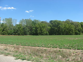
The Stoner Site is a substantial archaeological site in the far eastern portion of the U.S. state of Illinois. Discovered during the Great Depression, the site has produced large numbers of artifacts from a prehistoric village that was once located there, and archaeological investigations have shown it to be one of the area's most important archaeological sites for the Allison-Lamotte culture. After more than a decade of fruitful research and predictions of potentially rich results from future work, it has been designated a historic site.
The Clough Creek and Sand Ridge Archaeological District is a historic district composed of two archaeological sites in the southwestern part of the U.S. state of Ohio. Its name is derived from those of the two sites included in the district: one that lies along Clough Creek, and one that occupies part of the Sand Ridge near the creek.

The Turpin Site (33Ha28) is an archaeological site in the southwestern portion of the U.S. state of Ohio. Located near Newtown in Hamilton County, the site includes the remains of a village of the Fort Ancient culture and of multiple burial mounds. Detailed explorations of the site have revealed the bodies of many individuals in and around the mounds. The archaeological value of the site has resulted in its use in the study of similar locations and in its designation as a historic site.

The Book Site is an archaeological site in Juniata County, Pennsylvania, United States. Consisting of the remnants of a burial mound and a prehistoric village, the site lies on both sides of Camp Resort Road in Beale Township, near the community of Beale.

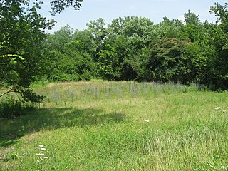
The Fisher Farm Site is an archaeological site in Centre County, Pennsylvania, United States. Located in fields on the outskirts of Unionville, it is one of central Pennsylvania's leading archaeological sites.
The East Fork Site is an archaeological site in the southwestern part of the U.S. state of Ohio. Located south of Batavia, it has yielded artifacts from more cultures than has any other site in Clermont County.

The Gatch Site is an archaeological site located near Milford, Ohio, United States. One of the largest archaeological sites in Clermont County, it is believed to have been a Native American village site during the Middle Woodland period.

The Winegardner Village is an archaeological site near Rushville in Fairfield County, Ohio, United States.
The Dodge Site is an archaeological site in the northwestern part of the U.S. state of Ohio. Located north of Bowling Green in Wood County, the site was inhabited by Middle Woodland and Upper Mississippian peoples. Among the artifacts discovered at the site are ceramics and stone tools. The site's stratigraphy is obvious: the Middle Woodland village site and cemetery can easily be distinguished from the Upper Mississippian occupation zone that sits on top of it. While only a small portion of the 2.2 acre (0.89 ha) site has been excavated, the artifacts that have been discovered at Dodge have contributed significantly to an understanding of the western basin of Lake Erie around AD 1300. Enough material has been recovered to facilitate radiometric dating, as well as identifying the peoples who once inhabited the site. The excavations also revealed the intensity of occupation: the Middle Woodland layer was substantially larger than the exceptionally thin Upper Mississippian component.
The Ufferman Site is an archaeological site in the central part of the U.S. state of Ohio. Located north of the city of Delaware, it occupies approximately 2 acres (0.81 ha) of land near Delaware Lake on property near to the boundaries of Delaware State Park. It appears to have been the location of a village of the Cole culture, which inhabited the region during the later portion of the Woodland period. Ufferman lies only 0.6 kilometres (0.37 mi) south of the W.S. Cole Site, the type site for the culture, and approximately 23 kilometres (14 mi) north of the Highbank Park Works, which are believed to have been built by peoples of the Cole culture.
The Beam Farm Woodland Archaeological District is a group of archaeological sites in the southwestern part of the U.S. state of Ohio. Located at 3983 Stone Road near the village of Sabina in Clinton County, the district is composed of one Native American mound and two other archaeological sites spread out over an area of 2 acres (0.81 ha). Known as the Beam Farm Mound and the Beam Sites 9 and 12, the sites that compose the district have yielded artifacts from the Adena culture and the Hopewell tradition, both of which inhabited southwestern Ohio during the Woodland period. Because both the Adena and the Hopewell lived around the mound, and because both cultures built mounds, the identity of the people who constructed the Beam Farm Mound cannot be established; all that can be known with reasonable certainty is that it was raised during the early or middle portion of the Woodland period, or between 800 BC and AD 500.
The Spring Creek Site (20MU3) is a significant archaeological site in the U.S. state of Michigan. Located in Muskegon County in the western portion of the Lower Peninsula, it is the type site for a certain type of Late Woodland period pottery produced by the Ottawa tribe.

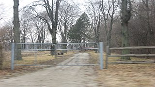
The Bullskin Creek Site is an archaeological site in the southwestern portion of the U.S. state of Ohio. Located near Felicity in Clermont County, the site appears to have been a base camp for nomads during the Late Archaic period. The site comprises three loci: two significant areas of various debris and a large midden that underlies everything else. From these components, which cover an area of approximately 400 feet (120 m) by 600 feet (180 m), collectors and archaeologists have recovered hundreds of artifacts, including stone tools, weapons, and bone tools. Because the site is located in a farm field, it has frequently been cultivated, and the plow has brought at least five burials to the surface from a cemetery on the edge of the site. Among the types of features found at the site are ovens, trash pits, and postmolds. Bodies at the site were generally adorned with red ochre and buried in a flexed position.

The Summer Island Site, designated 20DE4, is an archaeological site located on the northwest side of Summer Island, in Delta County, Michigan. It is classified as a stratified, multi-component site with Middle Woodland, Upper Mississippian and Early Historic/Protohistoric occupations. It was listed on the National Register of Historic Places in 1971.

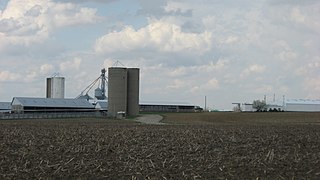
The Ellerbusch Site (12-W-56) is a small but significant archaeological site in the southwestern part of the U.S. state of Indiana. Unlike many sites created by people of the same culture, it occupies an upland site near a major river floodplain. Its existence appears to have been the result of the coincidence of periods of peace and growth in the related Angel Site, which led some townspeople to leave their homes for new villages that were more convenient for resource gathering. Researched partly because of its small size, Ellerbusch has produced information that greatly increases present awareness of other small sites and of its culture's overall patterns of settlement in the region. Because of its archaeological value, the site was declared a historic site in the late twentieth century.

The Hubele Mounds and Village Site are an archaeological site in the southeastern part of the U.S. state of Illinois. Located near the community of Maunie in White County, the site has received recognition from the federal government because of its archaeological value. Due to the lack of recent excavations, the site's dates of habitation are debated, ranging from 400 BC in some estimates to AD 1000 in others, but all agree on the site's significance to understanding the prehistory of the region.

The Moccasin Bluff Site is an archaeological site located along the Red Bud Trail and the St. Joseph River north of Buchanan, Michigan. It was listed on the National Register of Historic Places in 1977, and has been classified as a multi-component Prehistoric site with the major component dating to the Late Woodland/Upper Mississippian period.
Whittlesey culture is an archaeological designation for native people who lived in northeastern Ohio during the Late prehistoric and Early Contact period between A.D. 1000 to 1640. They flourished as an agrarian society by 1500—growing maize, beans, and squash—when their population began to decrease due to disease, malnutrition, and warfare. There was a period of long, cold winters that would have impacted their success cultivating food from about 1500. The Whittlesey culture people created a distinctive style of pottery and built villages that were designed to be defensive, set high on promontories with steep cliffs and then surrounded by ditches or stockades. The villages were established on the Lake Erie plain or overlooking river and streams. About 1640, Whittlesey villages were abandoned and due to the displacement of native groups during the early contact period with Europeans, it is not known where or how they relocated.


