
Crowland or Croyland is a town in the South Holland district of Lincolnshire, England. It is situated between Peterborough and Spalding. Crowland contains two sites of historical interest, Crowland Abbey and Trinity Bridge.

The Wash is a rectangular bay and multiple estuary at the north-west corner of East Anglia on the East coast of England, where Norfolk meets Lincolnshire and both border the North Sea. One of Britain's broadest estuaries, it is fed by the rivers Witham, Welland, Nene and Great Ouse. It is a 62,046-hectare (153,320-acre) biological Site of Special Scientific Interest. It is also a Nature Conservation Review site, Grade I, a National Nature Reserve, a Ramsar site, a Special Area of Conservation and a Special Protection Area. It is in the Norfolk Coast Area of Outstanding Natural Beauty and part of it is the Snettisham Royal Society for the Protection of Birds nature reserve.

The River Welland is a lowland river in the east of England, some 65 miles (105 km) long. It drains part of the Midlands eastwards to The Wash. The river rises in the Hothorpe Hills, at Sibbertoft in Northamptonshire, then flows generally northeast to Market Harborough, Stamford and Spalding, to reach The Wash near Fosdyke. It is a major waterway across the part of the Fens called South Holland, and is one of the Fenland rivers which were laid out with washlands. There are two channels between widely spaced embankments with the intention that flood waters would have space in which to spread while the tide in the estuary prevented free egress. However, after the floods of 1947, new works such as the Coronation Channel were constructed to control flooding in Spalding and the washes are no longer used solely as pasture, but may be used for arable farming.
Spalding is a market town on the River Welland in the South Holland district of Lincolnshire, England. Little London is a hamlet directly south of and contiguous with Spalding on the B1172, whilst Pinchbeck is a village almost contiguous, to the north. Spalding had a population of 31,588 at the 2011 census and this was estimated to have increased to 36,737 in 2020 according to government data, an increase of 1.6%.

Stamford is a town and civil parish in the South Kesteven District of Lincolnshire, England. The population at the 2011 census was 19,701 and estimated at 20,645 in 2019. The town has 17th and 18th-century stone buildings, older timber-framed buildings and five medieval parish churches. It is a frequent film location. In 2013 it was rated a top place to live in a survey by The Sunday Times. Its name has been passed on to Stamford, Connecticut, founded in 1641.
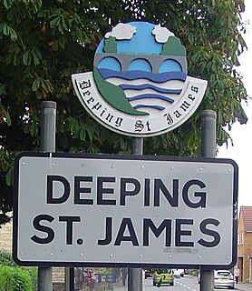
Deeping St James is a large village in the South Kesteven district of Lincolnshire, England. The population of the civil parish was 6,923 increasing to 7,051 at the 2011 census.

Bourne Eau is a short river which rises from an artesian spring in the town of Bourne in Lincolnshire, England, and flows in an easterly direction to join the River Glen at Tongue End. Within the town, it once powered three water mills, one of which is now a heritage centre. At Eastgate, it becomes much wider as it was navigable in the 18th and 19th centuries, and this was the location of the terminal basin. Below the town it is an embanked river, as its normal level is higher than that of the surrounding Fens. Navigation ceased in the 1860s and the river now forms an important part of the drainage system that enables the surrounding fen land to be used for agriculture.
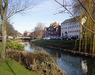
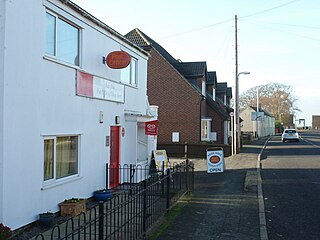
The Deepings are a series of settlements close to the River Welland near the borders of southern Lincolnshire and north western Cambridgeshire in eastern England. Peterborough is about 8 miles to the south, Spalding about 10 miles to the north east and Stamford about 8 miles to the west.

Thurlby is a village and civil parish in the South Kesteven district of Lincolnshire, England. It is situated just west of the A15 road, 2 miles (3 km) south from the town of Bourne, and on the edge of the Lincolnshire Fens. It is sometimes referred to as Thurlby by Bourne to distinguish it from other villages in Lincolnshire with the same name. Thurlby and the hamlet of Northorpe to its north are conjoined. The parish had a population of 2,136 at the 2001 census and 2,153 at the 2011 census.

Deeping Gate is a village and civil parish, lying on the River Welland in Cambridgeshire. Traditionally, the area was part of the Soke of Peterborough, geographically considered a part of Northamptonshire; it now falls within the City of Peterborough unitary authority area. With a very small population, void of any major services, including a post office or even a chapel, the community depends on nearby Market Deeping, one and a quarter miles (2.0 km) north of the river in Lincolnshire, for economic and market services. The parish had a population of 258 males and 257 females according to the 2011 Census. Renaissance composer Robert Fayrfax (Fairfax) was a native of the village. Fairfax House, the most prominent and grand property in the village, was home to the Fairfax Family.

Langtoft is a village and civil parish in the South Kesteven district of Lincolnshire, England. The population of the civil parish at the 2011 census was 2,045. It lies on the A15 road, about 10 miles (16 km) north from Peterborough and about 8 miles (13 km) east from Stamford, and on the edge of The Fens.
West Hythe is a hamlet near Palmarsh in Kent, England, and a few miles west of the cinque port town of Hythe.
Pinchbeck is a village and civil parish in the South Holland district of Lincolnshire, England. The civil parish population was 5,153 at the 2001 census, increasing to 5,455 at the 2011 census. It is situated 2 miles (3.2 km) north from the centre of Spalding.
Cowbit is a village and civil parish in the South Holland district of Lincolnshire, England. The population of the civil parish at the 2011 census was 1,220. It is situated 3 miles (5 km) south from Spalding and 5 miles (8 km) north from Crowland.

Deeping St Nicholas is a village near Spalding in Lincolnshire, England, on the A1175 road between The Deepings and Spalding. Unlike Market Deeping, which is in South Kesteven district, Deeping St Nicholas is in South Holland.

The A1175 road is a public highway in south-west Lincolnshire, England within the United Kingdom.
Pode Hole is a small village 2 miles (3.2 km) to the west of the centre of Spalding, Lincolnshire, England. The village lies at the confluence of several drainage channels, where two pumping stations discharge water into Vernatt's Drain from land in Deeping Fen to the South and West. Water from Pinchbeck South Fen to the North is also lifted into Vernatt's Drain. The village arose to service the pumping stations.

Gilbert Heathcote's tunnel was an engineering project dating from the 1630s as one of the earliest modern attempts to drain The Fens in Lincolnshire. Rendered obsolete by the mechanical drainage improvements after World War II, it was finally removed in 1991.

The Pinchbeck Engine is a drainage engine, a rotative beam engine built in 1833 to drain Pinchbeck Marsh, to the north of Spalding, Lincolnshire, in England. Until it was shut down in 1952, the engine discharged into the Blue Gowt which joins the River Glen at Surfleet Seas End.

Deeping Fen is a low-lying area in the South Holland district of Lincolnshire, England, which covers approximately 47 square miles (120 km2). It is bounded by the River Welland and the River Glen, and is extensively drained, but the efficient drainage of the land exercised the minds of several of the great civil engineers of the 17th and 18th centuries.


