
Baton Rouge is a city in and the capital of the U.S. state of Louisiana. On the eastern bank of the Mississippi River, it is the parish seat of East Baton Rouge Parish, Louisiana's most populous parish. Since 2020, it has been the 99th-most-populous city in the United States and the second-largest city in Louisiana, after New Orleans. It is the 18th-most-populous state capital. At the U.S. Census Bureau's 2020 tabulation, it had a population of 227,470; its consolidated population was 456,781 in 2020. It is the center of the Greater Baton Rouge area, Louisiana's second-largest metropolitan area, with a population of 870,569 as of 2020, up from 802,484 in 2010.

Interstate 10 (I-10) is the southernmost cross-country highway in the American Interstate Highway System. I-10 is the fourth-longest Interstate in the United States at 2,460.34 miles (3,959.53 km), following I-90, I-80, and I-40. This freeway is part of the originally planned network that was laid out in 1956, and its last section was completed in 1990.

Interstate 12 (I-12) is an Interstate Highway located entirely within the U.S. state of Louisiana. It spans a total of 86.65 miles (139.45 km) in an east–west direction from I-10 in Baton Rouge to an interchange with both I-10 and I-59 in Slidell. Along the way, it passes through the city of Hammond, where it intersects I-55 and US Route 51 (US 51). It also serves the cities of Ponchatoula and Denham Springs, as well as the St. Tammany Parish cities of Covington and Mandeville. Skirting the northern shore of Lake Pontchartrain, I-12 serves as both a northern bypass of the New Orleans metropolitan area and an alternate route for I-10, which serves the city of New Orleans itself.

Interstate 110 (I-110) is an auxiliary Interstate Highway in the U.S. state of Louisiana. It runs 9.06 miles (14.58 km) in a north–south direction as a spur of I-10 in the city of Baton Rouge.

The Huey P. Long - O.K. Allen Bridge is a truss cantilever bridge over the Mississippi River carrying US 190 and one rail line between East Baton Rouge Parish, Louisiana and West Baton Rouge Parish, Louisiana.

U.S. Highway 90 Business is a business route of U.S. Highway 90 located in and near New Orleans, Louisiana. It runs 14.25 miles (22.93 km) in a general east–west direction from US 90 in Avondale to a junction with Interstate 10 (I-10) and US 90 in the New Orleans Central Business District.
Interstate 10 (I-10), a major transcontinental Interstate Highway in the Southern United States, runs across the southern part of Louisiana for 274.42 miles (441.64 km) from Texas to Mississippi. It passes through Lake Charles, Lafayette, and Baton Rouge, dips south of Lake Pontchartrain to serve the New Orleans metropolitan area, then crosses Lake Pontchartrain and leaves the state.

Airline Highway is a divided highway in the U.S. state of Louisiana, built in stages between 1925 and 1953 to bypass the older Jefferson Highway. It runs 115.6 miles (186.0 km), carrying U.S. Highway 61 from New Orleans northwest to Baton Rouge and U.S. Highway 190 from Baton Rouge west over the Mississippi River on the Huey P. Long Bridge. US 190 continues west towards Opelousas on an extension built at roughly the same time.
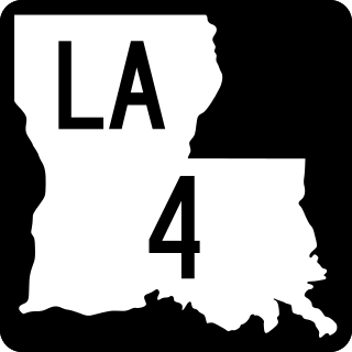
Louisiana Highway 4 (LA 4) is a state highway located in northern Louisiana. It runs 164.54 miles (264.80 km) in an east–west direction from U.S. Highway 71 (US 71) at Loggy Bayou to LA 605 in Newellton.
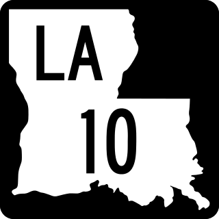
Louisiana Highway 10 (LA 10) is a state highway located in southern Louisiana. It runs 255.51 miles (411.20 km) in an east–west direction from U.S. Highway 171 (US 171) south of Leesville to the Mississippi state line east of Bogalusa.

Louisiana Highway 47 (LA 47) is a state highway located in southeastern Louisiana. It runs 15.91 miles (25.60 km) in a general southeast to northwest direction from the Mississippi River levee in Chalmette to the intersection of Hayne Boulevard and Downman Road in New Orleans.

Louisiana Highway 22 (LA 22) is a state highway located in southeastern Louisiana. It runs 71.15 miles (114.50 km) in a general east–west direction from the junction of LA 75 and LA 942 in Darrow to U.S. Highway 190 (US 190) in Mandeville.

Louisiana Highway 30 (LA 30) is a state highway located in southeastern Louisiana. It runs 28.10 miles (45.22 km) in a northwest to southeast direction from LA 73 in Baton Rouge to the junction of U.S. Highway 61 (US 61) and LA 431 east of Gonzales.
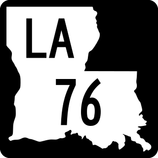
Louisiana Highway 76 (LA 76) is a state highway located in southeastern Louisiana. It runs 25.52 miles (41.07 km) in a general east–west direction from LA 77 in Maringouin to the junction of LA 1 and LA 987-4 in Port Allen.

U.S. Highway 11 (US 11) is a part of the United States Numbered Highway System that spans 1,756 miles (2,826 km) from New Orleans, Louisiana to Rouses Point, New York. Within the state of Louisiana, the highway travels 31 miles (50 km) from the national southern terminus at US 90 in New Orleans to the Mississippi state line south of Picayune.

U.S. Highway 51 (US 51) is a part of the United States Numbered Highway System that spans 1,277 miles (2,055 km) from LaPlace, Louisiana to a point north of Hurley, Wisconsin. Within the state of Louisiana, the highway travels 69.12 miles (111.24 km) from the national southern terminus at US 61 in LaPlace to the Mississippi state line north of Kentwood.

U.S. Highway 65 (US 65) is a part of the United States Numbered Highway System that spans 966 miles (1,555 km) from Clayton, Louisiana to Albert Lea, Minnesota. Within the state of Louisiana, the highway travels 100.77 miles (162.17 km) from the national southern terminus at US 425/LA 15 in Clayton to the Arkansas state line north of Lake Providence.
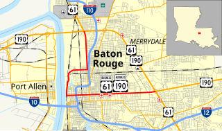
U.S. Highway 61/190 Business is a business route of both U.S. Route 61 and U.S. Route 190 in Louisiana that serves as a boulevard into downtown Baton Rouge. It spans 10.89 miles (17.53 km) in a southeast to northwest direction and it is signposted as Business 61/190, generally without directional shields. It follows parts of the former alignment of US 61/190 through Baton Rouge, which existed in downtown Baton Rouge from 1935 until 1960.
Louisiana Highway 75 (LA 75) is a state highway located in southeastern Louisiana. It runs 46.86 miles (75.41 km) in a general east–west direction from a dead end in Bayou Pigeon to the junction of LA 22 and LA 942 in Darrow.


