Hot Springs Village, Arkansas

Last updated

Hot Springs Village, Arkansas
CDP
Village of Hot Springs
Garland County Arkansas Incorporated and Unincorporated areas Hot Springs Village Highlighted.svg
Location in Garland County and Arkansas
Usa edcp relief location map.png
Red pog.svg
Hot Springs Village
Location in the United States
Coordinates: 34°39′24″N92°57′51″W / 34.65667°N 92.96417°W / 34.65667; -92.96417
Country Flag of the United States.svg  United States
State Flag of Arkansas.svg  Arkansas
Counties Garland, Saline
FoundedJune 1, 1970 (1970-06-01)
Founded byJohn Cooper, Sr.
Named for Hot Springs
Government
  Type POA
Area
[1]
  Total60.56 sq mi (156.84 km2)
  Land57.64 sq mi (149.28 km2)
  Water2.92 sq mi (7.56 km2)
Elevation
[2]
646 ft (197 m)
Population
 (2020)
  Total15,861
  Density275.19/sq mi (106.25/km2)
Time zone UTC-6 (Central (CST))
  Summer (DST) UTC-5 (CDT)
ZIP codes
71909, 71910 [3]
Area code 501
FIPS code 05-33482
GNIS feature ID2402601 [2]
Website www.explorethevillage.com OOjs UI icon edit-ltr-progressive.svg

Hot Springs Village is a census-designated place (CDP) in Garland and Saline counties in the U.S. state of Arkansas. As it is situated in two counties, it is also part of two metropolitan statistical areas. The portion in Garland County is within the Hot Springs Metropolitan Statistical Area, while the portion extending into Saline County is part of the Little Rock North Little Rock Conway Metropolitan Statistical Area. The population was 12,807 at the 2010 census. [4] It is the largest gated community in the United States.

Contents

Geography

According to the United States Census Bureau, the CDP has a total area of 55.7 square miles (144 km2), of which 53.5 square miles (139 km2) is land and 2.2 square miles (5.7 km2) (3.92%) is water.

Climate

Hot Springs Village ("HSV") has four distinct seasons. Winter freezes usually begin in mid November and may occur into April. Temperatures over 100 degrees may start as early as June and may occur into September. Typically, the area will see several days of snow during the winter and minimum temperatures of 15 degrees or higher. Rainfall is usually plentiful in spring and sparse in summer. [5]

Government and politics

Hot Springs Village has more than 26,000 acres, much of it wooded. HSV is governed by the HSV Property Owners' Association (POA), a private, tax-exempt property owners association. A general manager and a seven-member volunteer board of directors, who are elected in staggered three-year terms, comprise POA leadership. Day-to-day operation of the POA is handled by an average of 475 employees assigned to one of six departments: Administration, Golf, Planning and Inspection, Public Safety, Public Works, and Recreation.

In addition to the Planning and Inspection Department, HSV's Architectural Control Committee's responsibility is to ensure that all building plans conform to architectural policy and building codes of the Village and to issue permits for new homes, landscaping, and remodeling. The ACC ensures that green belt areas, roadways, lakes, and other common areas are protected for general character, appearance and use by Hot Springs Village property owners.

Hot Springs Village has a Declaration and Covenants and Restrictions with which all property owners must comply. The POA has an information and regulations booklet detailing rules for recreational amenities. All HSV common property and amenities are owned by the property owners as a whole and maintained, regulated and operated by the POA:

Law enforcement and crime

According to neighborhoodscout.com, the CDP has a crime rate of 4 crimes per square mile, significantly lower than the Arkansas average of 21 crimes per square mile. The organization had also determined that the risk of becoming a victim in Hot Springs Village was 1 in 81 compared to the state average of 1 in 28. [7]

Demographics

Historical population
CensusPop.Note
1980 2,083
1990 6,361205.4%
2000 8,39732.0%
2010 12,80752.5%
2020 15,86123.8%
U.S. Decennial Census [8]

2020

Hot Springs Village racial composition [9]
RaceNumberPercentage
White (non-Hispanic)14,48291.31%
Black or African American (non-Hispanic)2331.47%
Native American 520.33%
Asian 830.52%
Pacific Islander 100.06%
Other/Mixed 5753.63%
Hispanic or Latino 4262.69%

As of the 2020 United States census, there were 15,861 people, 7,279 households, and 5,045 families residing in the CDP.

2010

As of the census of 2010, [10] the CDP's racial demographics were 97.9% white (96.0 non-Hispanic, 1.1% White Hispanic), 1.3% Black or African-American, 0.8% American Indian and Alaska Native, 0.4% Asian, 0.0% Native Hawaiian and Other Pacific Islander, and 0.5 belonging to other races. 1.5 of the CDP's residents were Hispanic of any race.

2000

As of the census [10] of 2000, there were 8,397 people, 4,295 households, and 3,221 families residing in the CDP. The population density was 221.4 inhabitants per square mile (85.5/km2). There were 5,121 housing units at an average density of 135.0 per square mile (52.1/km2). The racial makeup of the CDP was 97.98% White, 0.94% Black or African American, 0.14% Native American, 0.19% Asian, 0.20% from other races, and 0.55% from two or more races. 1.01% of the population were Hispanic or Latino of any race.

There were 4,295 households, out of which 6.8% had children under the age of 18 living with them, 71.5% were married couples living together, 2.8% had a female householder with no husband present, and 25.0% were non-families. 23.1% of all households were made up of individuals, and 18.4% had someone living alone who was 65 years of age or older. The average household size was 1.94 and the average family size was 2.22. In the CDP, the population was spread out, with 6.6% under the age of 18, 1.7% from 18 to 24, 8.0% from 25 to 44, 27.2% from 45 to 64, and 56.6% who were 65 years of age or older. The median age was 67 years. For every 100 females, there were 88.5 males. For every 100 females age 18 and over, there were 87.6 males.

The median income for a household in the CDP was $41,875, and the median income for a family was $48,958. Males had a median income of $35,236 versus $20,313 for females. The per capita income for the CDP was $24,492. About 1.6% of families and 2.5% of the population were below the poverty line, including 5.6% of those under age 18 and 1.9% of those age 65 or over.

Education

Hot Springs Village is located in Fountain Lake and Jessieville school districts. [11] [12] Fountain Lake School District operates Fountain Lake High School.

Culture and society

The private-membership Diamante Country Club has a golf course and clubhouse. Country club members bought the club from the previous owners, ClubCorp and Cooper Communities Inc., early in 2018. [13] A weekly local newspaper, the Hot Springs Village Voice, is delivered every Tuesday. [14]

Related Research Articles

<span class="mw-page-title-main">Garland County, Arkansas</span> County in Arkansas, United States

Garland County is located in the U.S. state of Arkansas. As of the 2020 census, the population was 100,180. The county seat is Hot Springs.

<span class="mw-page-title-main">Bella Vista, Arkansas</span> City in Arkansas, United States

Bella Vista is a city in Benton County, Arkansas, United States. First established in 1917 as a summer resort destination, Bella Vista has evolved and redesigned itself over the succeeding years. Bella Vista became a retirement community in 1965, and, after much contention and a 2006 vote of its property owners, became an incorporated city.

<span class="mw-page-title-main">Fountain Lake, Arkansas</span> Town in Arkansas, United States

Fountain Lake is a town in Garland County, Arkansas, United States. Bordering Hot Springs Village, the town is part of the Hot Springs Metropolitan Statistical Area. The population was 503 at the 2010 census.

<span class="mw-page-title-main">Lake Hamilton, Arkansas</span> Census-designated place in Arkansas, United States

Lake Hamilton is a census-designated place (CDP) in Garland County, Arkansas, United States. It is part of the Hot Springs Metropolitan Statistical Area. The population was 2,135 at the 2010 census. It is named after Lake Hamilton, one of the area's man-made lakes.

<span class="mw-page-title-main">Lonsdale, Arkansas</span> Town in Arkansas, United States

Lonsdale is a town in Garland County, Arkansas, United States. It is part of the Hot Springs Metropolitan Statistical Area. The population was 103 at the 2020 census.

<span class="mw-page-title-main">Bear Valley Springs, California</span> Place in California, United States

Bear Valley Springs is a guarded-gate community in Kern County, California, United States. The unincorporated community is in the Tehachapi Mountains and is part of the greater Tehachapi area. The elevation ranges from 4,121 feet (1,256 m) to 6,934 feet (2,113 m). The population fluctuates between a low during the winter months when snow is common, to a high in the summer months when its elevation keeps it much cooler than surrounding areas and major cities. The population was 5,172 at the 2010 census, up from 4,232 at the 2000 census. For statistical purposes, the United States Census Bureau has defined Bear Valley Springs as a census-designated place (CDP). The census definition of the area may not precisely correspond to local understanding of the area with the same name.

<span class="mw-page-title-main">Lake Isabella, California</span> Census-designated place in California, United States

Lake Isabella is a census-designated place (CDP) in the southern Sierra Nevada, in Kern County, California, United States. It is named after the Lake Isabella reservoir and located at its southwestern edge, 6 miles (9.7 km) south of Wofford Heights in the Kern River Valley.

<span class="mw-page-title-main">Upper Lake, California</span> Census-designated place in California, United States

Upper Lake is a census-designated place (CDP) in Lake County, California, United States. Upper Lake is located 8 miles (13 km) north of Lakeport, at an elevation of 1,345 feet (410 m). The population was 1,052 at the 2010 census, up from 989 at the 2000 census. The Habematolel Pomo of Upper Lake are headquartered here.

<span class="mw-page-title-main">Lake of the Pines, California</span> Census-designated place in California, United States

Lake of the Pines is a census-designated place (CDP) and a gated residential community in Nevada County, California, United States. The population was 3,917 at the 2010 census.

<span class="mw-page-title-main">Lake Wildwood, California</span> Census-designated place in California, United States

Lake Wildwood is a census-designated place (CDP) in Nevada County, California, United States. The population was 4,991 at the 2010 census, up from 4,868 at the 2000 census.

<span class="mw-page-title-main">McCloud, California</span> Census-designated place in California

McCloud is a small town and census-designated place (CDP) in Siskiyou County, California, United States. Its population is 945 as of the 2020 census, down from 1,101 from the 2010 census.

<span class="mw-page-title-main">Country Club, Florida</span> Census-designated place in Florida

Country Club is a suburban census-designated place located in northwest Miami-Dade County, Florida, United States. It is located in the Miami metropolitan area of South Florida. The CDP is named after the Country Club of Miami, which was established in 1961 in what was then an unpopulated and undeveloped section of the county. The population was 49,967 at the 2020 census, up from 3,408 in 1990.

<span class="mw-page-title-main">Lakeland Village, California</span> Census-designated place in California, United States

Lakeland Village is a census-designated place (CDP) in Riverside County, California, United States. The population was 11,541 at the 2010 census, more than double the 5,626 reported at the 2000 census.

<span class="mw-page-title-main">Shawnee Hills, Greene County, Ohio</span> Census-designated place in Ohio, United States

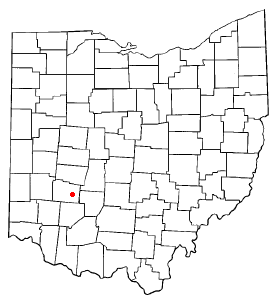
Shawnee Hills is a census-designated place (CDP) in Greene County, Ohio, United States. Shawnee Hills consists of a planned community centered on the 250-acre (1.0 km2) Shawnee Lake. The population was 2,230 at the 2020 census. It is part of the Dayton Metropolitan Statistical Area, and should not be confused with the incorporated village of Shawnee Hills in Delaware County.

<span class="mw-page-title-main">Lake Wylie, South Carolina</span> CDP in South Carolina, United States

Lake Wylie is a census-designated place (CDP) in York County, South Carolina, United States. The population was 8,841 at the 2010 census. Lake Wylie is located on a peninsula along the shore of Lake Wylie, a reservoir that was named for Dr. W. Gil Wylie in 1960. It is a suburb of Charlotte, North Carolina.

<span class="mw-page-title-main">Lake Kiowa, Texas</span> Census-designated place in Texas, United States

Lake Kiowa is a census-designated place (CDP) in Cooke County, Texas, United States, the majority of which consists of the gated community of the same name.

<span class="mw-page-title-main">Lake Shangrila, Wisconsin</span> Former CDP in Wisconsin, United States

Lake Shangrila was a census-designated place (CDP) in the town of Salem Lakes, Kenosha County, Wisconsin, United States. The population was 861 at the 2010 census. The core area of the CDP was annexed into the village of Bristol on March 15, 2011, at the same time that the CDP was deleted.

<span class="mw-page-title-main">Legend Lake, Wisconsin</span> CDP in Wisconsin, United States

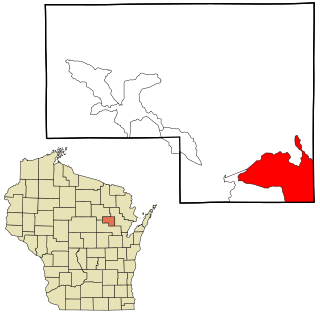
Legend Lake is a census-designated place (CDP) in Menominee County, Wisconsin, Wisconsin, United States, on the Menominee Indian Reservation. The population was 1,670 at the 2020 census.

<span class="mw-page-title-main">Peach Lake, New York</span> CDP in New York, United States

Peach Lake is a hamlet located mostly in the town of Southeast in Putnam County, New York, United States; a portion of the CDP is in the town of North Salem in Westchester County. As of the 2010 census, the population was 1,629.

<span class="mw-page-title-main">Lake Sherwood, California</span> Place in California, United States

Lake Sherwood is an unincorporated community in the Santa Monica Mountains, in Ventura County, California overlooking Lake Sherwood reservoir. It is a body contact lake, swimming, fishing, SUP and boating allowed, located south of the Conejo Valley and city of Thousand Oaks, and west of Westlake Village. The lake is naturally fed by thousand of acres of open-space, watershed mountains and natural springs.

References

  1. "2020 U.S. Gazetteer Files". United States Census Bureau. Retrieved October 29, 2021.
  2. 1 2 U.S. Geological Survey Geographic Names Information System: Hot Springs Village, Arkansas
  3. United States Postal Service (2012). "USPS - Look Up a ZIP Code" . Retrieved February 15, 2012.
  4. "U.S. Census website". U.S. Census Bureau . Retrieved May 6, 2011.
  5. Hot Springs weather on meoweather.com
  6. ACBL.org
  7. neighborhoodscout.com HOT SPRINGS VILLAGE, AR CRIME RATES
  8. "Census of Population and Housing". Census.gov. Retrieved June 4, 2016.
  9. "Explore Census Data". data.census.gov. Retrieved December 31, 2021.
  10. 1 2 "U.S. Census website". United States Census Bureau . Retrieved July 24, 2015.
  11. "2020 CENSUS - SCHOOL DISTRICT REFERENCE MAP: Garland County, AR" (PDF). U.S. Census Bureau . Retrieved March 3, 2021. - 2010 map
  12. "2020 CENSUS - SCHOOL DISTRICT REFERENCE MAP: Saline County, AR" (PDF). U.S. Census Bureau . Retrieved March 3, 2021. - 2010 map
  13. "Diamante members celebrate ownership". Hot Springs Village Voice. Retrieved April 23, 2018.
  14. http://www.hsvvoice.com/