
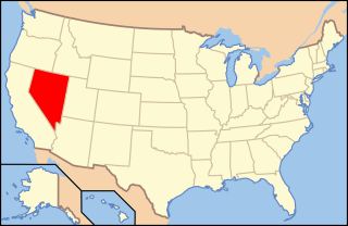
Clark County is a county located in the U.S. state of Nevada. As of the 2020 census, the population was 2,265,461. Most of the county population resides in the Las Vegas Census County Divisions, which hold 2,196,623 people as of the 2020 Census, across 435 square miles (1,130 km2). It is by far the most populous county in Nevada, and the 11th most populous county in the United States. It covers 7% of the state's land area but holds 73% of the state's population, making Nevada the most centralized state in the United States.

Great Basin National Park is an American national park located in White Pine County in east-central Nevada, near the Utah border, established in 1986. The park is most commonly entered by way of Nevada State Route 488, which is connected to U.S. Routes 6 and 50 by Nevada State Route 487 via the small town of Baker, the closest settlement.

The Las Vegas Valley is a major metropolitan area in the southern part of the U.S. state of Nevada, and the second largest in the Southwestern United States. The state's largest urban agglomeration, the Las Vegas Metropolitan Statistical Area is coextensive since 2003 with Clark County, Nevada. The Valley is largely defined by the Las Vegas Valley landform, a 600 sq mi (1,600 km2) basin area surrounded by mountains to the north, south, east and west of the metropolitan area. The Valley is home to the three largest incorporated cities in Nevada: Las Vegas, Henderson and North Las Vegas. Eleven unincorporated towns governed by the Clark County government are part of the Las Vegas Township and constitute the largest community in the state of Nevada.

John Day Fossil Beds National Monument is a U.S. national monument in Wheeler and Grant counties in east-central Oregon. Located within the John Day River basin and managed by the National Park Service, the park is known for its well-preserved layers of fossil plants and mammals that lived in the region between the late Eocene, about 45 million years ago, and the late Miocene, about 5 million years ago. The monument consists of three geographically separate units: Sheep Rock, Painted Hills, and Clarno.

Floyd Lamb Park at Tule Springs is a 2,040-acre (830 ha) park in Las Vegas, Nevada. The park is centered on Tule Springs, a series of small natural spring-fed lakes that form an oasis in this part of the Mojave Desert. One of the larger urban retreats in the Las Vegas Valley, Tule Springs was once considered to be far out of town but is now encroached by development. The park includes the Tule Springs Ranch, Tule Springs Archaeological Site, Tule Springs Wash and four ponds available for fishing.

Tule Springs is one of the larger urban retreats in Las Vegas, Nevada, and the Las Vegas Valley. It is a significant desert ecosystem consisting of a series of small lakes that formed an oasis in this area of the Mojave Desert. Both the springs and the ranch are located within the Floyd Lamb Park at Tule Springs which is operated by the City of Las Vegas.
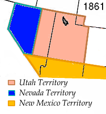
The History of Nevada as a state began when it became the 36th state on October 31, 1864, after telegraphing the Constitution of Nevada to the Congress days before the November 8 presidential election. Statehood was rushed to help ensure three electoral votes for Abraham Lincoln's reelection and add to the Republican congressional majorities.
Tule Springs Archaeological Site is an archeological site listed on the National Register of Historic Places that is located in the Las Vegas Valley of Nevada, United States. It is one of a few sites in the United States where humans were once thought to have lived alongside, and potentially hunted, extinct Ice Age megafauna, although this view is not supported by the available scientific data and is no longer generally accepted.
Tule is a plant of the sedge family.
Gypsum Cave is a limestone cave in eastern Clark County, Nevada, United States, about 15 miles (24 km) east of Las Vegas, that is listed on the National Register of Historic Places (NRHP).
Paleontology in Nevada refers to paleontological research occurring within or conducted by people from the U.S. state of Nevada. Nevada has a rich fossil record of plants and animal life spanning the past 650 million years of time. The earliest fossils from the state are from Esmeralda County, and are Late Proterozoic in age and represent stromatolite reefs of cyanobacteria, amongst these reefs were some of the oldest known shells in the fossil record, the Cloudina-fauna. Much of the Proterozoic and Paleozoic fossil story of Nevada is that of a warm, shallow, tropical sea, with a few exceptions towards the Late Paleozoic. As such many fossils across the state are those of marine animals, such as trilobites, brachiopods, bryozoans, honeycomb corals, archaeocyaths, and horn corals.
John Harry Mortenson was an American politician who was a Democratic member of the Nevada General Assembly.

Tule Springs Fossil Beds National Monument, a United States National Monument near Las Vegas, Clark County, Nevada, was established in 2014 to protect Ice Age paleontological discoveries. The 22,650-acre (9,170 ha) monument is administered by the National Park Service.

Basin and Range National Monument is a national monument of the United States spanning approximately 704,000 acres of remote, undeveloped mountains and valleys in Lincoln and Nye counties in southeastern Nevada. It is described as "one of the emptiest spaces in a state famous for its emptiness."
Margaret Marean Wheat was an American anthropologist, archeologist and paleontologist who worked and made significant contributions in the Great Basin, in North America.

Corn Creek is an unincorporated community in Clark County, Nevada, United States. The community is located along the former Las Vegas and Tonopah Railroad where it had a station. It is approximately 7.5 miles from the Las Vegas city limits by road and is situated south of the Desert National Wildlife Refuge border and bordered to the west, south, and east with the Tule Springs Fossil Beds National Monument.
Durango Drive is a major north-south road in the Las Vegas metropolitan area, Nevada, United States, located on the west side of the city.

Centennial Hills is a neighborhood in northwest Las Vegas, Nevada, United States. It is bordered by the Snow Mountain Paiute Reservation and Tule Springs Fossil Beds National Monument to the north, Lower Kyle Canyon and the Red Rock Canyon National Conservation Area to the west, Summerlin to the south, and North Las Vegas to the east. The Spring Mountains are visible to the west with Gass Peak in the Las Vegas Range to the north. Lone Mountain lies within the neighborhood.
Willie McCool Regional Park is a 160-acre regional park in North Las Vegas, Nevada, United States, located next to the Tule Springs Fossil Beds National Monument and Ice Age Fossils State Park. It is the northernmost park of the city park system.
