Isingiro

Last updated

Isingiro
Uganda location map.svg
Red pog.svg
Isingiro
Location in Uganda
Coordinates: 00°47′42″S30°48′55″E / 0.79500°S 30.81528°E / -0.79500; 30.81528
Country Flag of Uganda.svg Uganda
Region Western Region
Sub-region Ankole sub-region
District Isingiro District
Elevation
4,206 ft (1,282 m)
Population
 (2020 Estimate)
  Total34,300

Isingiro is a town in the Western Region of Uganda. It is the main municipal, administrative, and commercial center of Isingiro District and the site of the district's headquarters. [1]

Contents

Location

Isingiro is approximately 42 kilometres (26 mi) southeast of Mbarara, the largest city in the Ankole sub-region. The town of Isingiro is surrounded by the villages of Nyakigera, Gayaza, Rwembwa, Mabona, Kibwera, and Rumira. [2] Isingiro is located approximately 310 kilometres (193 mi), by road, southwest of Kampala, the capital and largest city of Uganda. [3] The coordinates of Isingiro Town Council are 0°47'42.0"S, 30°48'55.0"E (Latitude:-0.795000, Longitude:30.815278). [4]

Population

The 2002 national census estimated the town's population at 17,000. In 2010, the Uganda Bureau of Statistics (UBOS) estimated the population at 21,400. In 2011, UBOS estimated the mid-year population at 22,000. [5]

In August 2014, the national census put the population at 27,991. In 2015, UBOS estimated the population of the town at 28,800. In 2020, the population agency estimated the mid-year population at 34,300 inhabitants. Of those, 17,500 (51 percent) were females and 16,800 (49 percent) were males. UBOS calculated that the population of Isingiro Town Council expanded at an average annual rate of 3.6 percent between 2015 and 2020. [6] [7]

Historical population
YearPop.±%
200219,773    
201021,400+8.2%
201122,000+2.8%
201427,991+27.2%
201528,200+0.7%
202034,300+21.6%
source: [5] [6] [7]

Points of interest

The following additional points of interest lie within or close to the town: [4] (a) the headquarters of Isingiro District administration (b) the offices of Isingiro Town Council (c) Isingiro central market, the source of daily fresh produce and (d) the 74 kilometres (46 mi) Mbarara–Kikagati Road passes through the western neighborhoods of the town in a general north to south direction. [8] [9]

See also

Related Research Articles

<span class="mw-page-title-main">Kabale District</span> District in Western Region, Uganda

Kabale District is a district in the Western Region of Uganda. Kabale hosts the district headquarters. It was originally part of Kigezi District, before the districts of Rukungiri, Kanungu, Kisoro, Rubanda and Rukiga and were excised to form separate districts. Kabale is sometimes nicknamed "Kastone" as in the local language Rukiga, a "kabale" is a small stone.

<span class="mw-page-title-main">Mbarara</span> Place in Western Region, Uganda

Mbarara City is a city in the Western Region of Uganda and the second largest city in Uganda after Kampala. The city is divided into 6 boroughs of Kakoba Division, Kamukuzi Division, Nyamitanga Division, Biharwe Division, Kakiika Division, Nyakayojo Division. It is the main commercial centre of most of south western districts of Uganda and the site of the district headquarters. In May 2019, the Uganda's cabinet granted Mbarara a city status, which started on 1 July 2020.

<span class="mw-page-title-main">Adjumani</span> Ugandan town

Adjumani is a town in the Northern Region of Uganda. It is the main municipal, administrative, and commercial centre of Adjumani District. The district is named after the town.

<span class="mw-page-title-main">Bushenyi</span> Place in Western Uganda, Uganda

Bushenyi is a town in Western Uganda. It is the 'chief town' of Bushenyi District and the district headquarters are located there. The district is named after the town, in keeping with the practice in most of the districts in the country.

Rukungiri is a town in Rukungiri District of the Western Region of Uganda. It is the site of the district headquarters.

Mpigi is a town in Mawokota County, Mpigi District, in Central Uganda. Mpigi is the municipal, administrative and commercial headquarters of Mpigi District. The district is named after the town.

Ntungamo is a town in the Western Region of Uganda. It is the largest town in Ntungamo District and the site of the district headquarters.

Kiruhura is a town in the Western Region of Uganda. It is the largest town in Kiruhura District and the site of the district headquarters.

Lyantonde is a town in the southern part of the Central Region of Uganda. It is the main municipal, administrative, and commercial center of Lyantonde District.

Mpondwe is a town in the Western Region of Uganda.

Amolatar is a town in Northern Uganda. It is the main municipal, administrative and commercial centre of Amolatar District. The district is named after the town.

Bukedea is a town in the Eastern Region of Uganda. It is the chief municipal, administrative, and commercial center of Bukedea District, and the district headquarters are located there.

Abim is a town in the Northern Region of Uganda. It is the chief municipal, administrative, and commercial center of Abim District. The district is named after the town.

Bududa is a town in the Eastern Region of Uganda. It is the main municipal, administrative, and commercial center of Bududa District.

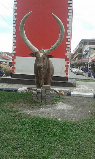
Kikagati is a town in the Western Region of Uganda. It sits across the Kagera River from the town of Murongo, in the Kagera Region of Tanzania.

Bukomansimbi is a town in the Central Region of Uganda. It is the chief municipal, administrative, and commercial center of Bukomansimbi District and the site of the district headquarters.

Alebtong is a town in the Northern Region of Uganda. It is the chief municipal, administrative, and commercial centre of Alebtong District. The district is named after the town.

<span class="mw-page-title-main">Buhweju District</span> District in Western Uganda, Uganda

Buhweju District is a district in Western Uganda. It is one of the districts that constitute the Ankole sub-region. Its 'chief town', is Nsiika.

Sanga, is an urban center in the Kiruhura District, Ankole sub-region, in the Western Region of Uganda.

Rugaaga is a town in Isingiro District in the Western Region of Uganda.

References

  1. Mindat (22 July 2021). "Isingiro Town Council, Isingiro County, Isingiro District, Western Region, Uganda". Mindat.org. Retrieved 22 July 2021.
  2. Google (22 July 2021). "Road Distance Between Mbarara, Uganda And Isingiro, Uganda With Interactive Map" (Map). Google Maps . Google. Retrieved 22 July 2021.
  3. Google (22 July 2021). "Road Distance Between Kampala, Uganda And Isingiro, Uganda" (Map). Google Maps . Google. Retrieved 22 July 2021.
  4. 1 2 Google (22 July 2021). "Location of Isingiro Town Council, Isingiro District, Western Region, Uganda" (Map). Google Maps . Google. Retrieved 22 July 2021.
  5. 1 2 Uganda Bureau of Statistics (2012). "Estimated Population of Isingiro In 2002, 2010 And 2011" (PDF). Uganda Bureau of Statistics . Kampala, Uganda. Archived from the original (Archived from the original on 7 July 2014) on 7 July 2014. Retrieved 22 July 2021.
  6. 1 2 Uganda Bureau of Statistics (14 June 2020). "The population of all Ugandan cities and towns with more than 15,000 inhabitants according to census results and latest official projections" (Citypopulation.de Quoting Uganda Bureau of Statistics). Citypopulation.de. Retrieved 22 July 2021.
  7. 1 2 Uganda Burau of Statistics (14 June 2021). "The population development of Isingiro as well as related information and services". Citypopulation.de Quoting Uganda Bureau of Statistics . Retrieved 22 July 2021.
  8. Google (22 July 2021). "Map of Isingiro Showing Mbarara–Kikagati Road Going Though The Town" (Map). Google Maps . Google. Retrieved 22 July 2021.
  9. ChimpReports (2 October 2014). "Mbarara–Kikagati–Murongo Bridge Road Completed". ChimpReports. Kampala. Retrieved 22 July 2021.