
The Mississippi River is the second-longest river and chief river of the second-largest drainage system on the North American continent, second only to the Hudson Bay drainage system. From its traditional source of Lake Itasca in northern Minnesota, it flows generally south for 2,340 miles (3,770 km) to the Mississippi River Delta in the Gulf of Mexico. With its many tributaries, the Mississippi's watershed drains all or parts of 32 U.S. states and two Canadian provinces between the Rocky and Appalachian mountains. The main stem is entirely within the United States; the total drainage basin is 1,151,000 sq mi (2,980,000 km2), of which only about one percent is in Canada. The Mississippi ranks as the fourteenth-largest river by discharge in the world. The river either borders or passes through the states of Minnesota, Wisconsin, Iowa, Illinois, Missouri, Kentucky, Tennessee, Arkansas, Mississippi, and Louisiana.

Saint Paul is the capital of the U.S. state of Minnesota. It is the county seat of Ramsey County, the state's smallest in terms of area, second-most populous, and most densely populated county. As of 2020, its population was 311,527, making it the 63rd-largest city in the United States and the 11th-most populous in the Midwest. Most of the city lies east of the Mississippi River at the confluence with the Minnesota River. Minneapolis, the state's largest city, is across the river to the west. Together, they are known as the "Twin Cities". They are the core of Minneapolis–Saint Paul metropolitan area, home to over 3.6 million and the third-largest in the Midwest.

Wabasha County is a county in the U.S. state of Minnesota. As of the 2020 United States Census, the population was 21,387. Its county seat is Wabasha.

Brooklyn Park is the sixth largest city in the U.S. state of Minnesota. The city is on the west bank of the Mississippi River, upstream from downtown Minneapolis in northern Hennepin County. Brooklyn Park is a northwest suburb of the Twin Cities metropolitan area. Its population was 86,478 at the 2020 census.

Lake Itasca is a small glacial lake, approximately 1.8 square miles in area. Located in southeastern Clearwater County, in the Headwaters area of north central Minnesota, it is notable for being the headwater of the Mississippi River. The lake is in Itasca State Park. It has an average depth of 20 to 35 feet and is 1,475 feet (450 m) above sea level.

Lake Pepin is a naturally occurring lake on the Mississippi River on the border between the U.S. states of Minnesota and Wisconsin. It is located in a valley carved by the outflow of an enormous glacial lake at the end of the last Ice Age. The lake formed when the Mississippi, a successor to the glacial river, was partially dammed by a delta from a tributary stream and spread out across the ancient valley.
The Mdewakanton or Mdewakantonwan are one of the sub-tribes of the Isanti (Santee) Dakota (Sioux). Their historic home is Mille Lacs Lake in central Minnesota. Together with the Wahpekute, they form the so-called Upper Council of the Dakota or Santee Sioux. Today their descendants are members of federally recognized tribes in Minnesota, South Dakota and Nebraska of the United States, and First Nations in Manitoba, Canada.

Highlanding is an unincorporated community in Highlanding Township in rural Pennington County, Minnesota, United States. The community has long been popular among locals as place to socialize. Highlanding dances date back to the early-to-mid 20th century. The community serves as a popular landing and launching point for canoes and other boaters on the Red Lake River. The USGS has a river monitoring station in the community.
The Swan River Logging Company was established in 1892 along the confluence of the Swan and Mississippi Rivers near Jacobson, Minnesota.

Maple Springs is an unincorporated community in Pepin Township, Wabasha County, Minnesota, United States, along the Mississippi River and Lake Pepin. The Mississippi River and King Creek meet at Maple Springs.

Reads Landing is an unincorporated community in Pepin Township, Wabasha County, Minnesota, United States, along the Mississippi River.
Camp Lacupolis is an unincorporated community in Pepin Township, Wabasha County, Minnesota, United States, along the Mississippi River and Lake Pepin.
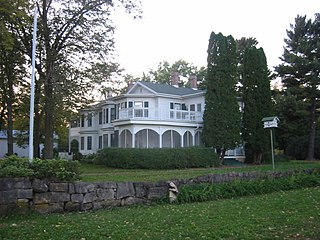
Frontenac is an unincorporated community and census-designated place (CDP) in Florence Township, Goodhue County, Minnesota, United States, on the Mississippi River. As of the 2010 census, its population was 282.
Swan River is an unincorporated community in southeast Itasca County, Minnesota, United States.

Dresbach is an unincorporated community in Dresbach Township, Winona County, Minnesota, United States.
Ball Bluff is an unincorporated community in Ball Bluff Township, Aitkin County, Minnesota, United States. The community is located between Jacobson and McGregor along State Highway 65. The Mississippi River flows nearby.
Libby is an unincorporated community in Libby Township, Aitkin County, Minnesota, United States. The community is located between McGregor and Jacobson along State Highway 65. The Mississippi River flows nearby. Libby is located immediately northwest of Big Sandy Lake.
East Lake is an unincorporated community in Spalding Township, Aitkin County, Minnesota, United States.
Rabey is an unincorporated community in Aitkin County, Minnesota, United States, within the Savanna State Forest. The community is located between Hill City and Jacobson along State Highway 200 near Rabey Road and Elliot Road. Rabey is located within Northwest Aitkin Unorganized Territory of Aitkin County.


