Gatineau is a city in south western Quebec, Canada. It is located on the northern bank of the Gatineau river, immediately across from Ottawa, Ontario. Gatineau is the largest city in the Outaouais administrative region and is part of Canada's National Capital Region. As of 2021, Gatineau is the fourth-largest city in Quebec with a population of 291,041, and a census metropolitan area population of 1,488,307 making it the fourth largest in Canada.
Hull is the central business district and oldest neighbourhood of the city of Gatineau, Quebec, Canada. It is located on the west bank of the Gatineau River and the north shore of the Ottawa River, directly opposite Ottawa. As part of the Canadian National Capital Region, it contains offices for over 20,000 civil servants. It is named after Kingston upon Hull in England.

Winterlude is an annual winter festival held in Ottawa, Ontario and Gatineau, Quebec.

The National Capital Commission is the Crown corporation responsible for development, urban planning, and conservation in Canada's Capital Region, including administering most lands and buildings owned by the Government of Canada in the region.

Sussex Drive, also known as Ottawa Regional Road 93, is an arterial road in Ottawa, Ontario, the capital of Canada. It is one of the city's main ceremonial and institutional routes. Travelling roughly parallel to the Ottawa River, Sussex Drive begins as a continuation of Sir George-Étienne Cartier Parkway at Rideau Gate, at the entrance to Rideau Hall. It travels south to Rideau Street, with the portion south of St. Patrick Street forming the northbound half of a one-way pair with Mackenzie Avenue. Both Mackenzie Avenue and Sussex Drive connect with Colonel By Drive at their southern end, which continues south alongside the Rideau Canal.

The Royal Alexandra Interprovincial Bridge, also known as the Alexandra Bridge or Interprovincial Bridge, is a steel truss cantilever bridge spanning the Ottawa River between Ottawa, Ontario and Gatineau, Quebec. In addition to carrying vehicle traffic, a shared use pathway on the bridge for pedestrians and cyclists is maintained by the National Capital Commission.

The Greenbelt is a 203.5-square-kilometre (78.6 sq mi) protected green belt traversing Ottawa, Ontario, Canada. It includes green space, forests, farms, and wetlands from Shirleys Bay in the west and to Green's Creek in the east. It is the largest publicly owned green belt in the world and the most ecologically diverse area in Eastern Ontario. The National Capital Commission (NCC) owns and manages 149.5 square kilometres (57.7 sq mi), and the rest is held by other federal government departments and private interests. Real estate development within the Greenbelt is strictly controlled.

The Centre for Geography and Exploration, located at 50 Sussex Drive in Ottawa, is headquarters to the Royal Canadian Geographical Society (RCGS) and home to Canadian Geographic magazine, as well as Can Geo Education and special project departments.

The National Capital Region, also referred to as Canada's Capital Region and Ottawa–Gatineau, is an official federal designation for the Canadian capital of Ottawa, Ontario, the neighbouring city of Gatineau, Quebec, and surrounding suburban and exurban communities. The term National Capital Region is frequently used to describe the Ottawa–Gatineau metropolitan area, although the official boundaries of the NCR do not correspond to the statistical metropolitan area.

Gatineau Park is a federal park located in the Outaouais region of Quebec, Canada. Administered by the National Capital Commission as part of the National Capital Region, Gatineau Park is a 361 square kilometres (139 sq mi) wedge of land extending north and west from the city of Gatineau. With a perimeter of 179.2 kilometres (111.3 mi), the park includes parts of the municipalities of Chelsea, Pontiac, La Pêche, and the City of Gatineau. The main entrance to the park is 4 kilometres (2.5 mi) north of downtown Ottawa, Ontario.
LeBreton Flats known colloquially as The Flats is a neighbourhood in Somerset Ward in central Ottawa, Ontario, Canada. It lies to the west of Centretown neighbourhood, and to the north of Centretown West. The Ottawa River forms the western and northern limit, with the western side being a wider area of the river known as Nepean Bay.

The Kichi Zībī Mīkan, formerly the Sir John A. Macdonald Parkway, and previously the Ottawa River Parkway, is a four-lane scenic parkway along the Ottawa River in Ottawa, Ontario, Canada. It runs from Carling Avenue near Connaught Avenue, to Booth Street at the Canadian War Museum and National Holocaust Monument. It is maintained by the National Capital Commission. The speed limit is 60 km/h (37 mph). Bicycles are allowed on the road and on a parallel recreational path along the parkway.

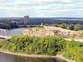
The Chaudière Falls, also known as the Kana:tso or Akikodjiwan Falls, are a set of cascades and waterfall in the centre of the Ottawa-Gatineau metropolitan area in Canada where the Ottawa River narrows between a rocky escarpment on both sides of the river. The location is just west of the Chaudière Bridge and Booth-Eddy streets corridor, northwest of the Canadian War Museum at LeBreton Flats and adjacent to the historic industrial E. B. Eddy complex. The islands surrounding the Chaudière Falls, counter-clockwise, are Chaudière Island, Albert Island, little Coffin Island was just south of Albert Island but is now submerged, Victoria Island and Amelia Island,, Philemon Island was originally called the Peninsular Village by the Wrights but became an island when the timber slide was built in 1829 it is now fused to south shore of City of Gatineau, and Russell Island, now submerged, was at the head of the Falls before the Ring dam was built. The falls are about 60 metres (200 ft) wide and drop 15 metres (49 ft). The area around the falls was once heavily industrialized, especially in the 19th century, driving growth of the surrounding cities.

Rue Laurier is a main street located in the heart of the City of Gatineau, Quebec. It starts at Rue Eddy and ends at Rue Dussault.
The General Report on the Plan for the National Capital (1946–1950), or Gréber Plan, was a major urban plan developed for Canada's National Capital Region in 1950 by Jacques Gréber, commissioned by the Federal District Commission of Ottawa, Ontario.
Confederation Boulevard is a "ceremonial and discovery route" in Canada's National Capital Region, running through Parliament Hill and encompassing downtown areas in Ottawa and Gatineau. Some of Canada's most important institutions and landmarks lie along its route. During state visits, Confederation Boulevard is toured by foreign dignitaries. On Canada Day, much of Confederation Boulevard is closed to cars. Confederation Boulevard is an initiative of the National Capital Commission (NCC).

Vincent Massey Park is an urban park along the Rideau River in the Confederation Heights neighbourhood of Ottawa, Ontario, Canada, accessible via Heron Road. It is extensively used in the summer for family and group picnics.

Central Chambers is a building at the corner of Elgin Street and Queen Street in Ottawa that is a National Historic Site. It is located at 42 to 54 Elgin Street, next to Bell Block. It faces the Canadian War Memorial at Confederation Square. Central Chambers was built between 1890 and 1893 and designed by John James Browne of Montreal, an example of Queen Anne Revival commercial architecture. Formerly serving as an office for the Canadian Atlantic Railway, it now houses the National Capital Commission.