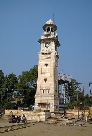
Bhind is a city in the Indian state of Madhya Pradesh. It is the headquarters of the Bhind district.

Bahraich is a city and a municipal board in Bahraich district in the state of Uttar Pradesh, India. Located on the Saryu River, a tributary of the Ghaghara river, Bahraich is 125 kilometres north-east of Lucknow, the state capital. The districts of Barabanki, Gonda, Balrampur, Lakhimpur Kheri, Shravasti and Sitapur share boundaries with Bahraich. A factor which makes this town important is the international border shared with Nepal.

Jaunpur is a city and a municipal board in Jaunpur district in the Indian state of Uttar Pradesh. It is located 228 km southeast of state capital Lucknow. Demographically, Jaunpur resembles the rest of the Purvanchal area in which it is located.
Khagaria is a town in Indian state of Bihar and the administrative headquarters of Khagaria district. Khagaria is a part of Munger division. It is located at 25.5°N 86.48°E and has an average elevation of 36 metres (118 feet). The Khagaria Junction railway station serves the town.It is situated about 25 km north of Munger.
Ballia is a city with a municipal board in the Indian state of Uttar Pradesh. The eastern boundary of the city lies at the junction of two major rivers, the Ganges and the Ghaghara.The city is situated 140 km (87 mi) east of Varanasi and about 380 km from the state capital Lucknow. It is home to a protected area, the Jai Prakash Narayan bird sanctuary. Ballia is around 4 km (2.5 mi) from Bihar.

Gyanpur is a town and a nagar panchayat in Bhadohi district in the Indian state of Uttar Pradesh.
Dhanuha is a census town in Jaunpur district in the state of Uttar Pradesh, India.
Kerakat or Kirakat is a town and nagar panchayat in Jaunpur district of the Indian state of Uttar Pradesh with a population of approximately 13,500. It is situated near the Gomati River, which helps the land around the town stay very fertile. Kerakat or Kirakat forms a part of Varanasi Division. It is located 30 km east of the city of Jaunpur and 279 km from Lucknow, the capital of Uttar Pradesh.
Kheta Sarai is a town and a nagar panchayat in Jaunpur district of the Indian state of Uttar Pradesh.
Kiraoli is a town and a nagar panchayat in Agra district in the Indian state of Uttar Pradesh.

Machhlishahr is a town in Jaunpur district in the Indian state of Uttar Pradesh. It is situated 30 km west of district headquarters Jaunpur. NH-231 passes through the city. Machhlishahr – Janghai – Bhadohi four-lane highway is under construction which will boost the economy of the region. Machhlishahr is a Nagar panchayat and there has been a longstanding demand for making it a Nagar palika parishad. In 2020, Machhalisahar nagar panchayat has secured 33rd all India rank in Swachh Survekshan cleanliness survey.
Mariahu (Mariyahu) is a town and a nagar panchayat in Jaunpur district in the Indian state of Uttar Pradesh. Its name Mariahu was given by Nanwag (Nandwak) king Naun Rao in 16th century on the name of Mandav Deo, the patreon deity of the Nanwag clan. The samadhi of Mandav dev is situated near to Chutka Devi temple which is in the east of tehsil. Mostly tehsil was ruled by Nanwag Rajputs who were the local rulers during 16th and 17th century. Baghi Sangram Singh a leader of the Nanwags revolted against the British East India company during the revolt of 1857 and defeated them on several occasions. It is one of the six tehsils of Jaunpur district, with the others being Jaunpur city, Shahganj, Machalishahar, Badlapur and Keraket.

Musafirkhana is a town and tehsil in Amethi district in Indian state of Uttar Pradesh. The word "Musafirkhana" means "Sarai," or "Dharamshala". Musafirkhana is located 32 km northwest of district headquarters Amethi.
Shahganj is a town and a municipal board in Jaunpur district in the Indian state of Uttar Pradesh.three block 1suetha 2khuthan 3shodha.three police station
Shankargarh is a town and a nagar panchayat in Prayagraj district in the Indian state of Uttar Pradesh.
Mughalsarai, officially known as Pandit Deen Dayal Upadhyaya Nagar, is a city and a municipal board in the Chandauli district of Uttar Pradesh. Located around 16 kilometres (10 mi) from Varanasi, it is an important railway junction.
Usraon (Mariyahu) is a town and nagar panchayat in Jaunpur district in the Indian state of Uttar Pradesh. It is one of the six tahsils of Jaunpur District; the others are Jaunpur City, Shahganj, Machalishahar, Badlapur and Kerakat.
Goshainganj, also known as Gosainganj, is a town and nagar panchayat in the Ayodhya district of the Indian state of Uttar Pradesh. Located 32 km from the district headquarters Ayodhya, Goshainganj has one of the oldest markets of the district.
Mungra Badshahpur is a town and a municipal board in Jaunpur district of Uttar Pradesh, India. It is situated 48 km north east of Allahabad city in the North-West part of Varanasi Division.
Badlapur is an administrative division in Jaunpur District in the Indian state of Uttar Pradesh. It was accorded the status of Town Area Nagar Panchayat on 27 June 2014.


